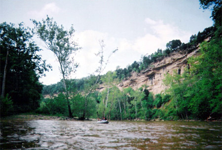
Elkhorn Creek
Forks of Elkhorn, Church lot below US460 Bridge to Knight's Bridge on KY1900 (6 miles)(Elkhorn Gorge)
Aug 11, 2022
Jun 13, 2021
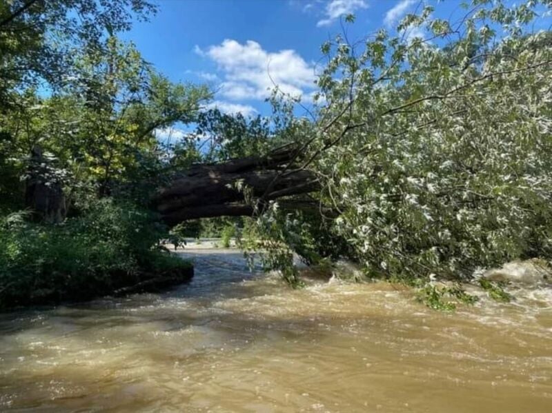
Big strainer on the left side of the old (second) bridge near Jim Bean. Also, the Jim Bean weir dam has been removed! Great run for beginners; sufficiently satisfying local run for those with more experience.
May 31, 2019
Any updates on water quality after the sewage spill?
May 31, 2019
Dilution was the solution and so the water in the Elkhorn should be fine.
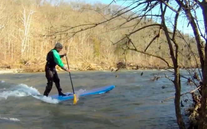
Nov 23, 2011
Yup, it's a SUP
Oct 24, 2011
No trouble with debris on 10/22/11
Oct 22, 2011
About 1100 cfs.
Aug 17, 2011
Caution is advised when entering the top of this rapid at lower water levels. At least one person has been injured here. Most of the water flow runs directly into/under the log.
Jul 26, 2011
7/25/11 600 CFS Trip Report.
The night before Elkhorn was running at 1000 CFS and so my brother and I made plans to run Elkhorn the next day. We thought the level would be around 700 CFS by the time we put in. I have run it at 700 CFS and Surf City was pretty good at that level. We ran it a few days later at 800 CFS and Surf City was great at that level. I once ran Elkhorn at 500 CFS in a Coleman raft and swore I would never run it at that level again. Much later I ran it at 350 CFS and had a blast, which made me think 500 CFS might be a good level as long as you're in a kayak.
We decided to use Canoe Kentucky for a shuttle. They charged us $25 for two kayaks and at 1p.m. they have you follow them to the AW takeout and then haul you and your stuff to the put-in. We figured the campground charges $4 for parking, and so subtract that from the $25 and you are left with $21, which is about what we would have spent on gas bringing another vehicle anyhow(it's 100 miles of driving including the shuttle).
Church Wave was a total bust, but we found a couple rope swings before the dam and had a good time with that. It had rained earlier and I said I bet Elkhorn will be at 1000 CFS tomorrow, and it turned out I was right. Before the dam there is a cool cascade on river left and we decided to hike up it. The cold water on our feet felt great and eventually we got to a spring. I washed my face in the water and it smelled like gasoline, my brother thought so also.
The surf wave on river right after the dam was at it's prime in a way. It gets bigger at higher levels, but at 600 CFS, not only was it big, but it also had eddy service. It required a very strong brace to keep you from turning and flushing out of it.
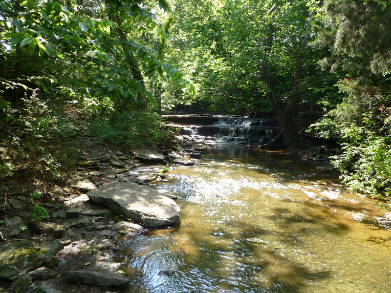
There was a cool waterfall that was about 10 feet wide and 30 feet tall. It only took us 30 seconds to hike up the hill to check it out, and it was so cold that I'm sure it's spring fed.
S-turn was pretty weak, but at least the lateral wave was in, which I surfed all along as it flushed me out.
Lunch Stop was also a bust, and so was Surf City. We hung out at Surf City anyhow just to lay in the creek and cool off. There was a tiny surf wave on river right, but it wasn't much at all. The Angioplasty side had more water, but Angioplasty was not in at all.
The wave directly after the large boulder on river right(this rapid needs a name and it needs to be added to AW) was in. The level was low enough that I could finally see what causes this wave; a large drop forces a ton of flow directly at a V shaped 2 foot ledge. This wave gets huge at higher levels, but at 600 CFS it was almost more of a hole than a wave. I tried surfing the wave and water from both sides of the V filled me up and it took a lot of effort just to get out of it.
The 2 mile section through the woods moved along great for the first half, but the second half is so slow. As slow as it was, we were still able to just lay around in our boats and let the current do all the work. By the end of the trip we were pretty exhausted due to a climbing and caving trip we did the day before.
All in all it was a great trip, escaping the summer heat, and at least we got to surf it up at the Dam Rapid. During the flat water stretches we took lots of swims and we would float down the creek letting our PFDs do all the work while we put our feet on top of our boats, our bodies in a hammock like position.
Jul 11, 2011
Looking upstream at the first drop of Lunch Stop rapid. Starting to get bony at this level, more rock avoidance necessary.
Jun 4, 2011
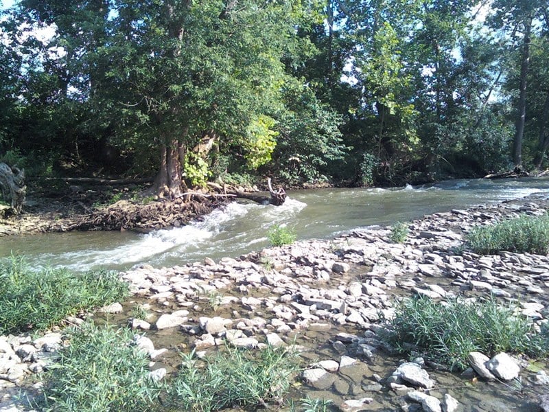
Nice little creek that comes in from the left toward the end of the run.
Feb 12, 2011
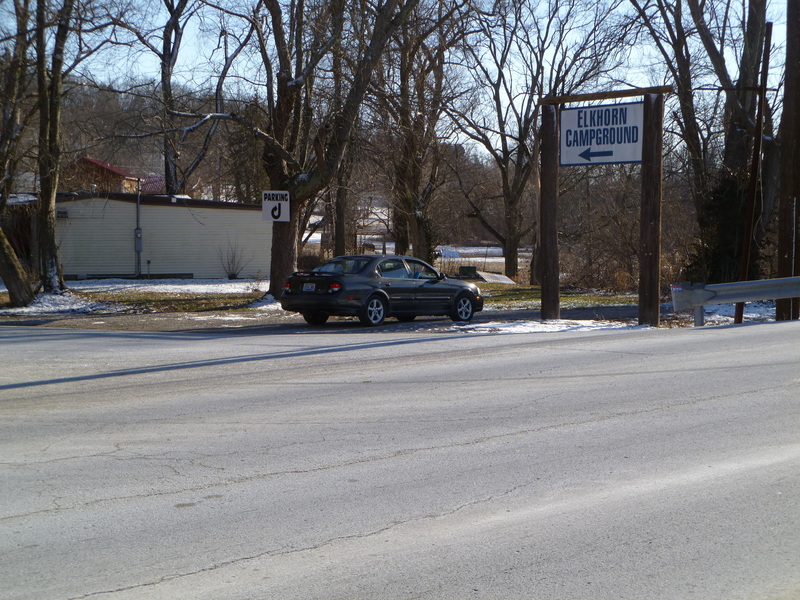
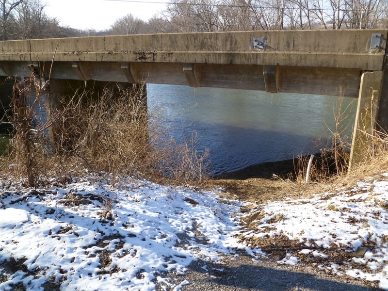
This is the tiny parking area at the putin. Pay the small fee at the campground before using it.
Feb 12, 2011
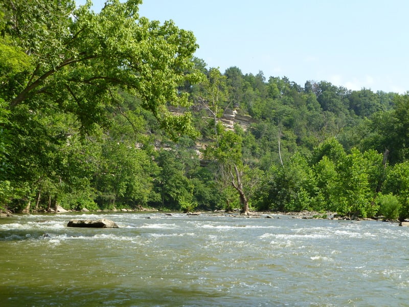
View looking down from the putin bridge at the first set of class I riffles to get your sea legs. Around the corner is the backwater for the Jim Beam dam. Roughly 950cfs in this picture.
Feb 12, 2011
This is the putin under the bridge next to the parking lot.
Oct 24, 2009
My brother made an awesome compilation of our 3000 CFS trip. The first rapid you see in the video, where we are surfing, is Surfcity. I decided to skirt around Angioplasty, and those big standing waves, and the lateral wave is of course S-turn. Enjoy: http://www.youtube.com/watch?v=kM1ATnrvXpA
Jul 11, 2009
In frankfort you silly willy
Jun 30, 2009
ACE Whitewater
Jun 26, 2009
you heard me
Jun 26, 2009
any good places to rent kayaks?
Jun 25, 2009
huh?
Jun 14, 2009
US460 bridge gauge = 10'
USGS ELKHORN CREEK NEAR FRANKFORT, KY = 690cfs
Jun 5, 2009
Andy Barber – Funfest on water!!!! Best Whitewater in Frankfort!!! Put your skirt on and boogie down the creek~~~~~~yeehaw!!!!
Jun 5, 2009
why, cause it's so cold?
May 31, 2009
they should rename it to turtle creek
May 1, 2009
Grant Stephens - I stand behind everything in my previous post as absolutely accurate based upon my personal observations and conversations with the father, the young lady and the young man with her.
Feb 24, 2008
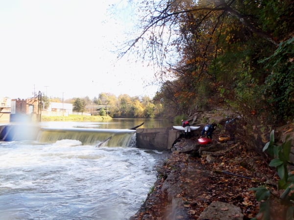
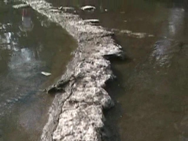
To portage the distillery dam, take out at this little spot and then walk on rock ledges to get past the reversal.
Dec 8, 2007
At 2000 CFS it is allot more pushy; filled with lots more and bigger rapids, and 2 things I didn't normally see were waves throughout almost the whole trip (even in the woods sometimes), and big whirlpools behind the bridge pillars. At 2000 CFS I thought portaging the dam was simple, and I watched two guys in a canoe do it quite simply, but I also watched the canoe sink after S-turn's insane rapids. I saw plenty of canoes make it past S-turn just fine, but they all had extra flotation in their canoes.
I think the minimum posted CFS of 500 is the perfect minimum, because I live in Louisville 50 miles away, and I am not driving out there unless it's at least 500 CFS and I’m really bored that day. At 500 CFS there were 4 hydraulics total (none capable of holding a raft), the surf section wasn't really in at all and it was almost a scrape in are rafts. We were able to portage on the island and walk up to the other rapid on the other side, which is this big drop. We re-ran it over and over, and my brother even ran it sitting on a giant log. When we ran this creek at 900 CFS it was completely different; instead of a kiddy park it is actually scary sometimes.
WARNING: S-Turn can be dangerous:
At 900 CFS the top of S-turn on the left; there was a 15 foot long sideways wave(it wasn't from left to right, take a normal rapid and turn it 90 degrees so that it runs from the top of the slope 15 feet all the way to the bottom of the slope) that goes in to a giant 3 foot tall mound, and my brother would disappear behind it for a couple of seconds the drop was so big(about 4-5 feet). Then there was another 2 foot tall mound right after it, and every time I ran the second one it threw me in to the island where the creek forked. One kayaker I saw got tipped over because of the sideways wave, and that section washed up on a very shallow area in both directions, but he climbed out just in the nick of time. I realized how dangerous the creek can be and still headed no warning. I go to jump in my raft and miss, even with a life jacket on I was swept to the very bottom of the creek and held there for many seconds, heading for the huge mound. I thought maybe a huge boulder was there and it was going to smash my head, and so I punched the creek with both my fists, skin scraping off my knuckles, I flew to the surface and my raft was right in front of me. I jumped in it with the quickness right before the 15 foot long sideways little curler wave. There are no mounds at all at 500 CFS. There is no 15 foot long sideways wave at 700 CFS, but the 2 large mounds are there. I think that they are only formed as a wavetrain, and I don't think a huge boulder is there anymore, because of what I have seen at 500 CFS: nothing.
At 2000 CFS S-Turn is allot more dangerous because of how much water is flowing over the island where the creek forks. I saw a kayaker get hurt and he even carried out. He got pinned on the island, then went left, and then fell and got all banged up. S-turn is very shallow, rocky, and pushy if you go left. Also where it forks it washes up on an island very hard at 2000 CFS, and pretty hard still at 900 CFS. At 2000 CFS I recommend running the right side where I found 4 back to back large hydraulics, and you won't have to worry about that island. The 15 foot long sideways wave was much larger and more powerfull at this level and it almost tipped my brother's raft. The two large mounds also greatly grew in size and even had big whitecaps on top of them.
The whole entire S-turn rapid is re-runnable at 2200 CFS, and there is two different eddies you can catch on the left to do this. There is an awesome limestone ledge that we walk along, and we have spent hours and hours re-running this rapid, because it's so fun and convenient to re-run (in a raft). I have seen kayakers re-run it also.
I love this creek because of it's watershed:
South fork: 179 square miles
North fork: 276 square miles
Elkhorn: 38 square miles (only about 10 would apply to the gorge section).
So that's a total of 465 square miles of watershed that contributes to the gorge section of Elkhorn. Another reason I love this creek is because it has a good lag time; after it rains all night it's ready to run the next day even in the late afternoon.
Oct 28, 2007
I am amused at recent comments about the Elkhorn, most of which appear to be jokes or from folks who don't know the basics. The S-turn (a.k.a. Railroad) rapid is the first significant rapid after the dam rapid. S-turn does indeed have an impressive diagonal wave, which seems to be at maximum height around 1500-2000 cfs. If you know how to do an eddy turn, you can easily avoid it by eddying right. If you have good balance and rudimentary ferrying skills, you can eddy left, then cut behind that wave. You'll be parallel to some large waves below it (hence need for balance), and you'll need to keep a vigorous paddle going, in order to avoid being washed into the island. I was once, but no harm done. But, if you are that skilled (a solid class II paddler), you might find it more enjoyable to crash through the diagonal wave with a right angle perpendicular to the diagonal wave. That eddy left of the diagonal wave is good for surfers.
River info on this site is an excellent guide to running levels. It is possible to portage the dam above 2500 cfs. I have at 3500 cfs, but it is disconcerting because you cannot see where to exit at the dam (left side) until you are almost right there. The more important considerations are that at that level there is room there for only one kayak at a time, and that you want to be sure to put back in well below the dam to avoid being pulled into the dam hydraulic.
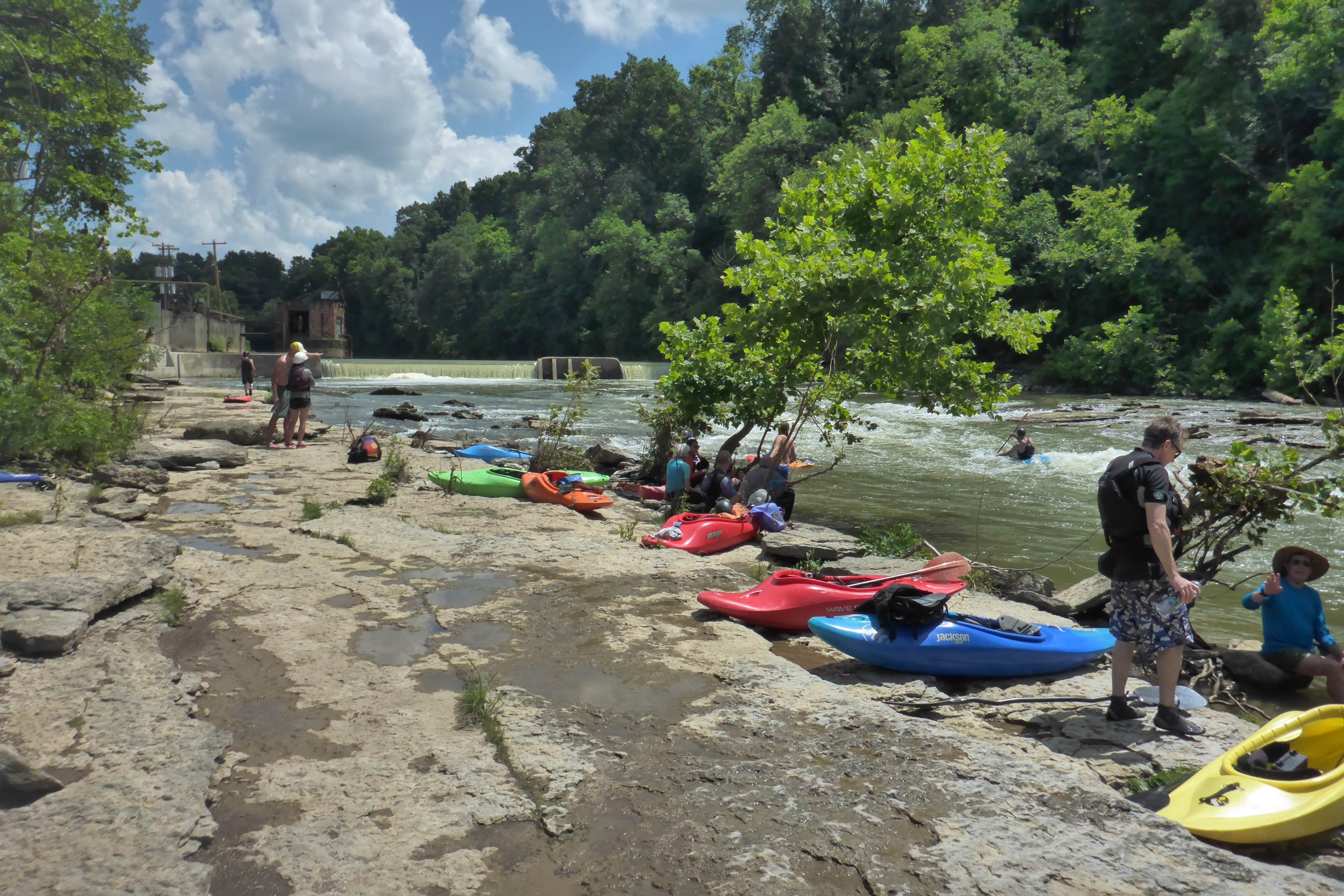
Basically, if you are a novice, you will need basic boat handling skills, and know how to catch eddies. And, you should go with someone who knows the river. Avoiding hazards is not difficult (hence the class II rating). A couple rapids (particularly Double Stump, below S-turn) can pick up strainers. Boat scouting is straightforward, and if strainers are present, portages are easy. So, a good responsible guide should make for a fun trip. No guarantee you won't swimm, but rescues aren't particularly hard. Again, this is a class II river, and a great one to learn on. The surf waves make it fun even for class IV-V paddlers, so it isn't difficult to get someone to guide you through. When there is water, just show up around 11 a.m., and the old hands will magically appear soon after. This is a good rule summer or winter, just make sure to “dress for the swimm” when it’s cold.
May 9, 2007
Sage making it look easy. You go girl!
Intrepid rock magnet boaters brave the Dam Rapid
at ELF flow levels.
The hydraulic at the Elkhorn Dam is minimal at the
low flow of 100cfs and can be safely run - especially
by experienced paddlers like Bubba.
May 9, 2007
This is for my buddy Pat's daughter. You go Sage!
Sep 26, 2006
Mad props to that guy!
Sep 6, 2006
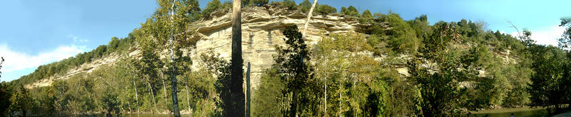
Click: See The Original File, to make it look like I meant for you to see it. We were standing on millions of tiny clam sea shells, it was a pretty random discovery I would say.It is said that the Gorge sometimes reaches 200 feet in height.
It Appears that the flood altered S-turn quite well because the island looks totally different, and I swear that it had a huge tree in the middle of it and it's gone now. What this has done is made the wave train allot furthor, meaning more humps. My brother said he went over the island and even ran over some small tree's, bending them strait down, and almost popped his raft. There were still 4 hydrolics in a row on the right side, but the first one seemed allot smaller to me.
Jun 10, 2006
I have actually ran the creek as low as 75 cfs, and believe it or not, no dry creekbed was exposed. At that level, the creek simply turns into a Class I+ deadwater and riffle run that is a perfect classroom for technicality 101. At that level, the S-Turn is more of the less a small ledge. However, that level is GREAT for fishing, since the creek is very clear and the fish are easily sighted.
I have canoed the stream up to 2000 cfs (about 1 1/2 ft.), and at that level, the dam scared the living hell out of me, I really dont see how the stream is paddeled at levels above that....
Oct 2, 2005
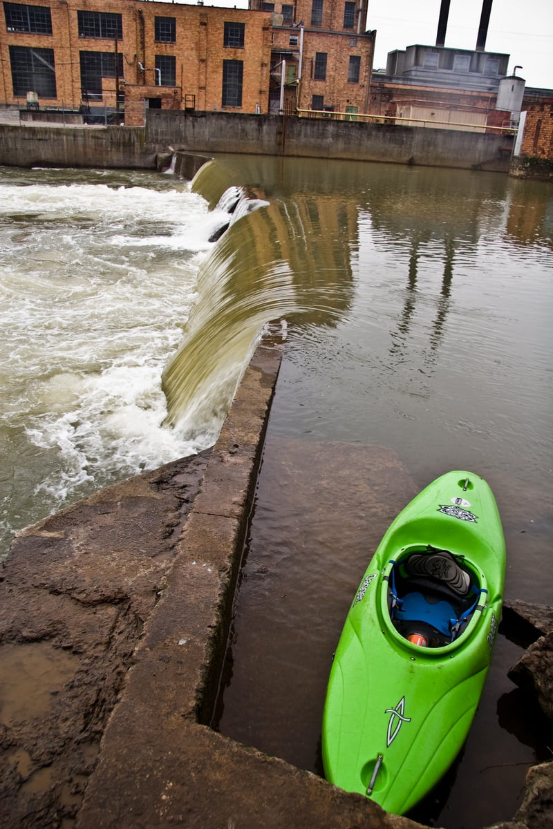
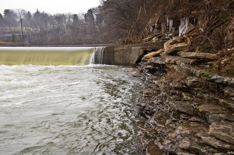
This is the dam that forms the first surfing feature, The Church Ledge.
Oct 2, 2005
This old foundation has slowly been uncovered over the last 10 years. There used to be trees on top of the foundation. Over the last 10 years, nearly a dozen trees have fallen on the river right at this rapid.
Note: This old foundation provides a surfing wave at normal levels. A mistake here could be bad. I suggest passing this playspot by.
Apr 8, 2005
I...I...I just don't know what to say...
Jan 15, 2005
This is one of the trees that formed the 'boof move' on the river right near Colstons Lane. The river right bank along Colston Lane has lost dozens of big sycamore trees in the last 10 years
Jun 5, 2004
Wow, what a run! major fun, but AVOID CanoeKentucky. Our first experience with them was great (i.e. decent prices, polite employees, great water level). The shuttle was only 10 bucks each then, and the place was staffed by a couple of guys who knew the water and could tell us the hairy spots. This time, however, was a little different. Suddenly the shuttle is 20 bucks each, the manager gets short with us when we try to talk to her about it ( she offered to let us put in upstream, float down, then give one of us a ride to the truck for $20), and it's pretty obvious that she doesn't care as much about our measly $40 bucks as much as she cared about getting the group of 20 customers paid and out the door. We left, and we won't be back. What she didn't know is that I was also shopping for a cheap skirt for my rascal ( oops, definitely a lost sale there!) and since we have wimpy little recreational boats, I planned on shopping there when I bought the boat I wanted. I WOULD have preferred to give my little bit of money to a small, local business rather than a huge department store like Dick's, but I'll be dipped in sheep butter & deep-fried before I spend another dime at a company that that treats paddlers that way, and I kinda like the way I sit in my new QT sport ($422.94 total at Dicks). Thank god we can take 2 vehicles, and ignore them. I guess they ARE in business to make money, but the shuttle shouldn't be 3/4 of a rental, and it definitely shouldn't be more than it costs to take another vehicle.
May 20, 2003
All I can say, is watch out for the drowing machine below the dam. If the level is below 250 cfs, then the dam doesnt prove to be much of a hazard. I've actually seen guys run it at this level, however, I'm not saying you should, I still say its not safe. As long as you exit on the left side, you'll be okay.
Apr 2, 2001
Info about all the various Elkhorn Gauges.
There are 3 'visual gauges' for the Whitewater section of the Elkhorn:
The US 460 Forks Bridge - this is the traditional paddlers gauge and is on the S. Fork of the Elkhorn tributary
The N. Fork bridge - this is a gauge that the local outfitter, CanoeKY has painted and roughly corresponds with the US 460 Forks Bridge.
The Knight's bridge gauge - this is at the 'AW Acres' takeout and was painted to read similar to the US 460 Forks gauge but it's typically a little higher.
Using the US 460 Forks bridge, anything around 6' - 10' usually means it's too low - at least for many wwpaddlers who don't like to scrape through rocky riffles (which is essentially all that remains of the 'rapids' at this level) or have to slog through the copious number of flatwater pools between the drops.
The US 460 Forks gauge has been in standard use by wwpaddlers for years, but in reality does not give consistent flow readings. A 10' reading in the spring can be way different than a 10' in the summer. This is because the US 460 Forks gauge is mostly measuring the S.Fork tributary and will often 'under report' the additional flow that the N. Fork is contributing.
In addition, there are two USGS gauges that have been used to determine flow on the Elkhorn Gorge:
N.Fork Elkhorn @ Georgetown - this one is way upstream on the N. Fork tributary and was the satellite gauge of choice before the arival of ...
Elkhorn Creek Near Frankfort - This is the new USGS real time flow gauge on the creek and (IMHO) the best to use because it accurately reflects both the N. and S. fork tributaries.
Based on the 'Elkhorn near Frankfort' USGS gauge I have put 500cfs as minimum wwfun and around 2500cfs as maximum.
Jan 1, 1900
stay outta the dam
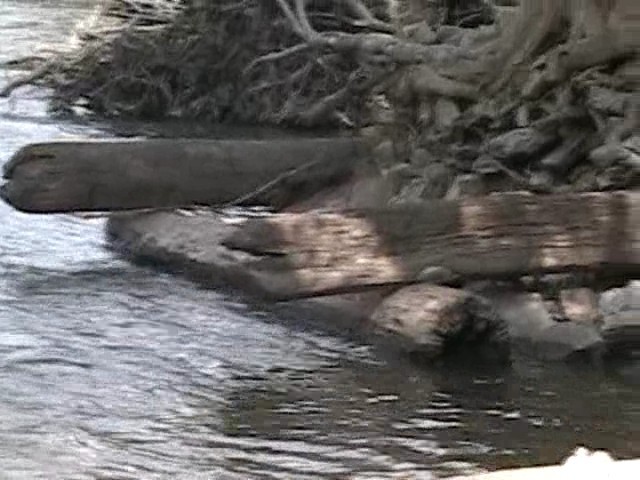
Croko-kayak surfing.
Jan 1, 1900
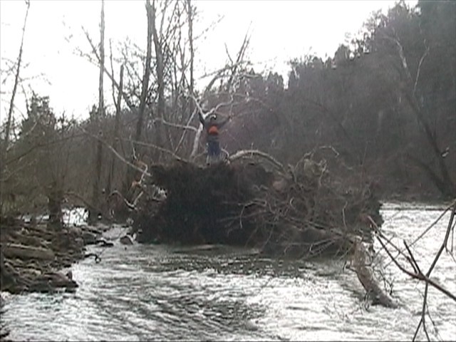
Looking back upstream at a rock 'sidewalk', which is the portage trail.
Jan 1, 1900
This was one of the last rapids of the day, and there aren't very many at 500 CFS.
This is the rope swing on the left side of the creek, it's easy to find.
'Sometimes reaching 200 feet in height'
Quote: A Canoeing & Kayaking guide to Kentucky
S-Turn at 500 CFS is fun, but not much, and the huge wavetrain on the left wasn't even there:(
Just taking it easy and enjoying the scenery
Attention: This video's purpose is to make S-Turn a safer place:
I convinced this real good kayacker to do this for Video sakes, and I felt bad when he flipped, but it looks like he had a fun time. He is not the first person I have seen flip because of this wave, and right afterwards it washes up on a shallow area to the left, and a island in the middle so it is a dangerous rapid, but the main flow goes right and it's pretty deep there. I am just glad he was a good roller, and made it out safe, and I'm never going to ask anyone again now that there's a video of the dangers of S-Turn.
Jan 1, 1900
Yeah Yeah I know it's not the best footage due to my far location on river right but the Koch brothers were throwing down in their brand new SUPER BAD Dragorossi kayaks and deserve the camera time.