Red
KY 746 to KY 715 (10.3 miles)(Upper Red)
Mar 28, 2017
Be aware that the class III rating for this section does not necessarily hold true at 900+ cfs on the Hazel Green guage. The big rapid in the narrows (falls section) is class IV ish at this level. Today (5.1.16) the Hazel Green guage was at ~950 cfs (cresting) with significant additional flow from tributary creeks. Great section of rapids in a beautiful setting!
May 5, 2016
Have waited for a window to run the Red for a few years. By chance I noticed a lot of black dots in eastern KY on the USGS map. The Red was running with more rain predicted. We made what turned out to be a 5-hour drive from Bristol and arrived at what we thought was the takeout with plenty of time to make the run. About half way up on the paid shuttle we realized that this was not the “upper” gorge that we wanted to run but was the middle section – all class I. After burning through the middle section (8miles) in 1.5 hours we were unable to get a shuttle to the upper and ended up staying the night at Sky Bridge Station a hostel/restaurant in Pine Ridge. Good food, beer and a clean bed with sheets and blanket. They typically serve climbers and some hikes but they do shuttles too.
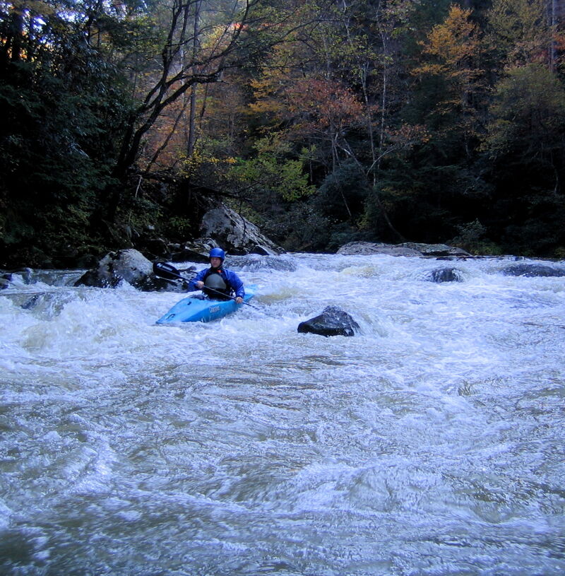
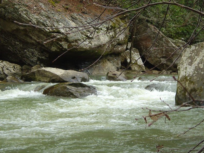
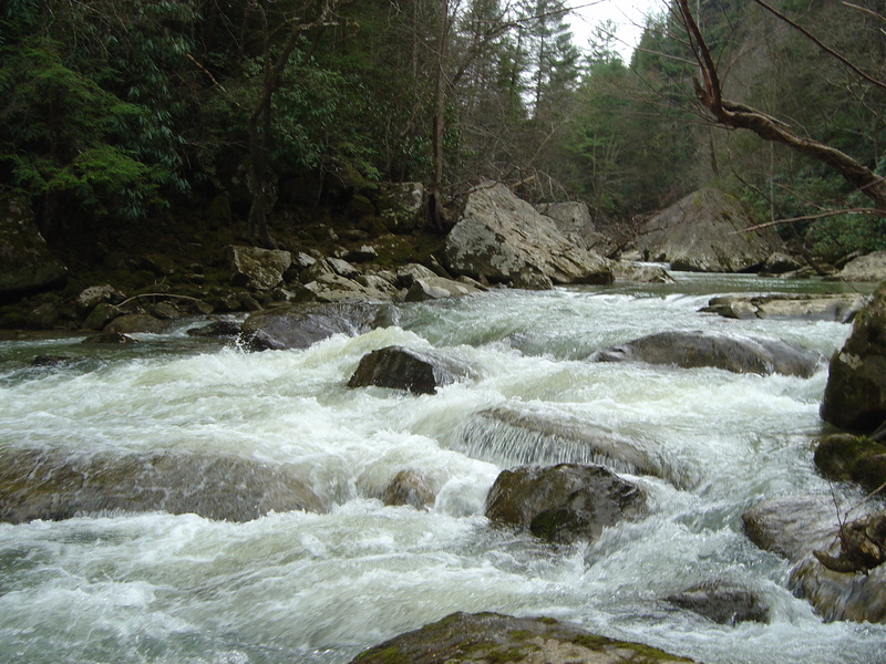
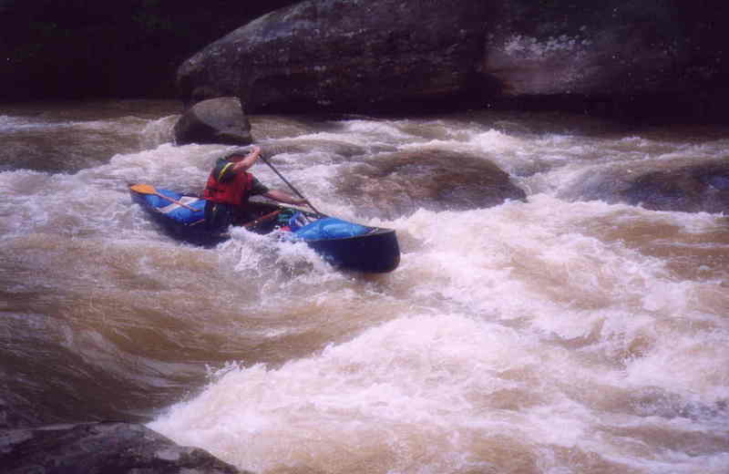
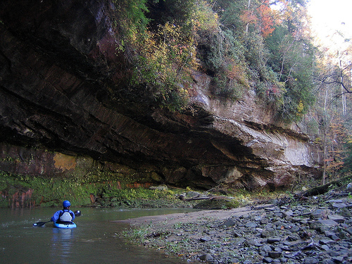
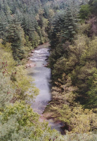
The River Gods were good to us giving enough rain overnight to slightly raise the level and leave about the same flow as we had the previous day. The level was 530 at Hazel Green when we put on for the upper gorge and 463 four hours later when we arrived at the takeout just below Concrete Bridge on Hwy 715. This is plenty of water to fill the river and give a swift current with strong eddy lines and solid class III rapids. Putting in on Stillwater Creek at the Hwy 746 Bridge the 2.5 mile run down to its confluence with the Red was scenic with several rock houses and small streams cascading in along the way. No rapids to speak of, but good current. At the confluence water color went from relatively clear to light brown and the speed picked up. On the Red there are more rock houses, numerous side streams with small cascades and waterfalls and some high sheer cliffs. You wouldn’t walk out of here, you would climb to get out. About half way down there was a cross river log that had to be carried on the left. There are about 5 or so significant rapids about three of these are class III and as noted by other reviews would be IV rated at higher water. All rapids have a well-defined route but there are big waves and some holes big enough to stop and hold a boat. One class III had a boulder jumble on river right that looked congested. About half the river feeds into the jumble and a right to left line is needed to avoid the boulders. This is a fun run with lots of interesting geology. Allow enough time to explore some of the side creeks.
May 3, 2016
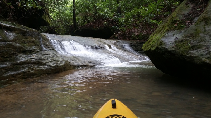
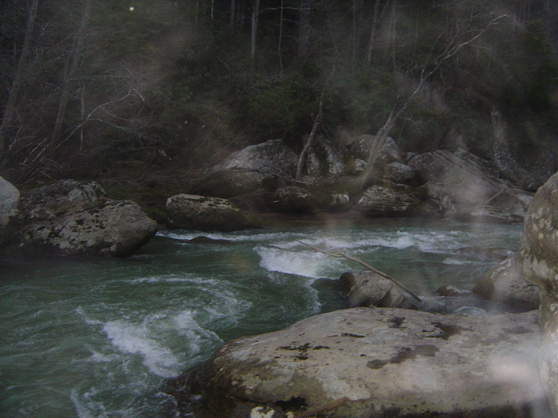
Grotto and small cascade on river left side stream. At this level, side streams on the Red form small, flooded coves. You have to paddle up into the side steam for about 200 ft to view this cascade.
Jun 26, 2015
The water level was rapidly dropping and we put in at about 6:30 or 7 on still water creek at the 746 bridge. Ive done this several times before at levels 400-1500 and never had an issue (in a raft at that). However, Still Water was too low. We scraped the whole way and actually walked several of the shallowest sections. The Red was great though, 400-600 is great in a kayak, not to big or pushy. If putting in on Still Water the water should be close to the rock overhang just behind the bridge.
Jul 27, 2011
We ran this river in a group of 3 in early March 2011. We scouted the river at 650 CFS (moving roughly 6 mph) the day before and decided it was running too fast for our skill level. The next day, the level was down to ~275 CFS (moving closer to 2-3 mph). Everyone in the group had beginner white water experience. We stopped frequently to scout, and there was only 1 rapid with a nearly river white strainer that required portage. At this water level there were some solid class III rapids (possibly III+) and a large number of class II. Dog drowning hole which was very obvious at 650 CFS was quite small at 275. Overall a very entertaining run, we ran the 10 miles in 4 hours or so. It was a tiring run (especially with the cold - water was high 30s or so), but the water was moving constantly which helped. I personally was using a recreational kayak and had no problems running it. Using a canoe would have been difficult due to some tight turns. I would recommend at least intermediate skill level at water levels higher than 350 as the current begins to become quite swift and recovery of your boat could be difficult. The water levels fluctuate rapidly, and without previous heavy rainfall, the river is more of a creek. I would recommend keeping a close eye on water levels after a storm.
Mar 21, 2011
Ran at around 140-150cfs (per Hazel Green gauge) on 3/19 & 3/20/2011 in a 12 foot recreational kayak. Water level not a huge problem on the majority of the river, although some of the drops required portages. This was mostly due to having a recreational kayak, and little whitewater experience.No river wide strainers, but we did encounter a few smaller strainers in between some of the boulders. All of which, we were able to pick a route around. Calaboose Falls is beautiful, and would have been fun in a smaller kayak.
All in all a great trip! The scenery and terrain are amazing. We did the trip with an overnight right around the 5 mile mark. I would not recommend leaving a vehicle at the put in off of 746, the location is very remote and seems to be a local party spot. For an excellent shuttle service, try Redriveradventure.net They are located 1/4 mile East of the 77 & 715 junction in the Red River Gorge. Ken is the owner, and he went out of his way to accommodate us to make the trip possible.
Mar 7, 2011
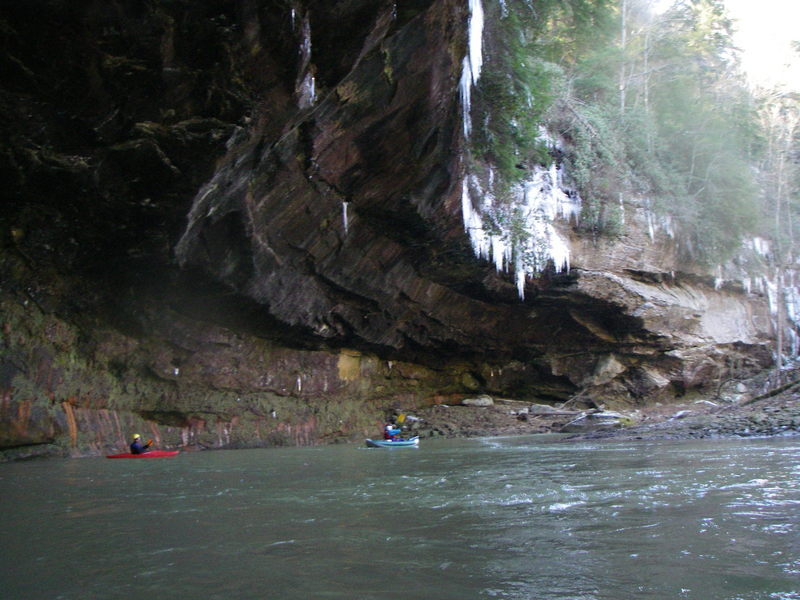
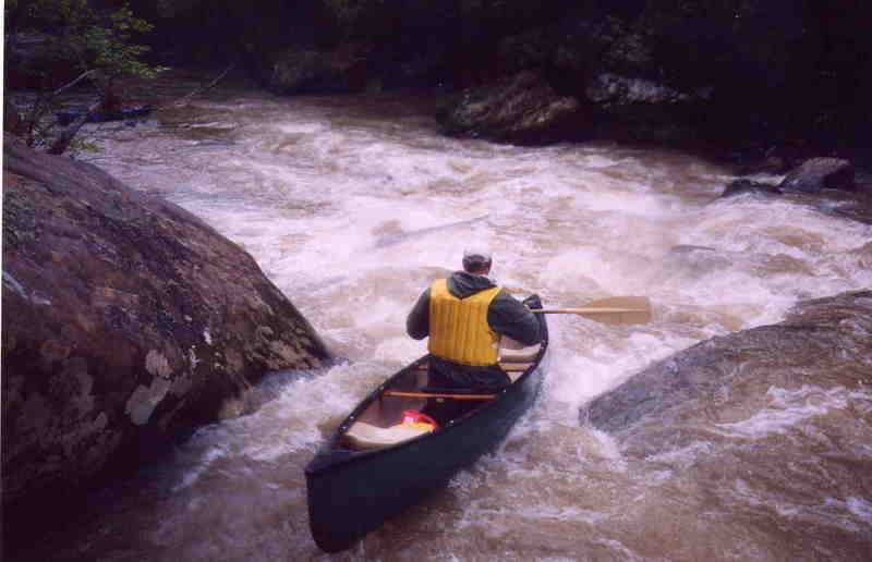
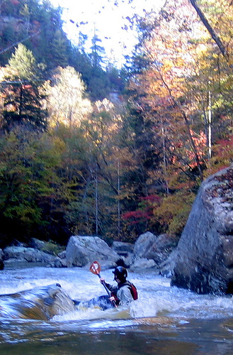
Hugo Araneda and I (Brent Austin) ran this on March 6, 2011 with approximately 1150 cfs in Hazel Green. We put on the Stillwater Creek, which we estimated had approximately 700 cfs with a combined flow at the Red of around 1850 - 2000 cfs. The holes were big and the rapids were substantial class III+ with consequences. Harder than the Ocoee at this level with Lower Gauley type moves. Very heavy water. At this level I would say a class III-IV overall because of the pushy water and problematic hydraulics with moves to make. Good level and a great choice for the right boaters. We did the trip in about an hour and a half. Wow, beautiful in there. Most of the river wide strainers at lower water were submerged at this level and we did not have to get out of our boats.
Brent Austin
Feb 2, 2008
Larry Cable and Josh Carpenter in the ampitheater
Oct 21, 2006
Oct 21, 2006
Red River Gorgeous
Jun 1, 2005
Ran the red on 4/29/05, post flood run again, red hit 3400 on Friday, ran it sunday at ~600 cfs (4ft). Some of the pictures here say the level is 6ft, but must be wrong because some of the boulders visible in the pictures are covered at 4ft. At this level the rapids are probably a solid class III, with a couple rapids borderline IV. The Falls of the red river have a pretty large hole on both sides, so the center is the best line on that. River left hole sucked me back under the falls and spit me out down river. There was a lot of wood in the rapids, one major bottleneck had a sneak on the river right side behind a large boulder, there was a river wide strainer in the flat water section toward the end.
Apr 4, 2005
Most recent run of the Red on Sun april 3rd.
Great level, proabably around 700 or 800cfs. It's different from the guage on most occasions. All the large rapids are clean and wood free, however, there are numerous smaller rapids with strainers. Some are nearly river wide and the path around is only visible at the last moment. Most rapids have an eddy making boat scouting possible. If you run this river at higer levels, don't let the flat water fool you. Please take this run seriously. It DOES have consequences.
Apr 15, 2004
Water up, great trip.
Apr 4, 2004
This is one of many small drops/holes you will encounter as you work your way around the many boulders in the Narrow section of the Upper Red River.
Apr 4, 2004
This rapid is known as the 'Falls of the Red River', more like a long slide consisting of two drops.
Another no name rapid, part of the narrows section. I call it portage left becuase it looks like a lot of people have portaged to left based on all the red canoe paint on the rocks. Very runnable, class III skills needed, a good brace is helpful, requires lots of navigation to get around the rocks.
Apr 3, 2004
This is first rapid of any measure that you come to on the upper section of the red river, the true narrows section starts about a mile or so later. This rapid is a at least 2 miles into the run.
The is the back end of the first rapid you will run in the upper section of the red river
Apr 15, 2003
Great trip, water up.
Jan 1, 1900
Spalding going down a rapid
Jan 1, 1900
Rock Amphitheater