Rockcastle
Beech Creek to Bee Rock Campground (5 miles)(Lower Rockcastle)
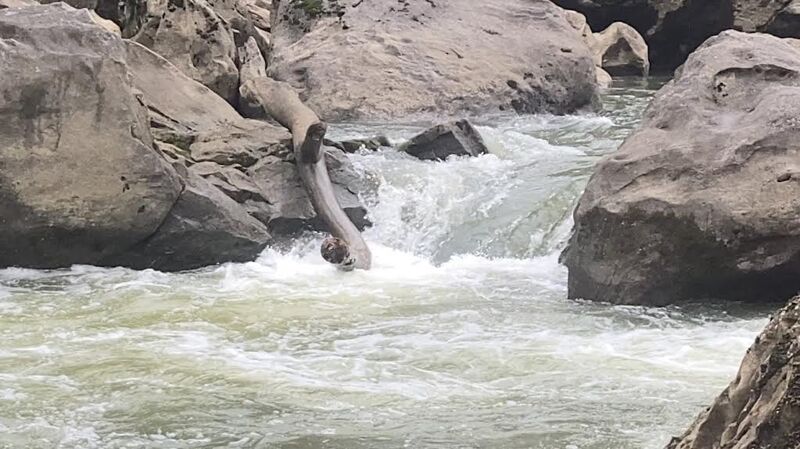
Nov 25, 2024
Mar 26, 2016
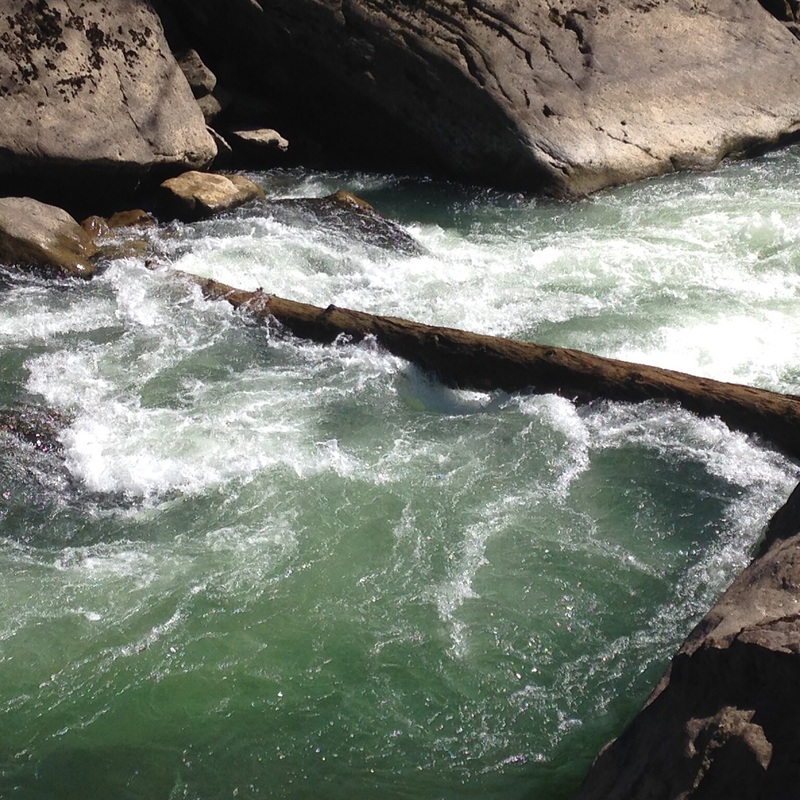
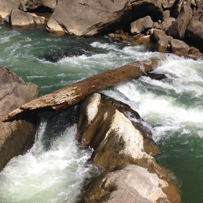
There is a river wide tree on drop 2 3-21-16
Mar 26, 2016
There is a tree blocking the river drop 2
Mar 24, 2011
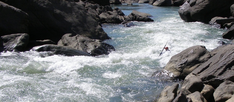
As a response to the comment below, I will add my opinion on levels. I personally believe that the Rockcastle is much more forgiving at levels below 800cfs. At these lower levels there is more time to react, more eddies to catch and not as much push. I think it is a III/IV run in this range, with Beech Narrows and Teeth possibly being IV's. Once you get much over 1000cfs I believe the whole run works it's way into the IV range. The lower narrows section turns into one class IV rapid that's a half-mile long, with push and holes to avoid. At 5000cfs, Beech becomes a significant V, while the lower narrows turns into upper Gauley quality stuff.
I will agree that levels over 1000cfs are a lot of fun, and class IV boaters should enjoy this range. However, I think it is misleading to suggest that 1500cfs is easier or safer than 300cfs. The again, I could be wrong. I have over 100 runs on this stretch from 60cfs to 5000 cfs and this is just my opinion.
Dec 4, 2009
This river is one of Kentucky's best for many reasons. The beauty of the rock structures, giving this river its name is one. Two, the rapid section from beech to bee rock above 2500cfs is some of the best set of rapids you will find in this state. I have run this section at 3200cfs and it is a blast, but starting to flush. 2200cfs to 2500cfs is the best level for surfing. There are a hand full of surf spots that you can play in until your heart desires, or until you are so tired that you think you may have to save some energy to procede to take out. Don't let high cfs #'s turn you off of this section. I think that this river is more dangerous at lower levels, ie 800cfs or below, than above 1500cfs. Be safe and have fun but always know your skill level. This section of river is a true Class IV river, at low or high water.
Sep 21, 2009
IMO the minimum for this run is closer to 80 cfs. The lowest I've run it is ~100 cfs and all the drops were totally doable without having to worry about scraping your boat up. Also, the gauge is about 16 miles upstream from the Narrows with a good number of tributaries in-between. As a guess, it takes about 8-12 hours for the water at the gauge to reach the Narrows and depending on where rain falls the tributaries can add a significant amount to the gauge reading. Expect the gauge to bump 1-2 days after a good rain.
Aug 17, 2007
That is video of the entire lower narrows section shot on
March 31, 2007 at 460cfs
Mar 11, 2007
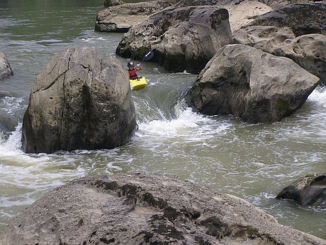
This is the main drop of Guys Surprise. The rock to the right has a fleck often under the current that will catch unsuspecting boaters thinking the whole thing is a hole.
Several small waves and holes down the middle make this one a flipper.
Mar 10, 2007
Park map of campground, trails, and river.
Map of Campground (Takeout for narrows)
This rapid is usually covered up by lake Cumberland, but with recent repairs to dam, lake is @ 580.
Jun 9, 2006
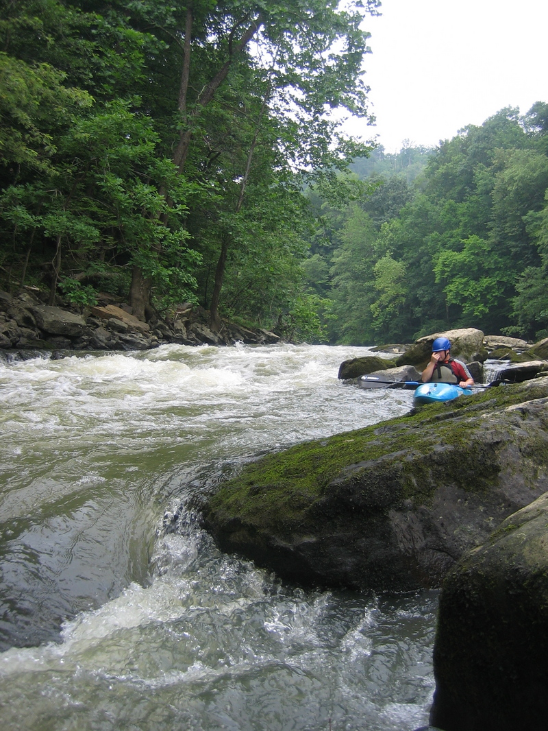
This is the river left trail for portaging around the
Beech Narrows. Take out just before the rapid on the
left.
Jul 15, 2004
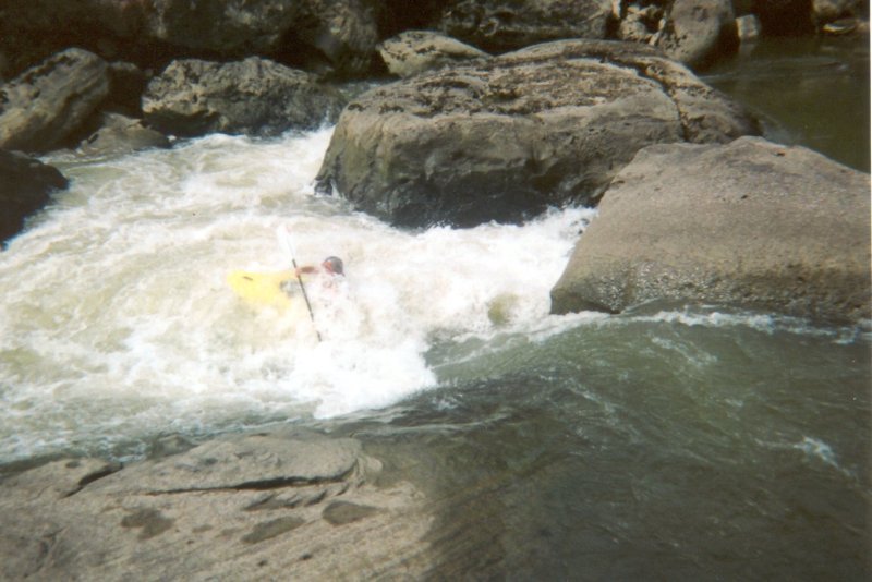
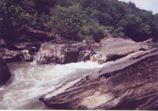
Guy Cottle deep in the foam.
Jun 15, 2002
This rapid has a hard-to-catch wave right in the middle, and also has a great play wave at the bottom, and a nice hole at the top...if you think to look for it instead of being distracted by the rapid.
Jul 15, 2001
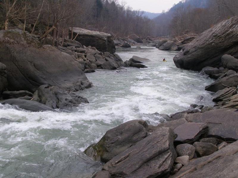
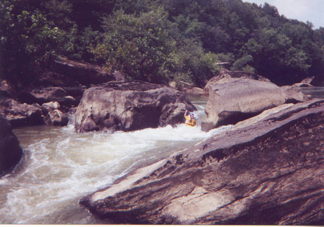
This is the trickiest rapid on this reach. After witnessing carnage in the hole, and noticing the large undercut rock right in the middle of the river just downstream, I decided that if the water is high enough to run the river left sneak (you can barely see it in the picture) then the sneak is the way to go. See the larger version of this picture by clicking here.
Jul 15, 2001
This is the trickiest rapid on this reach. After witnessing carnage in the hole, and noticing the large, possibly undercut rock right in the middle of the river just downstream, I decided that if the water is high enough to run the river left sneak (you can barely see it in the picture) then the sneak is the way to go.
Jan 1, 1900
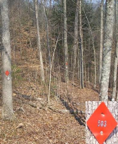
Look for these trail markers on each side of the road. The way to the river is down the hill.
Jan 1, 1900
Steven lining up for a clean run
Jan 1, 1900
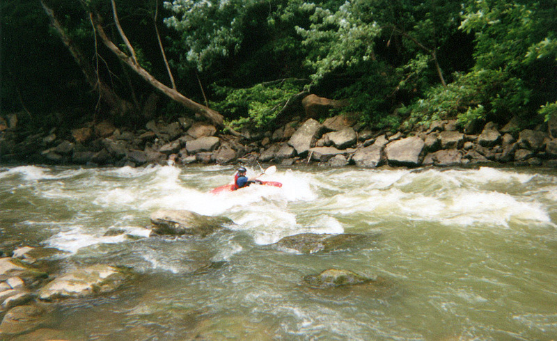
This is Ryan's first solo canoe whitewater experience, so you have to give him credit for not flipping here.
The complete saga of the Bardstown Boaters trip
down the Rockcastle during August of 2004