Cold
Route 2 hairpin turn to Deerfield River
| Difficulty | II-IV |
| Length | 3.7 mi |
| Avg Gradient | 125 fpm |
| Gauge | Cold River at Florida, Ma |
| Flow Rate as of 35 minutes | 3.39 ftbelow recommended |
| Reach Info Last Updated | June 29, 2015 |
Data supplied by Outdoor Center of New England
May 27, 2025
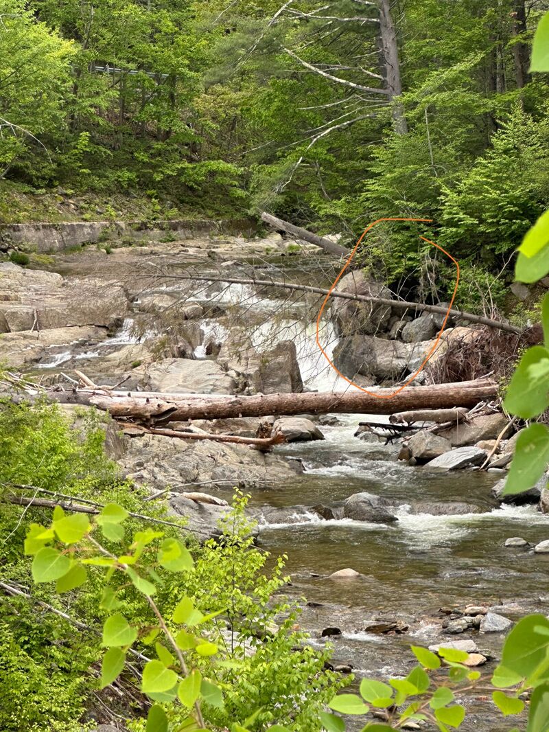
Major hazard- undercut from these two boulders that fell, in addition to the strainers
May 25, 2025
Rough coordinates of boulder & trees that need to be portaged:
(42.6336590, -72.9317385)
May 25, 2025
Generally recommended not to run this under 5ft on the connected AW gauge for the Cold.
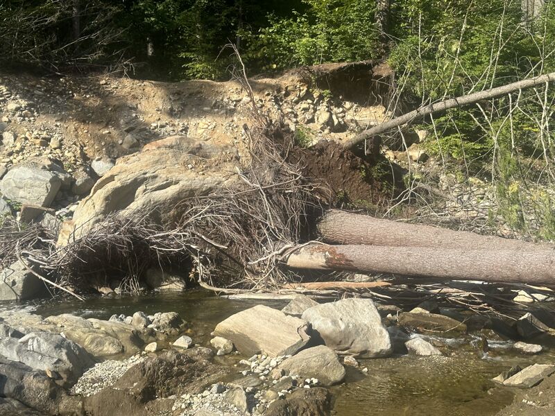
There's a giant boulder and several LARGE trees that fell across the main class IV drop, probably sometime around 2022/2023, which is clearly visible from Rt.2 and will need to be portaged. It may be possible for extremely skilled paddlers to run a line far river right if the water is at the right level, but there would be ZERO room for error, as even a small mistake would likely result in being snagged or pinned by several large river-wide strainers.
Apr 4, 2021
Ran this at 3.5 feet on Deerfield Fife gauge.
Decent run, we took a small raft down, and it was too low for that. The kayaks got through with a bit of scraping.
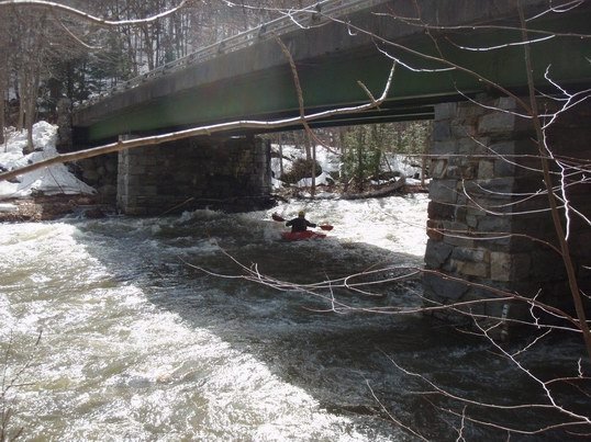
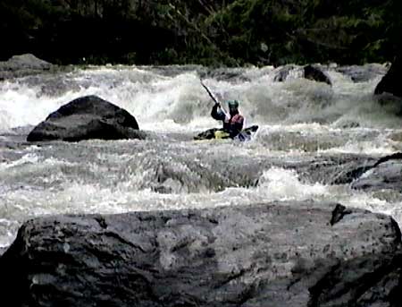
Most of the river is decent Class II - II+, and was fun in the kayak. There was one obvious class 4 that only two of us ran, the left line worked out best (this looks like it will change with higher water). There were a couple swims and one minor pin, be ready for rescues, it's rocky. The class 4 has an easy place to set safety and scout. You might have an audience, there's a pull of from the road right next to this.
In several areas of the river, it looks like the banks have had some sort of concrete poured on them, possibly it ran off from road construction, or possibly to prevent erosion. The concrete eroded below the waterline, so in several areas, river right looks quite undercut, with a very sharp concrete edge.
We took out at the railway bridge, about 1/4 mile downriver from where AW says to take out. There was a small lot. The area that AW has on the map looks like it would be easier to carry boats through, but the roads say no parking near there, although there may be room for 1 or 2 cars near the bridge. Another good place to take out might be right after the class IV, on a place google maps calls 'aire de repos' (Rest area). It's a small pulloff with a big sloping rocky area. You'll miss the last half mile of whitewater, but nothing too crazy happens there.
Apr 12, 2008
Cold River Takeout at the state park before the 'falls' section.