Hickory Creek
Joliet: Corcoran Park to S.Joliet Street (3.75 miles)
| Difficulty | II |
| Length | 3.7 mi |
| Avg Gradient | 19 fpm |
| Gauge | Hickory Creek at Joliet, Il |
| Flow Rate as of 21 minutes | 51 cfsbelow recommended |
| Reach Info Last Updated | March 13, 2025 |
Quick Facts:
Location: Joliet, IL.
Shuttle Length: 4.2 miles.
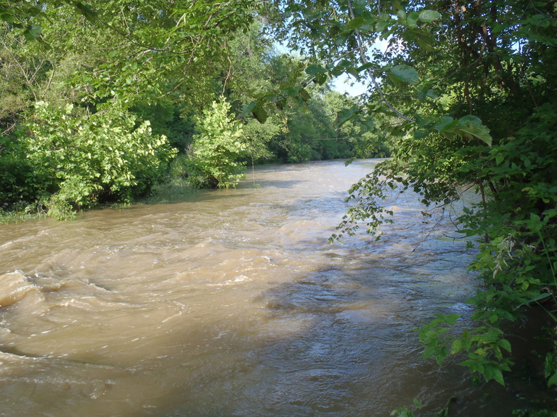
Character: In town run, though most of the early going is wooded parks, you come out past homes, and finish within vertical cement walls (before the confluence with Des Plaines River).
Drainage area: approximately 107 square miles (at gauge at Richards Street).
Put-in elevation is approximately 580'.
Take-out elevation is approximately 505'.
Thus total elevation change is approximately 75'.
Paul Bowman provides (2009-03-18):
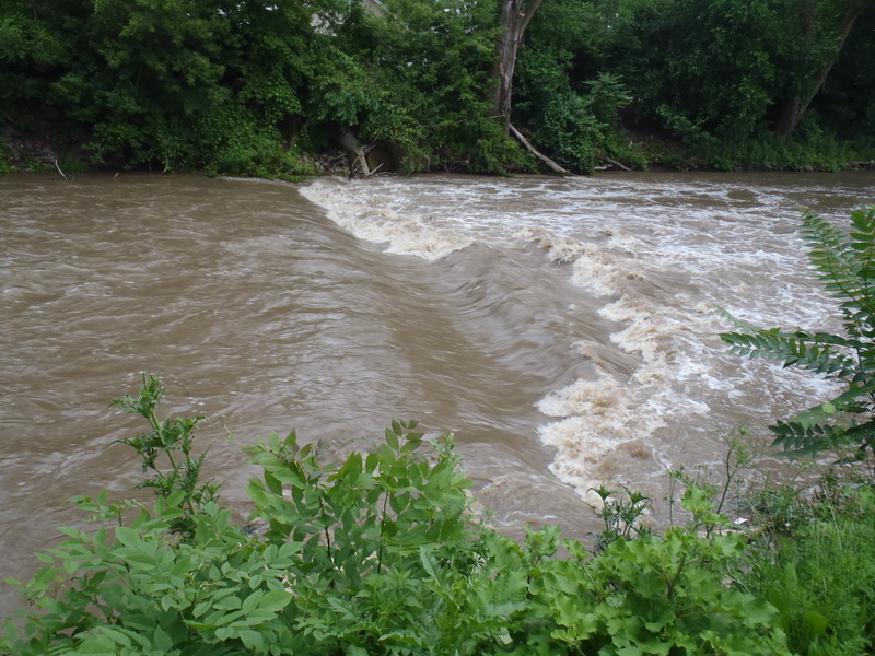
Hickory has been one of my favorites for almost 12 years. I usually put in below the dam at Pilkcher Park. There is a lot of parking and then follow trail below the dam to the creek. With water levels above 300cfs (minimum) you get some good 2ish boogie water. When you enter the concrete canyon, Spring Creek will be on your right.
*The first drop with the great surf has been called 'Upper Synthetic' and the surf spot below old Richards Street bridge 'Lower Synthetic'. About 10 years ago the water reclamation department had the creek bed majorly altered. Most of the gradient was directly below the I-80 bridge. A contrator with large rock chewing machines removed a 4' thick layer of creek bed. Directly below I-80 there was a great foamy wave. They removed the creek bed all the way up to where Upper Synthetic (man made) was formed.*
Brad Klimkowski provides (2009-03-17):
I have been this river on a few occasions; unfortunately river levels were drastically different each time. My first time down Hickory I scraped my way down at around 200 cfs and found almost no worthwhile whitewater features other than at the feature that is labeled “The Squeeze” (which is an excellent name for it by the way, whoever put this creek on here, and I would love to see it stick).
My second time down I managed to get o
...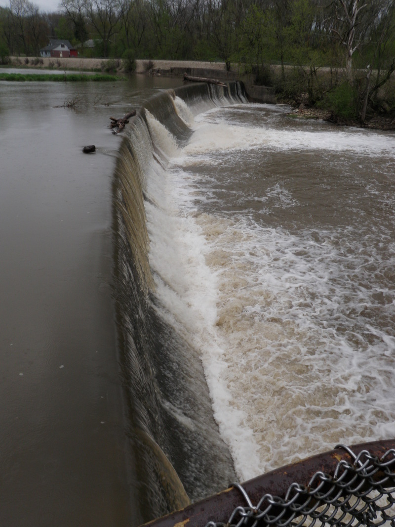
While there appears (via Google satellite view) to be one apparent spot of potential whitewater interest upstream of this dam, it is generally preferred to put-in below the dam. Parking is available upstream a ways, however, portaging the dam is very awkward due to fencing (on river-right) and a short but very steep scree-covered railroad embankment (river left). Running the dam is very strongly not recommended. At most flows, there will be very little water flowing over all but a center notch, where it falls hard onto a splash block.

Downstream of the dam, the width of the river is compressed as it heads toward a railroad bridge. At higher flows a fine surfable wave occurs before the flow piles into a bridge-pier.
Downstream of the railroad (again, at high flows) water swirls and boils in a deep pool. Whirling vortex currents appear and dissipate.
Following the swirling waters in the deep pool below the railroad tracks, there is a rocky shoals which may create some riffles and waves (though it may 'wash out' substantially at higher flows).
(Info via Google aerial reconnaisance only) There appears to be a small ledge/shoals at this location. It is not known whether this creates playable whitewater features at boatable flows.
(From Google aerial reconnaissance) There appears to be a ledge at this location.
Alas, this has reportedly been removed, leaving nothing of interest here. (Some folks call that progress.) Those who have done the run can look at the photo and reminisce. All others can see what you missed.
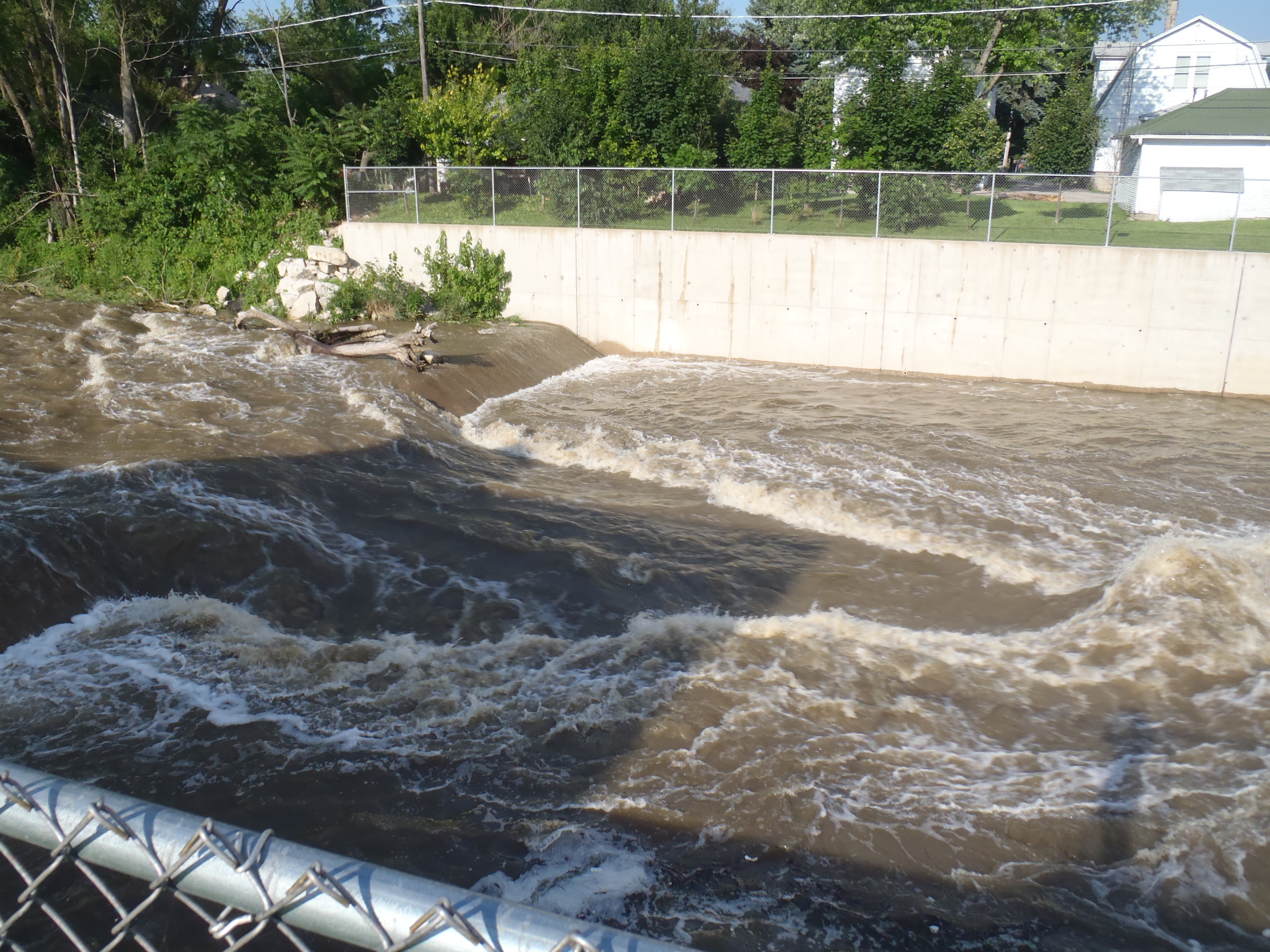
The USGS gauge is at Richards Street. Just past this, Old Richard Street crosses the river, and the flow spills across cement under that bridge. Two bridge piers split the flow into three channels. The left and right channels are prone to be pourovers at low/moderate flows, while the center channel will have a fine wave and wave-train. Repeat play is possible.
(Info via Google aerial reconnaisance only) There appears to be a small rockdam at this location. It is not known whether this creates playable whitewater features at boatable flows.
Another bridge pier and area of cement riverbed may possibly allow a bit of play (at the right flows).
Mar 19, 2021
Ledges/Squeeze Intact. Reports of the demise of 'The Squeeze' appear to be premature. Today, with flow at 345 cfsI I decided to do a visual tour of Hickory. Standing on the Fourth Avenue Bridge looking North, the Squeeze and ledges above were clearly visible. It's been several years since I paddled this section, but it did not look to have changed from my memory.
Jun 25, 2010
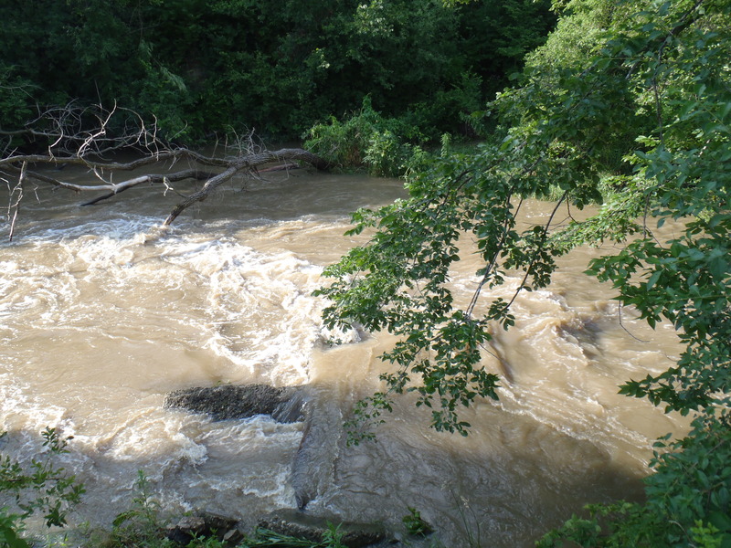
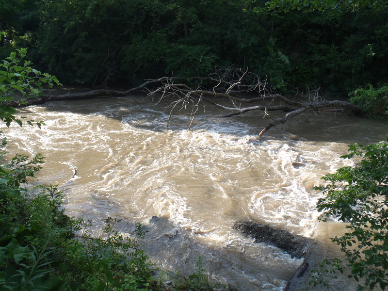
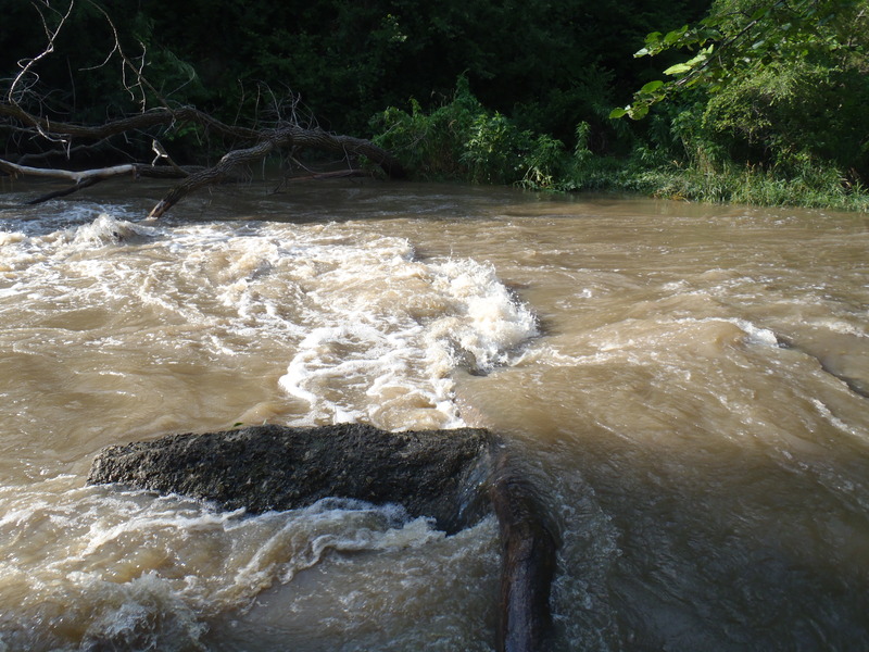
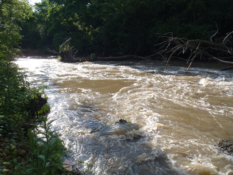
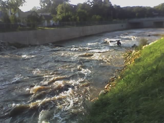
One tricky part of hickory creek - rock and log create a strong cross-current into a strainer. Eddy river right upstream of this feature. Scout behind the parking lot of the building east of the Collision Revision on Washington St east of Briggs.
Jun 25, 2010
One tricky part of hickory creek - rock and log create a strong cross-current into a strainer. Eddy river right upstream of this feature. Scout behind the parking lot of the building east of the Collision Revision on Washington St east of Briggs.