Hickory Creek
Joliet: Corcoran Park to S.Joliet Street (3.75 miles)
Mar 19, 2021
Ledges/Squeeze Intact. Reports of the demise of 'The Squeeze' appear to be premature. Today, with flow at 345 cfsI I decided to do a visual tour of Hickory. Standing on the Fourth Avenue Bridge looking North, the Squeeze and ledges above were clearly visible. It's been several years since I paddled this section, but it did not look to have changed from my memory.
Jun 25, 2010
One tricky part of hickory creek - rock and log create a strong cross-current into a strainer. Eddy river right upstream of this feature. Scout behind the parking lot of the building east of the Collision Revision on Washington St east of Briggs.
Jun 25, 2010
One tricky part of hickory creek - rock and log create a strong cross-current into a strainer. Eddy river right upstream of this feature. Scout behind the parking lot of the building east of the Collision Revision on Washington St east of Briggs.
Jun 25, 2010
One tricky part of hickory creek - rock and log create a strong cross-current into a strainer. Eddy river right upstream of this feature. Scout behind the parking lot of the building east of the Collision Revision on Washington St east of Briggs.
Jun 25, 2010
One tricky part of hickory creek - rock and log create a strong cross-current into a strainer. Eddy river right upstream of this feature. Scout behind the parking lot of the building east of the Collision Revision on Washington St east of Briggs.
Jun 25, 2010
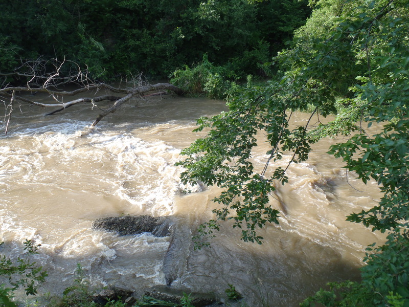
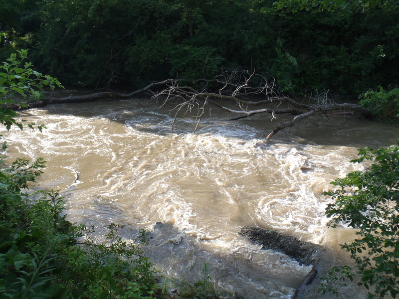
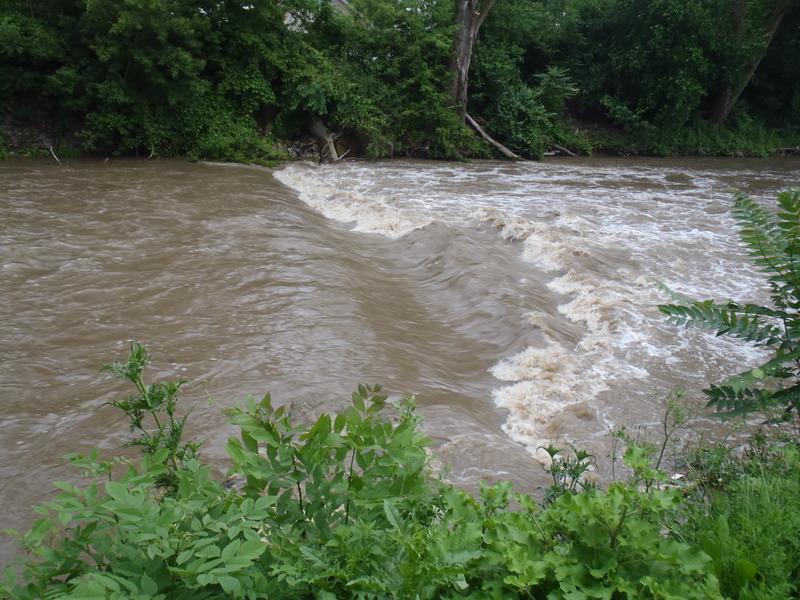
this is the first wave upstream from the wingdam at around 800cfs on 6/23/10
Jun 25, 2010
[looking upstream of strainer] One tricky part of hickory creek - rock and log create a strong cross-current into a strainer. Eddy river right upstream of this feature. Scout behind the parking lot of the building east of the Collision Revision on Washington St east of Briggs.
Nov 9, 2009
On a recent outing, as we prepared to put in, a 'concerned citizen' stopped to inform us that she had inquired about the legality of paddling (her recreational kayak on the waters above the dam) and was told it was illegal! We thanked her, watched her drive away, and proceeded with our run. As we approached our take-out, so too did a police car. They greeted us and said they had received a call about a couple kayakers 'in trouble' in the river. (Some other 'concerned citizen' had, no doubt, noticed us playing at 'the squeeze' or somewhere else, and evidently didn't watch long enough to see we were INTENTIONALLY getting in (and out of) the features.) We assured the officers that we were well experienced, and at no time had we been in trouble, and thanked them for their (and the citizen's) concern. They were quite friendly and shared some additional chatting before heading off on their way (with no hint of admonishment whatsoever about our having boated the river).
Jun 15, 2009
According to the USGS site for this gauge:
'The concerned citizen's and emergency manager's response to the potential loss of this streamgage has been incredible. Thanks to all of you, we believe we now have the necessary funding to continue the operation of this gage. FYI, this gage will now be funded through the following partnership:
USGS National Streamflow Information Program NSIP;
Illinois Department of Natural Resources, Office of Water Resources;
Joliet Township (Mr. Daniel Vera, Supervisor)'
May 1, 2009
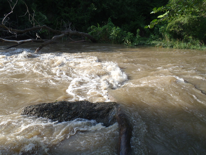
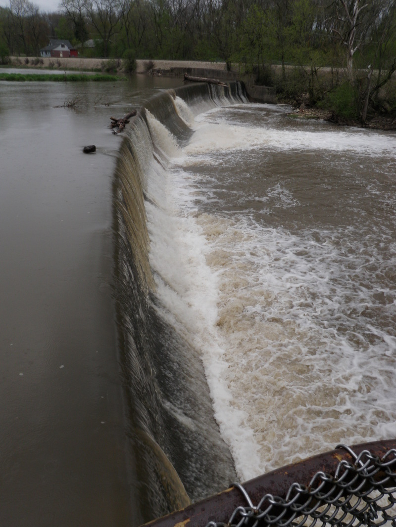
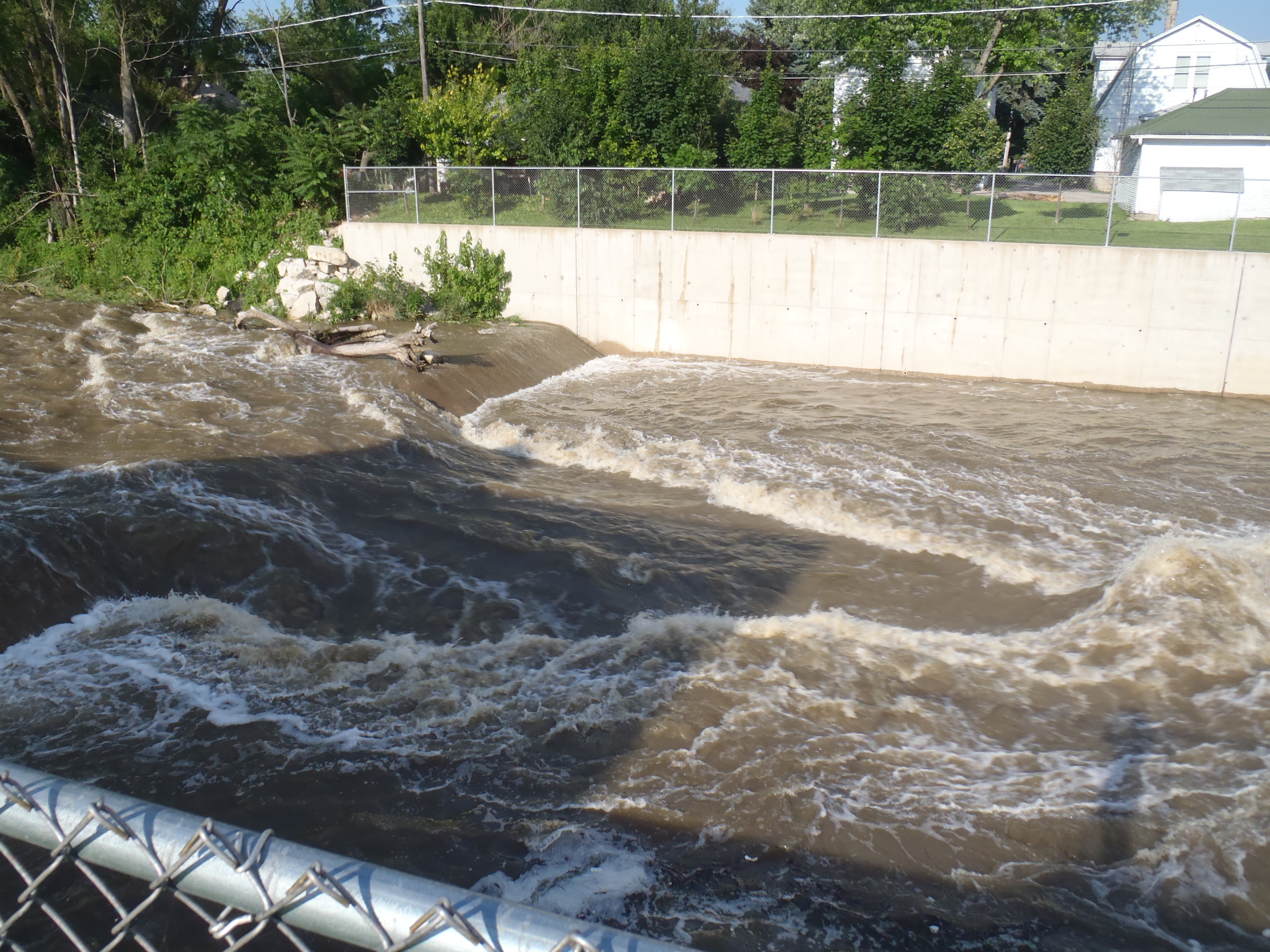
River right wing dam.
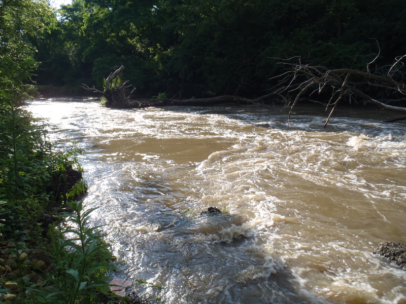
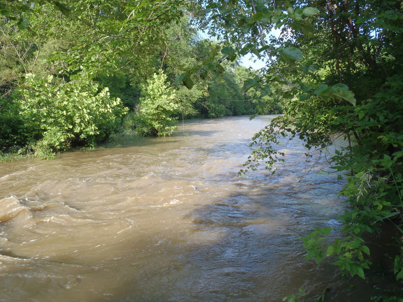
Looking down stream from the river right eddy next to the squeeze. The river is channelized like this for awhile.
Apr 25, 2009
Not too many folks pay attention to Hickory creek, but it does deserve notice. Unfortunatly, the gauge is going to be shut down, and so I have been trying to work out some corelations.
Just to the north and parallel to Hickory is Long Run Creek running through Lemont. Erik, Rich and myself ran it one day and it was fun but not worth doing again. However, it does have a USGS gauge that is not losing it's funding.
After expanding the USGS graphs of both creeks to 60 days, I noticed that both creeks have VERY similar patterns, and they showed two easy relationships. Hickory reads about ten feet higher than Long Run, and has about three times the flow. These are not exact, but pretty close considering how simple they are.
And as far as flows go, we scraped down at 175 cfs once, it was still fun but I would call that a minimum. At 700, there was some good play at the Squeeze, a formation at the top of the Concrete Canyon.
Jun 2, 2007
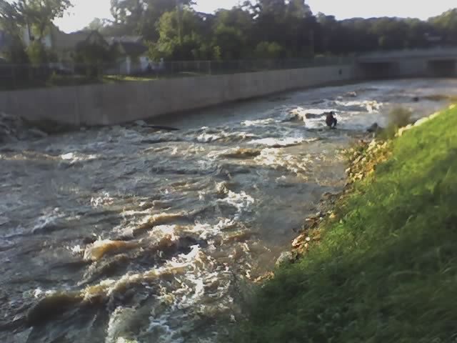
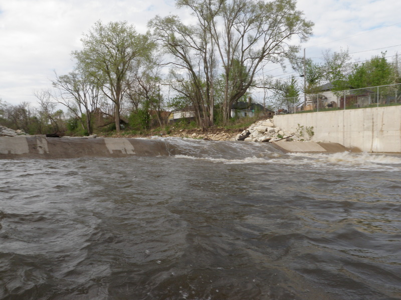
Looking downstream at the squeeze, a fisherman sits on a wingdam on river right, another exists on river left creating a decent wave and a fun little drop in the heart of Joliet, IL urban whitewater at its best
Jan 1, 1900
Looking upstream from river right.