Deerfield
3) Monroe Bridge to Bear Swamp(The Dryway)
| Difficulty | III-IV |
| Length | 2.5 mi |
| Avg Gradient | 78 fpm |
| Reach Info Last Updated | August 9, 2023 |
On October 5, 1994, American Whitewater signed a landmark settlement agreement with the New England Power Company, anglers, conservationists, and government agencies regarding the management of the Deerfield River (FERC P-2323). Located in Western Massachusetts, the Deerfield River is a classic whitewater run, and the settlement recognized its recreational, [...]Read More
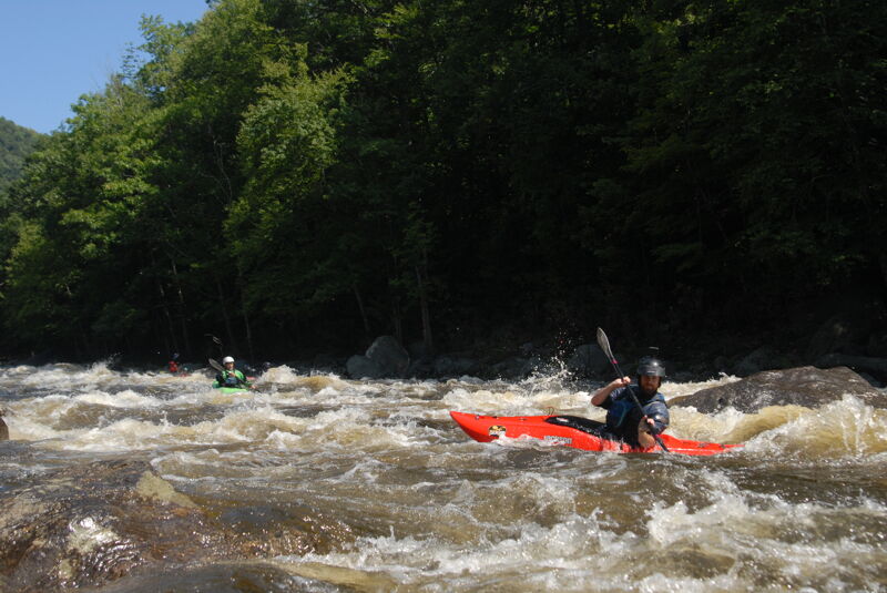
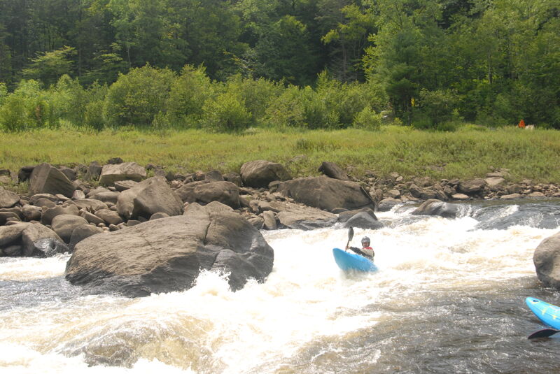
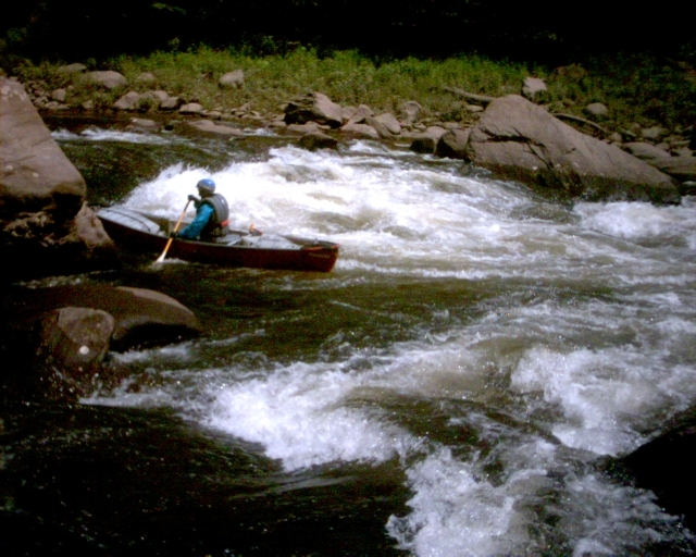
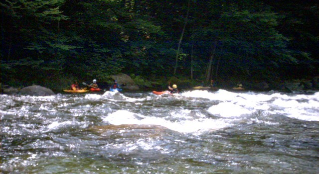
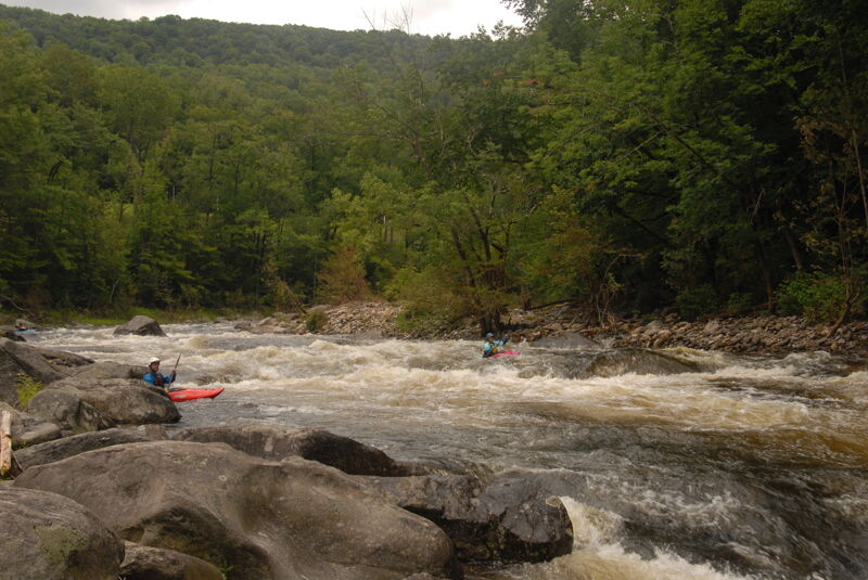
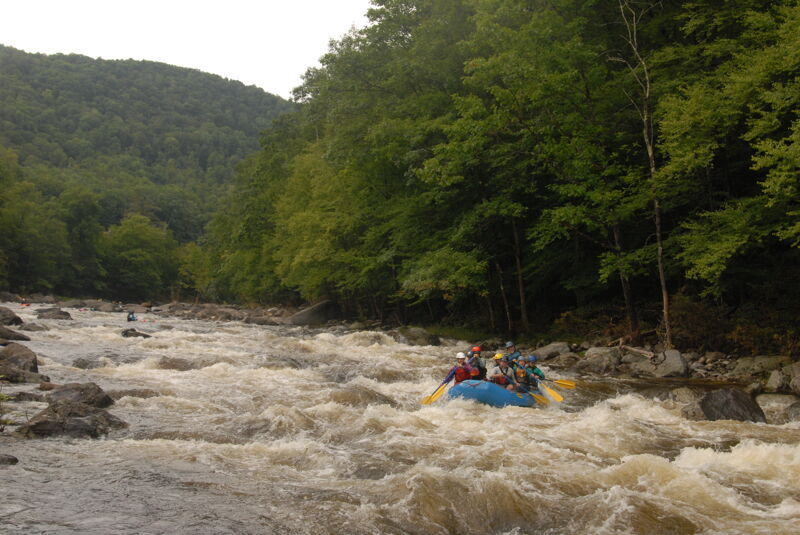
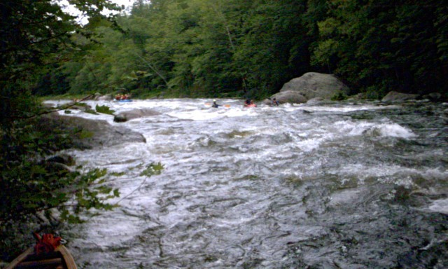
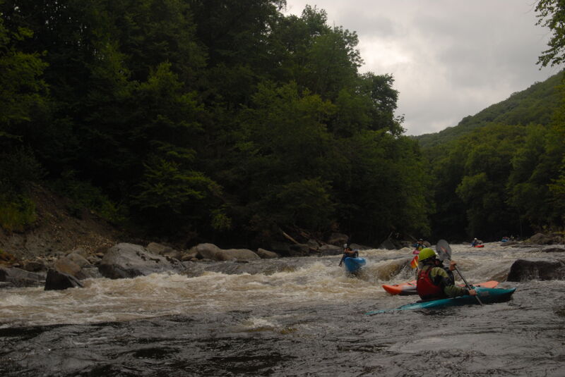
The Monroe Bridge Section of the Deerfield (also known as 'The Dryway') is a popular class III-IV river that can draw a rather sizable crowd on release days. The river generally starts out easy then gets progressively harder as one paddles downstream.
If you are up for the challenge, the Dryway is a premier destination for most northeastern paddlers. If you are not up for class III and IV water, try a raft trip from one of many outfitters in the Charlemont area. For an easier trip, try the Fife Brook section of the Deerfield just a few miles downstream.
The water in this three-mile section of the Deerfield is usually bypassed by a diversion canal from Dam #5 all the way down to the reservoir behind Fife Brook Dam (which is where the nickname 'Dryway' comes from).
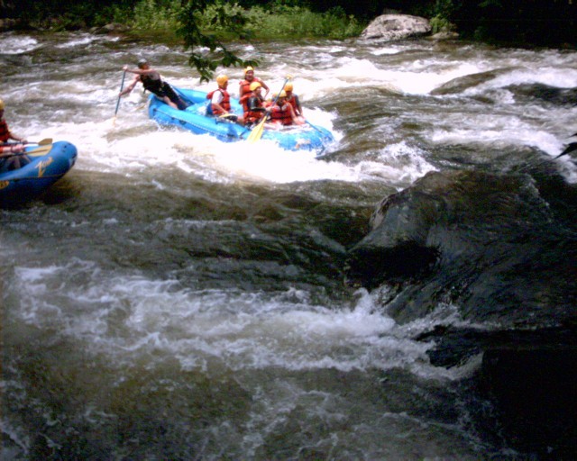
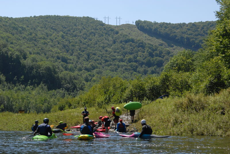
In addition to boating, may raft companies offer guided trips down The Dryway (and its companion easier Fife Brook/Zoar Gap section downstream). These include Zoar Outdoor, Crabapple Whitewater, and Berkshire Outfitters.
First scheduled releases began in 1991 with approximately ten per year.
On October 5, 1994, whitewater boaters, fishermen, conservationists, government agencies, and the New England Power Company took a giant step together to protect one of New England's most important watersheds.
NEPCO (Now TransCanada Hydro), a major regional utility based in Westborough, Massachusetts, together with twelve environmental and recreation organizations (including American Whitewater), and government agencies joined in an agreement that commits the company to enhance recreation, fisheries, and conservation along the Deerfield River in western Massachusetts and southern Vermont. The agreement is for 40 years and guarantees 32 release days on the Dryway each Summer.
This was an enormous achievement by paddlers and organizers. It involved dozens of meetings, th
...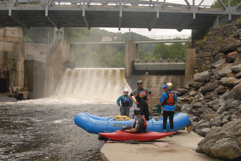
Put in on a concrete platform after walking down a long staircase built by the power company on river left just below the dam. Truly one of the nicest put-ins in the Northeast.
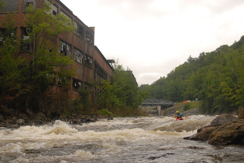
Shortly below the put in Factory rapid is a straight forward drop with good eddies on river left. There are also a couple good surfing spots accessed from this side of the river. River right still contains some debris (rebar, metal, etc.) from the dilapidating factory just upstream.
Boof Rock drops one into the setup eddy for the wave. Called Disapointment because it is not quite a great hole or wave even though it looks much better. Look for a good eddy on river left after the flat section following Factory Rapids.
Next to the old put-in is a rapid with several wonderful play waves. Count on a long wait for the one in the middle; but remember the rule for polite surfing time - two minutes minus 10 seconds for each boater in the queue.
Also known as 'Warm Up' to old-timers since in the early nineties this was the very first rapid on the river when the old put-in was in use.
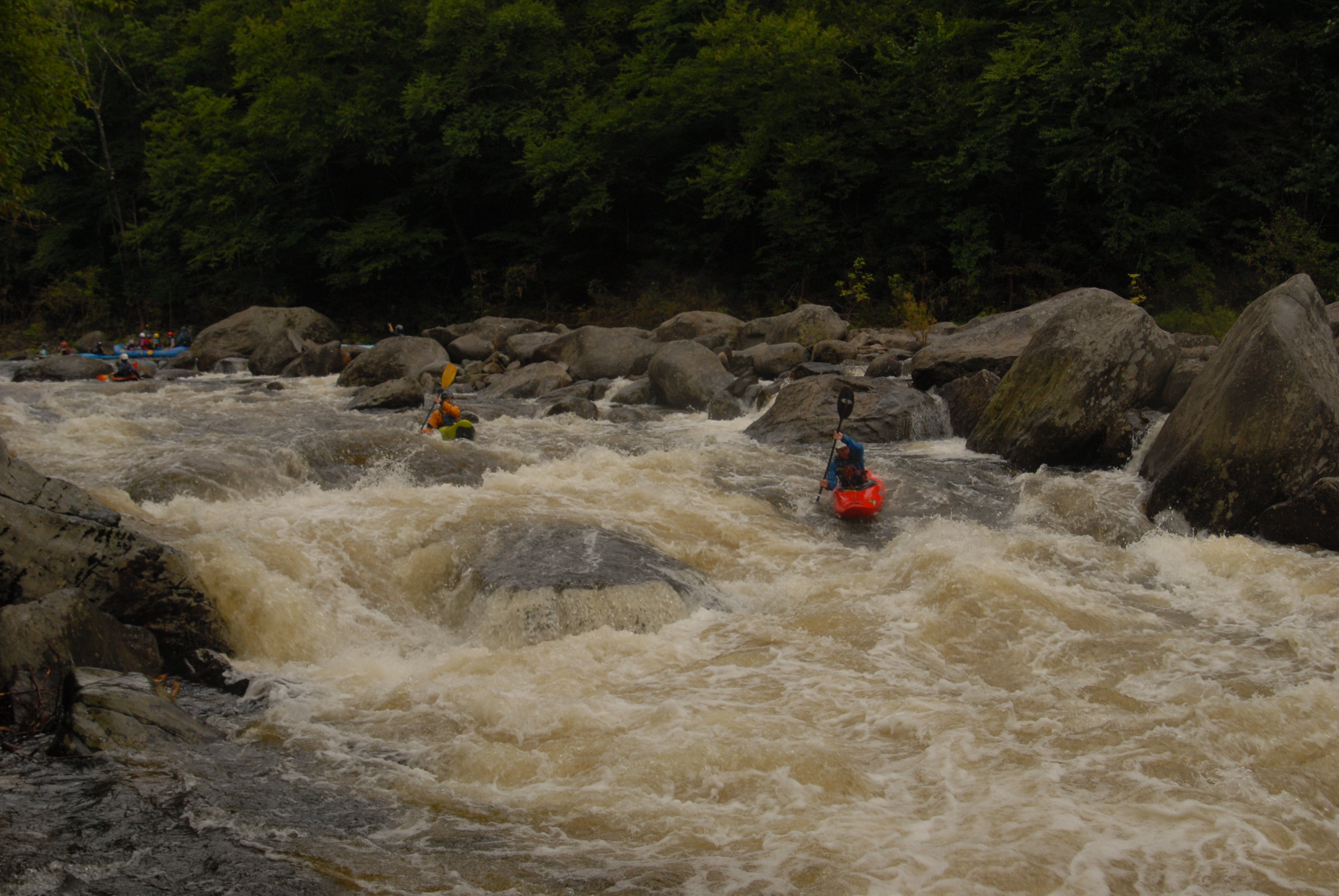
Also known as 'Split Rock Rapid', 'Initiation', 'Left Turn', and 'Governor's Rapid' (after a front page picture of former Governor Weld here). A large midstream rock splits the flow just as the river takes a slight left turn. Just upstream of the rock on river left there is a micro eddy that services a nice dynamic wave. Most boaters choose to run to the left of 'Split Rock' while rafts run to the right although either side is fine. After passing the rock the river takes another slight jog to the right. There is a rather large pourover near the bottom on river left that should be skirted to the right. This rapid has numerous play spots both above and below the split-hair rock.
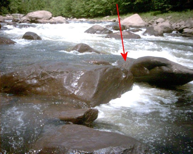
The Split Hair rock which marks the middle of the rapid where it turns left has both an undercut face plus an underwater sieve.
One paddler who was pinned underwater against the rock in the mid-1990's described seeing the light coming thru the sieve and was able to claw his way to safety thru the tunnel between the rocks. If you swim in this rapid above the rock quickly head for either side of the river.
In the pictures, taken at low water, the undercut rock and sieve between the two rocks is apparent. The tunnel between the rocks is likewise visible, it is just big enough to crawl through.
Note the brush and logs trapped in the undercut and sieve. These were completely submerged earlier in the day when the water was running at release level.
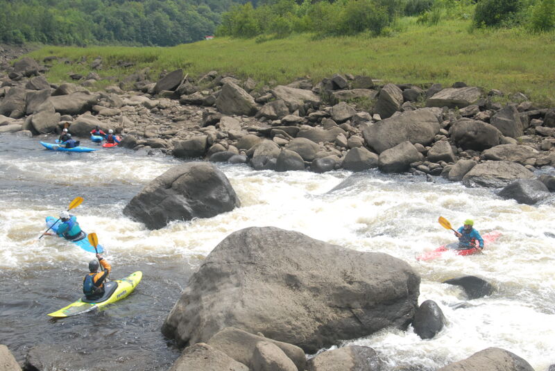
Below Split Hair is a large eddy on river right which provides a great place to pick up the pieces of any swim. You don't want to swim on the left as you'll immediately wash into Pinball Rapid which is full of rocks and holes. It's only class III, but any swim will likely leave one sore and bleeding. Rescues are particularly difficult due to the nature of the rapid which require constant rock-dodging by any rescurer.
Judy's Hole (in Pinball Rapid). Also called 'Mail Slot Hole'; this feature two-thirds of the way thru Pinball Rapid is a deep, meaty hole that attracts rafts for surfing. Smaller boats it sometimes eats.
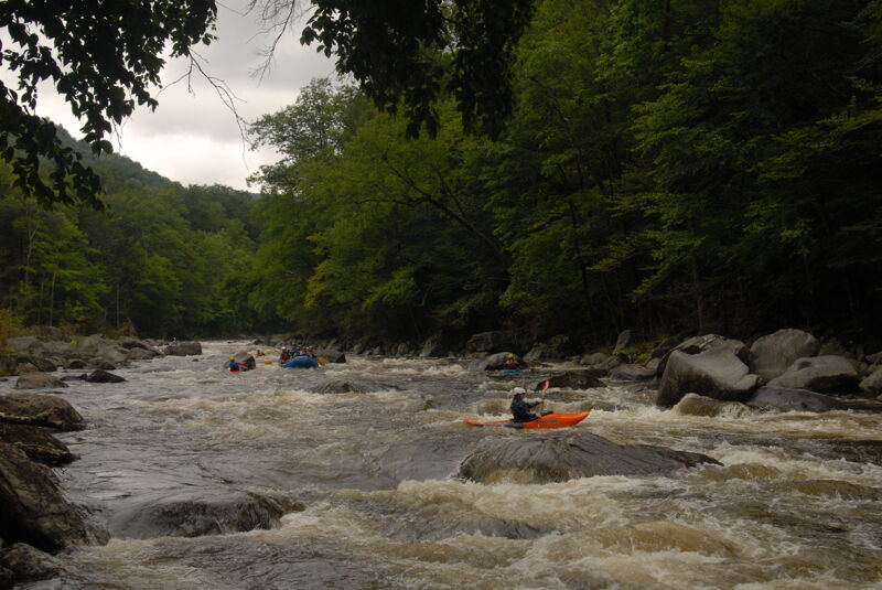
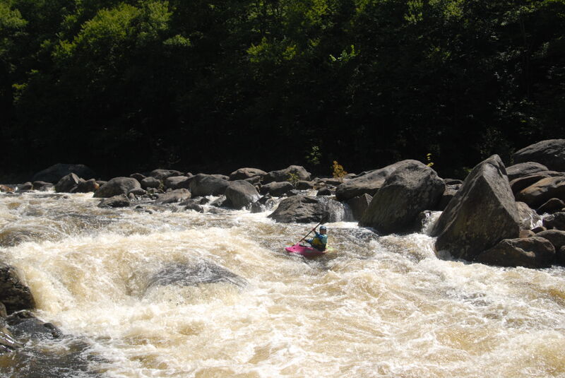
Also called 'Left Turn' (which is confusing since Split Hair has a more pronounced left turn). The top has a similar layout and approach as 'Split Hair' but with a number of smaller rocks instead of one large one. The first half is easier but requires constant maneuvering around all the rocks. Half-way down where the river turns left the gradient increases, and the channel narrows to a left-of-center run with the large gradient forming a huge wave train. A large dynamic surf wave can be accessed from a micro eddy on river left about 3/4 of the way through the rapid. The wave train on the bottom of the rapid feels like riding a bucking bronco and gives the rapid its name. Watch out for a pinning rock in the middle of the channel at the very bottom.
Below Rodeo is a benign rapid with several great play spots. Expect a waiting line for some of them. The last one (at the bottom of the rapid next to a huge boulder known as 'Lunch Rock') is where squirt boaters sometimes entertain the crowd with Mystery Moves.
Also known as 'Broadway'; this rapid is wide, shallow, and just as the name implies, a straight shot right down the center. Also called 'Big Boulder' after the huge rock on river-right near the bottom.
The channel is to the left of the boulder, however there is a nice slot along the right side of the boulder as well.
There are several nice surfing waves at the bottom of the rapid.
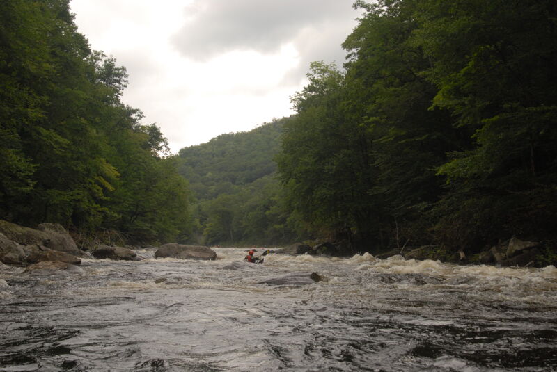
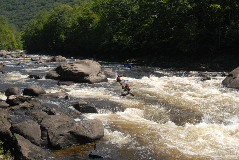
Also known as 'Eddy Hop' or 'Crazy Eddys' by old timers. At almost one-quarter mile long (the longest rapid on the river), it starts at the confluence with Dunbar Brook a popular lunch and break spot on river right. This rapid is mainly known for two large pourovers one at the top of the rapid and one in the middle. It is difficult to take a straight line through this rapid so hopping from eddy to eddy from river left then river right etc. is the tactical approach most boaters use. It is possible to eddy back and forth across the river over twenty times while paddling down this rapid.
Also called 'Landslide' or 'Pine Tree' (after the pine tree that hovered above the rapid in the early days). If you have run the Dryway once or twice before you may be fooled into thinking you are about to enter Dragon's Tooth at the top of the drop. The top of False Tooth rapid looks strikingly similar to the top of Dragon's Tooth. False Tooth is much easier with only a few big holes to punch. You can recognize False Tooth by the rock slide on river right of the rapid. You can also take-out above this rapid by climbing up the steep bank into the parking lot which overlooks this section of river.
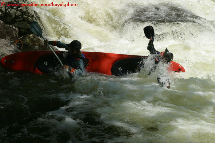
Shortly after False Tooth, pull out on river left and scout Dragon's Tooth. Dragon's Tooth rapid is steep, narrow, and turbulent. The main feature to avoid is a large retentive hole above a shallow rock ledge protruding from river right - this whole feature is the 'Tooth.' This ledge creates a shallow recirculating hole just below the upper hole. The usual route starts from river right moving towards river left through heavy turbulence just to the left of the 'Tooth'. Use the left, flushy edge of the tooth to start to move back river right. After passing the tooth, drive hard right to avoid Rodeo hole or stay center/left through rodeo hole. Rodeo Hole is trashy, and pulls slow rafts/playboats back in for more occasionally.
There are other options for Dragon's Tooth by going far right and running a vertical slot against river right of the tooth. You can catch a micro-eddy directly river right of the hole. Or the most difficult maneuver doing the 'Scary Ferry' from this same eddy just above the river right slot. The 'Scary Ferry' is not for the light hearted or unskilled. It requires you to do a ferry just above and below two large recirculating holes caused by the Tooth. A missed ferry could cause you to get recirculated in the shallow sticky hole below.
Below Dragon's Tooth is a wide flat spot where rafts stop to regroup. Below this Labyrinth starts thru a channel right-of-center.
At the very bottom of the flat spot where Labyrinth starts is a dangerous sieve in the center of the river. This was the site of a near-drowning in September 2006 where a rafter on an RPI (college) Outing Club trip was pinned underwater for a reported 3-7 minutes.
She was freed by several guides from Crabapple Whitewater, revived with CPR, and transported to a hospital. Several guides from Zoar Outdoor later went back and partially blocked the deepest part of the sieve with a large rock.
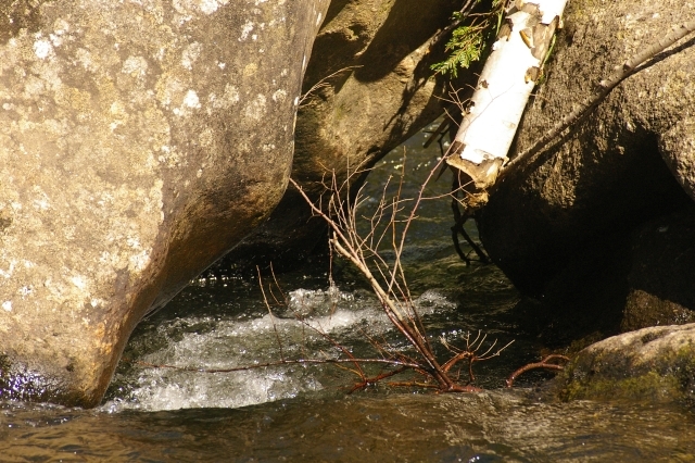
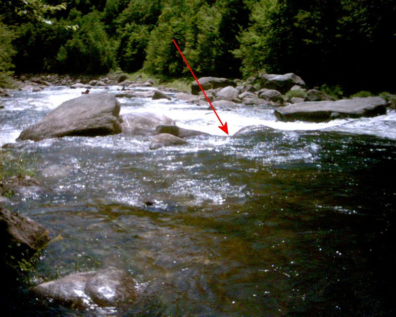
This sieve is not obvious; it forms a V-shaped slot that gets narrower like a funnel towards the downstream end. Anyone getting sucked in will be trapped part-way thru.
The entrance to Labyrinth is a channel right-of-center. The sieve is to the immediate left of the channel.
With the water low, the funnel effect of the two rocks that form the sieve that traps anything that floats into it is apparent.
This rapid lies just below the outflow to Dragon's Tooth. It is a pool drop section over ledge drops with several large 'and sticky' holes. This section is often flooded by the Bear Swamp Pump storage pool. There is no rhyme or reason to when or if this lower rapid would be flooded on any particular release day other than the price of electrical power. (The Bear Swamp Project is owned by a different utility and not regulated by any license or rules related to boating or fishing. The storage pool is filled when power is cheap and emptyed when the prices goes up.)
When the pool is high rapids will end at the bottom of Dragon's Tooth. If the Bear Swamp pump storage pool is low rapids will diminish about 0.1 miles above the take out.
Terminator Hole in Labyrinth: Three-quarters of the way thru Labyrinth is the Terminator Hole, the largest in the rapid. It's a steep drop next to a huge rock.
The channel is narrow here, you must paddle or portage. Either side of the hole can be skirted. Skirting the right edge of the hole puts you into an eddy below the rock; skirting the left edge puts you up against a pinning rock garden; going thru the center of the hole is sure to provide plenty of entertainment for onlookers.
Labyrinth Bottom: Below Terminator is a set of pinning rocks on the left that sometimes catch rafts. Furthur down is a final set of waves with one nice surfing wave at the bottom. There are handy eddies on both sides.
At the bottom of Labyrinth is a popular play wave with eddys on both sides. Rafts trips usually end here with customers watching the action.
Just above this on river-right is a sieve hidden among the rocks. The particular spot was the site of an accident in July 2006 where an experienced boater (after swimming and climbing out) slipped off a rock and was washed into the sieve. The sieve acts like a body-sized drain hole in a bathtub where it will suck someone down into a hole in the river bottom. The paddler in the 2006 accident was only able to let others know where he was by freeing an arm and sticking it up in the air waving frantically before being rescued.
With the water down the rock sieve is apparent. In the photos at right note the water flowing thru the sieve and appearing at the bottom of the rocks. In the close up shot the 'drain hole' appearence of the sieve is apparent.
Take out below Labyrinth on river rigth where the access road approaches the river.
Below the takeout is a short but enjoyable rapid. Bounce off the rock/wave in the center and into the eddy. Open boats typically avoid this rapid since it results in a more difficult carry up the rocks to the take-out. Also known as 'Bear Rapid' since there is a nice view of the Bear Swamp hydro project from here.
Hazard Warning: At levels where the big rock in the center is exposed, a nasty pillow/hole forms in front of it. The rock is also slightly undercut. A paddler got pinned/recirculated for a full minute in there, even after swimming. That feature has the potential to cause serious problems, especially for swimmers.
Aug 6, 2023
A Sunday trip on the Dryway with a whole lot of friends on Deerfield Festival weekend. Good flow and good times meeting lots of people and enjoying some great whitewater.
Aug 4, 2023
Trip with American Whitewater board and staff in advance of the Deerfield River Festival.
Jul 11, 2012
Interactive Panoram of the Dragon's Tooth taken July 2nd, 2012.
Posted in the event this can help anyone see what the rapids are like in this section of the river after hurican Irene.
http://www.gotlibdesign.com/GD/vr/DragonsTooth\_Seq1\_mr.html
Jul 28, 2008
If you want a complete schedule of the water releases for the deerfield, you can go to www.zoaroutdoor.com, then look at the sidebar on the left. put your cursor over the tab 'The Deerfield River' and then a little side menu drops down and you can click on 'Whitewater Release Schedule' and scroll down to the bottom of the page, they have the gauranteed release days listed there. Enjoy! :)