Gunpowder Falls
2 - Prettyboy Dam to Falls Road or Masemore Rd.(Gunpowder Gorge)
| Difficulty | I-III |
| Length | 2.1 mi |
| Avg Gradient | 18 fpm |
| Gauge | Gunpowder Falls Near Parkton, Md |
| Flow Rate as of 52 minutes | 161 cfsmedium runnable |
| Reach Info Last Updated | June 22, 2025 |
The river level of this reach is best described by the Parkton gage.
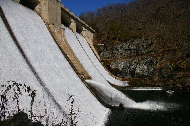
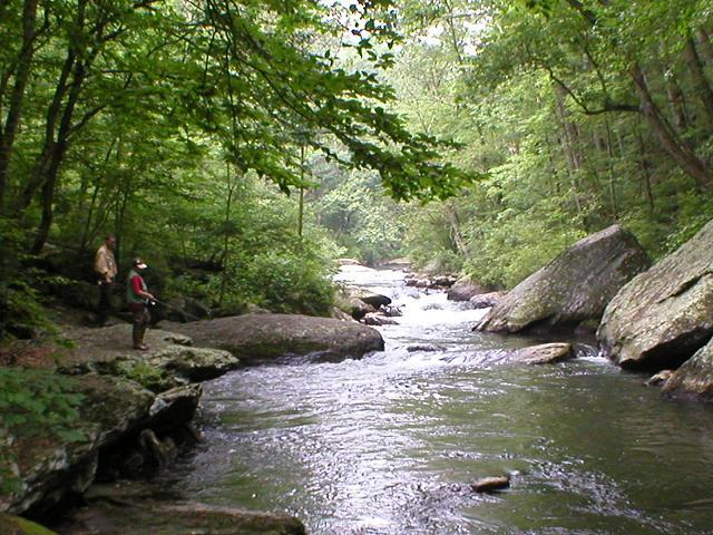
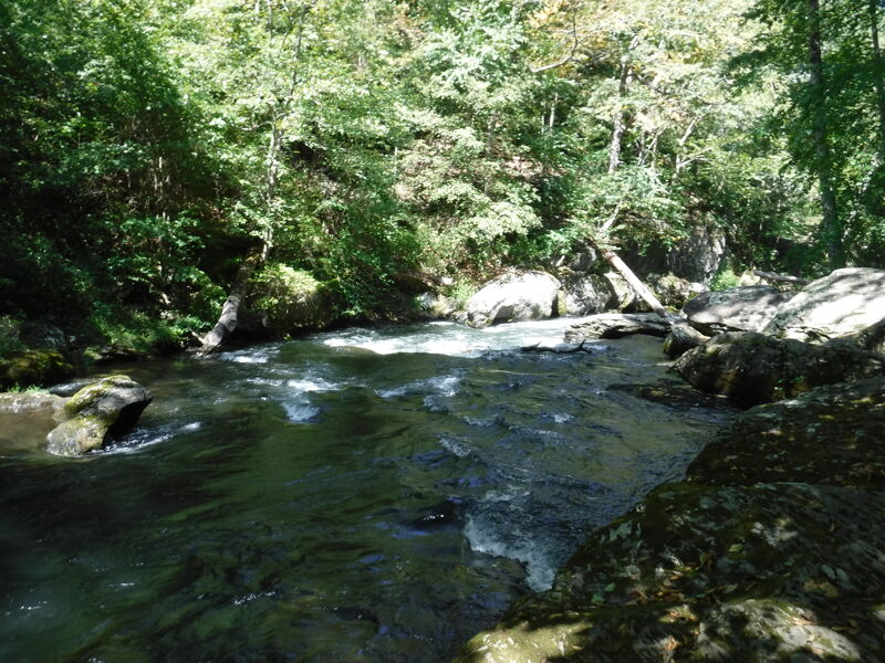
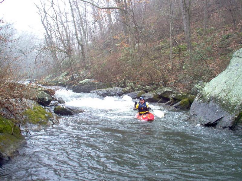
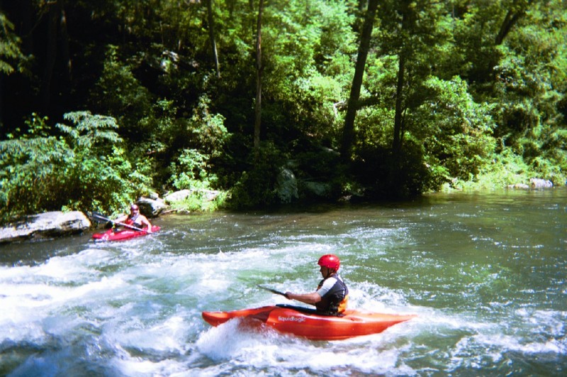
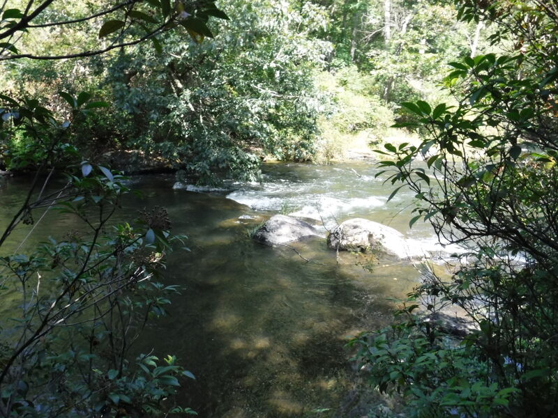
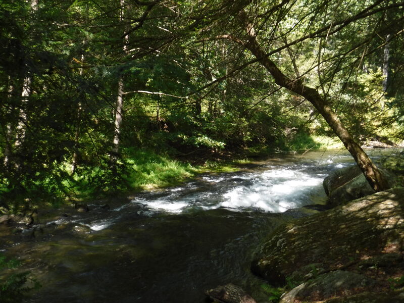
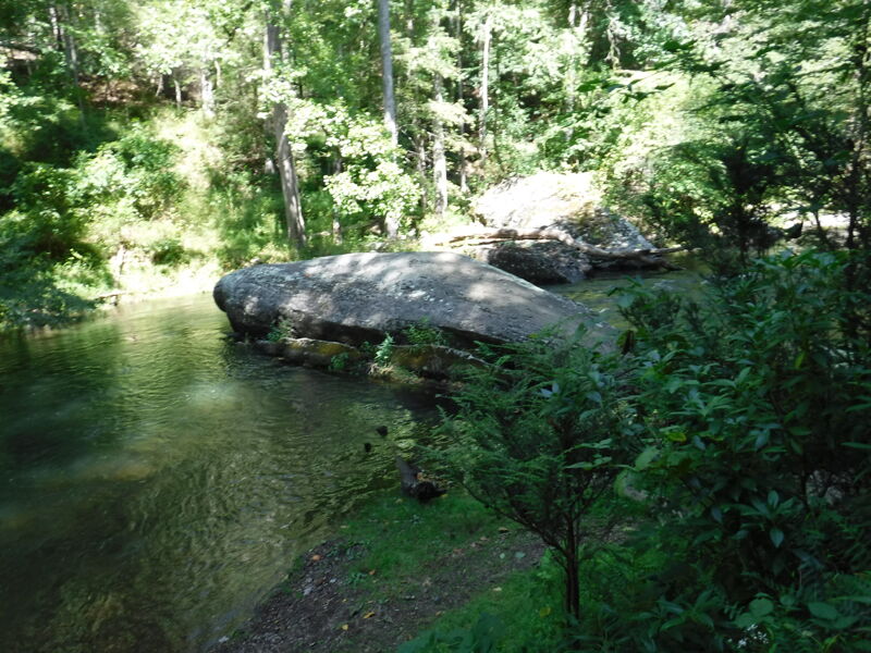
Prettyboy Reservoir to Falls Road Bridge -- Put In Very difficult to put in at the Prettyboy Dam, due to the 100 ft canyon walls and the fact that reservoir personnel frown upon it. I typically put in approximately 0.5 miles downstream of Prettyboy Reservoir. This put in is located approximately 0.5 miles south of the takeout bridge where Falls Road crosses the Gunpowder. When you cross the bridge coming from the North or river left side of the bridge, continue 0.5 miles up the hill. At the crest of the hill on the right side is a small parking area. There is a gated fire road entrance. Follow the fire road until it bears to the right; it then turns into a foot trail. From the gate to the water is approximately a 0.5 mile hike, all downhill. The hike is not bad and the trail is not very steep. Take Out The takeout is at the Falls Road bridge, either upstream or downstream of the bridge on river right. Do not park at the takeout itself. There is a parking lot approximately 1/8 mile up the hill on the right hand side as you walk South on Falls Road. You should have passed it on your way to the Put In. Except for the two designated parking lots, parking along Falls Road is now prohibited. If parking space runs out, the Masemore Rd. river access is available downstream. It will involve and addition half mile moving water paddle and a shuttle. River Description The first 0.25 mile is Class I-II warmups. The next 0.5 mile is Class III. The last 0.25 mile is Class I-II. CAUTION: You need to watch out for Strainers and Fishermen on this stretch. This creek is not very wide, and very popular with fishermen. If possible, try to stay behind them. So be respectful and friendly in order to to keep this run open. Reference Maryland and Delaware Canoe Trails, by Ed Gertler, for more details on this section.
Buddy H
...Fire Road/Trail about 0.5 miles below Prettyboy Dam. Accessed from a fire road/trail. Take Falls road south from the Gunpowder bridge to the top of the hill. At the top of the hill is a small parking area that leads to a gated fire road/trail. Follow the trail down to the river.
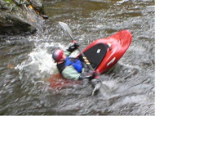
This rapid is similar to a slalom, basically follow it right and left and eddy out at the bottom.
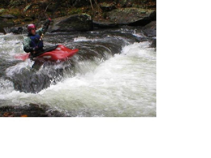
1 ft drop off a river wide ledge. There's a little 'Z' runout on river left that might look tempting, but is too tight to be anything but trouble most of the time. Just take the plunge off the ledge.
First drop stay center, second at bottom hit a rock (at lower levels) then (at all levels) make a sharp right turn; at the third drop go center again with a little left angle. Stay away from slanting rocks on river right at the bottom of the third drop which will flip you if you get under them and lean away. Eddy to river left.
The name 'Chainsaw' does not describe anything about the rapid, but refers to a legendary and unfortunate incident that is not to be discussed here.
Because the right and center of the rapid collects wood, at the top of the rapid, stay to far left. Then when as far left as possible you're forced to turn right against the left shore. Make the turn and take a drop and miss a diagonal log that is slightly left of center. Because it happens fast just keep going past the log -- usually to the right. If you hit the log, don't panic, lean into it and keep paddling to the right. The line is mostly the same at higher water, except there's more power in the turn against the left shore, but there's more manuvering room in the turn and the higher it is, the more you'd need to be right of the log.
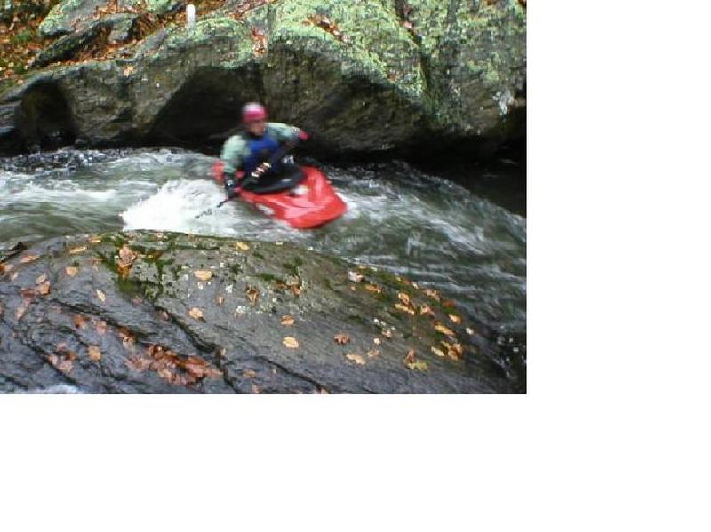
AKA: Slots or Chutes. Three chutes, left, right & center. Left chute is a straight narrow drop. [Recent (2025) reports indicate that the left chute is blocked by wood]. Right chute - start right, make a shallow left turn to avoid slanting rock on river right side which will flip you if you get under it and lean away from it. Center chute is a sloping slide down the rock at lower water, more of an option with more water. Eddy to left at bottom.
This rapid is runnable left at all levels. Eddies far left and a surf hole center and left bottom at 250cfs and up. Attainment at all levels at the bottom.
This rapid consists of a low ledge covering river left to middle with a notch in the left side and a tongue to the right. Good side surfing at minimal Levels and an actual play spot at 280 cfs +. The river right tongue is a straight chute with a possible attainment at mid levels.
Minor Ledge. There once was a beaver dam here
This rapid consists of a low rocky chute to boogie water at lower levels. At lower water, if too far left, the chute shoals out; if too far right there's a risk of a surprise. Best run left center. Above 230 cfs it’s a straight shot (not rocky) At 280 is where it becomes a play spot. Washes out at higher levels.
There is a blind turn behind the rock that looks like it's going to be a rapid, but it's just a moving water turn.
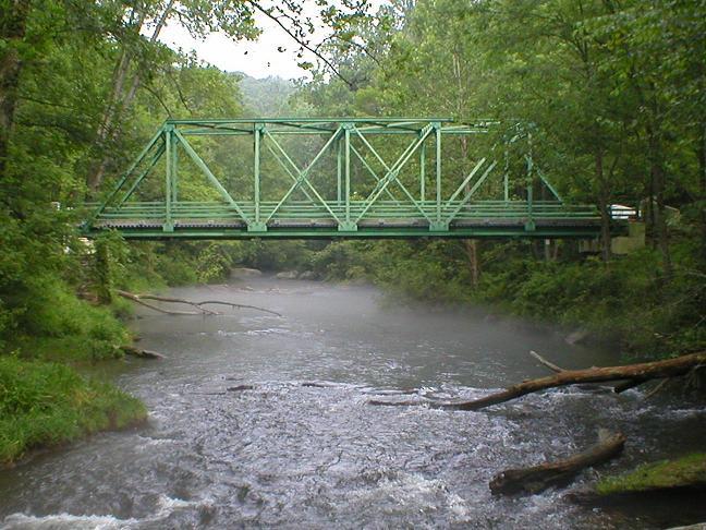
Take Out The takeout is at the Falls Road bridge, either upstream or downstream of the bridge on river right. Do not park at the takeout itself. There is a parking lot approximately 1/8 mile up the hill on the right hand side as you walk South on Falls Road.
Just below/at the take-out is a short s-turn rapid where, if there is enough water, there is an ender spot off of a rock on the left. It is close enough to the take-out that you can run it and carry back up.
Alt Takeout - Masemore Rd. (if Parking is a problem on Falls Rd - requires a shuttle).
Sep 28, 2025
Most of us had never run this section before and we were unfamiliar with the hike to the put-in. I suggest taking the right hand path when it splits, going left was not a good choice.
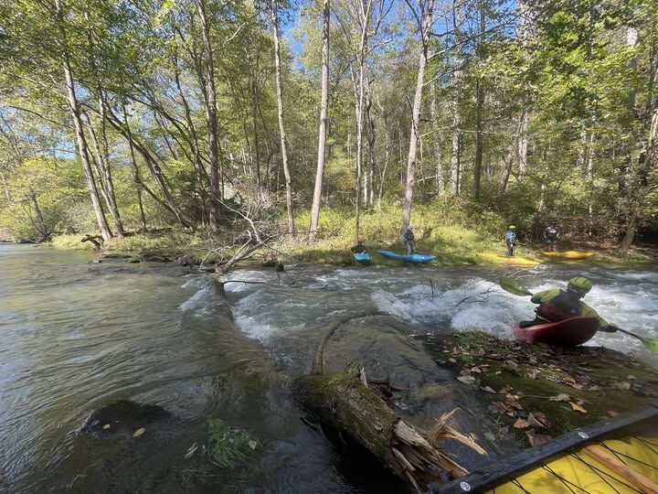
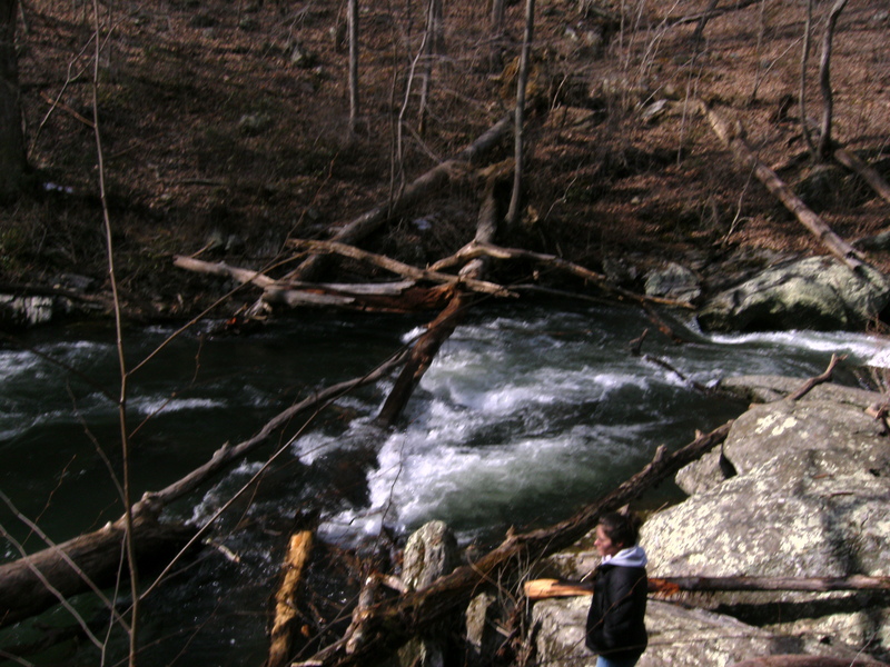
There was a strainer across the entire creek at Spanked Bottom. Most of us portaged river left but a couple went river right and seal launched from the rocks.
It's a fun run, I'd like to try it again with a couple hundred CFS more flow and picking the right trail to the put-in.
Jul 17, 2025
This is my favorite stretch of the gunpowder. Many thanks to the stewards who care for these trails and river, particularly for whoever chainsawed the downed tree blocking the river in June 2025. Props to anyone hiking hardshell boats down to the water from these parking lots, that's some good exercise.
This is generally a wonderful stretch to tube for a group looking for more adventure than other tubing stretches from 75-150cfs. The water is very chilly of course, and a 90 degree day may be 70 degrees at the base of the dam. But the rapids are great fun. At 180 CFS yesterday it was an exciting trip that involved a tube stuck in a hydraulic that I had to swim from and also having to scout every rapid stretch, feeling very adventurous. If I were to do that range again I would make sure the whole group is equipped with life jackets (as technically requiered), helmets, and possibly even paddles!
Aug 5, 2018
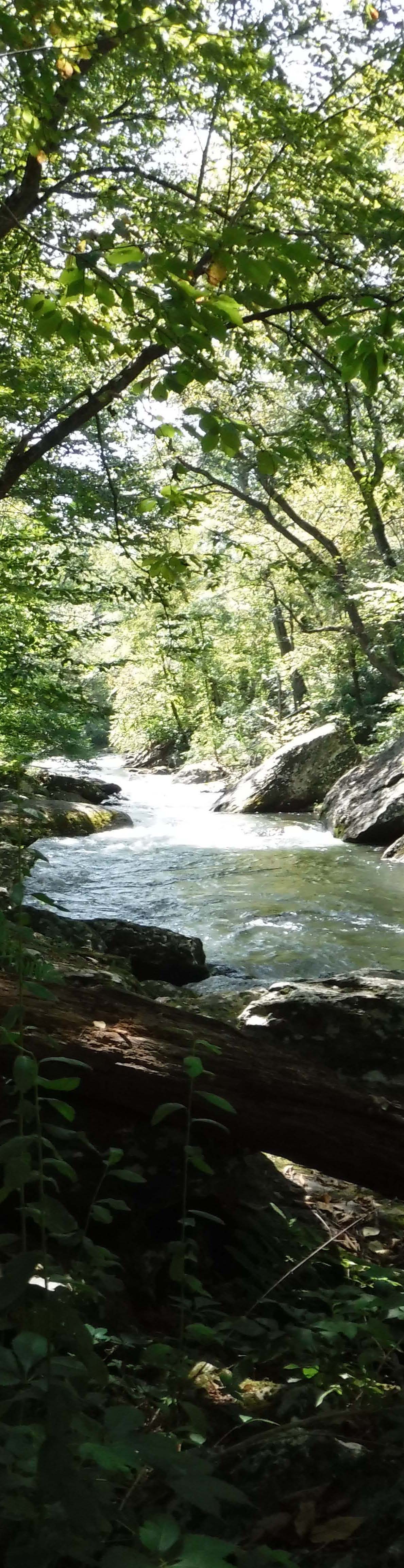
My son (call him a class II boater) and I ran this in the 200-250 CFS range. This is a particularly pretty stretch of river. There's a path river right (as well as paths higher up too), and I recommend it as a hiking spot in addition to a paddling one. At this level there were some fishermen, but not a lot. They were just getting started at about 10:30.
Most of the rapids were class I or II-, except for a stretch with four creeky-feeling ones in a row that I would call III-. This would be a really good beginner river if there was a little more recovery space between them.
Jul 21, 2011
Does anyone know who created this post about this portion of the Gunpowder?
I created a river tubing MD resource http://tubing-maryland.com and I'm looking to add water level information to the site for this location and other tubing MD locations. I see this site has pulled in this data and is displaying it and I wonder where I can find this data? MOre specifically is their an API for me to the pull water level data for this point and display it on my site.
thank you,
ryan spahn