Patapsco
2. Daniels Dam through Elkridge(Old Ellicott City, Oella & Former Bloede Dam section)
| Difficulty | I-III |
| Length | 12 mi |
| Avg Gradient | 14 fpm |
| Gauge | Patapsco River at Hollofield, Md |
| Flow Rate as of 34 minutes | 37 cfsbelow recommended |
| Reach Info Last Updated | January 19, 2024 |
This long reach can be broken up into much shorter runs, and it usually is. The Old Frederick Road Bridge to Ellicott City run, for instance, is only about 4.0 miles. See below for a description of these access points, and click on the Map tab to see them.
Time: varies with water level. As little as 1.5 hrs to Ellicott City, and another 1.7 hrs to Avalon/Glen Artney after very heavy rain with no play, or around 3 hours to Ellicott City and another 3 hours to Avalon/Glen Artney at a mild pace under average conditions.
Difficulty: I-III at up to about 3' (828cfs) on the Hollofield gauge, with some areas drifting into III+s above 4-5'+ (1880+cfs) range.
Fun Factor 6.5 out of 10. (High water can add 2 or more to this total)
Water Quality: Mostly good, with some suspicious-looking hues of brown during a heavy runoff. Tends to be warm after rain due to the vast amounts of warmed impermeable surfaces in the watershed.
History: Amazingly, this river was once a route for barrels of tobacco to get from Catonsville to the even more amazingly once-navigable tidal waters at the Route 1 bridge in Elkridge. Visit this portion some time and try to imagine a sailboat coming upstream at you. It ain't easy.
The Patapsco river is a convenient local conundrum to the paddlers of Baltimore in that it features too much whitewater for recreational boaters, and too much flatwater for some whitewater boaters. If you have the gumption in the first case, the patience in the second, or you like to experience a multitude of conditions from straight-forward rapids, to narrow chutes, to big, lake-like, half mile paddles, then this is the place for you.
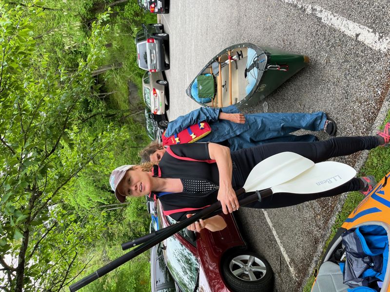
It offers several shorter sections easily done by traveling paddlers or those looking for some post-work water. You can park-and-play in the flatwater at Daniels Dam; do laps of Oella/Suicide Rapids through Doughnut Bend by parking at the public parking near the Trolley Stop, putting in upstream of the Old
...
A common put-in for this stretch of the river. Recently (August 2017) Jersey barriers were put up to severely limit parking at this location. Apparently MD DNR's concern was the accumulation of trash in the park while Howard County's concern was that people were jumping/sliding off the Dam with the result of emergency calls to fire & rescue. Anyway, it's unclear what the 'powers that be' are doing here. Plan ahead.
The Old Frederick Road Bridge trims 1.8 miles from Daniels of mostly flatwater/moving water from the top of the Oella stretch. The Old Frederick Road Bridge is where Old Frederick Road (Howard Co.) and Hollofield Road (Baltimore Co.) meet. You'll still have a good four miles down to Ellicott City, and almost seven beyond that should you choose to continue to Elkridge.
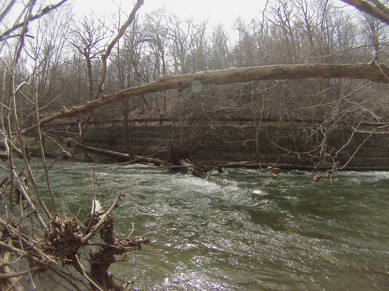
Just below the US 40 bridge, there is a small increase in gradient resulting in a Class II- rapid which becomes a wave train at higher water levels. This rapid is all that's left of the once deadly and now removed Union Dam. There are still some remnents of the dam on river left and the river is still adjusting from it's removal.
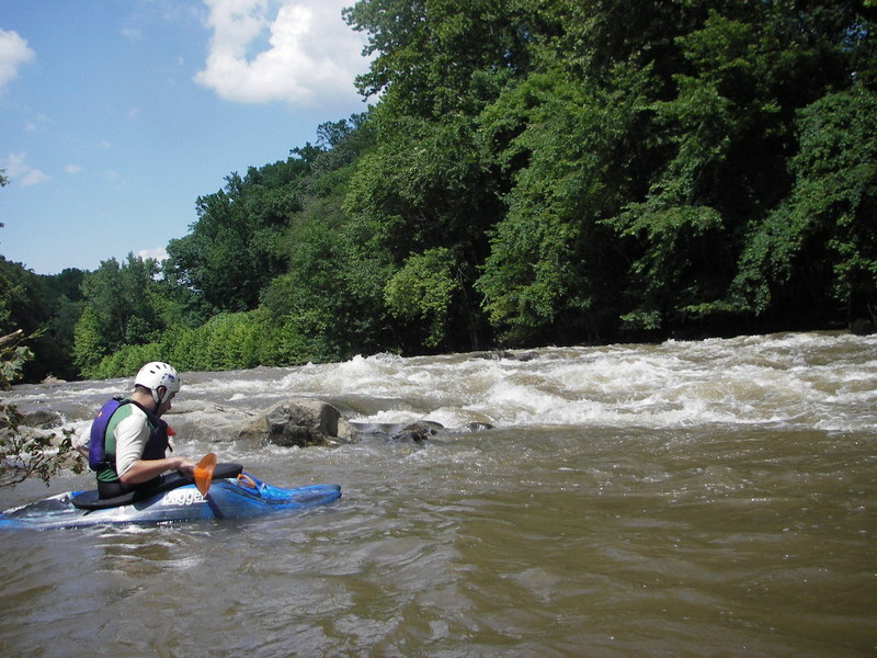
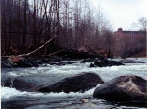
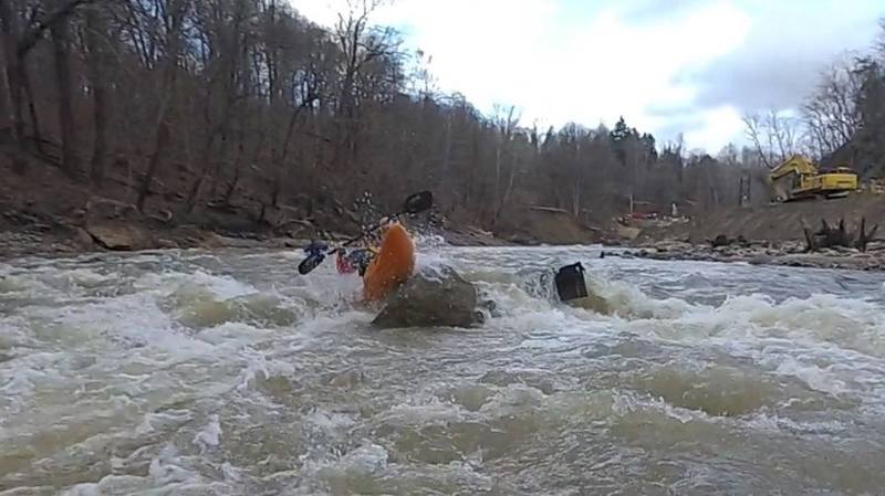
Soon you can see the old Dickey mill on river left, marking the beginning of 'Oella Falls'. Make your way down on river right, when you get to the main drop, the river shoals up to the right and the current moves from right to left with rock dodging all the way. It's a fairly long, bumpy (class 2+ at lower water and 3 or above at 3.5+' [~1,200+ cfs]) ride which ends in a nice recovery pool.
Suicide begins below a house sticking out of the cliff on river left. The river first turns right and takes a drop (take the drop center right; then move to center) then twists left (move to right) down into the backwater pool before Ellicott City. There are many lines here, and a decent surfing wave at the bottom of this at some levels. Much beyond 3' [~828 cfs], and the eddies all wash out, making one wild III+ run all the way from the river split (marked by a giant rock plastered with strainers in the center) to the bottom. At those levels, there are some sneaky holes with stopping potential through here, so keep a sharp eye out at the top of every big wave.
From Danny Miller:
Suicide proper at around 1150cfs (116.5' on Old EC gauge) contains a turbulent and retentive hole on the far left. I had a chance to experience it first-hand this morning after attempting to boof from far left and nearly got caught there. Most people probably already avoid the left line anyway due to supposed strainers. Yet in reality, the strainers aren't always there at this level; however, the hole (and the eddy trap mentioned below) is there and everyone should take caution. How it forms: The hole forms from the the left and the middle currents converging just left of center, producing a retentive hole just to the left of that convergence. To make things at the bottom of this pour over even more interesting, there is a tiny eddy behind a large rock on river left that at lower levels provides just enough space to eddy out. At this level, if you drop in over the far river left side of the convergence, your boat may get pushed into this small space, allowing the boat to get stuck and the stern to be dragged back into the pour over, which looks very retentive. Hope this adds needed beta on the left line. Center is okay, but I would not recommend going too far left unless you scout it out with others and know what you're doing. Much above this level and it washes out.
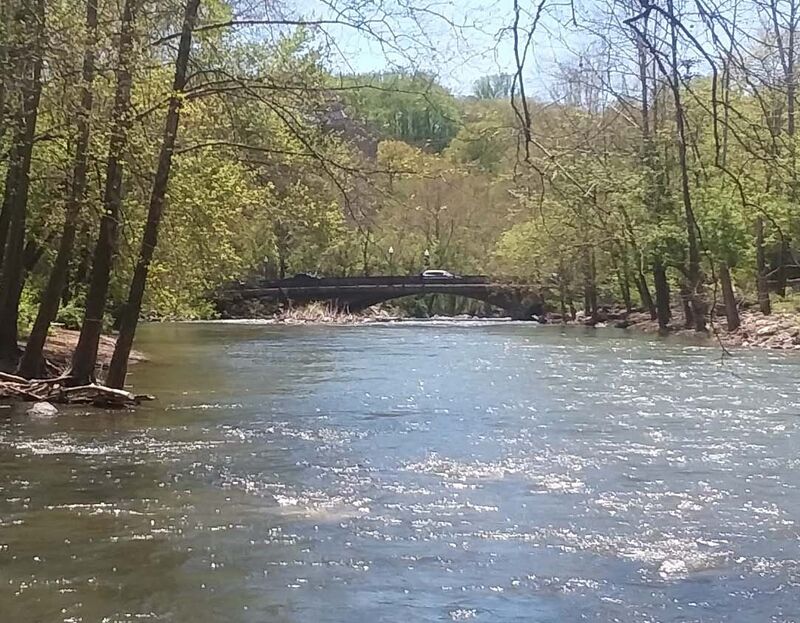
A long pool takes you to the MD 144/Frederick Rd.(Ellicott City) bridge where you can take out on river left, just before the bridge. Some Parking is usually available at Lot A next to the trolley line trail.
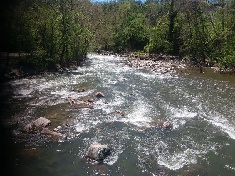
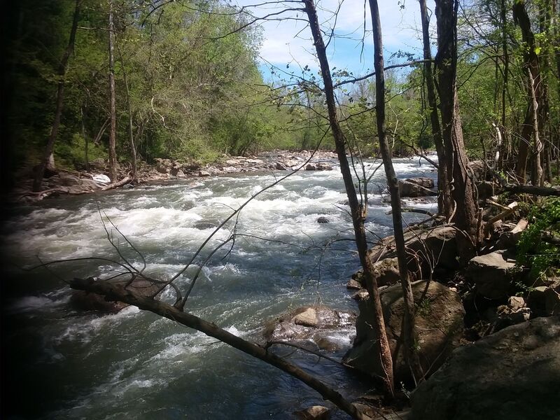
\[Class III or Class III+ above 900 cfs.] Below the MD 144/Frederick Rd.(Ellicott City) Bridge, the fun begins again. A major flood occured July 31, 2016 and again May 27, 2018. Both floods changed the river considerably below the MD 144 bridge. After the floods, the line below the bridge is to stay river left through the first part of the rapid, moving to center as you pass the flour mill on river left. Below 3' (828 cfs) stay in the center of the channel for the run-out behind the mill -- there are eddies both right and left at the bottom of the runout. At higher water, you still start river left, but there is a mid-channel rooster tail that suggests navigating a little to the right, but not too far right. At higher water there is a big, long, bouncy wave train which takes you down the left-turning bend with a couple of rocks to avoid while approaching the abandoned train siding bridge around the corner. Due to the two Ellicott City floods in 2016 and 2018, there can be significant metal in the river on the right side of the rapid, so don't let the waves push you far right.
As the river is adjusting from the removal of the Simkins/Thistle Dam just downstream, it has exposed two fiber-optic pipes. Although our group was able to easily find a slot over them, if not corrected, over time they will eventually become a strainer hazard
At lower water you will hardly notice the small rapid at the location of the removed Simkins/Thistle Dam, but at higher water there is a noticeable Class II rapid here.
Limited River Access, as of 2020, most of the area has been marked 'No Parking, No Standing, No Stopping' - Was usually a takeout, but could be a put in for the Bloede Rapids to Avalon/Glen Artney section. Now, no parking.
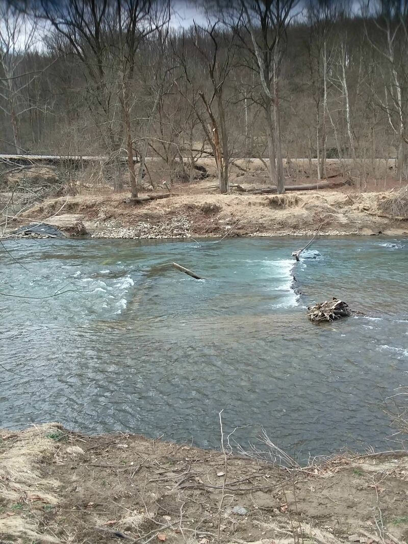
Below the Ilchester Road bridge [mile 8.0], the gradient increases as the river begins to drop into the backwater of the now removed Bloede Dam. The line is mostly in the center with some moves to dodge rocks. It ends at a short pool where the river makes an abrupt turn to the left.
From the short pool where the Ilchester rapid ends, the gradient increases again as the location of the recently removed Bloede Dam \[mile 8.5] is approached. This area is evolving into two class II+ rapids (III at certain water levels), both of which involve turning and rock dodging for the next half mile. Another half mile or so, the river approaches the Orange Grove area of Patapsco State Park \[mile 9.3]. The river is very unstable through this area and is constantly changing. During March 2019, it seemed to be a Class III-IV run for more adventuresome paddlers; as of Summer 2019, as the gradient works upstream and downstream and the river channel settles out, it is becoming more Class II+, although still approaching Class III as the level approaches 1,000 cfs. If you venture below Ilchester Road, you'll either have to carry back to Ilchester Road or run into the Patapsco State Park, Avalon area and set shuttle at either the Avalon or Orange Grove areas \[modest fee required: April through October: Monday through Friday: $2.00 per vehicle in-state; $4.00 per vehicle out-of-state] . .. Weekends and Holidays: $3.00 per person in-state; $5.00 per person out-of-state. November through March: Honor System in effect: $2.00 per vehicle in-state; $4.00 per vehicle out-of-state.
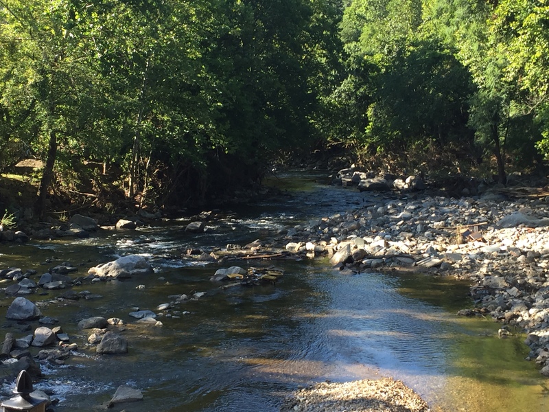
River access & parking just upstream of the swinging bridge. Below Orange Grove, the river loses most of its gradient and consists of gravel bar after gravel bar and the occasional strainer. Float trip runs are possible down to 175 cfs from Orange Grove down to the Avalon, Thomas Viaduct, or Elkridge take-outs.
Takeout is at the Avalon/Glen Artney area of the Park, marked by a brick bridge running over the water just past some ballfields and no-swimming sign on river left.
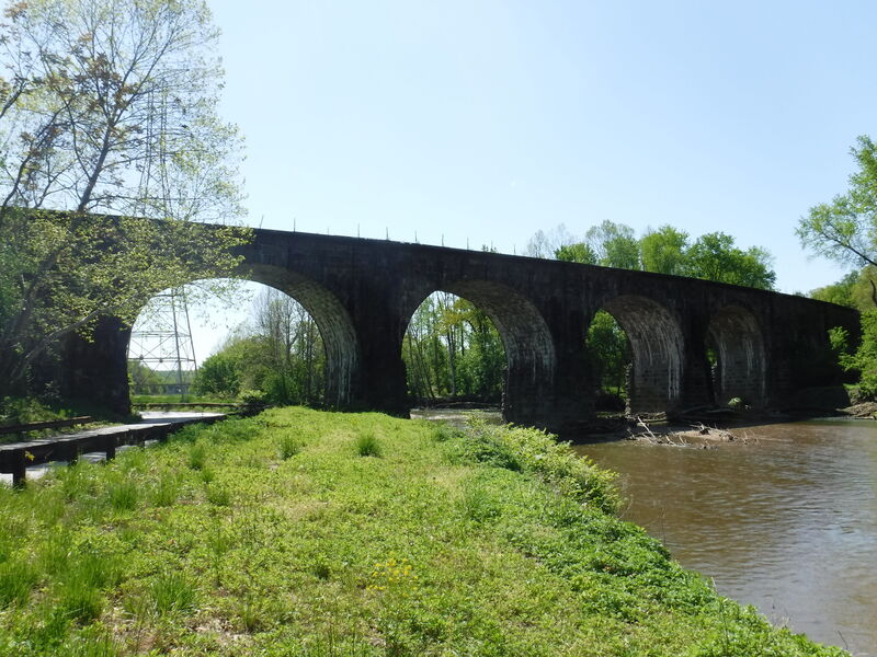
An ancient stone train bridge built in the 1830's. As of February 2020 there was considerable wood (potential strainers) against the viaduct piers. There appears to be a trail on the upstream side of the bridge from Levering Ave/River Rd to the river right side of the river. Check this from the road before committing to it, but if this is true, this is a potential take-out downstream of the State Park.
A long pool takes you to the US 1 Elkridge bridge where you can take out on river left. This access is potentially gated (you'll have to talk to the auto repair place that seems to control access) and appears to be a little sketchy with respect to potential break-ins.
Mar 13, 2019
[Hollofield gauge was restarted by USGS]. There is no longer a USGS Hollofield gauge. The North Branch of the Patapsco at Cedarhurst USGS gauge http://waterdata.usgs.gov/nwis/uv?01586000 can give you an approximation (it correlates fairly well with the old gauge). I prefer running it at higher levels (above 500 cfs). You should be good to go at 400 cfs and above on the North Branch gauge. Another good indicator is that if there is a wave train just past the Main Street Bridge in Ellicott City, then the Patapsco is running. You need about an inch of rain to get the Oella section at a 'fun' level. It is very flashy, so catch it while you can and scout before you run it.