Patapsco, South Branch
2. Marriottsville Rd to Patapsco, N. Branch confluence "McKeldin Falls"(McKeldin Falls)

Jun 7, 2017
I've split the Gaither Gorge section from the McKendin Falls section, so some of the following comments may refer to the other Patapsco, S. Branch section.
Jun 1, 2015
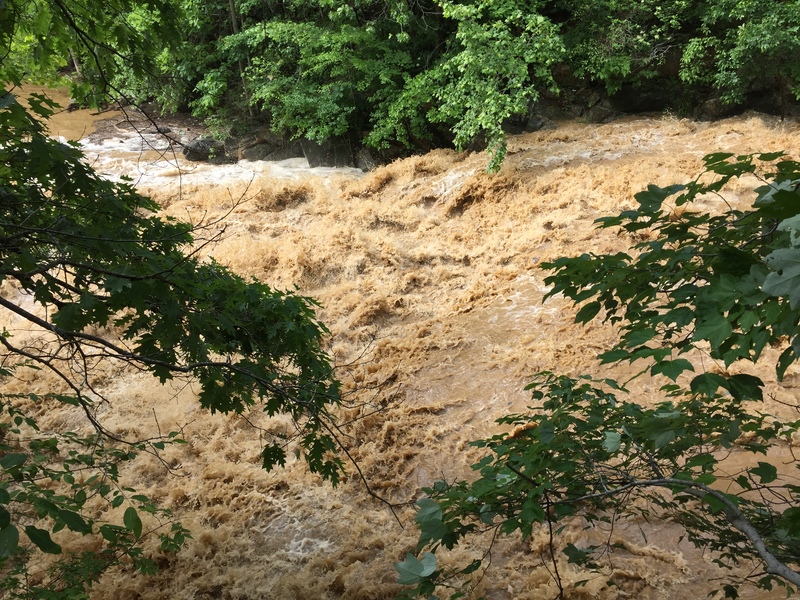
Over 1200 CFS in the South Branch of the Patapsco makes for a beefy level. 6/1/15
Mar 18, 2015
For a minimum level, look at three gauges: Hollofield 500 cfs; Cedarhurst 150 cfs; Unity 90 cfs. Hollofield is well downstream on the Patapsco Mainstem, so it can still be up when water's drained out of the S. Br. Patapsco, but it is a good reflection of the watershed as a whole; Cedarhurst and Unity are on parallel watersheds about the same amount upstream, so they can give some idea of 'top of the watershed' conditions. Because the S.Br. Patapsco is so flashy, you need to be aware that water can run out from the night before to the morning of the run. I don't know what a maximum level might be, but I would suggest that you go to the downtown Sykesville bridge and look at the river. If your reaction is FUN!, run it; if your reaction is 'Oh My God' it's too high.
Mar 14, 2015
S. Br. Patapsco from Gaither Rd. to Henryton Rd. today with Tony during rain with snow melt, it was high and brown. Hollofield 2,130 cfs and 4.27, Cedarhurst 1,120 cfs, Unity 546 cfs. Least that's what it said when we got back, Gauges were 1/2 lower early morning before leaving home. No strainers to portage. A lot of play was washed out. 4-5 good rapids with 2/3 moves to miss holes, with no terminal holes. Intermediate run. Most of the rocks you would normally see around Sykesville were submerged.
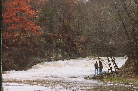
Dec 7, 2009
Monday DEC 7 2009 1630hrs, after two day rain
Oct 26, 2009
We ran from Skyesville to McKeldin Falls on 25Oct09. It had poured the night before and the Cedarhurst NB Patapsco gauge peaked at 870 cfs. However, looking at it after the fact, it looks like that by the time we ran it that it had dropped to 108 cfs. The section was barely runnable but we still were happy to be out on a beautiful fall day. We never had to walk but we did get temporarily stuck on gravel bars several times. Mckeldin was runnable but boney. Given the same level again, if it was a choice between not paddling and doing this, I'd paddle this. But if there were anything else you could paddle I'd probably recommend that.
Sep 26, 2009
One of three Class II areas just before Sykesville
Jun 15, 2009
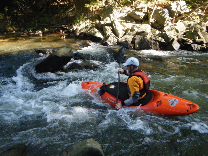
Ran this with about 180 cfs on the Little Patuxent guage, 60 on NB at Cedarhurst. Level was pretty low, but passable and still fun on the bigger rapids. The rapids below McKeldin Falls to the confluence are alot of fun too, making it worthwhile to go down to Woodstock. Aside from the class IV McKeldin Falls, the toughest rapids seem to be the three steep, bouldery drops past that barn.
Apr 5, 2004
Paddle from Gaither Rd. to Henryton Rd. on April 3, 2004, No river wide strainers, was a branch in the second part of No Way Out rapid no problem just keep to left of it. Level was around 3.50' on the Hollifield Gauge about 1300cfs
Nov 2, 2003
Ran Gaither Road to McKeldon, 4 hours, on 11/2/03 at 2.6. Scrapey but runnable. Another 6' - 1' on the guage would be ideal for passing through all the rock gardens. Whatever log jam used to be is no longer there. Had to portage 2 riverwide strainers, both in flat water, - 1 just below Gaither Rd and the other in the park.
Jan 1, 1900
dont want to do this one upside down...shallow!
there is a large pool at the bottom that will allow for recovery...hopefully
Jan 1, 1900
60 cfs Cedarhurst-