Potomac
2. GW Canal Loop or Violettes Lock/Riley's Lock to Pennyfield Lock(GW Canal or Seneca Breaks)
Jul 20, 2025
GW Canal Trip 7-20-2025.
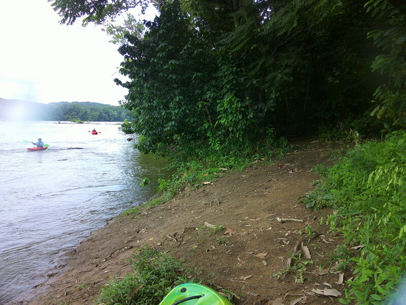
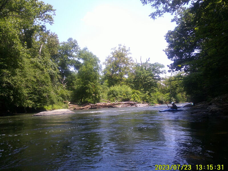
Jul 23, 2023
GW Canal trip 2023-7-23
Sep 30, 2017
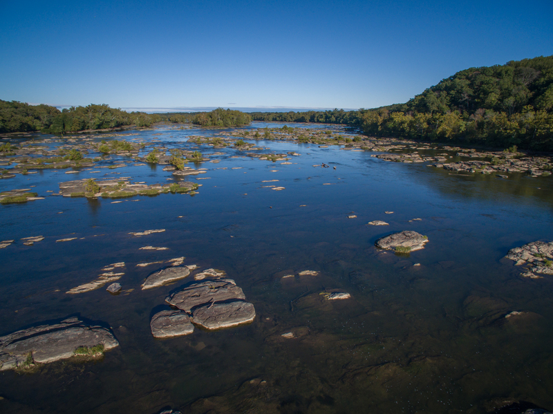
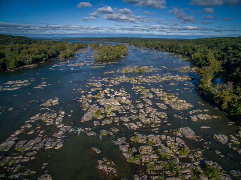
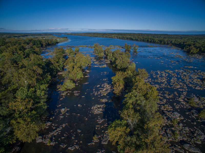
A beautiful section of the Potomac, but challenging to find a good route through these shallow rapids which extend about a mile downstream towards from the end of the long section of flatwater.
Sep 30, 2017
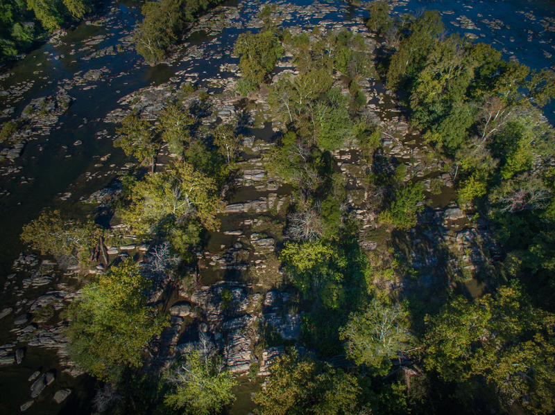
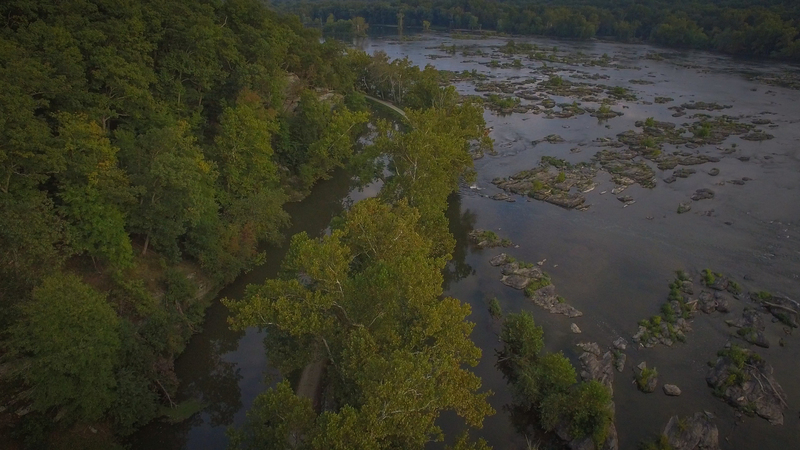
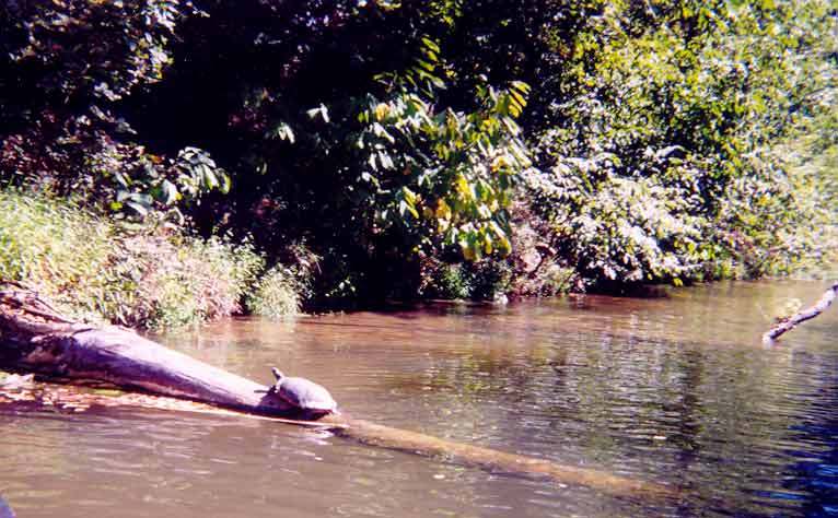
You can see the demarcation between the flatwater section upstream and the beginning of the shallow rapids and islands that extend approx. a mile downstream from Violette's Lock
Sep 30, 2017
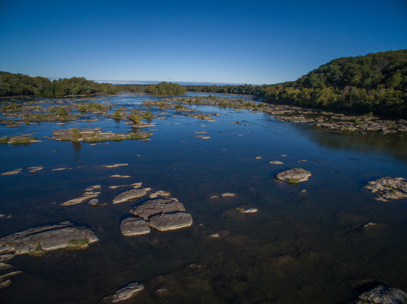
This is an interesting rock island in the middle of the Potomac 1/4 mile downstream from Violette's Lock. Park your kayak and explore this area if you're so inclined.
Sep 30, 2017
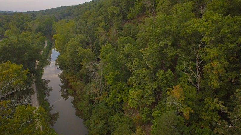
This watered section of the C&O canal can serve as your return after running the river rapids adjacent.
Sep 30, 2017
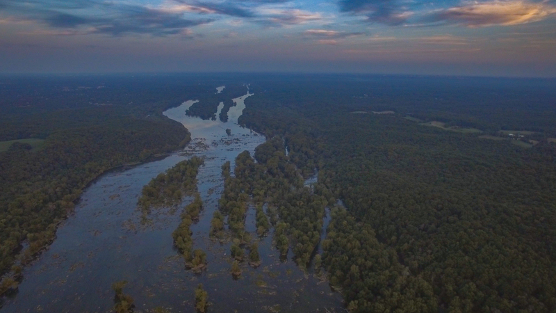
My bird ascended to a pretty high altitude for this pic looking downstream. Virginia is on the right here, and the route downstream.
Sep 30, 2017
This view shows the demarcation between the flatwater section and the beginning of the shallow rapids and islands that begin at Violette's Lock.
Sep 30, 2017
The river bends around here about 1/2 mile downstream from Violette's Lock. You can us the C&O as your return route if so inclined.
Sep 30, 2017
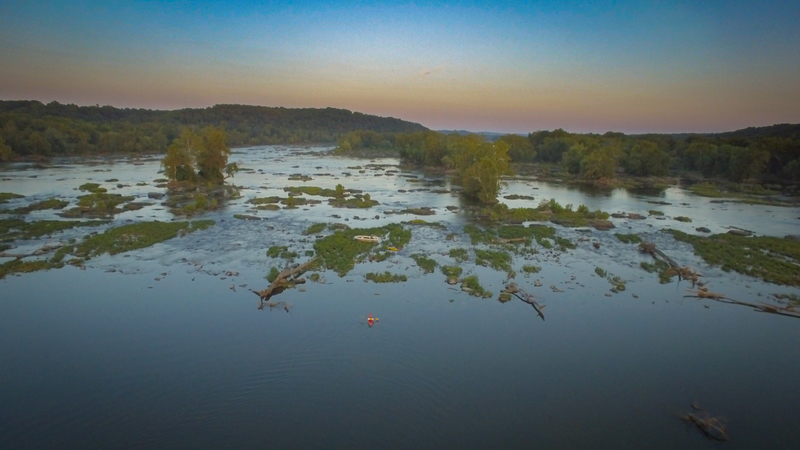
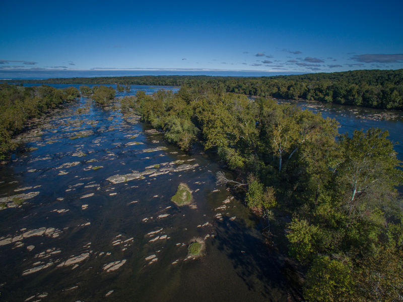
This birds eye view upriver is about 3/4 mile downstream from Violette's Lock. Nice place for a picnic in the middle of the river. You have no idea how difficult it is to find a bird willing to carry my GoPro. The GoPro bird harness helps, but a gimbal would be even better.
Sep 30, 2017
This view is about 1/4 mile downstream from Violette's Lock looking upriver. This view is closer to the Virginia side. You can see the large island in the middle of the river. Routes through this side of the island are equally difficult to locate.
Sep 30, 2017
Many islands and shallow rapids extending the width of the river for this 3/4 mile section.
Sep 30, 2017
1/4 mile downstream from Violette's Lock. A birds eye view upriver, you can see sharp demarcation of the flatwater section from the shallow rapids and islands. Challenging to find a route through the upper section. I'll have to watch one of the outfitter groups for the best route.
Oct 4, 2016
Ran center line of Potomac off Violet's Lock in a broad loaded canoe. No issues river only slightly swollen off last few days of rain. I-II's perfect little beginner run or control refresher.
Avoided right side channels plenty of strainers across the top made me doubt the run in a canoe, sure a kayak could squeeze through.
Jun 7, 2016
GW canal running very well. No real hazards due to high river level.
Sep 13, 2012
This is a great place to learn how to PooPoo Roll, but after that it is time to move on to the peepee area.
Mar 17, 2012
Ran this today at 3.93ft and had a great time! It looks like a really long ferry across the river to the Patowmack (GW) Canal section, but it passes rather quickly. Lots of choices to make while in the canal section as the islands and debris piles cut the river into individual channels. When nearing the end of the canal, note the large yellow arrow on the tree on the left side of the right-hand channel. It'll be pointing left into what is (at this moment) a strainer. Simply run to the right of the woodpile/strainer and then attain around the left hand side of the island to get back to the main channel and run a couple of fun little ledges before starting to ferry left to the shore line to take out. The best take-out is visible as two trees are marked with yellow paint squares which you can see from just about anywhere on the river. The paddle back up the canal starts out really shallow at the 4' mark, and then deepens for a bit, but once you are committed to the canal, there's no real way out until the take-out at Violette's lock. At 3.93 feet, we had to clamber up the canal bank 100 yards from the lock because it simply got too shallow to go any further.
Mar 17, 2012
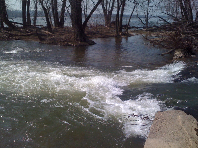
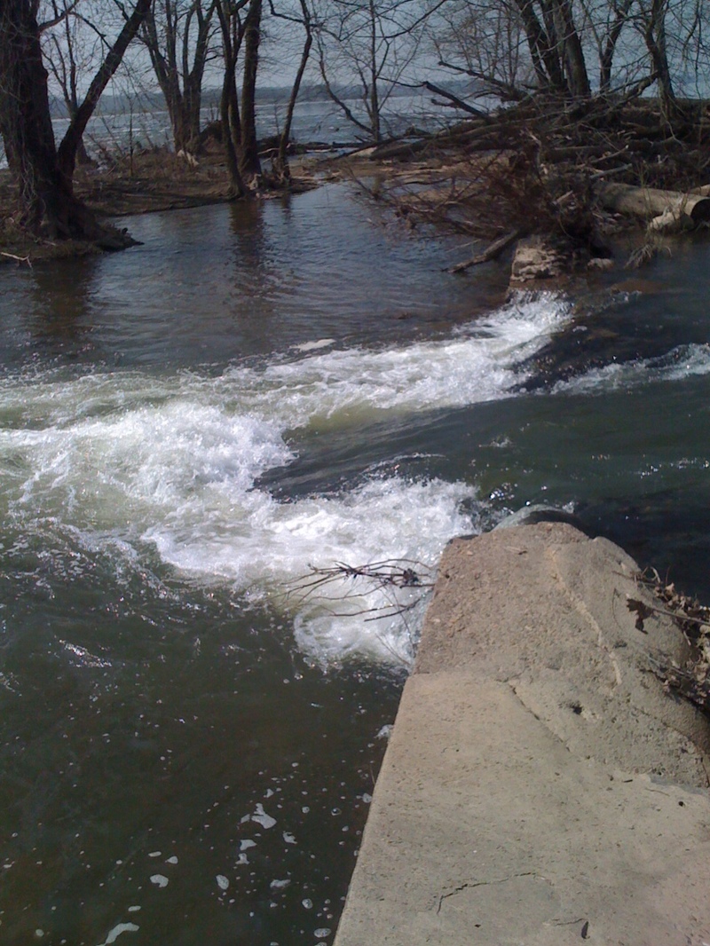
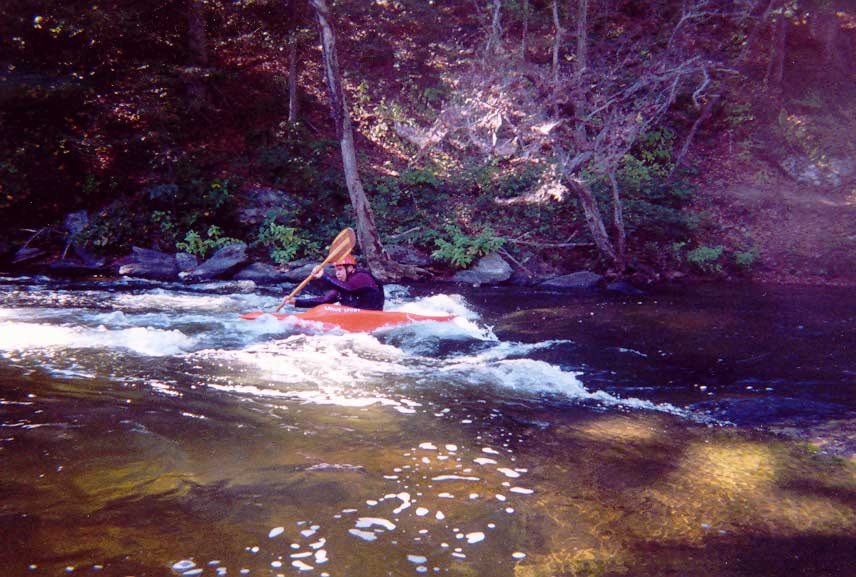
The man-made breach in the feeder canal dam at Violette's lock makes for a fantastic park-n-play spot right at the put-in.
Mar 17, 2012
Another shot of the park-n-play hole/wave
Mar 17, 2012
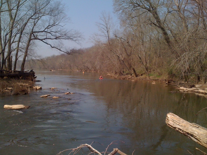
View upstream of the locks to the put-in
Jun 9, 2011
I recently taught my friend to paddle here and this is a GREAT section for it. One of the pluses that I'm surprised not to see here is the play wavehole right at the put in! This is the most park and play I've ever seen. BE WARNED: the wave is fun, but shallow after, so make sure you have a solid brace and combat roll! For new paddlers, this is a great way to learn to run small drops and power through holes (my buddy had a blast with that).
Oct 3, 2010
I ran it today, three days after a topical depression passed over the area. Quite a bit of fun. Several big trees headed downstream, competing with me for space. The level at Little Falls was 4.4. A bald eagle buzzed over me. No strainers today anyway.
Apr 8, 2009
Added by John Querry:
The park on the Virginia side of the GW canal and the Seneca Breaks is owned by Northern Virginia Regional Park Authority. It is just down stream of the Lowes Island Golf Course. Officially, the park has no name, but it is commonly know as 'the park at the end of Seneca Road'.
For paddlers looking for an aerobic river access hike while carrying their boat, they can park outside the park gate at the end of Seneca Road. Then carry down the paved road, pass by a utility dirt road gate on your right, to where the road takes a sharp left turn at the intersection of the Potomac Heritage National Scenic Trail. Continue straight onto a dirt trail for about 500' along the ancient Seneca Road bed to the GW canal shore. It's about 1 1/4 mile and a 300' hill carry from the gate to the put in. To paddle all of the rapids in the Canal loop, the best take out is about 500' past the Colonial Pipeline right of way. The right of way is easily recognizable from the river. It's a 100' wide swath on both sides of the river that is completely void of large trees. The trail at the take out connects back to the Potomac Heritage Trail which is also the dirt utility road you saw while carrying to the put in. So it, in turn, takes you back to Seneca Road.
Be prepared for a work out: it's a 3 mile, up hill carry from the take out to the park gate. That's about 4 1/4 miles of total carrying; but if you live on the Virginia side of the these rapids, it will save you about 2 1/2 hours of rush hour driving to get to and from Violets Lock.
Apr 28, 2008
The 'maximum' level of 4.2 is rather odd here. At somewhat higher levels (I ran this at 4.6 recently, for example), some of the features tend to wash out, and the trip actually becomes more interesting going down the Seneca Rapids on the river itself, but there is nothing dangerous in the way that a 'maximum' normally is meant to indicate.
May 13, 2005
As the above description says, take a right turn once you cross the bridge over the canal. There is a very inviting trail off to the left that leads right to the water. Bad trail to take.
The river is damn near a mile wide here. And the play is on the opposit bank. So get ready to do a whole lot of flatwater paddling to get across to the other side.
When you get to the river, you'll see a river wide shoal area. Make sure you ferry across the river above the shoals. The entrance to the feeder canal is above the shoals. If you miss that move, one of the channels below the shoals comes in just below the wave pictured here. Fun wave.
If I were in my long boat, I'd stay in the main channel and play with attaining my way back up over taking the canal. Most of the upstream moves looked very do-able in the 3 foot range on the gauge.
Brad.
Aug 15, 2002
The river is very low in this shot taken during the drought of 2002.
Jun 15, 2001
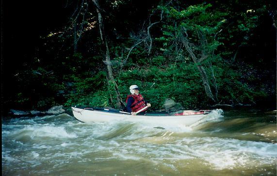
Canoe Cruisers Association safety chair Jeff Davis surfs in the Surfer's Hole after conducting a swiftwater rescue clinic on the Violette's Lock loop.