Potomac
4. Sandy Beach/O-Deck to Anglers Inn (Mather Gorge)
| Difficulty | II-III(IV) |
| Length | 2.2 mi |
| Avg Gradient | 8 fpm |
| Gauge | Potomac River Near Wash, Dc Little Falls Pump Sta |
| Flow Rate as of 59 minutes | 2.90 ftlow runnable |
| Reach Info Last Updated | May 19, 2023 |
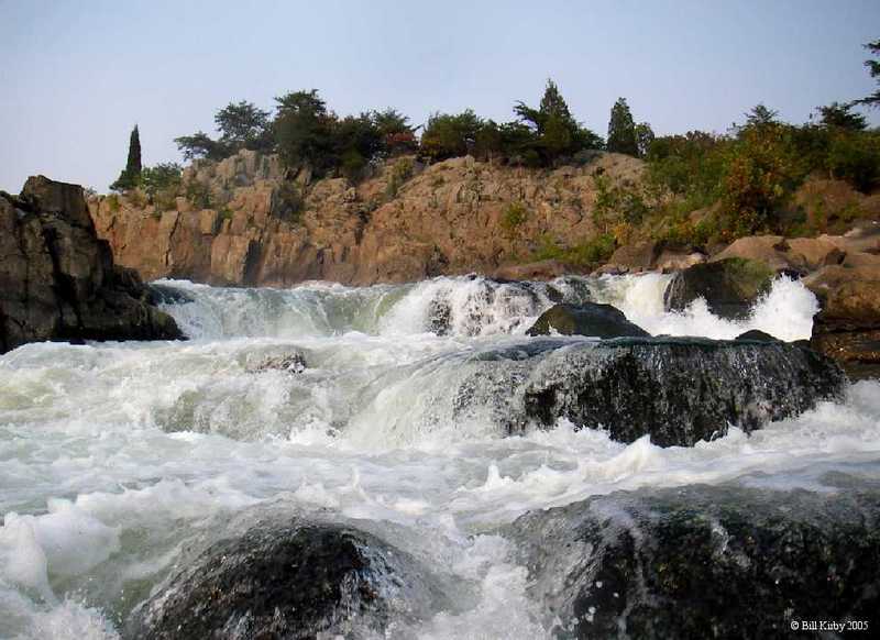
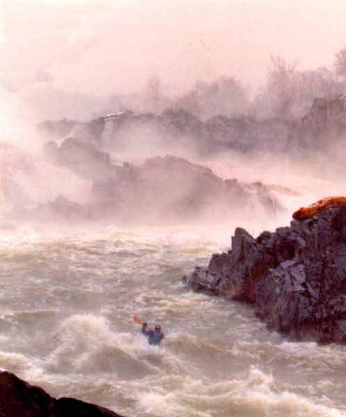
The Potomac River below Great Falls is literally in the back yard of Washington, D.C. This fact contributes to the strong boating community in the metropolitan region. Mather Gorge, where this section begins, is a stunning cliff-lined gorge. Further down, the river maintains it's wild and remote feeling, except for at choice spots where Virginia has allowed sloppy development to mar the shore.
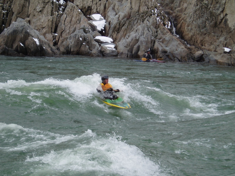
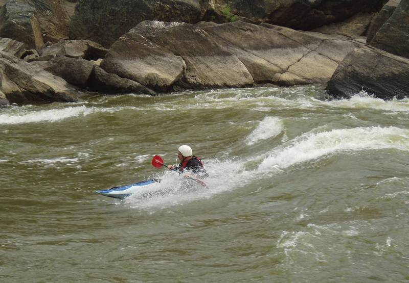
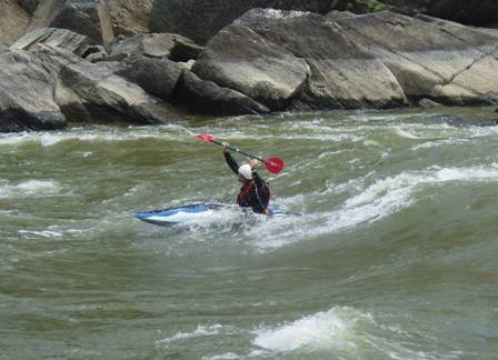
The river offers play and practice for beginners to experts and numerous sections can be run. This description will deal with the rapids and access points and doesn't provide details on the numerous play spots.
It should be noted that the stretch of river from O-Deck just below Great Falls thru Wet Bottom offers some of the best big water paddling in Maryland. 10,000 cfs thru a 100 foot wide gorge makes for some large waves, surging eddies and boiling eddylines. Below Mather gorge the rapids get considerably easier. See Surf the Potomac for good playspot info. Older playspot pages are the Potomac Playspot Project, Potomac Paddlers, as well as another popular playspot guide developed by David Mackintosh.
Playspot List & Levels:
2.5' - 4.2' Wet Bottom (Class 3)
2.6' - 2.8' Horseshoe (Snodgrass) Wave (Class 3+)
2.7' - 2.9' Fishladder Wave
2.7' - 2.9' Portage Waves (Class 2)
2.7' - 3.0' Annie's
2.7' - 3.0' O-Deck 3 (Class 3)
2.7' - 4.0' Maryland Chute (Class 2+)
2.7' - 4.2' Virginia Chute Wave (Class 2)
2.8' - 3.3' Bloody Good
3.3' - 3.6' O-Deck 2 (Class 3)
3.6' - 3.8' O-Deck 1 (Class 3)
3.6' - 3.7' S-Turn (Class 3)
3.7' - 3.9' S-Turn
...
Primarily a playspot with large surfing waves. Adjacent to Fisherman's Eddy. Using this for a downriver trip is inconvenient because shuttle must be set on Virginia side of river.
Easiest access is from the VA side as a park & surf. Enter Great Falls park and take an immediate right into the first parking area. Just above the lower observation deck is the trail down to Fishermans eddy. Carefully work down the steep trail to the waters edge. Ferry across and slightly upstream to access the O-deck wave.
From the MD side you will have to work upstream past the mouth of the fishladder and attain up about another 300 yards to access O-deck.
Boat: longboat
Levels: 3.6-3.8 ft
The wave just above the normal odeck wave. From the river left eddy
attain to river right, then paddle up and ferry back river left to get
on this wave. Or catch it on your way down from the falls.
Boat: RPM type, longboat, maybe fast creekboat
Levels: 3.3-3.9 ft
The normal odeck wave, parallel to the end of the rock outcropping river left.
Boat: creek boat, fast playboat
Levels: 3.3-3.6ft
The wave below the odeck 2 wave. At the lower levels it often has a foampile. Higher levels and it’s a green wave.
Boat: playboat
Levels: 2.7-3ft
A small pour over hole, the sides are great for cartwheels.

Location uncertain, my best guess is: pour over hole on the river right
side of the O-Deck 2 wave. Fun hole to boof, but not a very good
playspot. Another guess is the small green wave river left above rocky.
Levels: 2.7-3.0 ft
Boat: Playboat
Large wave just after the cliff ends below the MD side overlook. You
will need a fast playboat/ rpm style boat to catch it. Very large bouncy
wave. At 6.5 ft it is very possible to get a modern playboat on this
wave, but it's hard.. This is the stakeout wave of the Potomac. It is
surfable on the fly much higher than 7ft, it finally washes out too much
to surfable in the low 9 ft range, any level below that and its good on
the fly. The stated range only refers to the eddy service. If
thunderdome is in scout from the overlook and you will find several big
waves. This wave is always trashy and boily, surfs of more than 10
seconds are impressive and rare. Boats like rippers, with bow rocker
will help a lot.
Levels: 6.4-7.2 ft
Boat: RPM type, playboat
Hole river right below odeck, at the top of fishermans eddy. Powerful hole, good for hole moves.
Levels: 4.2-4.4ft
Boat: Playboat
The wave formed by the rock at the bottom of the eddy you sit in to surf
odeck. Ferrying out to this wave is a challenge, or run the thunderdome
channel and catch it on your way down. It’s about 8ft tall, no eddy
service, but you can walk laps river left for the ferry. From 7.6 ft up
to about 7.9 ft there is a foam pile on this wave, making it much easier
to catch. At 7.6-7.8 ft is is possible to ferry on to the wave from the
eddy but it is extremely challenging. Above 8ft this wave is super
green and fast. You'll need to paddle hard to get on it.
Levels: 7.6-8.6ft
Boat: RPM style
Virginia Access Point. Park at Great Falls National Park (Virginia - fee area). From lower lot, carry across picnic area to steep trail that leads to Fisherman's Eddy.
The wave is far river right at portage. There is eddy service. Between
5.6 and 5.3 this is basically a pourover that is deep enough to ender
creek boats and throw ends in a slice boat. It only becomes a good
playwave at 5.6 ft.
Levels: 5.3-6.4ft
Boat: Playboat
Hole (playboat): The hole against the river left shore at portage. Good for hole moves. Levels: 3.9-4.1 ft
Wave (RPM style / longboat): The wave train in the middle of the river at portage. These waves used to be better, they aren’t that good now.
Levels: 2.5-2.9 ft
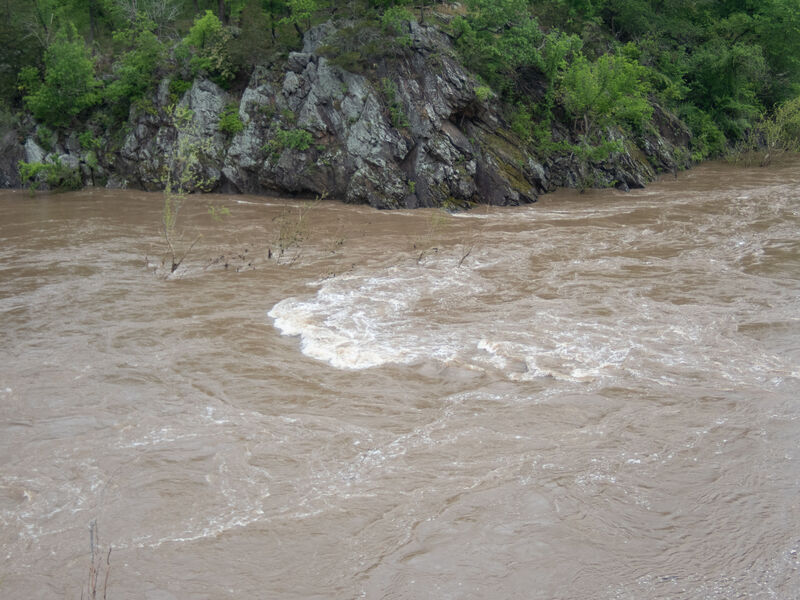
Wierd currents where the fishladder dumps into the main stem of the Potomac. Fast current, big waves and a messy pourover at some levels.
Converging currents and constricted river form dynamic waves, current and whirlpools. Rocks form pourover holes at lower levels.
Playboat level: 3.6-3.9ft
The hole in the center of sturn. Good powerful hole, can throw lots of
moves here. Attain up the boils river right for eddy service.
Outburst/Slalom level: 4.8-5.5 ft
River left against the island. Catch the big eddy river left and paddle
up the boils against the island. It's hard but doable in an RPM, which
is the slowest boat that could catch this wave. Fast wave that's pretty
fun, watch out for the big boils once you blow off the wave, go for a
stern squirt.
River right in the backchannel, between sandy beach and where the back
channel splits from the main channel. Comes in when daves starts to wash
out, its a bigger version of Daves.
Boat: playboat
Level: 6.6-6.7 ft
The waves river right of the back channel, paddle up from sandy beach to
get here. Nice bouncy waves. The top wave is usually the best.
Boat: Playboat
Levels: 6.1-6.6 ft
The small green wave river left above rocky. It’s been occasionally referred to as Annies but the name isn’t concrete.
Levels: 2.7-3.31 ft (guess)
Boat: RPM style / longboat
Maryland Access Point river left just below the fishladder. Park at Great Falls National Park (fee area), reached via MacAuthur
Blvd. in Montgomery County, MD. Carry 1/4 mile south along the C & O
Canal towpath. Take the trail on the right just off the towpath down from Lock 17, upstream of the overlook that leads to Sandy Beach. Can also be accessed from Anglers by paddling up the canal a mile, then carrying another 0.4 mile to the put-in.
A diagonal wave hole that's very smooth with a nice foampile. At the top
of the farthest right channel. No eddy service sadly. there are a few
ways to walk up that are more or less easy.
Levels: 4.9-5.4 ft
Boat: Playboat
Small easy wave hole in the middle back channel. In the center left, right after the first rapid.
Levels: 4.8-5.2 ft
Boat: Playboat
Large bigwater waves and eddy lines at higher flows. Good long boat surfing between 4 and 5 feet on the gauge.
Levels: 3.9-4.8 ft
The hole river left in the last drop of the backchannel. The sides of
the hole can be played at 6.6ft, but the middle is shallow and trashy.
Levels: 6.7-6.9 ft
Boat: Playboat
The wave river left in the last drop of the backchannel. There is eddy service.
Levels: 7.0-8.2 ft
Boat: Longboat
At normal levels is a 3 foot sloping ledge drop that can be run most anywhere. River right hole is good for playboats (2.5-4.2 ft) and has the potential for cartwheels. Has good eddy service. River left of the hole is a glassy green longboat wave (2.8-3.8 ft). Do the normal wet bottom attain to below the center island at wet bottom and ferry out to above this wave and drop on for laps.
The wave river right as the gorge makes a left turn
Levels: 7.2-8.6 ft
Boat: RPM style
The wave river left at the jump rock. Essentially it is the first wave
of the jumps. Just a guess that this is the around the corner wave, but
there are really no other features this could be.
Levels: 9.3-9.8 ft
Boat: RPM style / Outburst style
The hole just belowwhere the canal has a small overflow trickle. River
left. There is eddy service. Shallow untill 8ft, and starts to get
greenish at 8.5 ft.
Levels: 7.7-8.8 ft
Boat: Playboat
River right of the island that begins the divide between the dead cow
channel and the main channel. On the fly only, no eddy service. There
can be a big hole here at lower levels (Low 8's). There is a bit of a
foampile.
Levels:Mid 8's
Boat: Playboat/Axiom style
Levels: 2.7-4.2 ft
Boat: Playboat
3.9 is a nice glassy wave, good for RPMs
Awesome playboat hole at the top of the back channel with huge eddy service
Levels: Different sources site vastly different levels for dead cow. They are listed below
Small playhole, good for cartwheels and loops. At the top of center chute river left. At higher levels good for salalom boats
Levels: 4.1-4.8 ft
Boat: Playboat
Levels: 4.9-5.4
Boat: Slalom
Hole in the middle of center chute. Use the center chute ledge hole to
make the elevator move and ferry out to this hole. No eddy service,
you’ll have to make the elevator move every time. (location isn't
precise, but the hole is somewhere in the middle of center chute
slightly downstream of the center chute ledge.)
Levels: 4.20-4.33 ft
Boat: Playboat
Chuck Thorton: “There's a great surfing wave in the middle of Center
Chute. I'd say in the high 4s. I've never heard a name for it. Good for
RPM, slalom (not playboat). It's just downstream of your marker for
'Center Chute ledge smaller hole?”
Levels: 4.6-4.9 ft
Boat: RPM style
Small playhole.
Levels: 2.5-4.0 ft
Boat: Playboat
Awesome wave at the bottom of the island that separates MD from center
chute. The island is underwater at these levels, and there are some
holes in there, along with trees so be careful. There is fantastic eddy
service for this wave. It’s big, got a great foamliple, and has
potential to throw some big tricks.
Levels: 9.6-11ft
Boat: Playboat
Awesome playhole, good for all hole moves. At higher levels it becomes a great wave for longer boats (slalom / RPMs)
Levels/boats:
5.2-6ft playboat
6-6.3ft medium playboats / RPMs
6.4-6.9 RPMs / longboats
7-7.4ft 14+ft boats
Powerful hole where rocks below MD chute normally are. Attain up from anglers. There is eddy service.
Levels:
6.8-7.5ft playboat hole
7.5-8.5ft playboat wave
8.5-8.9ft slalom wave
The waves against the river right shore. There are two right after each other that are good, but the first is more stable.
Levels:
9.0-9.6ft playboat
9.6-10.3ft long river runner / slalom
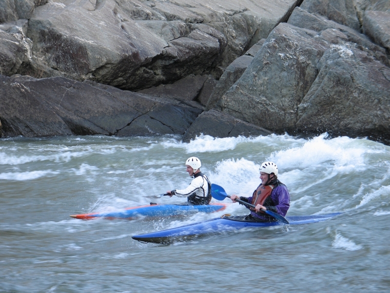
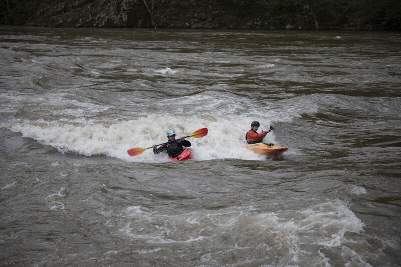
Maryland, Center, & Virginia Chutes. Washington's practice spot and home to the Maryland chute playspot. Each chute offers a different type of practice. All lines are straightforward.
Cool wave that barrels from river right to left, 6.6ft is ideal for an
RPM style boat. Its a small feature but easy enough to use the barrel to
stay in. No good eddy service, but its a fun spot to hit on the way
down from the center chute wave. Its far river right above the skull
island. At levels lower than 6.3 ft it is still surf-able as a really
small hole down to about 5.9ft (guess).
Levels: 6.3-6.8ft
Boat: playboat / RPM style
Smooth longboat wave just parallel to the front of skull island in the
main channel. Attain up the back of skull island for laps.
Levels: 6-7.6ft
Boat: longboat
Maryland access point reached via MacAuthur Blvd. Park in one of three gravel or dirt lots across from the Angler's Inn, a fine restaurant. Carry across the canal, then 100 feet south on the towpath, then right down to the shore. From the river, the beach is easily seen on river left.
Feb 14, 2008
My truck got broken into at the Old Angler's put in yesterday afternoon. Somehow they got right through the passenger side lock! Lock is now busted and my debit card is a goner... the thieves ran up $700 in charges before BofA automatically cancelled the card. Anyway, don't learn the hard way this is a problem that doesn't seem to be getting any better. Leave nothing of value in your vehicle at this put-in!
Apr 21, 2007
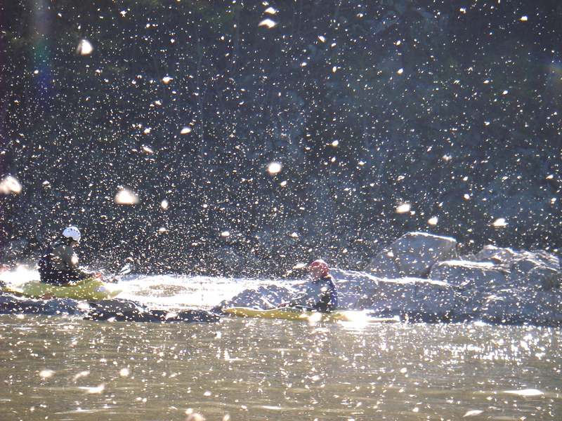
Center chute park and play in the middle of a huge stonefly hatch. Surf with your mouth closed.
Jan 6, 2007
Rocky Island surfing on an amazing 70 degree day. Video here