Potomac
4. Sandy Beach/O-Deck to Anglers Inn (Mather Gorge)
Feb 14, 2008
My truck got broken into at the Old Angler's put in yesterday afternoon. Somehow they got right through the passenger side lock! Lock is now busted and my debit card is a goner... the thieves ran up $700 in charges before BofA automatically cancelled the card. Anyway, don't learn the hard way this is a problem that doesn't seem to be getting any better. Leave nothing of value in your vehicle at this put-in!
Apr 21, 2007
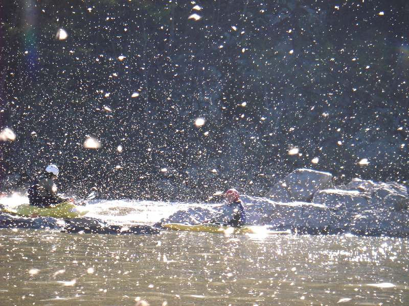
Center chute park and play in the middle of a huge stonefly hatch. Surf with your mouth closed.
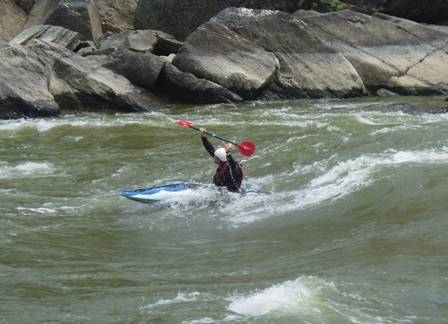
Jan 6, 2007
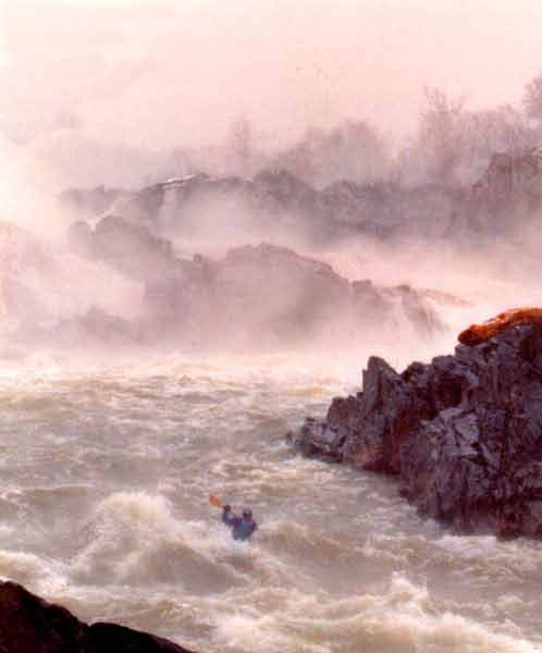
Rocky Island surfing on an amazing 70 degree day. Video here
Nov 4, 2006
fast
Jan 15, 2006
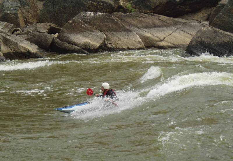
This is a dynamic wave at the top of Center Chute. It's a great surf, but you'll have to get out and carry over an island to run it again. Which we did again, and again, and again....
This is a great boof that lands you in a very aerated hole that is backed up by another ledge. Expect the melt down and enjoy the ride. This is one of three cool rapids in the back channels of Rocky Island at this level.
Sep 10, 2005
The view while surfing Horseshoe Waves
Feb 6, 2005
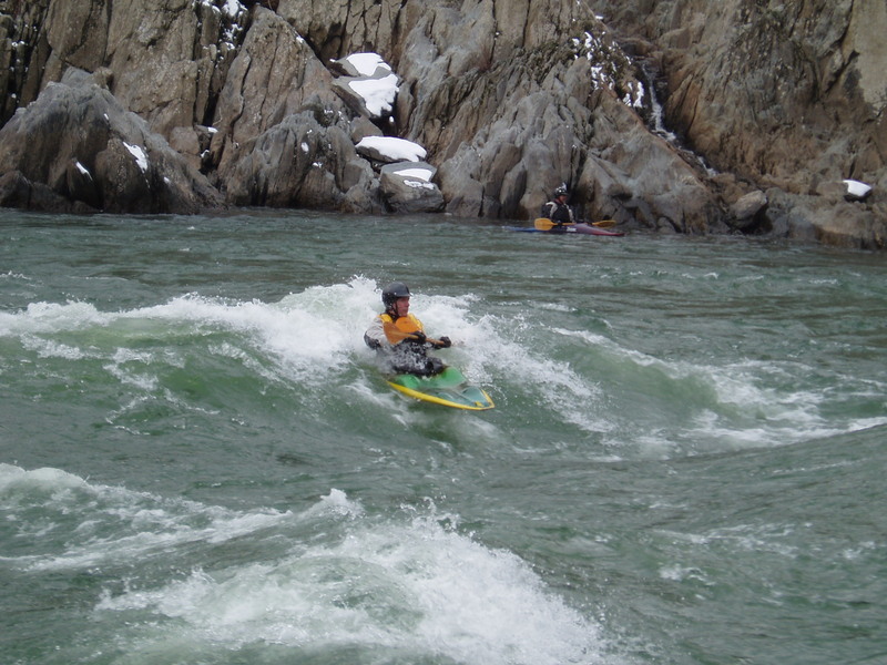
This is a great level at Rocky for both short and long boats. Second wave offers the most dymanic rides at this level.
May 16, 2004
Rocky Rocks in an RPM!
Rockin'the top wave in an RPM
May 11, 2004
Subject: Record high run on Potomac above DC - Sunday 1/21/96
This is the only article in this thread
View: Original Format
Newsgroups: rec.boats.paddle
Date: 1996/01/22
TRIP REPORT: date - 1/21/96; level - 19.31' at Little Falls gauge; put-in:
Bear Island 200 yards above jumping cliffs in Mather Gorge; take-out -
Lock 10 on C&O Canal; difficulty - if you believe in runnable class 6,
this was it, baby!!
Sunday saw the highest known run ever down the Potomac Gorge, surpassing
the 1985 run at 18.3' by Davey (the resistor) Hearn et al. We put in at
about 1:15 pm, just as the river crested. The Little Falls gauge was
confirmed at 19.31' at 1:00 pm. We estimate the cfs at 375,000, which is
extrapolated from data supplied by the Army Corps of Engineers for 1985
flood. I tried to get confirmation from the Corps for yesterday's cfs, but
without success so far.
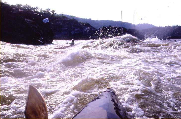
The water was indescribably monstrous and chaotic. I led out of the put-in
eddy, and as I was crossing the boil zone towards the shear line, I was
attacked by a massive moving hydraulic about 8' high. It pulled me
completely underwater for 3 or 4 seconds before dissipating and letting me
go. We all realized very quickly that a blown skirt might be fatal.
The main action was at the rapid named Jumps, which started about 200
yards down from the put-in and continued for 1/2 mile. This rapid occurs
in a spot which is normally placid flatwater. I believe it was named by
the 1985 crew, who were the first to discover it. It is named after an
area popular for it's 50' cliff jumps down into the river. The tops of
these cliffs were probably 15-20 feet underwater yesterday.
Jumps is formed from an interesting hydrological phenomenon wherein Mather
Gorge fills in to the brim (about 60' above the height of the average flow
of 7,000 cfs) and virtually dams up Great Falls, which is about 1.5 miles
upstream of this point at the top of Mather Gorge. As a result, Great
Falls flattens out to some extent, and the drop which normally occurs at
Great Falls (about 60 vertical feet) is delayed as the incredible
funneling pressure of the relatively narrow, sheer-walled Mather Gorge
keeps the river elevated. Only when the vertical walls give way to a
less-steep, rocky valley does the river get to madly eject itself from
this bottleneck.
This sight, the Jumps, is one of the most awesome spectacles of nature
I've ever beheld. Hundred of thousands of cfs tumble wildly out of the
gorge through giant boils and folds in a state of mad chaos. Riding
through this involved going from one envelopment to another. The wave tops
periodically broke into temporary, truck-sized hydraulics. But each of us
only got nailed by two or three of these during the worst part of their
cycles. There was some debris and a few trees, but it was not an
overriding concern, and no one was hit by any debris.
At low water there is a 45' high mound of rocks on the center left here,
sort of a high-water island. Yesterday this rock was well under water and
formed a massive 25' high continuous hydraulic (it was here that Kirk's
boat was smashed back in '85). This hole was maybe 50 yards wide, and
extended 50 more yards into a wave on either side. It was easy to miss
this beast, but it was somewhat unsettling to go by it on the shoulder of
the wave extension.
Below Jumps, the river normally makes a 90 degree left turn below Madeira
School towards Angler's Inn put-in, then turns back to the right.
Yesterday the river cut this corner, with less than 40% of the water going
down the existing river channel. There were two major channels, one to the
right of Skull Island, and another of similar size to the right of it
(into the area of Black Pond). The rapids in here, which we were not
expecting, were nearly as intense as Jumps, but much shorter. I hit just
two massive waves, one of which broke on me.
Of the four in our group, two emerged from all of this unscathed (myself
included), one swam and was pulled out by us, and the fourth disappeared.
Later, after a lot of worrying and some soul searching, we found him safe
at home. He had apparently engaged some trees at the bottom of the Black
Pond channel, lost his gear, and swam to shore. He hiked up the Difficult
Run Creek drainage to the nearest house, and the homeowner drove him back
across the river to his home in Cabin John, MD.
This trip was of course the experience of a lifetime. While we all agreed
that we would probably not do this again, it was exhilirating beyond
belief. Perhaps one or two in our party should not have gone or perhaps we
all made sound decisions. We certainly knew the risks and we knew some
elements were not in our control (a branch poking through your spray
skirt, or a tree in the hole with you). We had some 50 years of paddling
experience between the 4 of us, mostly in these waters. Our weakest member
had 5 years experience. No one was pressured to put in.
We planned the trip carefully to avoid contact with authorities using
alternate parking and access points and other measures. We luckily did not
see authorities (other than helicopters) en route to the put-in, nor did
we see any signs indicating that the river was closed. It was, apparently,
but we did not know this. We understood that Park Police or Rangers would
have no choice but to turn us back (what are they going to say, 'oh, yeah
anything under 400,000 cfs is perfectly safe, go right ahead'), so we
avoided contact.
The whole question of river 'closure' has already provoked some debate on
this newsgroup in connection with Davey (the resistor) Hearn's arrest and
TV interview on Channel 9 last night. And it will probably continue to get
a lot of attention. We are grateful that we did not get tripped up by this
problem and were able to make the decision to go or not go purely based on
our scouting. We did talk to several fireman, county police, park police,
and rangers at the Lock 10 take-out, but they were quite civil with us and
did not accuse us of being insane. They just said get out and we did, as
our run was over - thankfully!
Paul Schelp
1/22/96
May 11, 2004
For the out of towners:
Park at Anglers Inn. 3 major options.
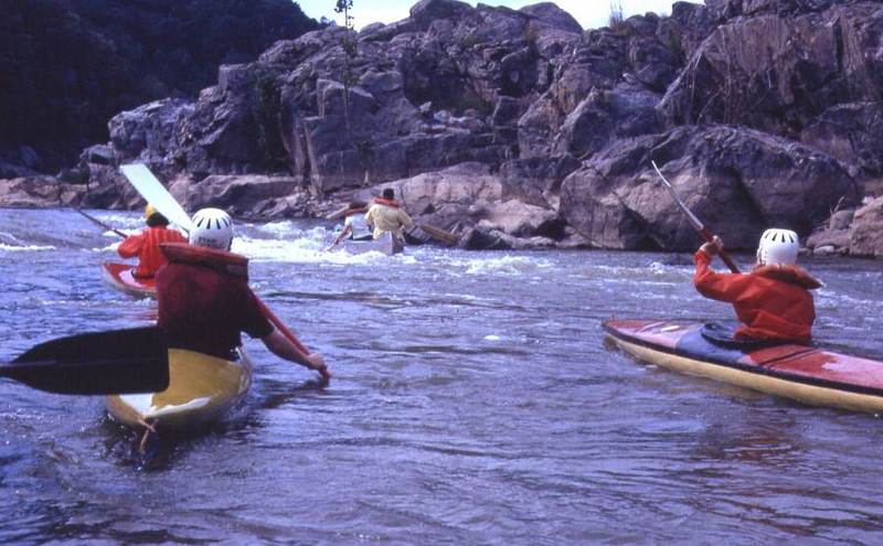
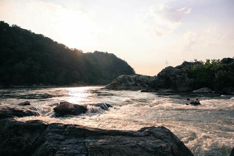
1. walk down the trail, across the bridge, and veer to the left to the wide trail down to the river. From there you can attain up to the maryland and center chute. Easy attainment even in a 6 foot long boat. Best to just follow the crowd. Someone is always there. Float back down to anglers when done. Center is best around 6 feet. Huge wave, nice eddy. Turns into a hole in the 5 foot range.
2. using the same put-in, float downstream and go to the left of the big island. These are the offut waves. Lots of fun in the 4 foot range, and much more user friendly for novices than the upstream chutes. To get back to your car, get out on river left. Follow the trail DOWNSTREAM, it will eventually take you back up the hill to the C&O towpath. From there either paddle back up the canal or carry your boat a half mile back to anglers.
3. From anglers, walk down to the canal, hop in your boat and slide into the canal. Paddle upstream about a mile. Get out when you get to the lock and carry your boat up the trail past the overlook. From the overlook you will look down on the sandy beach put-in. Keep going up the trail until you see the main wide trail on the left going down to sandy beach. From there, pick one of the many options and eventually float back down to anglers. It seems that most people access the Rocky Island waves this way. Good surfing up by sandy beach above 6 feet. Major boiling eddies and swirly water. Rocky Island is a great surf in a fast long boat around 4.5 feet.
Enjoy.
Brad.
Jul 5, 2002
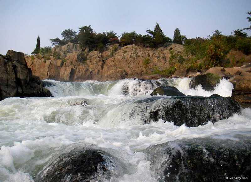
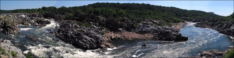
Panorama view from the Virginia side of the Potomac. Photo made from O-Deck.
Jan 15, 1978
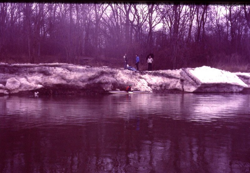
The winter of 1978 saw bizarre collections of ice on the Potomac, making for some surreal landscapes.
Mar 15, 1973
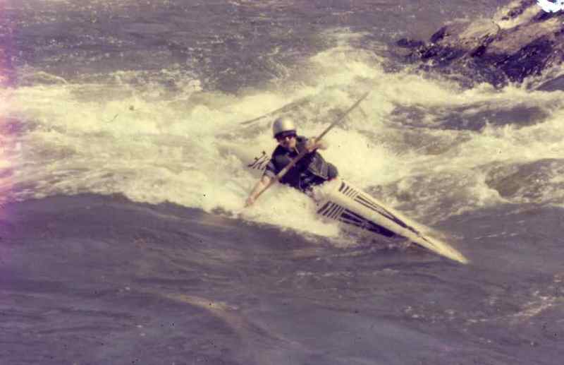
Carrie Ashton going big on the Middle Chute Wave.
Master boat builder and C-1 paddler Bill McKnight getting stuffed by the Middle Chute Wave.
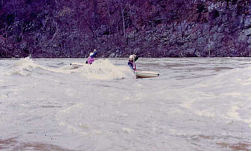
Red hot C-2 action on the Mighty Po. Russ Nichols and John Evans shredding the Middle Chute Wave. Thanks to John Hefti for remembering who was there.
Jan 2, 1973
John is the creator of the poignant 'MEG' sculpture memorial on the unnamed island below Difficult Run.
Oct 15, 1972
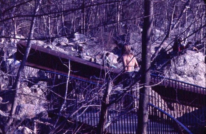
Al Jenkins looks over the remains of the footbridge to Olmstead Island after the Hurricane Agnes flood. It was many years before this bridge was re-built
Jul 15, 1972
Left to right: John Sessler, Rick Ryan, unknown open boaters, Kevin Sessler. Shredding the chute, old-school.
Jan 1, 1900
The second year of the S-Turn Slalom, the river zoomed from 3-4 ft to over 7 in a few hours. Made for one hairy slalom race.
Jan 1, 1900
Dave Jones, Katie Hudock, Tom Kopczyk, Gary Pieruccioni, and Bill Kirby. Our fifteen minutes of fame, syndicated nationwide in the summer of 1979.
Jan 1, 1900
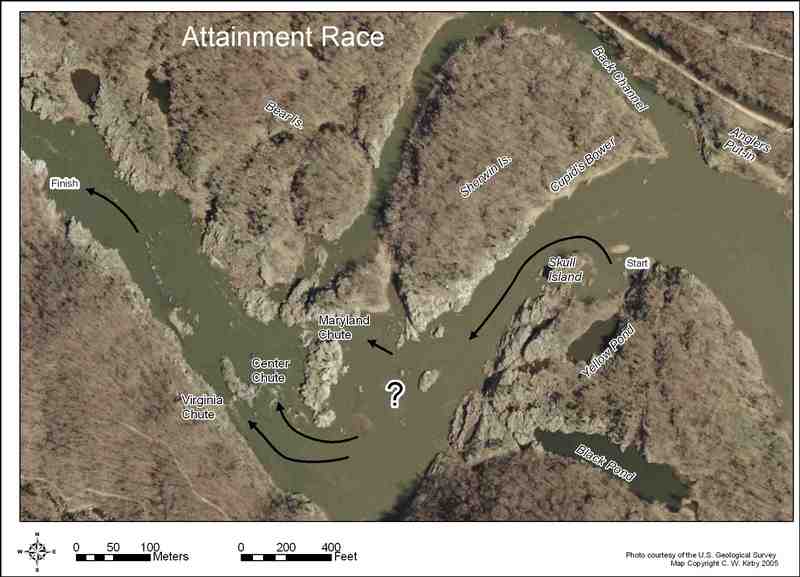
The race course for the 2007 Potomac Whitewater Festival Attainment Race
The proposed course for the 2007 Attainment Race
Jan 1, 1900
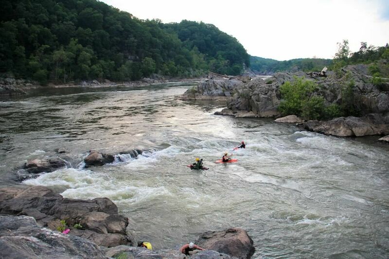
Maryland Chute
Jan 1, 1900
Look Ma No Brains - resized. Peter Bross proves an RPM can rock at Rocky.
Jan 1, 1900
Maryland Chute
Jan 1, 1900
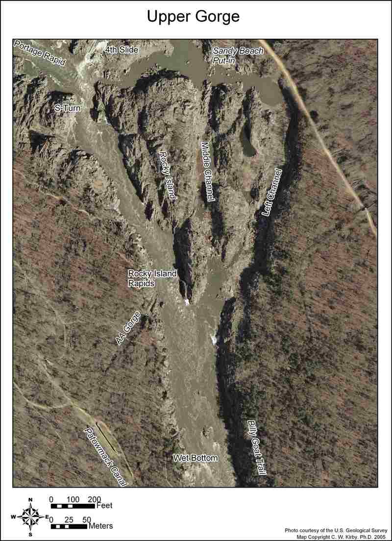
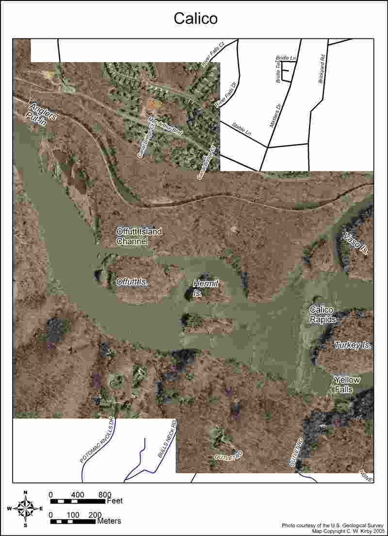
Part of a series. This map is designed for printing on 8 1/2 x 11 paper
Part of a series. This map is designed for printing on 8 1/2 x 11 paper
Part of a series. This map is designed for printing on 8 1/2 x 11 paper
Part of a series. This map is designed for printing on 8 1/2 x 11 paper
Index to the series. This map is designed for printing on 8 1/2 x 11 paper
Jan 1, 1900
Part of a series. This map is designed for printing on 8 1/2 x 11 paper