Youghiogheny
2. Swallow Falls Rd. (Bridge above Swallow Falls [State Park]) to Hoyes Run.(Top Yough)
| Difficulty | IV-V |
| Length | 2.8 mi |
| Avg Gradient | 83 fpm |
| Gauge | Youghiogheny River Near Oakland, Md |
| Flow Rate as of 1 hour | 153 cfsbelow recommended |
| Reach Info Last Updated | January 22, 2026 |
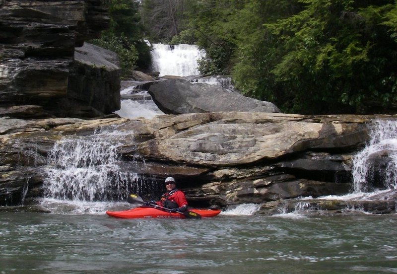
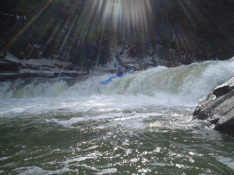
Photo: Richard Hopley runs Swallow Falls, by Pete Martin. Photo courtesy of the Monocacy Canoe Club.
For a helmet-cam view of the run, check out this video from the Top Yough Race in April of 2011. http://www.youtube.com/watch?v=R3uD704nj5U&feature=related
American Whitewater editor Bob Gedekoh writes:
I just learned that several days ago a boater swam above the siphon on Suck Hole on the Top Yough and his boat went down it. Fortunately the boater managed to avoid going down the siphon too. (I was not there when it happened, but heard about it from those who were.) The boat disappeared completely. It was down in there for a couple of days, but has since been recovered. At any rate, the logs, etc that had been blocking the siphon for the past few years have shifted... and the siphon is once again open for business. I think a lot of younger boaters dont even know where the Suck Hole siphon is, or how dangerous it can be, since it has been blocked by debris for so long. Be careful and spread the word. Bob G (FYI the siphon drains the eddy that most people catch at the top of the rapid on the right. This is the eddy just above the huge midstream rock. Look behind you next time you are in that eddy and you will see it.)
Alternate takeout: paddle an extra 4 miles of flatwater and run the Upper Yough!
This one's maybe a little smaller and tighter than the Upper Yough. On balance, it's a bit easier, because the continuous rapids aren't quite so big. Nonetheless, it deserves respect and it's a lot of fun.
Gradient, from putin to takeout: 110, 110, 30. In other words, you have two very busy miles before it flattens.
Rapids of note:
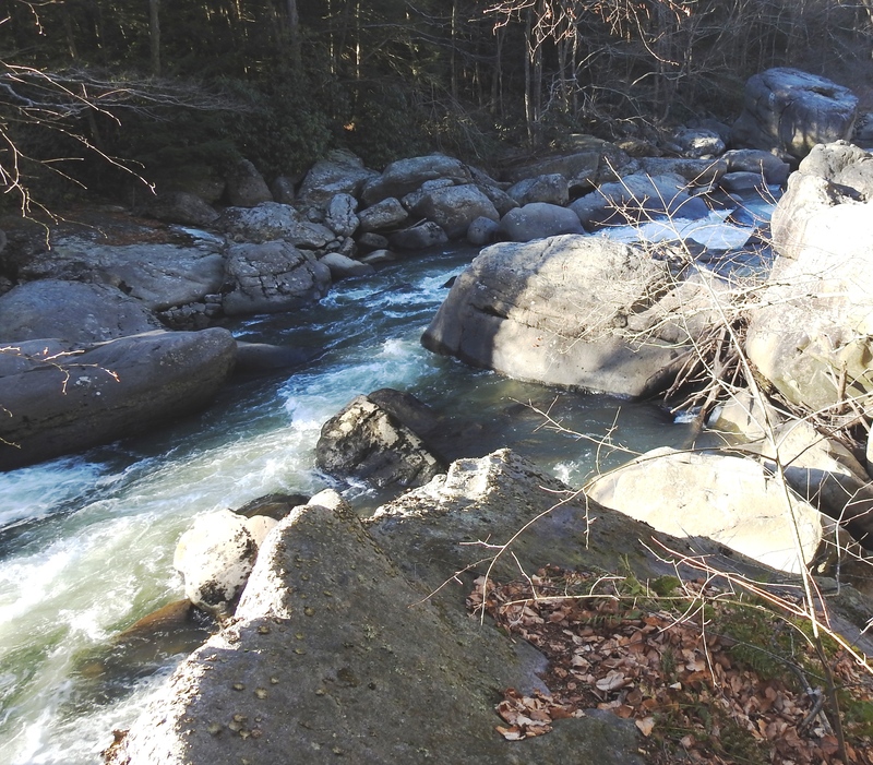
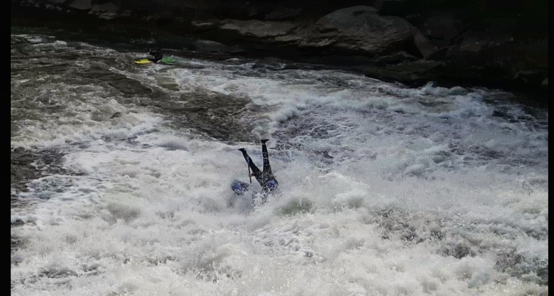
Swallow Falls. This is the first rapid, a long slide into a hole. You don't want to go upside-down here,
...
A variety of routes depending on water levels. The scouting rocks on river right are very slippery.
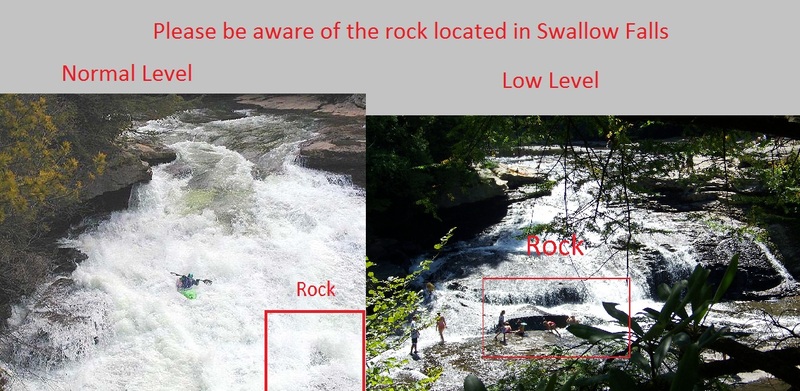
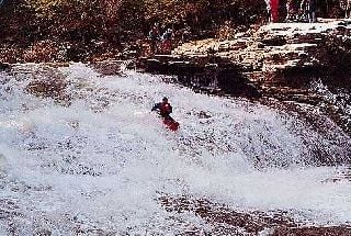
Note: There's a piton rock at the bottom of the slide. In 2012, this was the scene of a back injury. Check out this photo to see the rock at low water.
A big-ol' ledge drop. At higher levels, this can be sticky.
On the river left after Muddy Creek comes in is Best Boof in Maryland. There's a big boulder river left with a horizon line above it which is the boof. A good eddy is formed above it for lining up or giving a first timer beta. Aim for the slight mound, lining up a so you're pointing slightly right of the the boulder. As you get closer you'll see the flake.
Eddy hop down the left. Don't go into the sieve on the right, just below the big rock at the top that hides most of the rapid. This sieve has swallowed numerous boats over the years. It's especially dangerous when it's not jammed full of logs, bottles, tires, woodchucks, and other debris.
Lat/longitude coordinates are an educated SWAG, from Google Satellite Map.
Nov 30, 2017
Suck Hole at about 130 cfs with a few logs stuck in it. November 29, 2017 I was hiking not boating. You could probably scrape down at this level, but lower than most would be willing to run it.
Jan 2, 2017
The Hoyes Run gauge right near the takeout of the Top:
https://waterdata.usgs.gov/md/nwis/uv?site\_no=03076100
May 24, 2013
A duckie that did not quite punch through the curler wave at the top and got shot slightly left. This led him to drop off the ledge that can cause pain for hard boaters. Luckily with a pocket of air beneath him he was fine.
May 16, 2010
Everyone seems to know about the strainer at the left boof below Muddy creek. It is quite visible. There is an insidious little strainer in a calm stretch below suck hole and the rock in the middle rapid but above the last slot move rapid. It looks innocuous but at about 300 CFS it is just the right level to grab a boat. Hope somebody takes it out.
Apr 30, 2010
The directions to the put in are incorrect. It says, 'turn right onto Oakland Sang Run Rd' that will take you to the take out. You want to take a left at (google says to 'continue') Oakland Sang Run, a right at Swallow Falls Rd, and then park on the left after a mile or so.
Below are directions from Friendsville to the put in. Note that Swallow Falls is clearly visible in the satellite map so this definitely the put in.
Apr 6, 2010
So I visited the Top Yough for the first time in 14 years, and I didn't have perfect recall concerning the proper line at Suckhole. I tried the most obvious line, with a vague feeling of some partially-lost memory that there might be some hidden midstream rocks, but thinking that at this higher water level (250 cfs/2.8) than my 2 last times, maybe it would go. Well, I pitoned into some unseen, covered midstream rock(s), ricocheted over to broach on a rock on the right, and had an all-too-interesting recovery, blah, blah, blah, ferrying river left 5 feet above Certain Death, blah, blah, blah, etc. So on my second trip, while I was waiting for my partners who had somehow gotten left behind, and after throwing a rope to a girl who turned out not to need it (nice recovery, Flea), I spied a solo boater who seemed to know the True Line, and who paddled it confidently and with nice momentum, and I, not being an idiot, immediately decided to emulate him, 'cause I know a good thing when I see it! Consequently, I'm here going to describe the ideal line for you, in case you just have to run the hero route despite the presence of a perfectly good sneak route tight to the left. First, a digression: The first mistake that I made on my first run was to start right. This puts one at a bad angle upon entering the constriction at the main ledge. Everything after that is just trying to recover. So, then, the friendliest approach to the hero route starts tight left, drops over the small approach ledge, and then angles rightward across the main ledge drop at the constriction. From here, stay right of the unseen, submerged midstream rocks in the foamy, choppy water, and just left of the intermittently-covered flat rock on the right (where Flea messed up), and then cut a smooth arc back to the left above the ugly pillowed rock just above Suckhole, the left side of which is mildly undercut at this level, so try not to contact it. Your line should describe a backwards C, or a parabola (I think) for you engineering types. It's elegant and uncomplicated, and I hope that this will aid you so we can prevent the pile-up of boats and corpses at Suckhole. Yeah, I always hate it when I have to paddle past a big pile of smelly river-soaked corpses, so let's be safe out there.
Nov 18, 2007
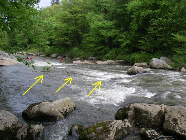
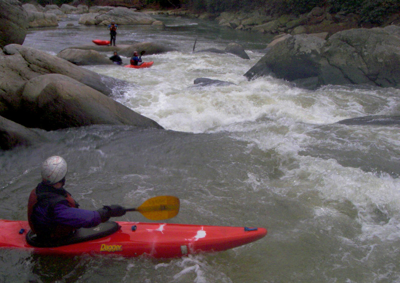
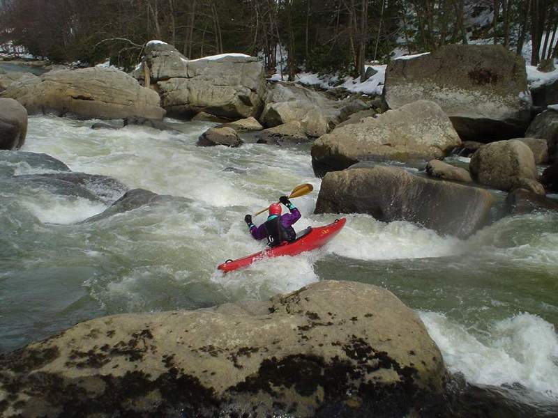
Mike choosing his line for the last half of Suck Hole. One fun line is to go from where Mike is to the swirly eddy in front of the BIG rock on the right edge of this photo. Then, peel out and catch the eddy behind the 'divider rock' (the rock that is a little above center in this photo and is almost covered with water).