Youghiogheny
2. Swallow Falls Rd. (Bridge above Swallow Falls [State Park]) to Hoyes Run.(Top Yough)
Nov 30, 2017
Suck Hole at about 130 cfs with a few logs stuck in it. November 29, 2017 I was hiking not boating. You could probably scrape down at this level, but lower than most would be willing to run it.
Jan 2, 2017
The Hoyes Run gauge right near the takeout of the Top:
https://waterdata.usgs.gov/md/nwis/uv?site\_no=03076100
May 24, 2013
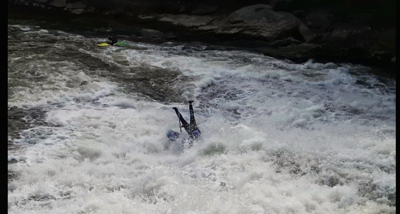
A duckie that did not quite punch through the curler wave at the top and got shot slightly left. This led him to drop off the ledge that can cause pain for hard boaters. Luckily with a pocket of air beneath him he was fine.
May 16, 2010
Everyone seems to know about the strainer at the left boof below Muddy creek. It is quite visible. There is an insidious little strainer in a calm stretch below suck hole and the rock in the middle rapid but above the last slot move rapid. It looks innocuous but at about 300 CFS it is just the right level to grab a boat. Hope somebody takes it out.
Apr 30, 2010
The directions to the put in are incorrect. It says, 'turn right onto Oakland Sang Run Rd' that will take you to the take out. You want to take a left at (google says to 'continue') Oakland Sang Run, a right at Swallow Falls Rd, and then park on the left after a mile or so.
Below are directions from Friendsville to the put in. Note that Swallow Falls is clearly visible in the satellite map so this definitely the put in.
Apr 6, 2010
So I visited the Top Yough for the first time in 14 years, and I didn't have perfect recall concerning the proper line at Suckhole. I tried the most obvious line, with a vague feeling of some partially-lost memory that there might be some hidden midstream rocks, but thinking that at this higher water level (250 cfs/2.8) than my 2 last times, maybe it would go. Well, I pitoned into some unseen, covered midstream rock(s), ricocheted over to broach on a rock on the right, and had an all-too-interesting recovery, blah, blah, blah, ferrying river left 5 feet above Certain Death, blah, blah, blah, etc. So on my second trip, while I was waiting for my partners who had somehow gotten left behind, and after throwing a rope to a girl who turned out not to need it (nice recovery, Flea), I spied a solo boater who seemed to know the True Line, and who paddled it confidently and with nice momentum, and I, not being an idiot, immediately decided to emulate him, 'cause I know a good thing when I see it! Consequently, I'm here going to describe the ideal line for you, in case you just have to run the hero route despite the presence of a perfectly good sneak route tight to the left. First, a digression: The first mistake that I made on my first run was to start right. This puts one at a bad angle upon entering the constriction at the main ledge. Everything after that is just trying to recover. So, then, the friendliest approach to the hero route starts tight left, drops over the small approach ledge, and then angles rightward across the main ledge drop at the constriction. From here, stay right of the unseen, submerged midstream rocks in the foamy, choppy water, and just left of the intermittently-covered flat rock on the right (where Flea messed up), and then cut a smooth arc back to the left above the ugly pillowed rock just above Suckhole, the left side of which is mildly undercut at this level, so try not to contact it. Your line should describe a backwards C, or a parabola (I think) for you engineering types. It's elegant and uncomplicated, and I hope that this will aid you so we can prevent the pile-up of boats and corpses at Suckhole. Yeah, I always hate it when I have to paddle past a big pile of smelly river-soaked corpses, so let's be safe out there.
Jul 8, 2009
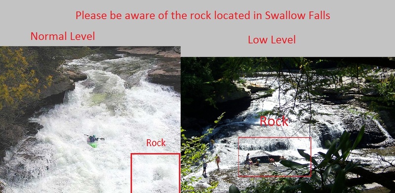
On 7-1-09 our party had a boat stuck at the rock at Suck Hole. True to its name it sucked in the boat and it was jammed. It took us three hrs to remove it. Many thanks to the Harrington Manor for their assistance,Chris, Jeremy, and Tim you guys are awesome
Nov 18, 2007
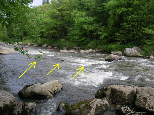
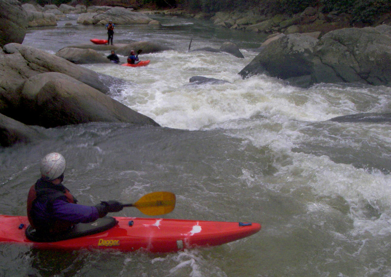
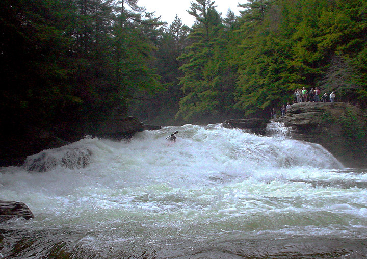
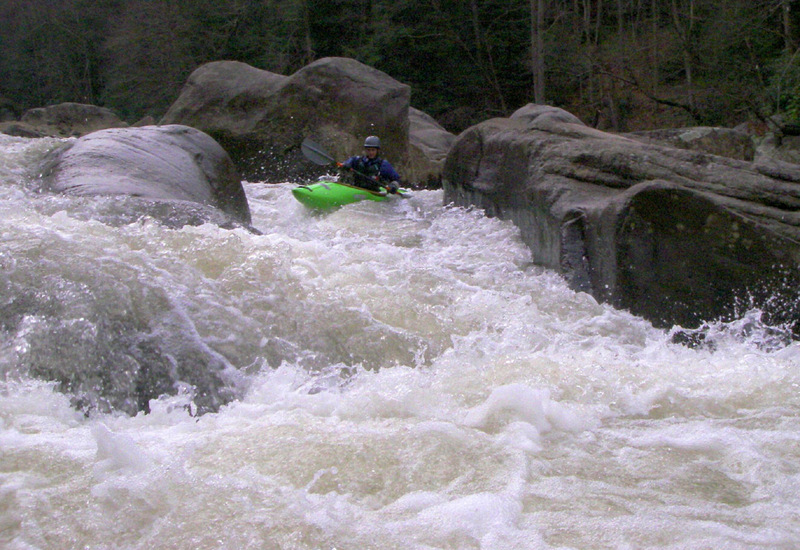
Mike choosing his line for the last half of Suck Hole. One fun line is to go from where Mike is to the swirly eddy in front of the BIG rock on the right edge of this photo. Then, peel out and catch the eddy behind the 'divider rock' (the rock that is a little above center in this photo and is almost covered with water).
Oct 7, 2006
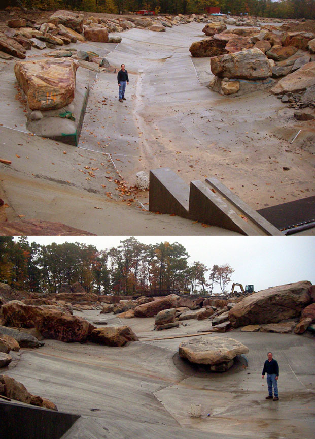
This is a view of Adventure Sports Center's man made white water course that is under construction in McHenry, MD. Top image is looking 'downstream'.
May 25, 2005
go by cfs New
Forum: BoaterTalk
Re: Top Yough know it alls please read: bankfull1 New
Date: May 25 2005, 15:15 GMT
From: rloughne
180 is minimum
450 is medium
600 is juicy
1000 is one heck of a ride
its at 450 right now, should hold in the mid 200's for the weekend, which means lots of sweet boofs
May 23, 2005
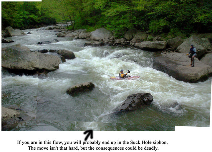
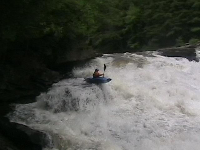
This is a view looking upstream at the approach to Suck Hole. Ken Gfroerer is in the boat and Keith Pasquariello is on river left shore. Camera position is right above the Suck Hole siphon. When the siphon is open, an amazing quantity of water flows through it. There have been a few close calls here. BE CAREFUL!
Apr 30, 2005
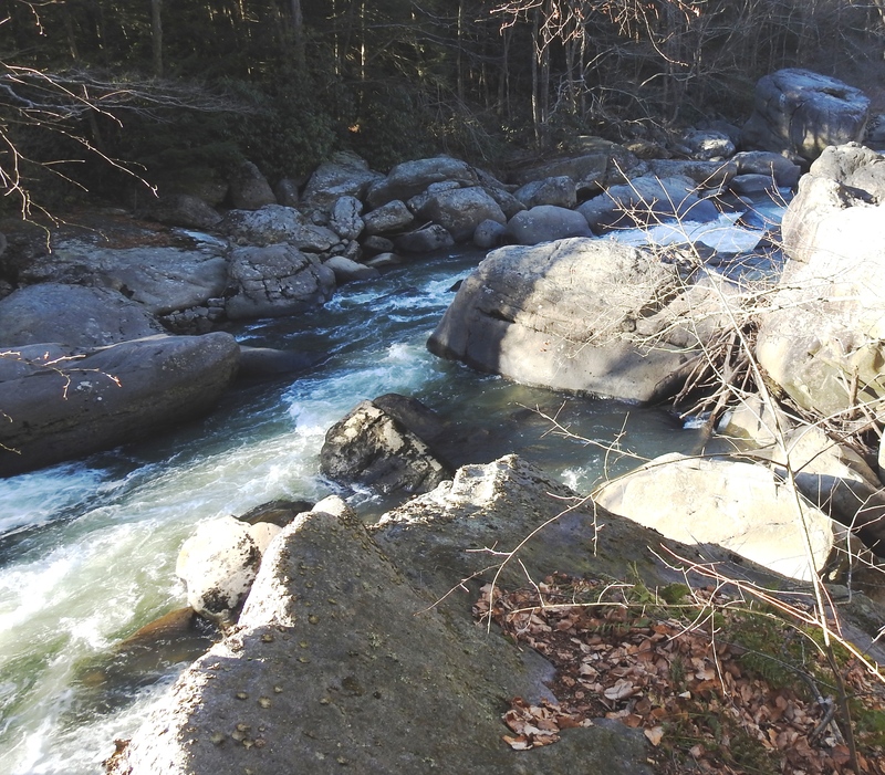
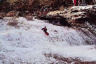
A beautiful day and a beautiful run. On days like this spectators are common at Swallow Falls. Many of these spectators followed us to the confluence of Muddy Creek.
Feb 13, 2005
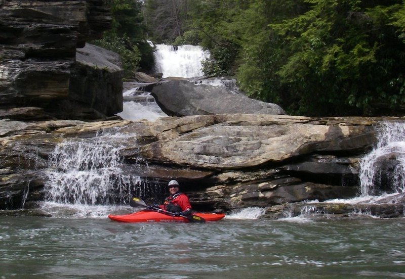
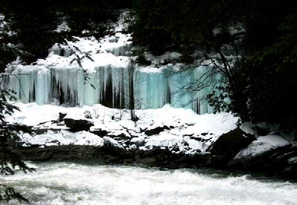
The ice by the falls was stained blue presumably due to limestone in the rock strata. Stunning.
Jun 29, 2002
The hard rapids actually start well upstream of the suggested putin. If you have an exploratory mindset, check out this section too.
Jul 7, 2001
(3.7 ft at Oakland, that is.)
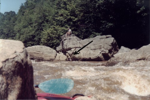
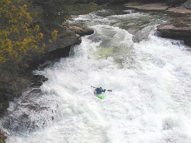
The arrow points to the notorious sieve which poses a real pinning hazard. There have been lots of close calls this year. That eddy looks nice, and it's okay as long as you stay high in the eddy...but I steer clear of it and just run the rapid. Call me a wuss.
Jul 6, 2001
(Level at Oakland.)
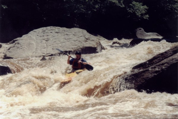
(Level at Oakland.) Yes, he rolled up.
(Level at Oakland.) The hole looks fierce at this level, but it's actually pretty tolerant of some impure lines.
Jun 9, 2001
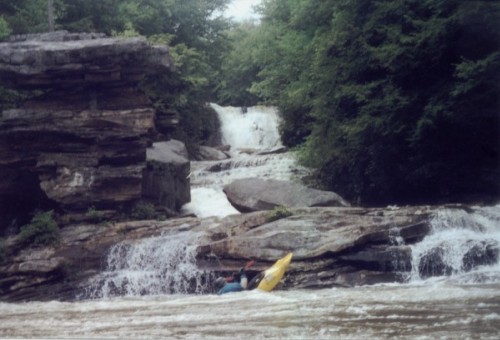
Noooo...Muddy Creek Falls is not runnable.
Well, the last couple of slides are runnable, but the big stuff ain't.
(Level at Oakland.) This puppy has the potential to recirc those who mess up the line.