Potomac
7. Little Falls
| Difficulty | III+(IV) |
| Length | 2.4 mi |
| Avg Gradient | 15 fpm |
| Gauge | Potomac River Near Wash, Dc Little Falls Pump Sta |
| Flow Rate as of 43 minutes | 2.96 ftmedium runnable |
| Reach Info Last Updated | January 4, 2024 |
SUMMARY:
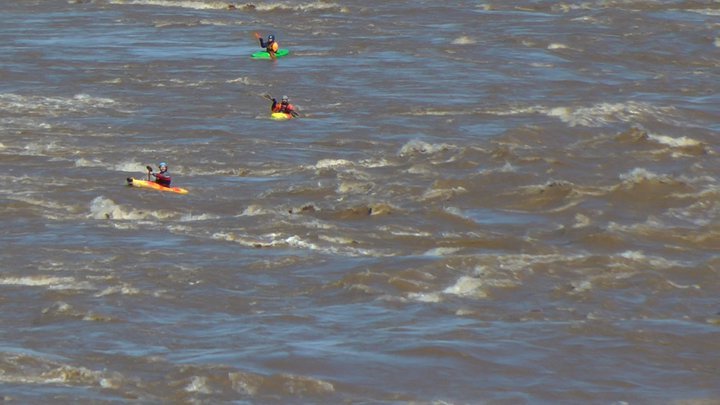
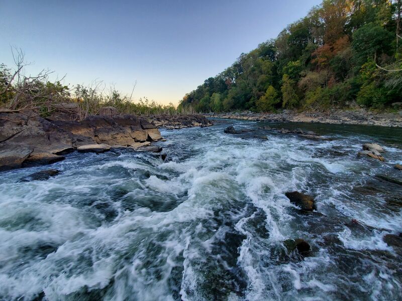
This is a popular intermediate run in the D.C. area due to the amazing fact the final rapid, Little Falls itself, can offer Class IV punch right where the tidal Potomac begins at the Maryland and D.C. line. Like some other stretches of the Potomac, the C & O Canal, when watered, can be used to complete a loop without setting shuttle. This description focuses on the runs characteristics when Little Falls is between 2.7 to 3.5 feet. Little Falls can be run by advanced and expert paddlers at higher levels.
THE RUN
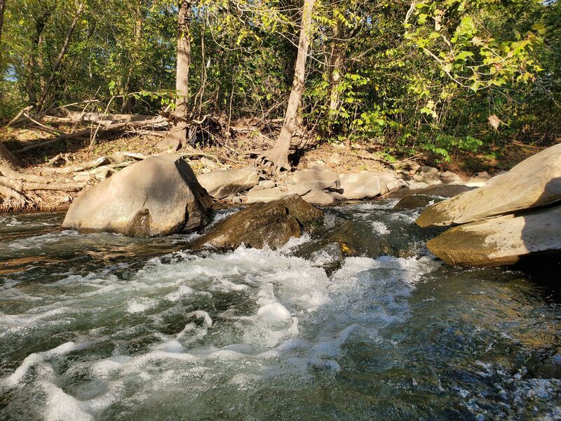
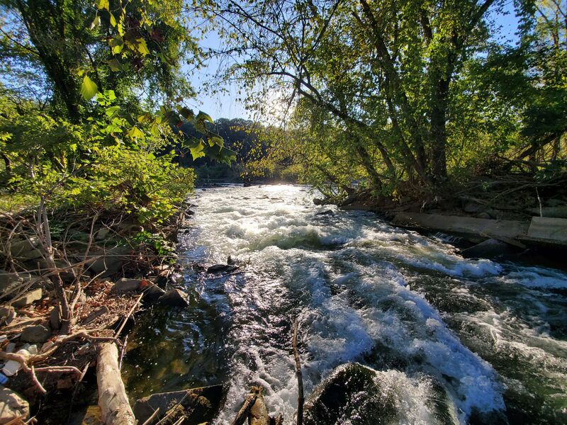
The Little Falls run begins in a canal feeder channel reachable from either Lock 6 or Lock 5 of the C&O Canal. See directions below. Enter the main flow of the river by: a) Using the Z-Channel - an connector between the feeder channel and Potomac River between the two locks. This channel is class II with a Class III finale that has pinning potential (The final drop also catches a lot of strainers, so scout from an upstream eddy first). b) Paddling upstream on the feeder channel and into the main river. Run the channel in the left-center break in a rubble dam. Rocky with pinning potential - call is Class III.
Once on the main river, work to the far river right to begin the run through the constricted channel of Class II-III water. At lower levels, some good surfing hydraulics form in the upper part. These turn to fast, standing waves at medium levels. At most all levels the top wave is best caught on the way down, though second waves are sometimes smooth as well. Halfway down the main channel, you can portage at a small beach on the left ot run the Beaver Slide - a Class III creeky drop (zig-zag move). The last drop before the Little Falls rapid can be run straight but entering a diagonal chute from a large river right eddy is more interesting.
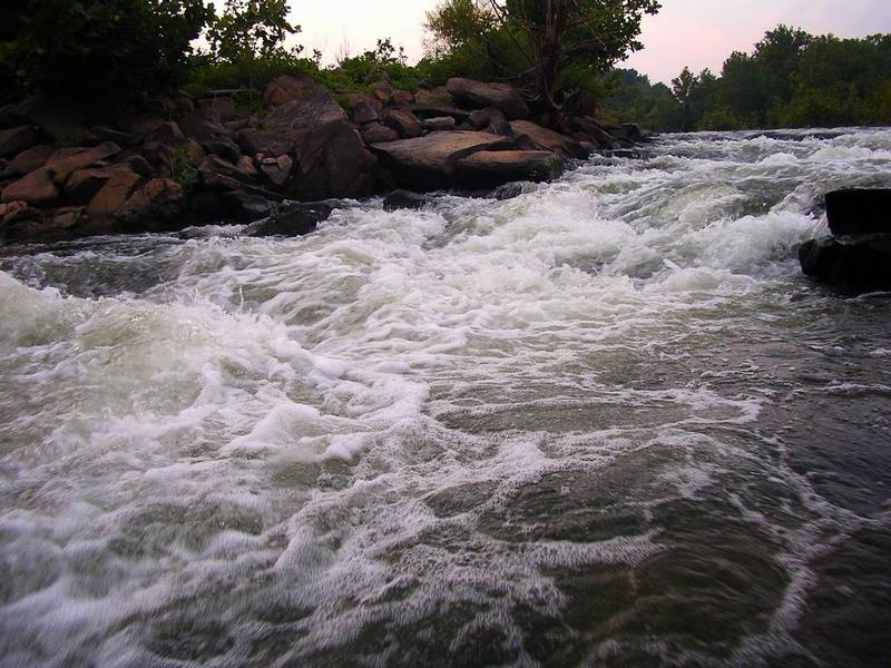
LITTLE FALLS
Little Falls is next and can be scouted by pulling up on river left (or right, but this side involv
...From the Lock 6 parking area, walk around the lockhouse and the bridge across the canal, walk a short distance down the C&O Canal and take a well worn trail to a side channel of the river called the feeder canal. There are slalom gates set up in the feeder canal just upstream of this put-in to practice and perfect your moves.
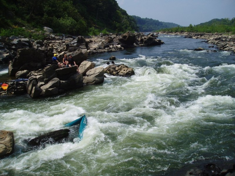
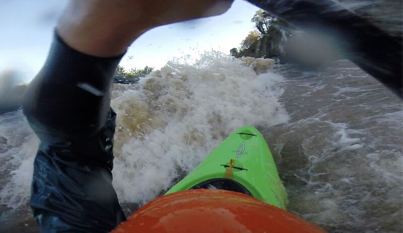
Z-Channel starts off as an easy eddy-hop. The final drop however is a constricted channel with a large pinning rock dead center, which can clearly be seen in the photo taken at 2.7 feet on the LF gauge. At water levels below 3.2 feet, this rock will push kayaks sideways and underneath the rock on the river left bank if you miss the boof stroke. At low levels, an alternative line can be run by cutting hard right immediately before the drop, and snaking around the rock while hugging the right riverbank. This channel is extremely shallow, even at ideal flow ranges and even with an excellent tuck. Watch for strainers here as well as broken pieces of concrete towards the center of the entrance.
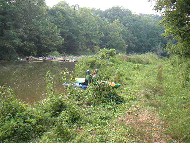
You can seal launch from anywhere along the bank and either run Charlie's, or paddle up the feeder canal to the Z-Channel.
A broken area of the dam right next to the Lock 5 put-in that can be entered either by boofing a low head dam like hydraulic in the center, or a narrow ledge drop on the far right. This ends in a long slide that leads from the put-in to calm water near the top of the Beaver Slide. This entire channel is filled with rebar, sharp rocks, and countless other boat maiming obstacles. This channel is almost never run due to the many manmade hazards and sharp/pinning rocks that are in play at lower water levels, but can offer fun lines at higher levels after careful scouting. Watch out for the low head dam like hydraulic at higher levels, getting stuck or swimming above the slide is a great way to end up in the hospital.
Run the rubble dam center left through a twisty, rocky channel. Make sure you watch for a log, right in the center about halfway down the chute that creates a nasty strainer, and a large rooster tail at the very end of the channel, also dead center.
Great surfwaves in the upper portion of the run are easiest to catch as the river level drops. 2.7-2.9 ft. are premium and are distinctly divided into an upper and lower set of waves with some riffles in between. These start to completely wash out above 3.5 feet. At lower levels, there are some interesting breaking waves in the first set of waves about halfway through and left center.
This is a fun little slide that drops a good 12-15 feet from the river left side channel into the main flow. This channel consists of an entrance that drops into a small hole, with a larger hole on river left hugging the bank just past the first one. At levels between 2.5-3.0 feet, you will then have to cut hard to the left after the second hole to avoid two rocky shelves, or take some hard paddle strokes and stay center/right if you wanna make things interesting or are paddling a boat you don't own yourself. At 3 feet and above, its just a straight shot into the main current immediately above the Little Falls rapid. The Beaver Slide can be accessed either by going left immediately after the Z Channel at higher water levels, or taking out on a beach right below the second set of Midway Waves on the left. From there, it literally 20-30 steps up to the channel that feeds into the Beaver Slide
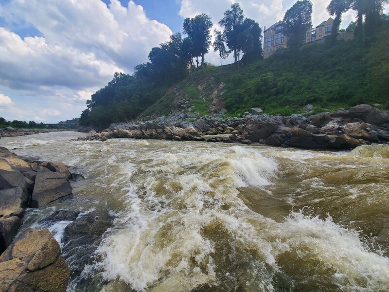
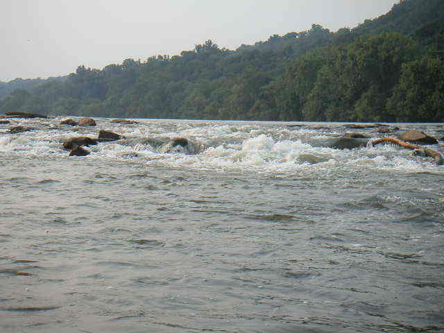
The Maryland side of Little Falls is the left chute when you reach the island dividing the channel in two. This line consists of weaving in between or running two decent holes into a somewhat unpredictable runout. The first hole is just off the river left bank, right when you first enter the rapid, and can be missed by either hugging the shore on the left or by going around the right and then cutting back towards the left before the center island. When the river is above 3 feet, the first hole morphs into a breaking wave that is affectionately referred to as the 'Welcome Wave' by local kayakers. When the Potomac is above 3 feet, this feature will quickly remind you why knowing the difference between high and low tide at Little Falls is important. At high tide, this will be a steep, but respectable little drop that will bounce a kayak up and down, resulting in smiles all around. At low tide, this will be a sheer drop into a breaking wave hole that will have a good 3-4 feet on the tallest of paddlers. At higher water levels, the right line around the hole will try to push you straight into the island that divides the channel so make sure you keep a left angle and keep paddling till you are past this hazard.
The second hole is halfway down the MD side and parallel to the center dividing island. It has a tongue that runs from the center left to the right side of the hole that will let any paddler with a good angle right through without even getting their bow wet. It also is great fun to just plow straight through! At lower levels, watch for a rock dead center in the second hole that will give you a good jolt. Depending on the water levels and tides, the runout after the hole may be completely flat, or may have some chaotic and irregular waves that push towards a gnarly looking wave hole parallel to the end of the center island on river left.
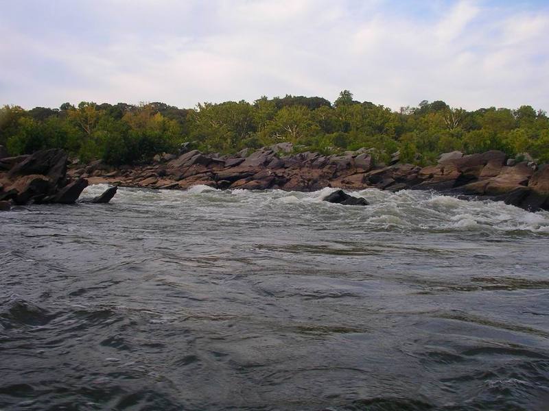
All these features are well spaced out and easy to avoid, but great fun to hit! This side is an easy class II-III at most levels until the water level goes above 3.5 feet, where a large wave train begins to develop.
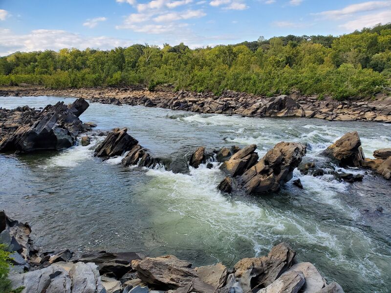
At some lower water levels, you can sneak by the biggest parts of the rapid by taking this chute which is immediately before the rapid begins on river right. The chute consists of a short slide into a deceptively powerful and deep hole, scout before running! Taking this chute will allow you to enter the VA side of Little Falls about halfway down and past the strongest parts of the current and Darkside hole, but you will still have to re-enter a very strong current and may get pushed into the Swirling Eddy Of Doom depending on the water level and tide.

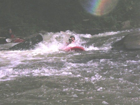
An extremely fun and adrenaline pumping line that consists of going to the right of the center island that divides the river. Here you will find an extremely fast moving current that drops into a large and irregular hole to the immediate right of the island known as the Darkside Hole. The center of the VA channel is more of a slide over two shelves with a frighteningly powerful current whipping into the side of your boat at a 45 degree angle from upstream, and a large staging eddy on the far right.
Below these features, the two main currents from the VA side converge again into a single current which creates all sorts of chaotic eddy lines, mystery boils, and reactionary waves which will flip you before you even realize you are going over. Swimming here or getting pushed off line at higher water levels will likely end in the Swirling Eddy Of Doom which can be very hard to boat out of and downright terrifying to swim into. The narrow channel also can lead to flipped boaters briefly pinning against the rocks on river right which often results in swims. Be extremely careful on the eddy lines here at higher water levels, and get ready to deal with some powerful pushy water.
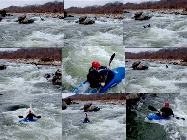
There are numerous ways to successfully run the VA side. You can take the conservative sneak route mentioned above depending on the water level, enter to the far right and cut past a little pour-over hole into the large eddy, go straight down the center and work on edge control, do the hairy/scary ferry from the MD side over to the VA side above the center island, or take the hero route to the immediate right of the island and down the slide into the Darkside Hole. At certain water levels, you can even start on the VA side and then cut back to the MD side in between a divide in the rocks of the center island about halfway down the rapid. It's a ton of fun and one of the best intermediate rapids in the area! Still an awesome rush after countless runs!
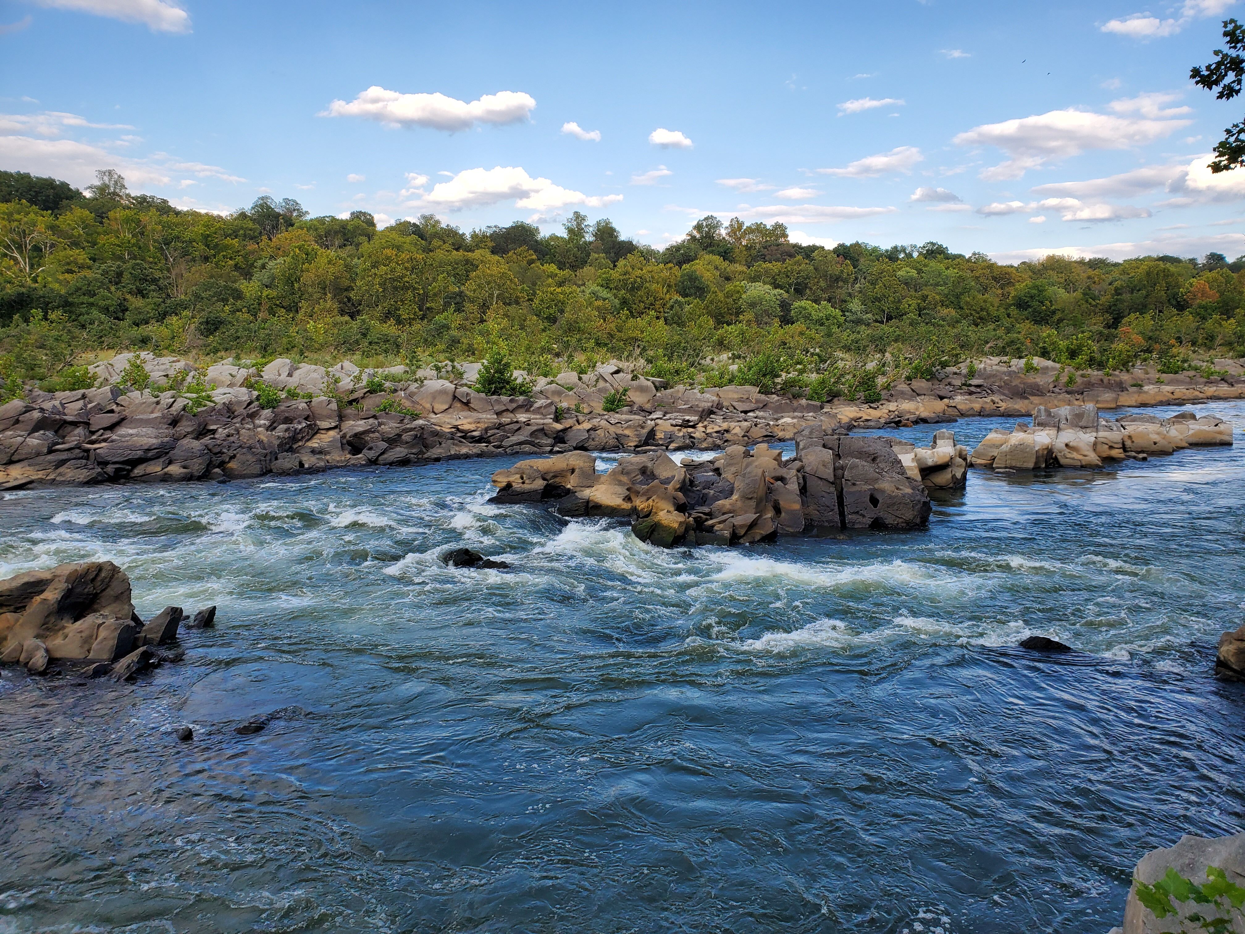
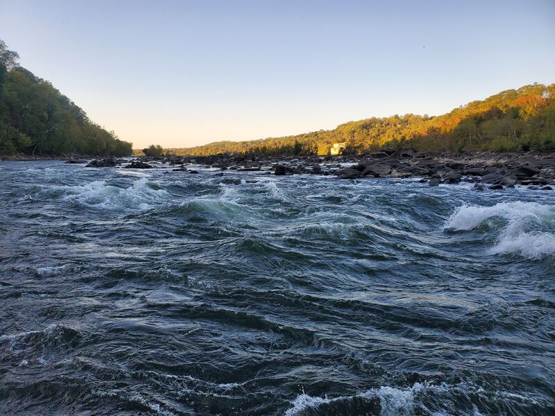
Little Falls completely changes as a rapid as the water level rises, and takes on an aggressive and chaotic character not found at lower levels. From lower water levels to around the 4 foot mark, the changes are mostly limited to the waves and currents getting more powerful and irregular, and hydraulics and eddy lines becoming larger and stronger. At these levels though, the Little Falls rapid itself is still divided in half by the rock island forming the MD and VA sides respectively. Once the river goes above 4.5 feet, this is no longer the case.
At 5ft, the center island starts going underwater, and a long wave train develops. Parallel to the observation deck, a 2nd wave train develops at low tide with some irregular waves and holes. These continue down to Chain Bridge at low tide, but don't appear at high tide.
From 5ft to about 6.5ft, the wave train gets a little larger and the waves start to crash more. It really has the feeling of a rapid on the Gauley, though the waves are more irregular and chaotic. The lines are still fairly wide, and the river right contains eddies you can use to bypass most of the chaos, but it is still very much a Class IV rapid.
Above 6.5ft the wave train starts to wash out and over 7-7.5ft, two new dangers come into play. The first is that the river is flowing over the observation deck, creating a pretty nasty hole that doesn't go away until the river is over 9ft. The second is the water starts piling high on Chain Bridge, and some nasty eddy lines and whirlpools form. Also, at these levels, Z-Channel changes directions, forcing you to attain up it, rather than paddle down it. Experience boaters can probably find a line over the break in the canal by Lock 5 (Charlie's Little Shop Of Horrors)
Once you are in the 9+ft range, the wave train and hole are mostly gone, but some really powerful eddy lines, whirlpools, and exploding waves take their place. You will be running the main rapid next to entire trees, and there isn't a predictable line. Also, you'll have to paddle into the river right from Lock 5, as Z-Channel and the Feeder Canal are flowing downstream much too quickly to attain. It's a really fun experience for an accomplished boater, but, not something that should be attempted by anyone without solid skills.
The first take-out is at the observation deck, which involves a steep carry up rocks to the deck and then a fairly long carry back to the C&O Canal. But assuming the canal is watered, you can then paddle up the canal back to Lock 5, or with a fairly short additional carry, put back into the feeder canal to paddle back up to Lock 6.
Fletcher's Boathouse is on river left (MD side) about 2/3 miles below Little Falls. If you prefer a vehicle shuttle (rather then the carry and paddle from the observation deck back to Locks 5 or 6), Fletcher's has parking close to the river in the lower parking lot, but there are some height limitations (7' at center - less at sides) to get under the canal. There is also an upper parking lot without those restrictions or when the lower lot is full.
May 21, 2018
This week of heavy rain has rendered the slalom course unusable. Some of the gates are low hanging and in contact with the water, so if you are running this section, watch out for those barriers so you don't become entangled.
Apr 21, 2015
To go further with what Blas said, Little Falls changes pretty dramatically as a rapid once the river goes over 4.5-5ft. At 5ft, the center island starts going underwater, and a long wave train develops. Parallel to the observation deck, a 2nd wave train develops at low tide with some irregular waves and holes. These continue down to Chain Bridge at low tide, but don't appear at high tide.
From 5ft to about 6.5ft, the wave train gets a little larger and the waves start to crash more. It really has the feeling of a rapid on the Gauley, though, the waves are more irregular and chaotic. The lines are still fairly wide, and the river right contains eddies you can use to bypass most of the chaos, but it is still very much a Class IV rapid.
Above 6.5ft the wave train starts to wash out and over 7-7.5ft, two new dangers come into play. The first is that the river is flowing over the observation deck, creating a pretty nasty hole that doesn't go away until the river is over 9ft. The second is the water starts piling high on Chain Bridge, and some nasty eddylines and whirlpools form. Also, at these levels, Z-Channel changes directions, forcing you to attain up it, rather than paddle down it. Experience boaters can probably find a line over the break in the canal by Lock 5
Once you are in the 9+ft range, the wave train and hole are mostly gone, but some really powerful eddylines, whirlpools, and exploding waves take their place. You will be running the main rapid next to entire trees, and there isn't a predictable line. Also, you'll have to paddle into the river right from Lock 5, as Z-Channel and the Feeder Canal are flowing downstream much too quickly to attain. It's a really fun experience for an accomplished boater, but, not something that should be attempted by anyone without solid skills.