Belt Creek
2. Monarch to Riceville
Jun 13, 2026
Ran with a group including 2 kayaks and 2 pack-rafts. Fun flow for small crafts! Upper section out of Monarch had quite a bit of wood in the river so keep your eyes peeled!
May 26, 2025
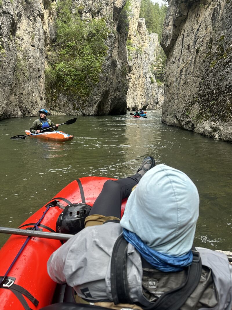
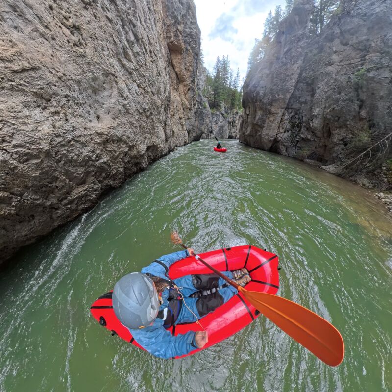
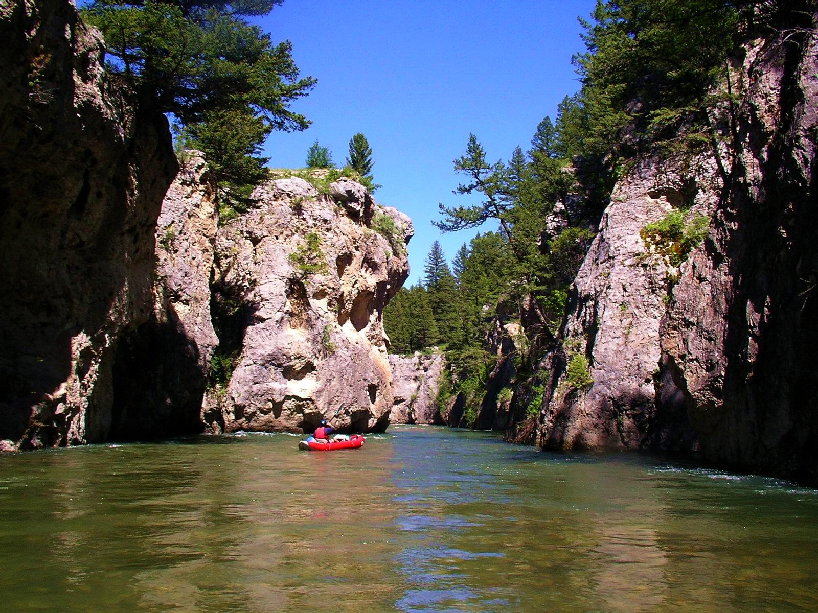
Flow 730. Packrafts. Water through the gorge was fast! Scouting can be a little difficult, but at this level we only needed to get out and scout two rapids, both of which has easily avoidable holes.
If the flow is any higher, it would be quite fast, hard to get out/scout, and definitely tough for most packrafters.
We were unsure of any logjams upstream (though it is now confirmed clear), so we hiked up from the bottom of the gorge along a great trail and put in just above the gorge - we did not float from Monarch.
Overall, one of the prettiest slices of river in Montana - the gorge is quite unique!
Jun 22, 2023
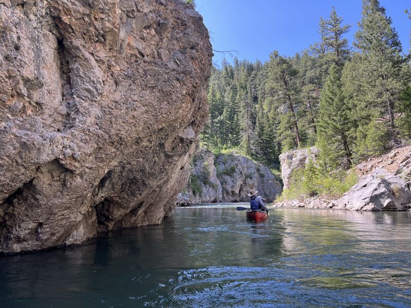
Chris Ennis and I paddled from Monarch down with our kids on a nice sunny June day. Flows were low but pretty ideal for the kids, and still fun in a canoe and packrafts, with minimal scraping. There were a couple log jams in the first few braided miles that were a bit sketchy but we navigated past them without issue. The trip took us just shy of 4 hours with a short lunch stop and some pretty active paddling. The kids had a great trip, though putting in at Logging Creek probably would have made for a more ideal length for them.
Aug 31, 2010
looks like MT FWP removed the logjam in the canyon on Aug 6 2010. Was up there last weekend in August and took a short hike up. At home saw these posts and then investigated further. See full article here: http://www.kxlh.com/news/logjam-removed-belt-creek-open-again/
May 19, 2010
Sluice box
Jun 18, 2008
Gauge information. There was a USGS gauge at Monarch from 1951 to 1982. Historical data from that gauge is available at:
http://nwis.waterdata.usgs.gov/mt/nwis/inventory/?site\_no=06090500&
Other historical USGS gauges on Belt Creek can be found at:
http://nwis.waterdata.usgs.gov/mt/nwis/inventory?search\_station\_nm=belt+creek&search\_station\_nm\_match\_type=beginning&format=station\_list&sort\_key=site\_no&group\_key=NONE&sitefile\_output\_format=html\_table&column\_name=agency\_cd&column\_name=site\_no&column\_name=station\_nm&list\_of\_search\_criteria=search\_station\_nm
The topo map shows a gauge site just upstream of Rice. USGS does not list this gauge so it may be maintained by another agency. It may or may not be currently functional.
Jun 2, 2008
If you are looking to put on with a raft, logging creek bridge is a good put on. From Monarch to logging creek is much less raft friendly and there are barb wire fences. From logging creek down there are not any fences and the water is deeper. There are a couple cabins on one side of the creek at logging creek, put on on the opposite side of the cabins. There is a small turn out on that side and just up river from it is a nice grassy place to walk your boats down.
May 27, 2008
Monarch to the sluice box takeout: No info on gauges, but if theres around 4-6
inches at the monarch put-in, its do able. Itll take around 5-8hrs depending on flow and stops. Its absolutely beautiful, a mini-smith river. A few class 3's above canyon (which starts about the last 3rd of the float) you should watch out for, especially at the entrance but pretty much stay center. The canyon is awesome, swift pushy water could lead to a bunch of wall collisions, but at lower water not a danger. I would caution to do it higher flows bc of the hydraulics, yet we did talk to someone today who did it and they went through it fine. Make sure to stop and throw a line in of theres a hatch. Also fairly close to monarch theres a barb-wire fence, and depending on flows you might have to portage but its not blind. I also recomend doing the neihart section, we did it today at real high flows in ik's and its definitly a ride.
May 23, 2008
Anyone got any info on this one? I am looking to run Belt creek through the Sluiceboxes and I cannot find much info. Even stage/Gauge info would be helpful, i.e. when it is too high, too low etc. Thanks in advance.
Jun 25, 2005
A table useful in getting a current ESTIMATE of Belt Creek flow conditions, based on real-time Smith River flows.
Jun 18, 2005
into the heart of the sluice boxes
Jan 1, 1900
first section Monarch to Logging creek.
Jan 1, 1900
Second section past Logging creek. Nice little break for snack and a surf.
Jan 1, 1900
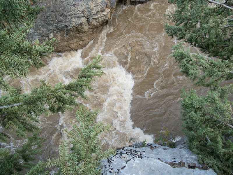
My favorite section of Belt creek. Even at low flow the sluice boxes can be swirly!
Jan 1, 1900
Rafts beware! You may have to portage. First 2 miles from Monarch put in. We came across fallen tree.