Wild and Scenic Designation
Two segments of the Crooked River are designated as Wild and Scenic in 1988. The eight mile segment from Bowman Dam to Highway 27 mile marker 12 is known as the Chimney Rock Segment. The second designated segment is the nine mile reach from the Crooked River National Grasslands boundary to river mile 8. Both were designated into the Wild and Scenic Rivers System in 1988 and protected for outstandingly remarkable scenic, recreational, geologic, hydrologic, wildlife and botanical values, and significant fishery and cultural values.
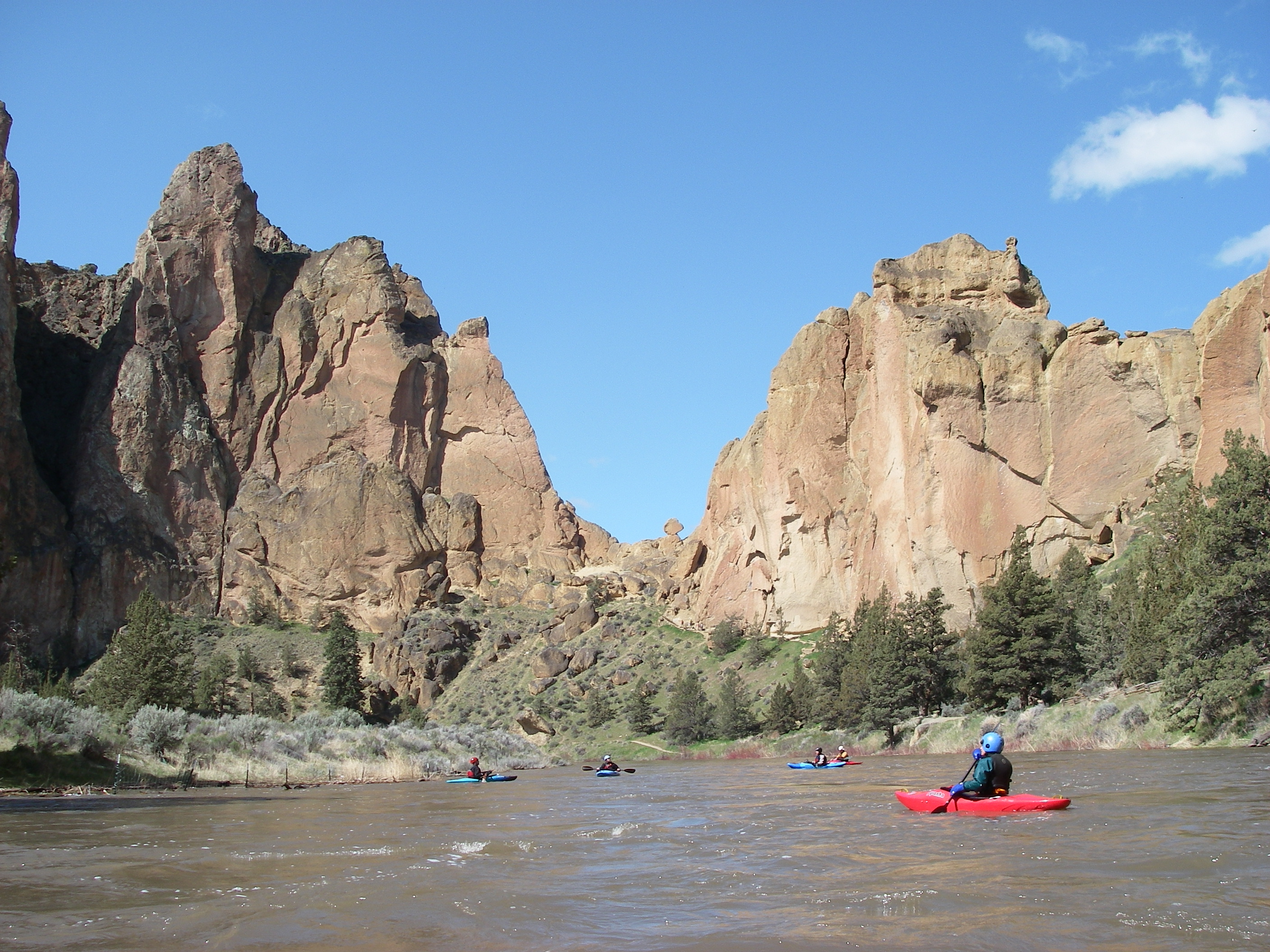
Public Access
 While the Chimney Rock segment is easily accessible off Highway 27, the downstream segment had no public access for many years. The river flows through a steep canyon, and the few places where the river is easily accessible were all on private property. One of these access points was the old Hollywood Road at the Crooked River Ranch. Before the housing bubble burst, the property was slated for development, threatening access at this critical access point for whitewater boaters and the general public. Fortunately, in 2011 the Trust for Public Land acquired 110 acres along the Crooked Wild and Scenic River corridor.
The Forest Service ultimately acquired funding from the Land and Water Conservation Fund to acquire the property from Trust for Public land and bring it in to public ownership. The LWCF is funded each year by revenues generated by offshore oil and gas leases, and has supported recreation access projects such as the BZ Corners put-in on the White Salmon, key parcels on the Green River in Washington, the New and Gauley in West Virginia, the Middle Fork Salmon in Idaho, and the Illinois River in Oregon. The LWCF supports much more, funding projects that conserve our natural resources, benefit local, state and national parks, water quality and protect communities from natural hazards.
Hydropower Development at Bowman Dam
For many years, hydropower developers have considered installing hydropower facilities on Bowman Dam at Prineville Reservoir. American Whitewater supports installation of hydropower on existing federal facilities that otherwise provide beneficial services for flood control or water storage. In this case, the Federal Energy Regulatory Commission (FERC) determined they did not have the authority to license hydropower at Bowman Dam because the Wild and Scenic river boundary extended to the face of Bowman Dam, and Section 7 of the Wild and Scenic Rivers Act prevented FERC from licensing a facility on a designated Wild and Scenic river. In order for the project to move forward, Congress had to modify the boundary of the Wild and Scenic river to a point ¼ mile downstream of the dam.
In 2012, legislation was introduced to amend the Wild and Scenic Rivers Act to adjust the boundary for the Wild and Scenic Crooked River to a point ¼ mile downstream of the dam. While American Whitewater supported this provision, the legislation also included language authorizing the storage and release of water from Prineville Reservoir “for the benefit of downstream fish and wildlife.” American Whitewater fully supported these provisions, but we expressed concerns that the legislation did not explicitly recognize the added benefit to whitewater recreation of releases (i.e. spring spill) from the dam and provided testimony to the Senate Energy and Natural Resources Committee to document this issue and the opportunity to recognize recreation. Ultimately our interests were not addressed in the Crooked River Collaborative Water Security and Jobs Act that was signed into law as Public Law 113-224. We will continue to highlight the benefits of these spring high water events, which serve as ecological process flows and provide a regionally significant opportunity for whitewater recreation.
Fish Passage and Public Access at Opal Springs Dam
 With recent addition of fish passage at the dams on the Deschutes River, fish advocates supported modifications to the Opal Springs Dam. The dam is operated by the Deschutes Valley Water District and is located 7 miles upstream from Lake Billy Chinook. This small hydropower facility is currently a barrier to fish passage on the Crooked River and is a hazardous structure to navigation that requires a portage. American Whitewater advocated for safe portage facilities at the structure. We reminded parties that the federal license that allows the District to operate the hydropower project states in part that, “the Licensee shall allow the public free access, to a reasonable extent, to project waters and adjacent project lands owned by the Licensee for the purpose of full public utilization of such lands and waters for navigation and for outdoor recreational purposes.”