Cispus
4 - Road 28 Bridge to Scanewa Reservoir (The Lower)
| Difficulty | III |
| Length | 15.6 mi |
| Avg Gradient | 24 fpm |
| Gauge | Cispus River Ab Yellowjacket Creek Near Randle, Wa |
| Flow Rate as of 1 hour | 401 cfsII-IIIlow runnable |
| Reach Info Last Updated | June 9, 2026 |
Washington’s legendary volcanoes – Mount Rainier, Mount St. Helens, and Mount Adams – are the source of wild, free-flowing rivers and streams that cascade over big drops and through deep basalt canyons on their way to the Columbia River. Rivers like the Clear Fork of the Cowlitz, Cispus, Green, [...]Read More
In 1986 FERC issued a license to Lewis County PUD to construct a new hydropower project at the site of Cowlitz Falls at the confluence where the Cispus River joins the Cowlitz River. The Cispus has a history of recreational use dating back to at least the early 1950’s [...]Read More
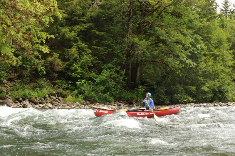
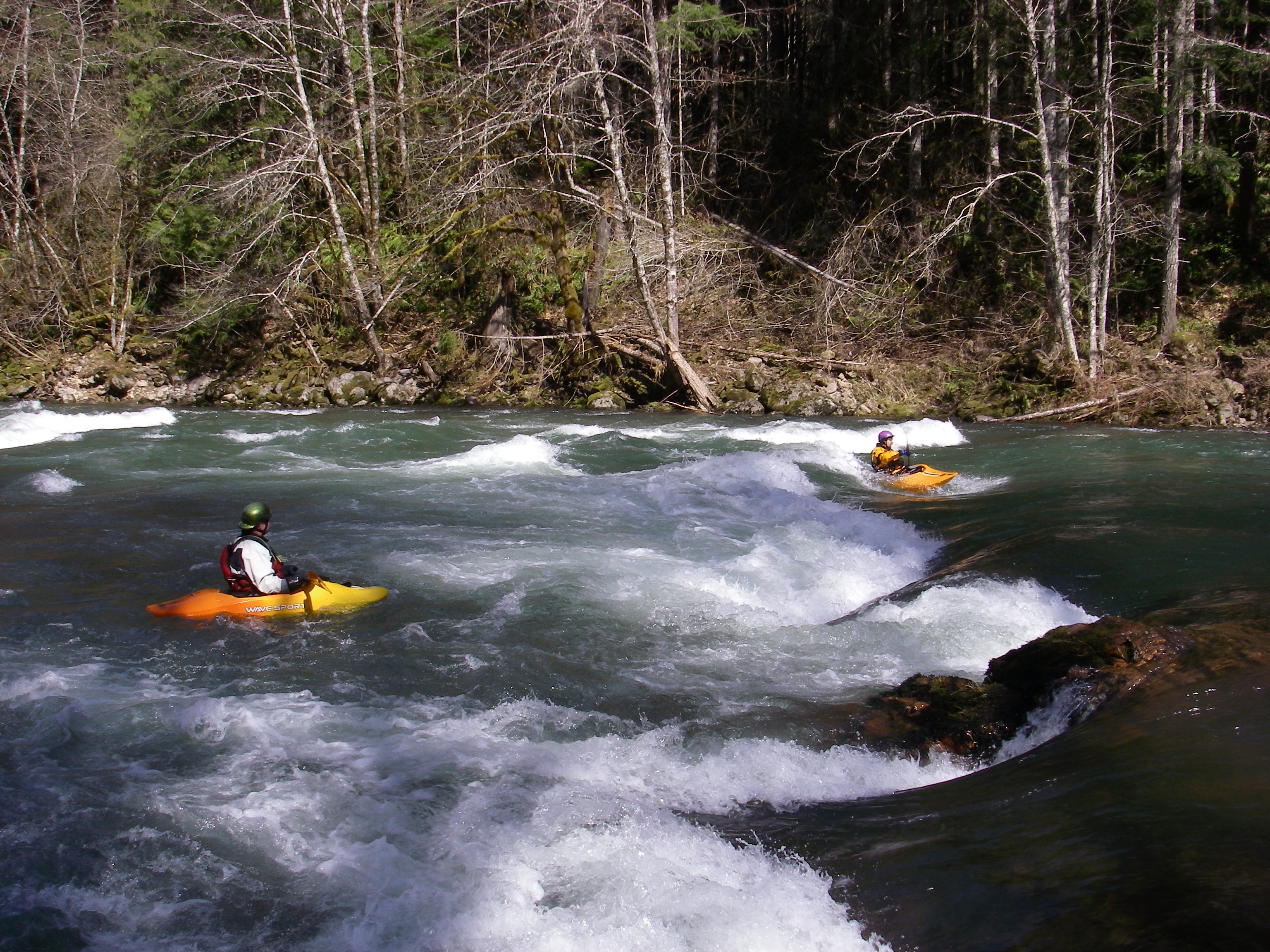
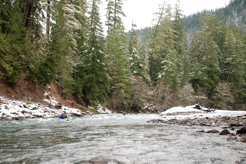
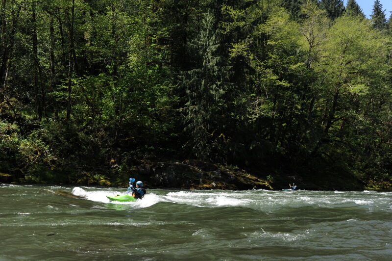
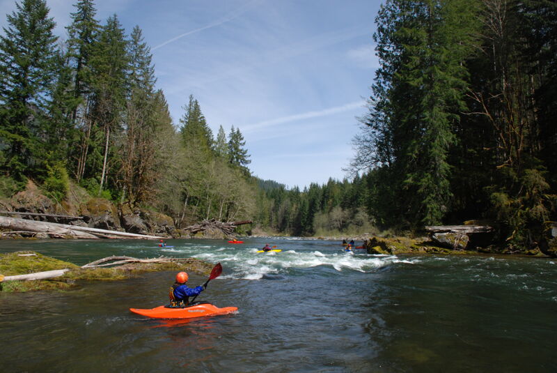
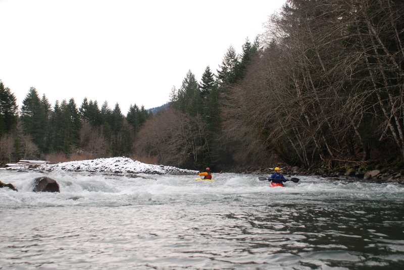
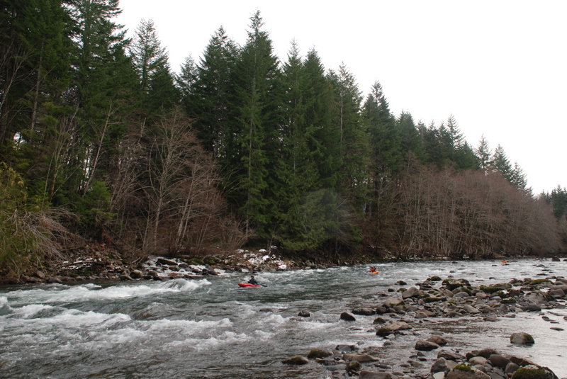
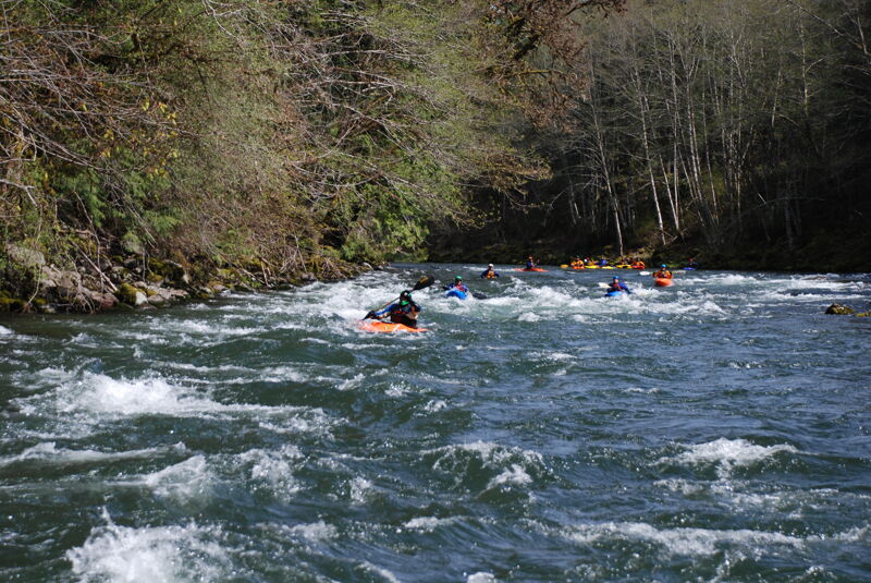
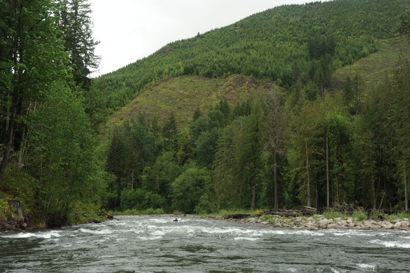
With nearly 30 miles of continuous intermediate whitewater, the Cispus provides opportunities for one of the longest whitewater trips in the state. By combining this section with the Upper Cispus you'll find opportunities for overnight excursions through the Gifford Pinchot National Forest. Braided channels with wood hazards upstream of the Forest Road 28 bridge however keep most from embarking on such an adventure. Paddlers typically divide the lower run which starts at the Forest Road 28 Bridge into two sections separated by the Twin Cedars access point located just upstream of the confluence with Iron Creek.
*Forest Road 28 to Twin Cedars*
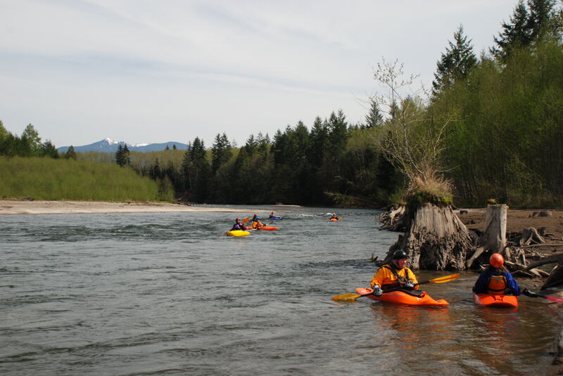
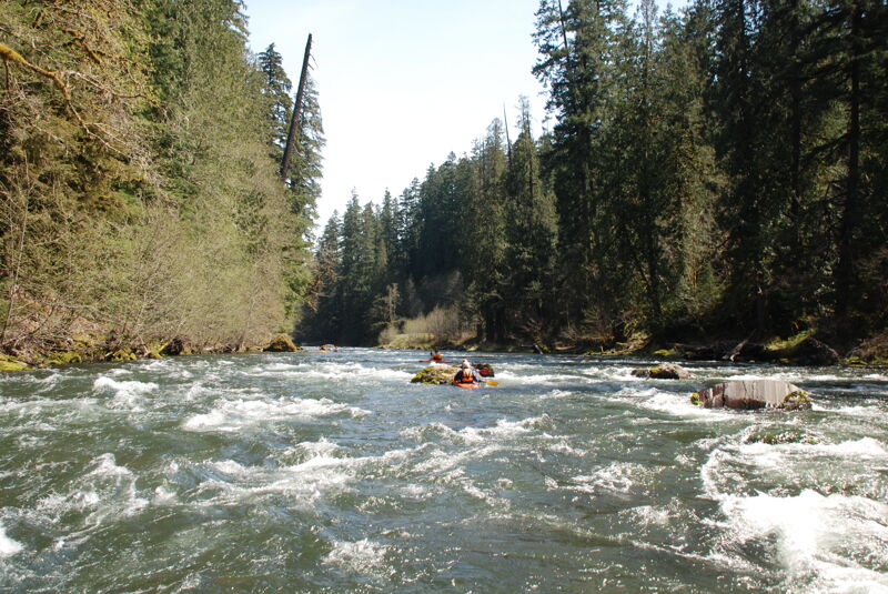
Starting from the Forest Road 28 bridge (river mile 17.5), the run starts with some braided channels and shifting gravel bars. Most of the whitewater in this section is class II, but beware of wood hazards particularly in the first 1/4 mile below the bridge where engineered log jams have been installed. For the next couple miles the river cuts a dynamic channel under the shadown of Tower Rock that looms overhead. There are some expansive gravel bars that would make fine camping for an overnight trip on this reach. You will encounter some private property along river left but evidence of it from the river is fairly limited. Once you enter the National Forest the river tightens, while still remaining class II, and you are treated to the scenic beauty of the temperate rainforest with massive trees that line the banks.
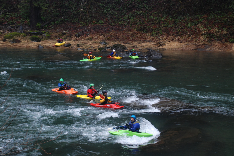
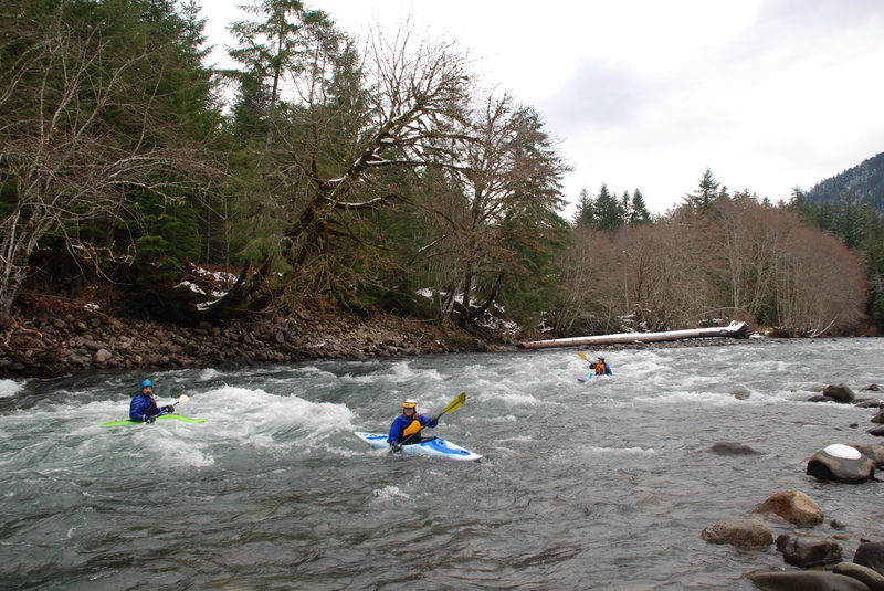
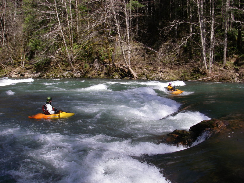
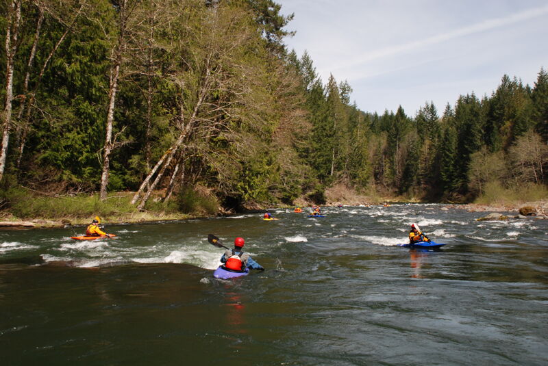
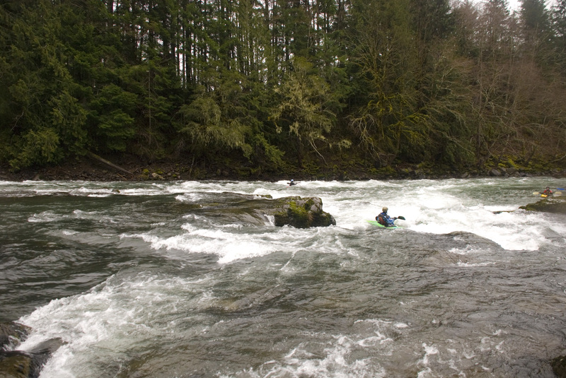
*Twin Cedars to Scanwea Reservoir*
The second half of the run contains the interesting rapids, several of which rate class III, and starts about a mile upstream of the Iron Creek Campground. You can put-in here at the Twin Cedars access (river mile 9.2), a small pull-out with a twin pair of majestic cedar trees along the river bank and a couple larger pull-outs immediately upstream. The great thing about this section is all the rapids have relatively straightforward lines that m
...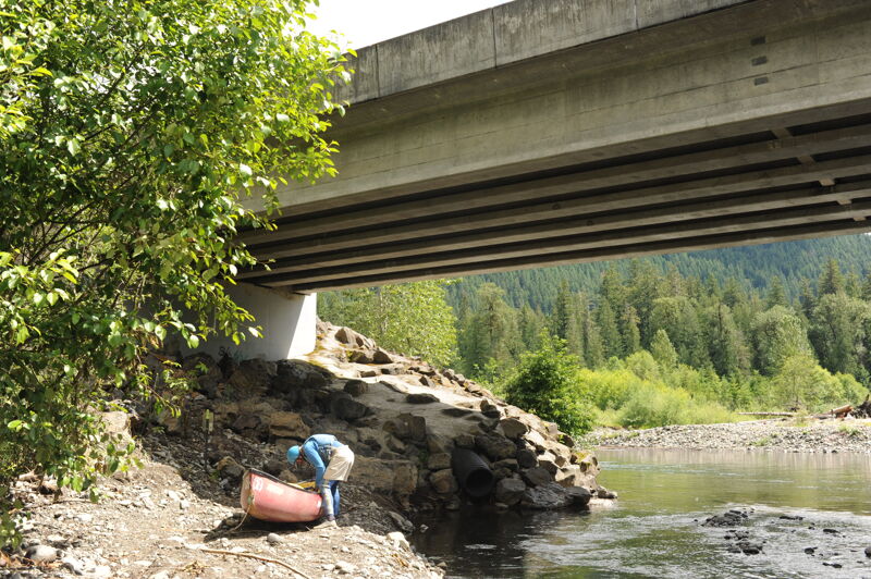
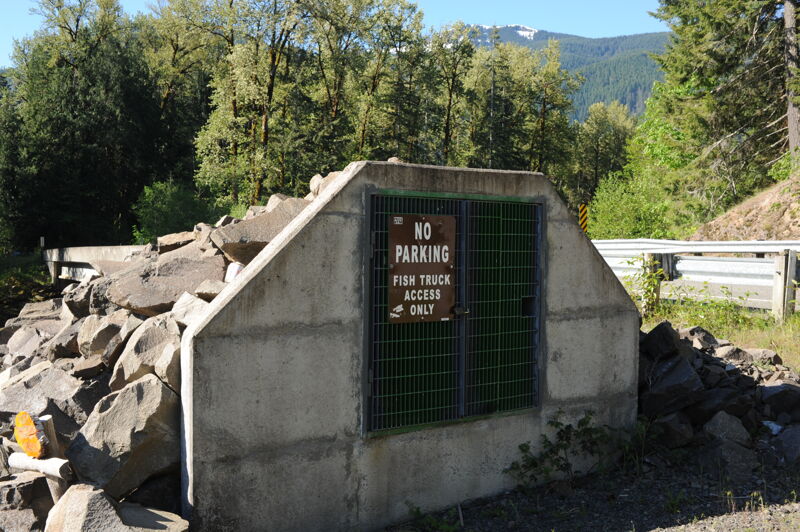
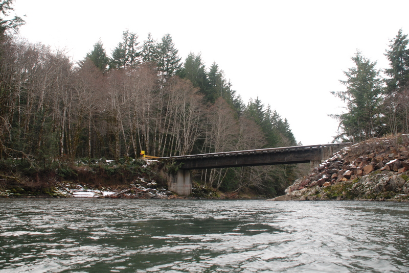
The Forest Road 28 Bridge serves as the upper put-in for the full run. The best access is on river right on the upstream side of the bridge where you can walk down the concrete 'ramp' that embeds the fish chute. Just be sure not to park right in front of the fish chute to ensure access is available for the fish truck.
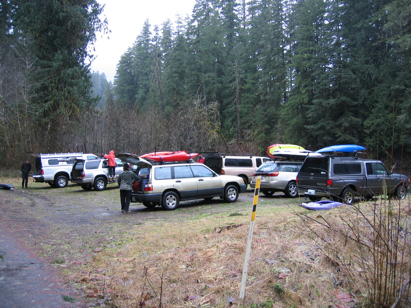
Twin Cedars is an intermediate access point that is a common starting point for many trips. The best rapids start from this access point with the Iron Creek Rapids just downstream. The access is recognized by two tall cedar trees. At one time a gravel bar between the trees provided good access. Currently better access is available 100 yards upstream at a cleared area on either side of a culvert. These cleared areas provide good options for parking but are sometimes used for dispersed camping. Located at USGS River Mile 9.2.
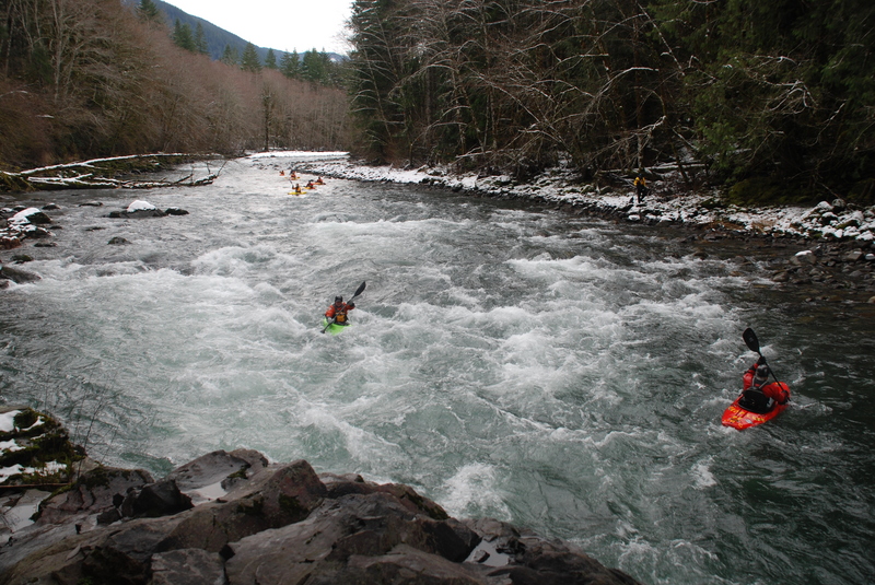
This rapid is a short distance downstream of the Twin Cedars access point. It is generally run right of center down the main flow. Located at USGS River Mile 8.8.
A rapid with options to take either the left or right channel. The left channel is often a little easier to boat scout and the right channel has been known to collect wood hazards. Located at USGS River Mile 8.6.
An easy line to the right or a more technical line to the left. USGS River Mile 7.6.
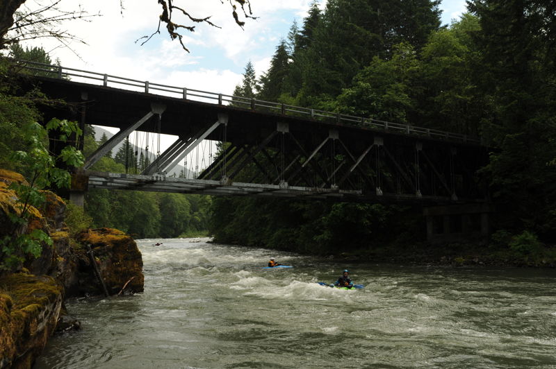
The rapid just upstream of the Huffacker Bridge. The main current flows around to the right side of the channel. Be prepared for the hit in the wave at the end of this rapid. Located at USGS River Mile 7.2.
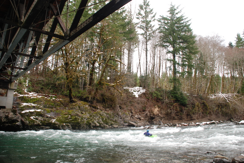
Upstream of this bridge is Forest Service land and downstream is private timber company land. Located at USGS River Mile 7.1.
Easy class II from Huffacker Bridge down to Paul's Play Pen with some surf on the way. At 3500cfs a green glassy wave with a nice breaking pocket develops about 100 yards above Paul's Playpen. The wave has eddy service from the right. Located at USGS River Mile 6.6.
The main wave is on river right with a generous eddy on river left. A secondary wave forms just downstream of the first one. It is common for trips to stop at this rapid and spend some time surfing. Located at USGS River Mile 6.4.
Whirlpool Corner was the site of the proposed Cispus 4 Hydroelectric Project. This has been known as a fun rapid for squirt boating. Located at USGS River Mile 6.3.
Shortly after going around the corner to the left after Whirpool the river drops into Agitator which is run center left. Located at USGS River Mile 6.2.
Routes to the right or left around an island. Located at USGS River Mile 5.9.
Beware of the Lion's Jaw, a hole at the bottom of the rapid on center right. It builds in intensity as the flow increases particularly at flows above 2000cfs. Located at USGS River Mile 5.6.
A bedrock ledge splits the flow providing options to the right or left. You can take the straight shot down the left or take the slightly more technical line around the right. Located at River Mile 5.4.
An easy class II down the right side. Located at USGS River Mile 4.6.
This bridge serves as an alternate access point. Access is available on downstream river left. USGS River Mile 4.5.
The last major rapid before the river settles out into the slackwater of the reservoir and one of the longest rapids on the run. Located at USGS River Mile 2.3.
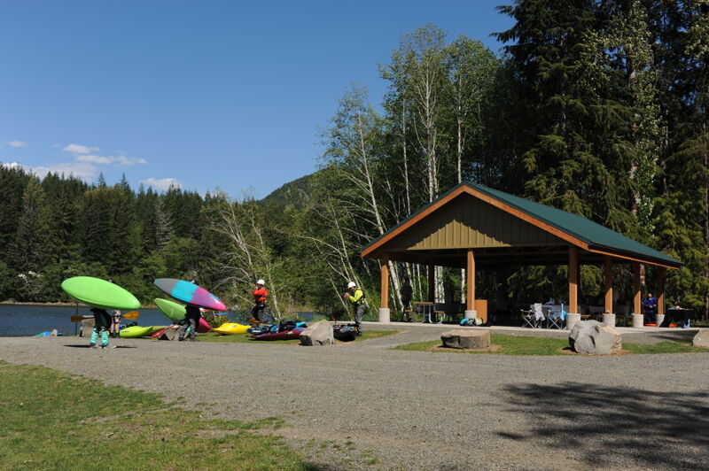
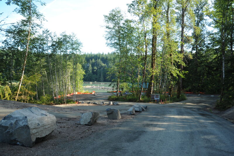
A license requirement from the 1984 license directed Lewis County PUD to construct a recreational site at the head of the reservoir to serve whitewater boaters. In 2007 the PUD opened a rudimentary site but only a few scheduled weekends. After years of delay the PUD finally completed the site and it was fully opened to the public in 2023. While the site is on PUD property, accessing the site requires driving through Port Blakely lands which they can gate and close which typically only happens during extreme fire danger. The access is located on river left just downstream of where Copper Creek joins the reservoir. The site has a large parking area, porta-potties, a gravel ramp that is accessible for rafts, and a picnic shelter. It is located at USGS River Mile 1.0.
Jun 27, 2017
According to the following website: https://www.lcpud.org/recreation/copper-canyon-creek-take-out-site/ 'Road Status Last Updated: June 21, 2017 Port Blakely 300 Road Gate: Open Port Blakely 340 Road Gate: Open Information Hotline: (360) 345-1484 As of 2017, all access roads to our Copper Canyon Creek Take-Out site are now open unless otherwise noted on our website due to hazardous or safety concerns.'
Apr 21, 2014
2014 340 Road gate opening days are scheduled for: Saturday, 26 April Saturday, 10 May Sunday, 11 May This gate is scheduled to be open 10am to 5pm on these days. The 340 gate serves the Copper Canyon Creek take-out facility. To verify, please check with contact Debbie at debbie@lcpud.org.(360)740-2457. For additional information, please visit http://www.lcpud.org/Recreation/Take\_Out\_Site.