Lehigh
1. White Haven to Rockport (Upper)
| Difficulty | II-III |
| Length | 9.1 mi |
| Avg Gradient | 30 fpm |
| Gauge | Lehigh River White Haven to Rockport |
| Flow Rate as of 38 minutes | 341 cfsbelow recommended |
| Reach Info Last Updated | July 13, 2026 |
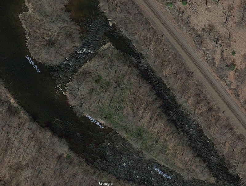
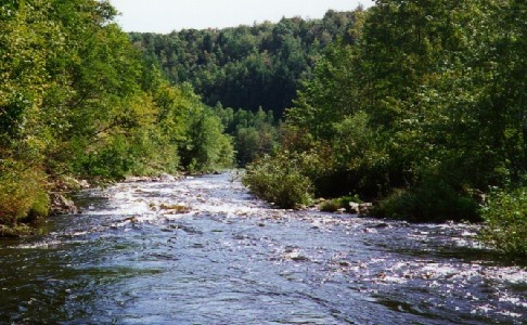
The Lehigh River is a pretty dam-controlled river in eastern Pennsylvania. It offers paddlers several sections of good class III rapids in a forested river corridor. It also is the first (or only) taste of whitewater that many people in the Philadelphia area get to experience. The river is [...]Read More
Access The White Haven DCNR access is downstream of the I-80 bridge. From the I-80 White Haven interchange, turn right on PA 940 going away from the town of White Haven and immediately look for the DCNR White Haven Lehigh Gorge sign on the left. Turn left and follow this road down to the river for the put-in. Cars can be parked in a parking lot a little way up the hill.
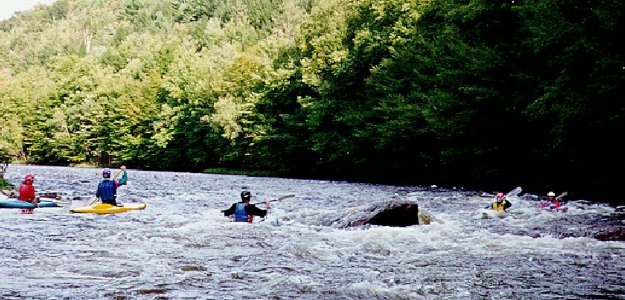
The Lehigh River has 2 whitewater sections classed as an II- III depending on levels (easier than Mongaup and the Lower Yough, but much harder than the Delaware), with guided raft trips, raft rentals, or great trips for private boaters. The river can get crowded during weekends (particularly release weekends) with raft trips and clubs.
Section I (the Upper) is a 9 mile run from White Haven (at Rt 80) to Rockport.
Section II (the Lower) is a 13 mile section from Rockport to Glen Onoko (or you can use the Jim Thorpe take out which adds about 2 miles of mostly flatwater and Class II).
Section III is a summer Class II 'family float' trip running from Jim Thorpe to Bowmanstown. Not as pristine and scenic as the first two sections, but nice on those hot summer days.
The Upper has more play spots than the Lower, but is not as pretty as the gorge area of the Lower. The biggest rapids in the Lower (Little Swimmers, Oxbow, Tower) are longer and bouncier than anything on the Upper. But then the Lower has more flatwater stretches, and can have a pretty stiff headwind near Bear Creek.
...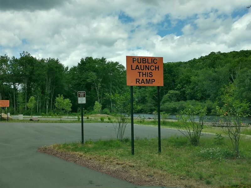
The White Haven DCNR access is on the downstream side of I-80. From the I-80 White Haven interchange, turn right on PA 940 going away from the town of White Haven and immediately look for the DCNR White Haven Lehigh Gorge sign on the left. Turn left and follow this road down to the river for the Put-in. Cars can be parked in a parking lot a little way up the hill. This access is also used for bikers going down to Rockport, Glen Onoko, Jim Thorpe and beyond. Part of the D&L rails to trails system, it is managed by the PA DCNR park rangers.
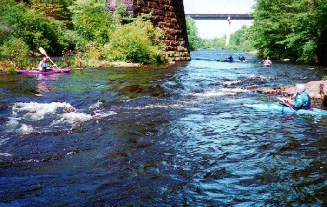
This is actually several small rapids at the start of the run. The first is at the railroad bridge crossing, with a shallow squirt eddy on river right at the bridge pier. Just below this is a small surfing wave with an eddy on river left. After this is a short stretch of whitewater. Follow the current down the center to the pool below. The next stretch should be entered to the left of center. Follow the current as it meanders to the right, back to the left, and then down the center to the end of the rapid.
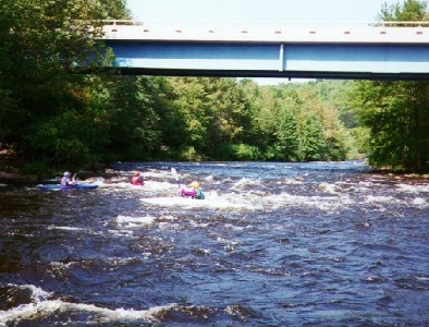
Once the site of the second largest tannery in the US, this rapid is marked by a bridge across the Lehigh. The upper portion of this rapid (above the bridge) has a ledge on river left, with a kayak slot on the right side of the ledge at higher water. The normal route follows the main current to the right of the ledge. The lower part of the rapid (below the bridge) has a couple of standing waves in the middle of the river with a large eddy to the right. Watch out for fishermen in this area. Photo 1 Photo 2
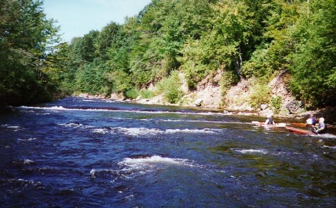
A large island divides the river with some Class II riffles to the right of the island. Some small rocks and bushes mark the passage entering the left of the island. Chose any slot that has enough water to float you. Enter the channel below in the center, and work your way right to avoid a ledge on river left. About half way down the island you will see a horizon line marking a drop of about 1 foot. Run this drop on the far right, the hole is very steep and sticky everywhere else. At higher water levels (3,000 cfs or greater) the hole becomes a very sticky surf. Several people have dislocated their shoulders here. There is a tiny side-surfing wave on river left below this drop. It's a great place for people learning to spin. After it, work your way over to the right to rejoin the current as it comes from the right side of the island. A fair stretch of flatwater brings you past Hayes creek with 3 pillars remaining from an old bridge.
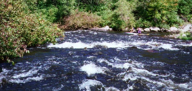
An island divides the river, with Class II riffles to the right. Take the chute to the left side of the island. Come as close as possible to the left bank (ducking underneath the tree) at the chute entrance to avoid rocks lower down in the right side of the chute. At the bottom of the chute against the shore is a pinball rock (smearable). Work to the right as you go down the chute to avoid it, or eddy left just before the rock. Watch out for fishermen in the eddy. Paddle to the top of the eddy and ferry across the chute to exit the eddy and avoid the rock. Stay to the center as you go down the left side of the island. The large square rock on river left becomes Perculator (a raft flipping hole) over about 10,000 cfs. Work your way to the right as you go past the end of the island. Photo 1
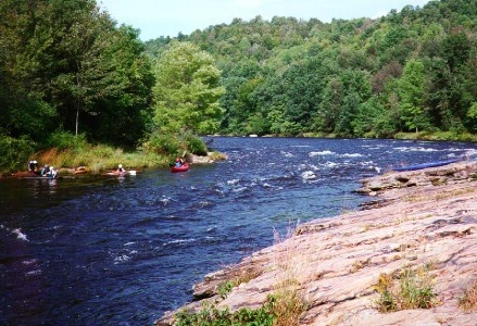
It gets shallow approaching Lunch Rock. Stay to the center right, and then work your way to the center as you get closer to the rock. There is a small surfing wave in the center before your reach lunch rock. There is a strong eddy line as you go past lunch rock, with a large eddy on your right. Great place for squirts, and to practice your ferrying. Watch out for rafters swimming from the front end of Lunch Rock. Below this is a large pool with Tom Turk rock on the left. A rock dive cliff is opposite this on river right. Lunch rock can be reached from Hickory Run State Park by following the Hickory Run trail to the Lehigh at Eddy Turn Rock, and then going upstream. PHOTO 1
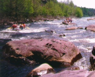
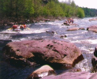
Stay to the right of the island entering this rapid. The river bends to the left, with a large flipper rock in center right. Avoid it to the left or to the right. Follow the current over to the center right, and then as it goes sharply to the left (some shallow slots for kayaks exist on the right side). Follow the chute down the left side to where it is blocked by a series of rocks across the river. Below 750 cfs, only one slot is wide enough to let a raft through - the center right one (with a small pointy rock to the right of the slot). Miss it and you could wrap your raft. Below this is a maze of rocks to negotiate, but without much current pushing you around. Some large rocks on the right side of this chute above the slot makes a great lunch spot with plenty of amusement.
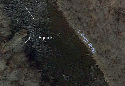
A large rock sticking out from the right hand shore marks this rapid. There are eddys in front of and behind the rock. Great for smears above the rock and squirts below.
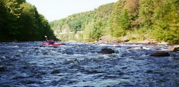
Below Eddy Turn rock, and after a small riffle is Class III Staircase. It is a gradual drop over a jumbled series of rocks. At low water start far left follow the current over the rocks to wind up on the right at the bottom. On river right, watch out for a metal beam along the shore in the small eddy at the bottom of the drop. At 850 cfs or above start right, and stay on the right side down the drop. Below this is a set of 3 large rocks across the river, called Broken Canoe. Photo 1 Photo 2
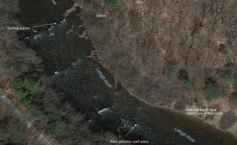
Formerly river wide but tiny ledges mark the entrance to this Class II rapid. You could front surf a kayak from one shore to the other. However, people built eddys from rocks on river left, taking out about 1/3 of the surfing wave. That part of the wave is gone permanently, but the eddys need to be rebuilt every year after being washed out from high levels. Hope the people who destroyed that part of the wave are committed to doing this every year.
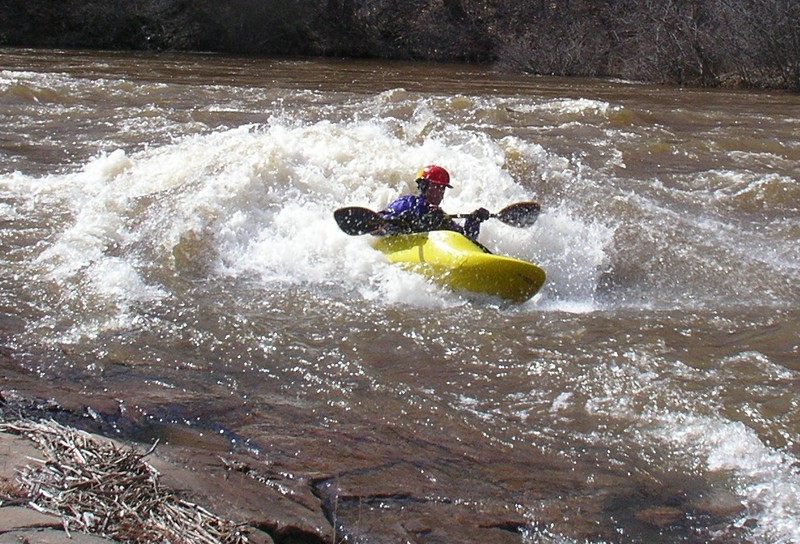
Some points on the ledges are just deep enough to side-surf. Just below the river wide ledges is a hole in center right that is a good side-surf above 1000 cfs. After a slight left bend in the river is a large set of rocks on the right with a eddy behind it. The best surfing wave on the upper is right next to the eddy. Can be easily front or back surfed, or surfed with a raft. Remember though, no one likes a hole-hog. Have some consideraton for those waiting in the eddy (especially C-1ers). A sandy beach is opposite the eddy on the left shore.
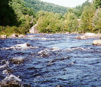
The entrance to this rapid has two large rocks on center left, with a slot between them which can be run by a raft above 750 cfs. Mud Run creek enters from the left - a popular run for local expert steep-creekers (only runnable after a heavy rain). Follow the main current down the center, through a set of small waves and holes. There is a nice surfing hole with access from an eddy on the right, then two or three standing waves you can surf in the middle. The last hole is 'Beaver Hole', with good eddy service river left and some great surfs on the wave.
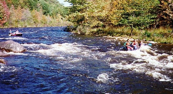
Called second chance, because if Beaver Hole didn't get you wet, this one will. Stay to the left of center as the river makes a left bend, and this will put you in the center to hit the big wave/hole. To the right of the hole is a rock ledge with a large eddy behind it. From the eddy, you can get out to the wave which is one of the best surfs on the upper.
A series of three Class II riffles, the first of which has an island (take either side), the second has a little hole (the curl), and the third has a large rock at the bottom. The names come from three early guides - Larry Skinner, Dan Chabot (with curly hair), and Mo Iezzoni.
A large flipper/wrapping rock is in the middle of a narrow section of the river.
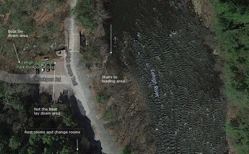
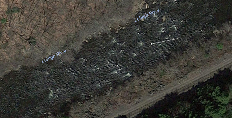
Below Wilhoyts is a long stretch of fast water leading up to take-out eddy, where raft trips stage for controlling access to the small take-out area. The last piece of whitewater is a hole along the right bank. Innocuous at 500 cfs, at 1000 or higher it becomes very sticky, and is a great place for guides to direct rafts that have been a pain in the butt all day. Named for an early guide, Scott Newlin, who had a memorable ride there at high water. There was another Whitewater Challengers guide named Scott - Scott Strausbaugh (who won the Olympic gold medal in C-2 slalom with Joe Jacobi at Barcelona), but it wasn't named for him (I had to drop Scott's name somewhere in here). The fast water alongside takeout eddy becomes an impressive wave train at high (>10,000 cfs) water. A great place for rocket moves. Just before takeout, at a large rock on the right shore used for high water takeout, is a great glassy surfing wave. At higher levels you can get good squirts on the eddyline behind the rock. There are 3 sets of stairs at take out, the first is for rafters and private boaters, the second is used to transport rafts to the top, and there is a third set of stairs lower down used by some raft companies for put in.
Aug 29, 2016
Upper Lehigh River Tannery Part 1
Aug 29, 2016
Upper Lehigh River Tannery Rapid Part 2
Jun 2, 2016
A detailed description of the entire Lehigh River can be found in the 'Lehigh River Paddling Guide,' which can be purchased online at http://www.ggentile.com/nonfiction\_books.html. Scroll down to the appropriate title.