Underwood Creek
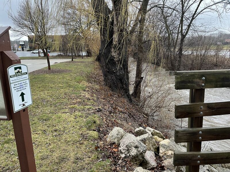
*2025.07.11 WOOD ALERT* Krueger Park to Hoyt Park (0.5 - 3.5 miles)
Apr 11, 2025
Jan 14, 2018
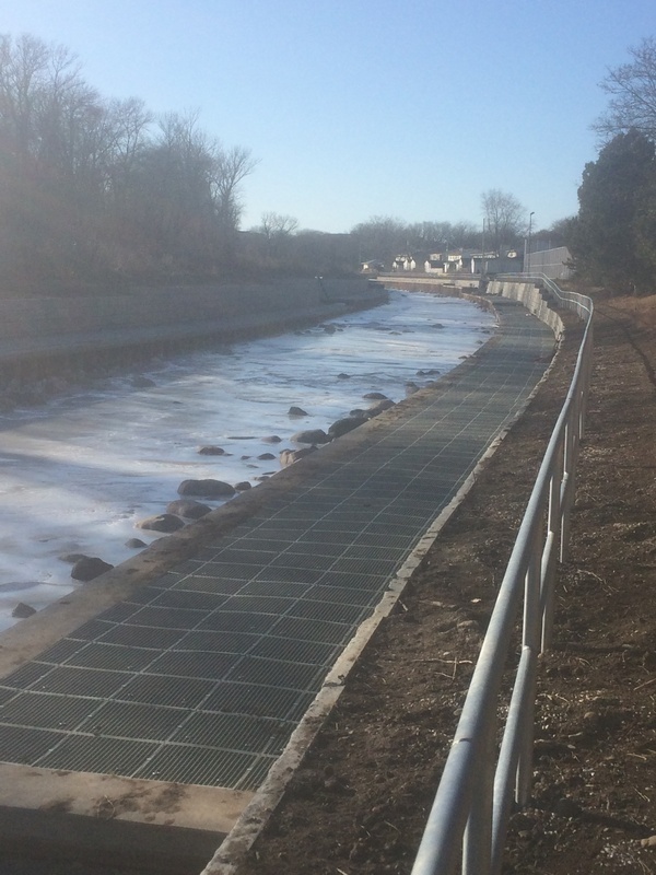
Heading past a condo complex (river-left) and toward the Hansen Park Golf Course area (river-right), a 'two-step' terracing has been done. The lower terrace has metal grates (not sure what happens when flow rises to this point), and the upper terrace has a metal railing (to guard against people not realizing there's a sudden dropoff, and provide a 'riverwalk' area, I suppose).
Jan 13, 2018
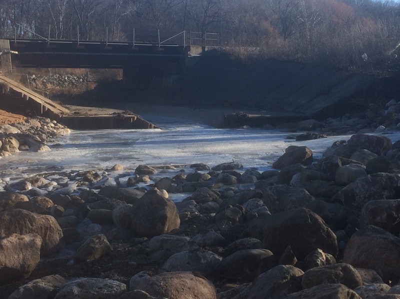
The Railroad Jump (as revised by remediation project, 2017) appears now to have a substantial pool (backed up by rocks downstream and at its base). At some elevated flows, there may be a bit of a wave/hole here (when water flows over the 'shoulders').
Jan 13, 2018
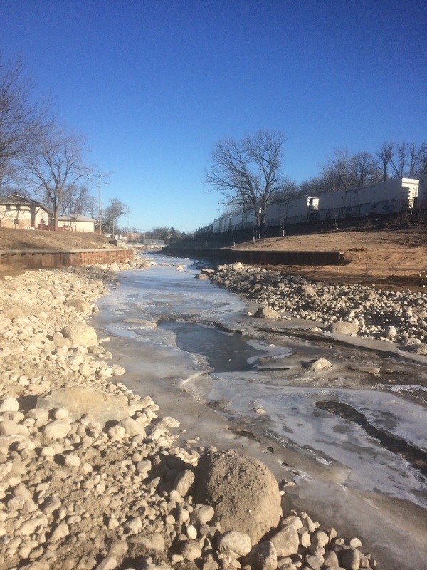
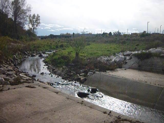
Partway down this final stretch, where private property prevents meandering the creek and laying back a floodplain area, the creek was widened a bit, and now flanked by vertical walls. Rocks in stream seem (perhaps) a bit less prevalent (not so many huge boulders to encounter at low-to-moderate flows, compared with the earlier stretch from under the freeway).
Jan 13, 2018
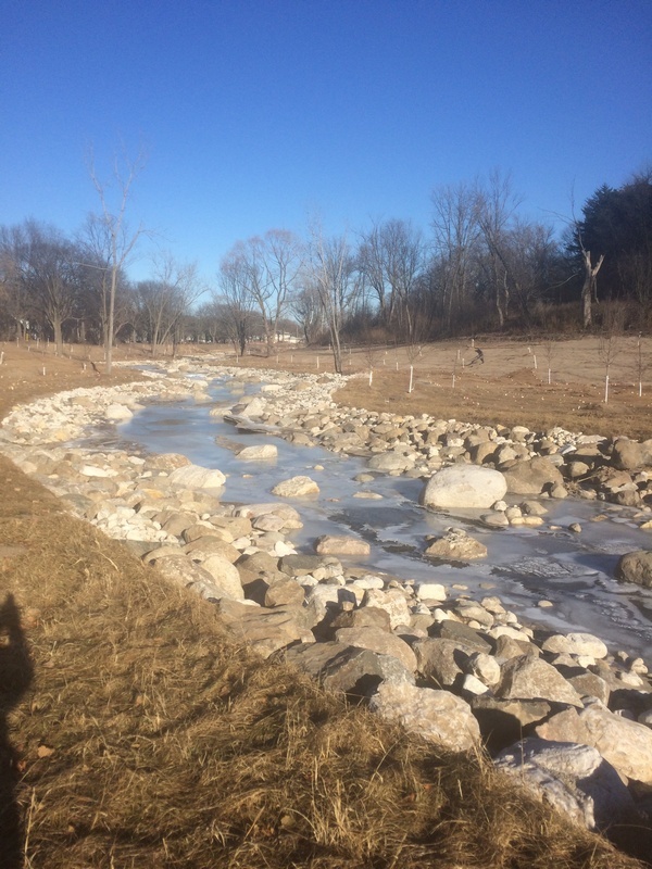
All 'jumps' downstream have been removed replaced by rocks and boulders in the streambed. The channel has been meandered a bit, and floodplain created wherever possible. Little more than rock-dodge swiftwater will now occur down the remaining distance in the creek to the confluence with the Menomonee River.
Jul 31, 2017
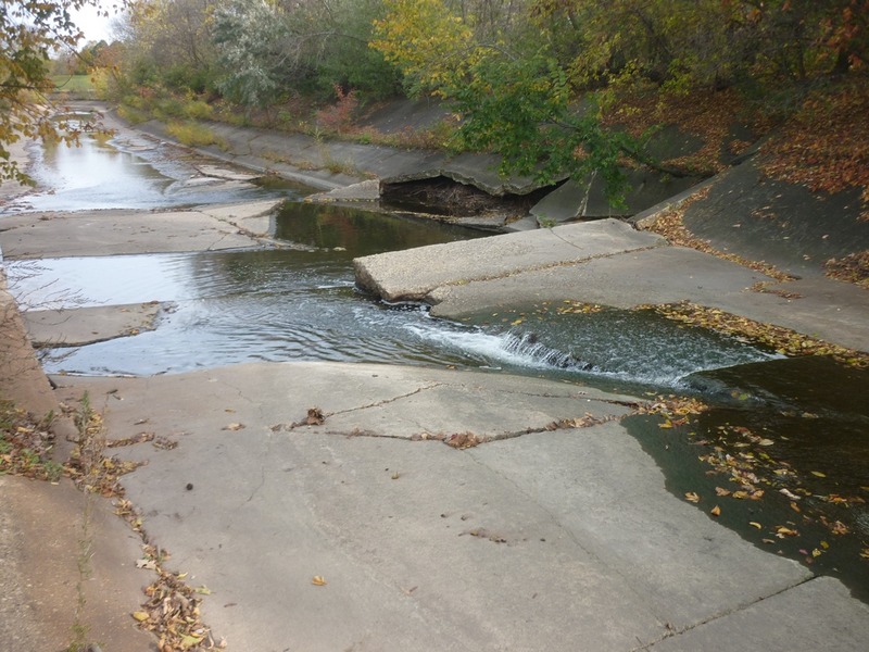
While it is underway, a project to remove the cement from this stretch of river has temporarily left a pathway of cement for the work equipment to cross, while areas upstream and downstream are being filled with rock. No doubt the project will finish with this cement also gone and replaced by rock.
Jul 31, 2017
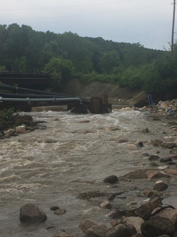
A project undertaken during the summer of 2017 to remove another stretch of cement from this creek used the 'Railroad Jump' to funnel all water (at low/normal flows) into a coffer-dam area to be pumped through pipes to bypass the section while they worked.
Jul 31, 2017
Looking down toward where the 'Scary Drop' used to be ('scary' only in that there were oddly heaved slabs of concrete, making odd waves, potential for pitons, and ugly consequences if one were to flip or be out of their boat), it seems likely the area will be slightly wider than before, but still will be 'sea-walled' a bit, and likely be swift-water, but no whitewater.
Jul 31, 2017
Looking downstream from where the 'Big Drop' used to be, toward where the 'Little Drop' was, perhaps there will remain some mild rocky rapids.
Oct 22, 2013
This is the biggest 'jump' on Underwood Creek, at about 4'.
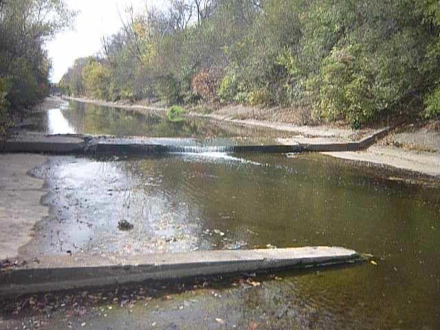
Oct 22, 2013
This is your view as you head into the Railroad Drop.
Oct 22, 2013
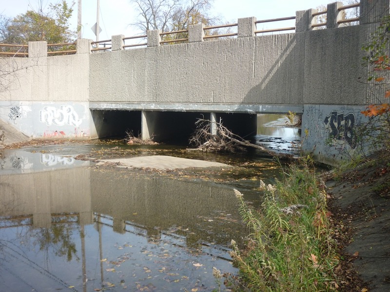
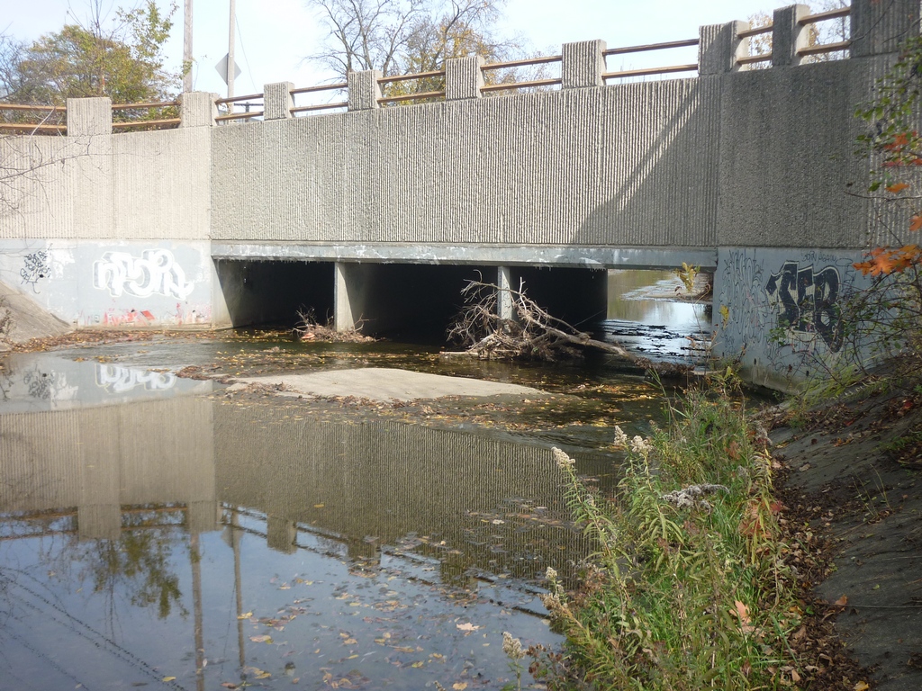
Before putting on upstream, it is a very good idea to scout this location to be aware of any wood blocking the flow of one or more of the three box-culverts.
Oct 22, 2013
This drop is about 30' at the bottom of the trough, 66' at the iron plate on the shoulders. With flow, expect the trough to be nearly filled, so your effective drop is likely to be somewhere between 4' and 6'.
Oct 22, 2013
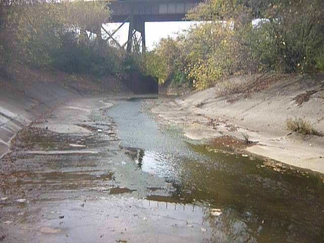
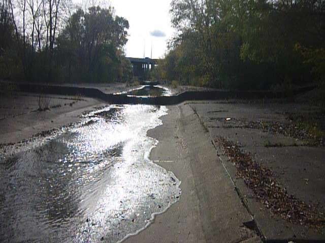
This is the end of the restored meandered section above the railroad, and the beginning of the next section of cement ditch.
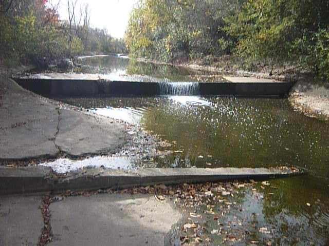
Oct 22, 2013
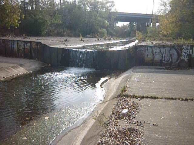
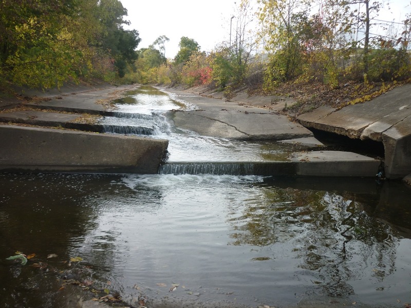
This view looking downstream shows the left side (slide) and the right side (~41' jump). Take note of the caved, eroded, overhanging cement slab downstream on the right shore.
Oct 22, 2013
It doesn't look like much without flow, but just ever-so-slightly below dead-center of this frame, if you look closely you may be able to perceive the change from sloped cement to level and flat. At that transition point, with good flow, this kicks up the Rooster Tail wave. In the background is the Railroad Chicane.
Oct 22, 2013
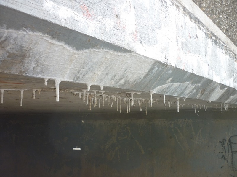
If you have the time and presence of mind, look up as you pass through or play under 115th Street to see these small stalactites leaching out of the cement of the bridge.
Oct 22, 2013
Watertown Plank Road (WPR) Drop, about the same height as the second drop, but sometimes a bit more 'boil' to it.
Oct 22, 2013
If this one gets you at all interested, you're in for a lot more. If this one scares you, get out now and walk back up. (Trust me, even this little drop looks a lot different with water!)
Oct 22, 2013
The second transect will wake you up a bit if flows are moderate or higher and you are lolly gagging, as it can have a pretty fair boil below.
Oct 22, 2013
Always scout (before putting on upstream of 115th Street) to know whether wood blocks any (or all) of the three box culverts here.
Oct 22, 2013
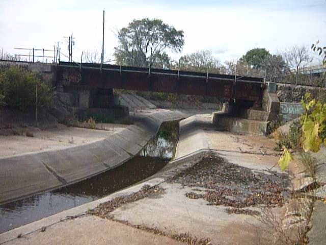
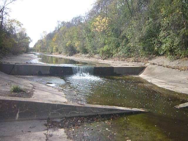
Looking upstream, you can see the river-left half (frame-right) steps and slides more gradually down, while river-right (frame-left) stutter-steps twice before jumping 41' into the pool. This photo also shows the eroded 'cavern' (river-left, frame far-right) behind/under the steep slanted cement slabs which form the left bank.
Oct 22, 2013
Here you can see the 'Little Jump' in this cement ditch (with 'Big Jump' in the background).