Haw
2. US Route 15-501 (Bynum) to Highway 64(Middle Haw)
| Difficulty | I-III |
| Length | 4.2 mi |
| Avg Gradient | n/a |
| Gauge | Haw River Near Bynum, Nc |
| Flow Rate as of 1 hour | 146 cfsbelow recommended |
| Reach Info Last Updated | March 13, 2025 |
River Description
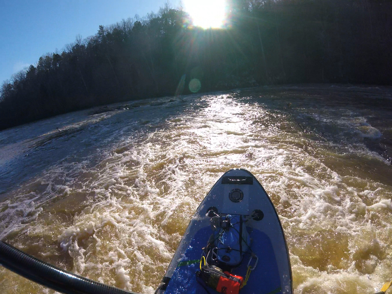
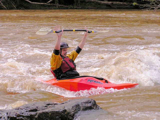
Scenic North Carolina Waterway. There is little development between Bynum and the Highway 64 bridge. During the summer, the islands are covered in poison ivy, but it the late Fall and early Spring, the islands provide good fishing and canoe camping opportunities. However, be aware that dozens of boaters have been rescued from this section over the past 30 years when the waters rose unexpectedly due to rainfall near Burlington, NC.
The take-out for the Middle Haw is on river right on the downstream side of the Hwy 64 bridge. There is a parking area immediately adjacent to the riverbank. To get to the put-in, drive up the gravel access road to Hwy 64 and turn right (eastbound toward Raleigh). Go to the next traffic light. This is Mt. Gilead Church Road. Turn left on Mt. Gilead and go all the way to the end, where it makes a T-intersection with Hwy. 15-501. Turn left (south, toward Pittsboro) onto 15-501. There used to be two places in Bynum to put in on the river: the power plant or the footbridge. Due to a fire at the old mill/power plant, that parking lot is blocked off and is no longer accessible.
To put-in at the Bynum Footbridge, continue on 15-501 across the bridge. Take the first left past the bridge. You will come to an old bridge which is now closed to vehicular traffic. Park at the end of the bridge on the right. There is a path running down to the river and a pretty good sized eddy where you can put-in on river right.
River Features
Put In
Thunder Falls
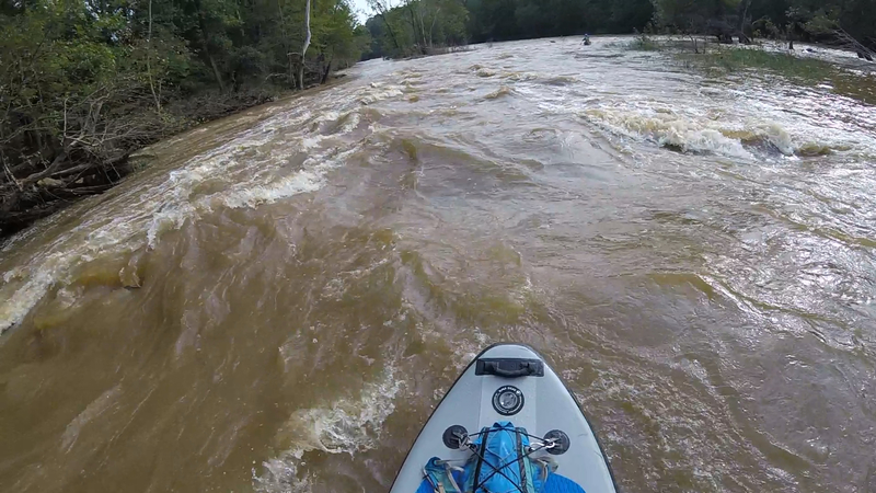
Last drop between the islands. The steeper drop is at a sharp right once the right side island ends.
S-Turn
At the far right channel, the river curves left and then back to the right. You can eddy left midway and catch a small boof on the left of the final part of the drop.
Take Out
Trip Reports
Log in to add a reportPaddled on May 25 2020 at about 7000 cfs, and May 30 2020 at about 4400 cfs. Double ducky the first time, and double ducky and old town 15' canoe the second time. No problems getting through and navigating rocks with canoe in these flows and some fun spots.
Big rapids were really fun. Most of the smaller stuff was washed out.
Ran it at 4500cfs yesterday! Super fun!
Fun timesπ€ October 2018 post Michael conditions πββοΈ
Oct 18 πββοΈπ€
Ran this stretch with a friend who is a new paddler twice last week. The first run down was at ~1000 cfs. It's a good level for a first time paddler, nothing over class 2, but it's quite shallow at that level and we definitely left some plastic on the rocks in numerous places. The second run was after about 2 inches of rain and it was running over 3000 when we put on (about 1.5 on the 64 bridge gauge). This level was much more entertaining with some sizeable wave trains and a couple of class 3ish drops with the last drop being class 3. After these two runs I would definitely recommended this stretch at over 1500. It's undeveloped and very pretty and we saw a bunch of herons and a bald eagle.
Some additional beta from that below, for those who have never run it:
Put in at the 15/501 bridge. From the pull-off, take the right trail over the spillway and down to the small beach. Paddle up towards the dam, not too close though, and ferry out to the middle of the river, around a small island.
Head downstream underneath the bridge and through some splashy waves. You'll then head down through and below the old Bynum bridge.
For all the islands below, with the exception of the final one before the takeout, you can go to either side, but below is my recommendation.
When you hit the first split around a major island, just after the Bynum bridge, head right for a s-turn style rapid, with a little bit of maneuvering required but nothing crazy. Below this you'll come to some small rock outcroppings in which you can go wherever. At the next island after this you can go either way, but I suggest going left. After just shy of a quarter mile you will see some channels running towards river right in between the islands. Head down the channel and you will end up at a bend with a ledge drop with a sizeable wave (3+ ft @ 3k) and then another ledge drop just below that. This is quite a fun splash for novice paddlers and probably the biggest wave on the river.
Head down through some more rock outcroppings and some small islands.
You'll then come a a large island with a large outcropping of rocks scattered across river right. It almost looks like the river ends and shunts completely to the left. But don't go left here as this is the last island and if you do go left you end up below the 64 bridge takeout. Head right through through this maze of rocks and down through the two most difficult rapids of the run. The first just requires some maneuvering around some rocks and small holes (class 2-2+). At 3k, the last drop, which the poster below refers to as mini-s-turn is what I found to be the only legit class three drop, but it's manageable for a beginner/novice and quite fun. You have to maneuver around a couple of rocks and you come to a river wide ledge. The only good way through this is to head far river left around a drop which curves back around sharply toward the center of the river. Hence, mini-s-turn.
This is a fun, fast little drop. My friend had only ever paddled twice and handled it just fine. After that just paddle down to the 64 bridge and catch the micro takeout eddy. See you on the river!
I would avoid this stretch at anything below 800cfs. Yes, you can scrape down it at 400cfs but it is sort of miserable (did it yesterday). 800cfs would be a minimum level that is fun for newer paddlers and still kind of fun for experienced paddlers.
Kevin's 1 min.surf easy
There is a new put-in for the Middle Haw. The new put-in is off of 15-501 upstream of the 15-501 bridge. The new put-in has a path that leads down to the outflow of the Bynum Dam. The DOT removed all the rocks and left the natural rock bed. This opens up a nice section of Class II water between the 15-501 and Old Bynum Bridge.
New section recommended run:
Put-in on river left after dam spillover.
Work your way to center along dam, do not get too close. Go center to river right then center. You should end up near the Bynum visual gauge bridge support rapid.
Once past the Bynum Bridge run as usual.
But for those who have not run this:
The river run is pretty straight forward. Thunder Falls and S-turn (work towards center narrow section between islands) are past the Class II and Flatwater section near the Bynum gauge. There is a Class II drop past this section. Proceeding through more flatwater, you will come to a decision. Do I run the Class I-II on river left or the Class II on river right. River left is fun, at the fork at the end, go right for a Nanty-like little ride. You will have to crossover past the 64 bridge to hit the take-out and/or Lunchstop Rapid approach. River right is like a mini-maze, but fun. There are two rapids, which I refer to as, Mini-Gabriel's Bend and Mini-S-Turn. This section will put you on the right approach for the take-out and/or Lunch stop.
This section is worth the paddle at 1000-2000 cfs. Couple this with the Lower, and I call that a good day.
At the request of all other paddlers, Jim 'Stinky' Carroll was shamed into rinsing his under-arms. Even in the nasty Haw, it was an improvement. This small ledge is about half way through the run. It is after 'Thunder Falls' and before 'S-turn'. The level has to be above 1.0' on the paddler's gauge (~5.7' on the USGS) in order to form a wave that you can sit on. It is really a pretty lame wave, but there are no real features on this section so you have to exploit what you have to work with.