Pequannock
Macopin Dan to 287, Riverdale
| Difficulty | II+(IV) |
| Length | 4.1 mi |
| Avg Gradient | n/a |
| Gauge | Pequannock River at Macopin Intake Dam Nj |
| Flow Rate as of 1 hour | 9 cfsbelow recommended |
| Reach Info Last Updated | December 13, 2019 |
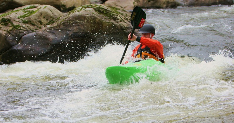
Fun intermediate river right on the edge of suburbia that runs well during wet seasons that fill up the upstream reservoirs. Once it gets up it holds. Gauge is just above the start of this section so very accurate. As the river has lots of similar sized boulders it goes very quickly from fun to scrapy to unrunnable.
Except for the dams I’d keep it at 2-2+. Lots of nearly continuous rapids and the water – straight out of a reservoir - is clear and cool.
Normal launch is literally under 23 on the off ramp from 23 south (east) to Hamburg Turnpike. Carry over the guard rail.
There’s almost 2 miles of river above the normal launch but no clearly legal parking with an acceptable carry to the launch.
Mileage is measured from the Macopin Dam and your author has paddled from there by dropping boats on the u-turn and riding a bike along 23 from where we parked.
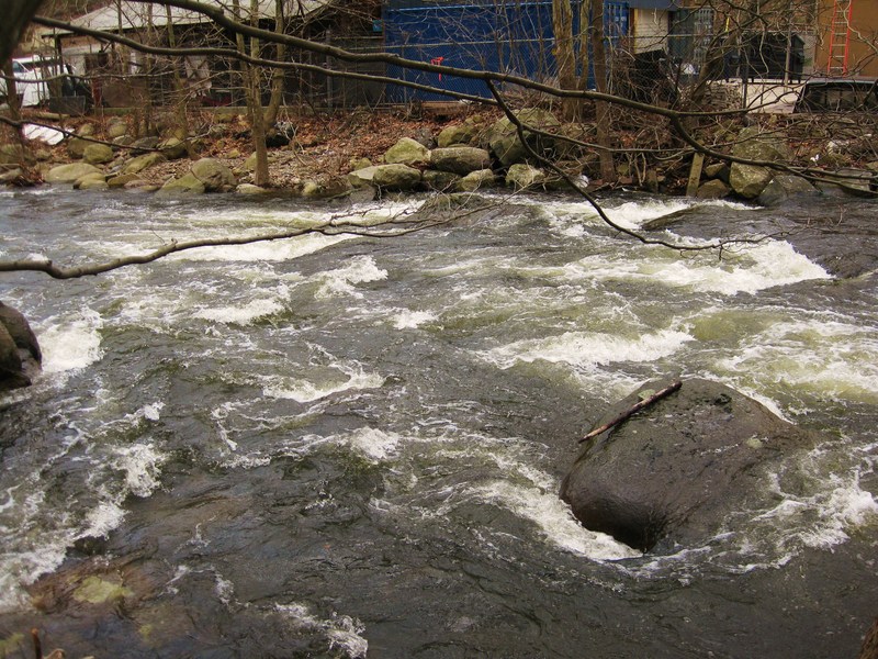
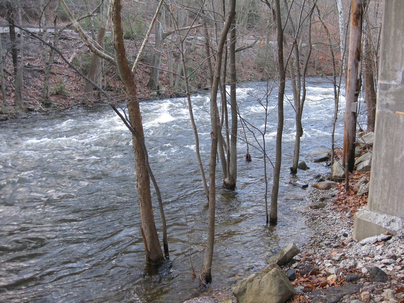
Aesthetics are mixed at best with some downright ugly sections, some old industrial stuff and some sections with high enough banks or far enough from roads to feel natural.
There are three dams on this run.
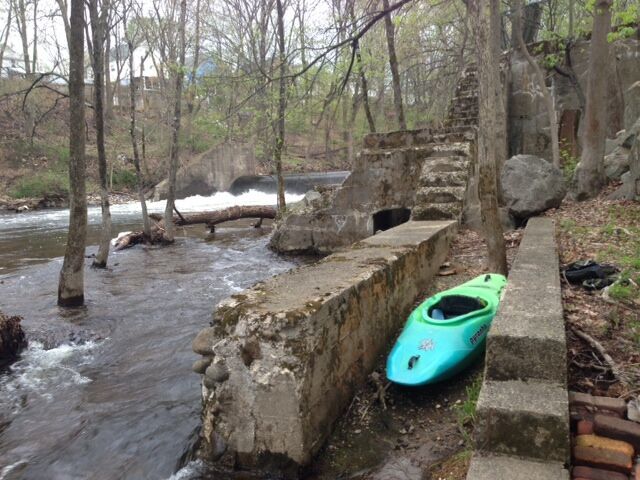
Dam 1 at Waterfall Court apartment complex is boofable into the center pool and not a bad portage and easily scouted during the shuttle as well.
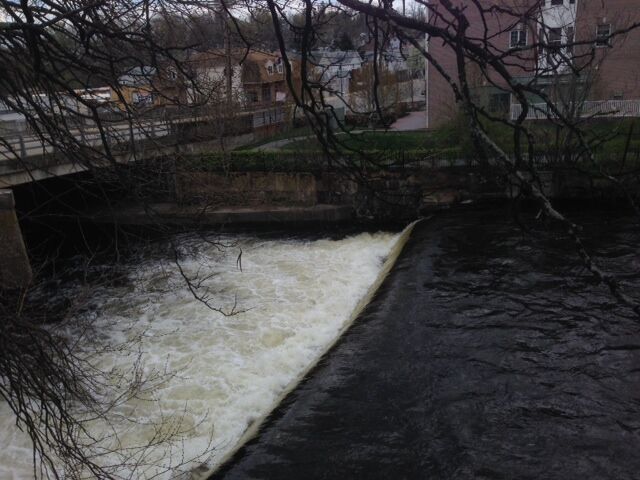
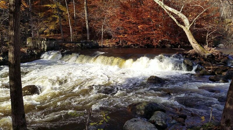
The deadly middle dam on Main street in Butler has retaining walls that limit access and a bad recirc. Scout on the shuttle as you don’t want to miss this… about a 4’ drop. On river right about 30’ above the drop is a big eddy where you can scramble up through a small gate. At high water this is a true killer low head as the sides start to recirc in and there’s no good access to set up safety at high water. ( It was running about 1500 cfs when Kamikaze Ken was killed which is discussed in the linked article).
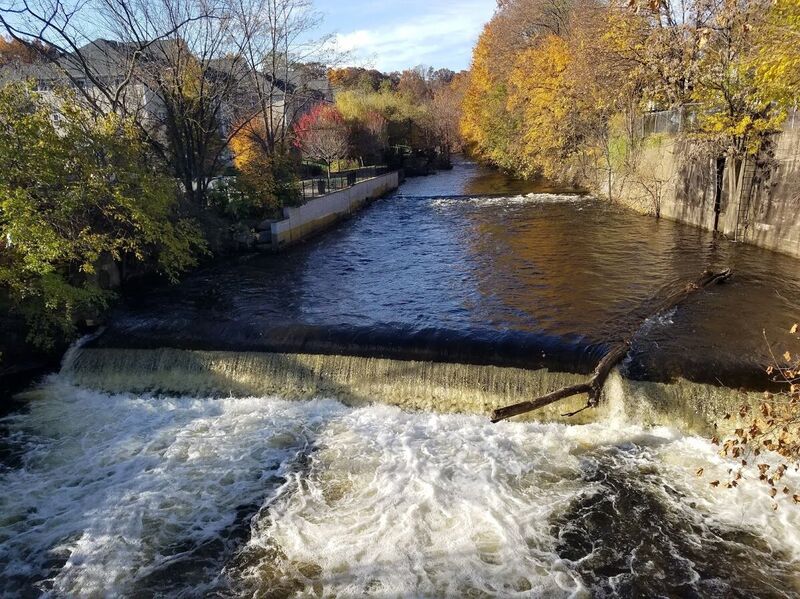
Dam #3 at 2nd Street in Butler is
...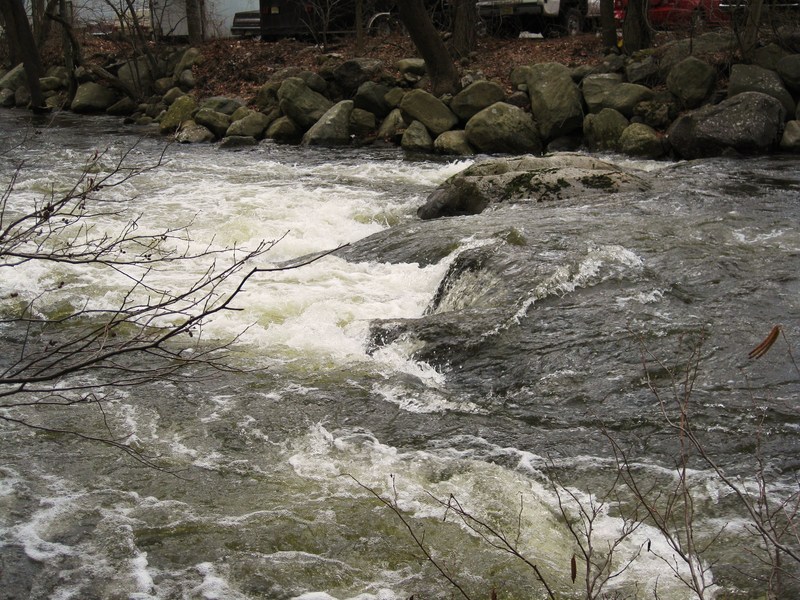
Only natural feature on the river that drops enough that you can't see all the details from the boat. Complex entrance with rocks at center that can catch wood. Eddy on right just above the main drop. From the boat you still can't see over the drop very well you can probably tell if there's significant wood from the boat. Boof/slide over right or drop and go thru hole and wave.
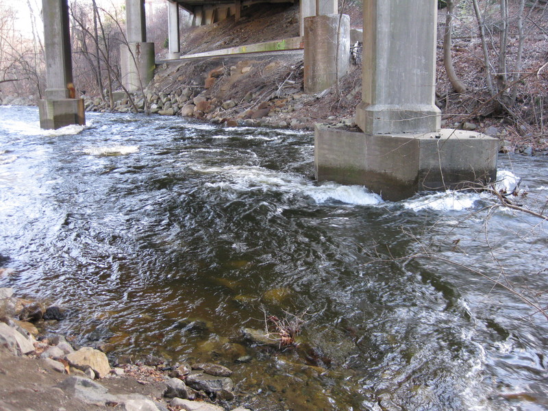
Really. On the normal shuttle take Hamburg turnpike north onto 23 then take the 1st u turn on the left and the first exit. Parking on left immediately after the underpass and carry over guardrail to launch under bridge. Despite being along route 23 the 2 miles upriver are nice...but there's no clearly legal parking close to the river.

After going under the hamburg turnpike bridge the river is undercutting the road. Left side has a lot of awkward, sharp rip rap boulders dumped to stabilize the bank. Center or right is much cleaner.
Islands catch a lot of wood behind Xtreme Graphics. Best route changes. Right has a low fence, left a steep bank. Use caution, eddy hop and be polite if you have to carry thru someone's backyard. Always a good spot for ambitious beavers.
Just upriver from the bridge is very friendly easy wave with great eddy service.Nice place to practice spins etc. down to about 150 cfs.
Parking on north-east side of Hamburg Turnpike just northwest of bridge. Paths from parking head northeast to river.
If playing pull out on river right below bridge and carry back to parking.
Nothing spectacular, but the Pequonnock is more about convenience.
At the northwest corner of Waterfall Court Apartments.
About a 4 foot drop easily portaged on left. Run center right boofing into pool or if right side is clear of wood there's a slide to the right of the boof that pushes you to rocks and often wood on the right side.
Scouting is better from right atop the concrete structure to get you a good view to line up where to go over the drop but the portage on right is lots worse. Scouting from left (or during the shuttle) gives you a great view to check for wood.
Normal line is near (river) right at right side of ripples above drop, boofing off the lip. At normal levels and done right it's a cushy landing. At higher levels you're into the rapids below really quick.
At higher levels there's a scrapy and often woody sneak on left.
This is the killer. At high water this recircs on the side. 1500 cfs killed kamikaze ken (see https://www.americanwhitewater.org/content/Accident/detail/accidentid/107 ) and having seen it at 1300 i can see why. Eddy line is 15'+ out and sides recirc with more power then you could paddle out of.
Hard to miss but since you really don't want to miss it, scout on the shuttle by parking nearby and walking over to the bridge and/or from the public river walk on (river) right/south side.
On the river after Waterfall court you go under the railroad bridge and then retaining walls start.
About 40' above the dam on (river) right is an ok pullout and eddy with a scramble up to a fence. Open the broken gate, be nice to the dog walkers, carefully put the broken gate back in place. Put in on either side, either dropping down the steep slope on river left or carrying to the upstream side of the body shop on right, lifting over the jersey barrier and launching from the scrapy rocks or, at all but the lowest levels, you can seal launch off the bridge abutment on river right without hitting bottom.
At low water drop is boofable. Obviously you're going to one side and on the far right there's a ledge under the water that sticks out about a foot from the wall. Far left has held big wood for ages. But if in doubt, walk. This really is a killer and, even done right, there's nothing thrilling about this except possibly the thrill of terror as you get sucked back into the recirc at even low levels. (Yours truly was too far left in a playboat at less than 300 cfs and got sucked back in, flipped, caught the green water below while upside down with the paddle and pulled himself out).
There's also no good way to set up safety as the fence on river left is to high, the bridge is too far away and too high. The abutment under the bridge is close enough when running river left, but if the first throw misses and they get sucked towards the middle... It should go without saying that if you have any doubts walk it. It's an easier portage then it looks. And if you have any doubts about hitting the eddy above the dam and getting out, the car portage from waterfall court to the 2nd street dam is a nice option, bypassing the ugliest stretch of this river. this dam or even to the next one at 2nd street.
Looks a bit intimidating, but straightforward at center if you got this far. Downstream momentum will carry you right thru.Surfable but retentive with ok eddy service at lower levels if you want to go back in. Bus depot on river right. Don't exit here to relieve yourself as they don't like trespassers (and you'll be out of the river for the 2nd street senior center dam in a minute anyway).
Another straightforward drop down the center as river makes an obviously unnatural turn to the left. Right side can be a fun bounce of the rocks. Left side looks like a boof but at has an edge on the upriver side and at lower levels you get stuck (twisted and fall awkwardly over). Ok surfing and squirting with good eddy service below.
Dam #3 at 2nd Street in Butler portaged on right. There's ceramic pipes in the spillway, occasional strainers in the right but the real problem is boat abuse as the bow smashes into a gravelly spillway if you run.
If you want to launch here, launch below dam carrying down old spillways on river left. Not a bad launch, but there's no way off the water on river left (retaining wall with fence). Access is via 2nd street and the senior center parking lot. At high water ( somewhere around 1000 cfs+) where the missing the eddy on the main street dam=death, a car portage from waterfall court to here isn't a bad idea.
The last significant drop on the river ends against a big wall. Straightforward and wouldn't bother mentioning it except for a few hundred feet below is a nice beach on left behind Lina's restaurant with a path along the river and into the woods to the parking lot behind Bloomingdale Hot Bagels (and Danny's Pizza). Nice bathrooms, good cheap quick food and plenty of parking.
Below here is some easier water and a pretty stretch down to the normal takeout, but in cooler weather or for a slightly shorter run...
Nice park for a nice weather pullout/meetup. Even in summer car is viable from river.
Aug 3, 2009
At 200CFS and up the river is fun to do. I can only speak for the lower portion starting at Elizabeth St. and Hamburg turnpike in Bloomingdale and ending up in Pompton lakes just under the Hamburg turnpike over pass. There are 2 downed trees 1 which you should be able to go over and the other just fell and we had to go around it on the left hand side. The second tree is just after the 287 under pass. PIcs to come soon.
Apr 23, 2009
punching a small hole
Apr 22, 2009
low level, but just enough to have some fun
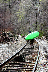
just a lil shoulder shuttle back up to the car
it was a low day, but still enough flow to have some fun
level was 3.30' on the Macopin Intake Dam gauge...seems like anything at or above 4' would be best
just a lil shoulder shuttle back up to the car