Umpqua, North
2. Soda Springs to Deadline Falls
| Difficulty | III |
| Length | 33 mi |
| Avg Gradient | 36 fpm |
| Gauge | N Umpqua River Abv Copeland Ck Nr Toketee Falls,or |
| Flow Rate as of 48 minutes | 693 cfsrunnable |
| Reach Info Last Updated | December 24, 2024 |
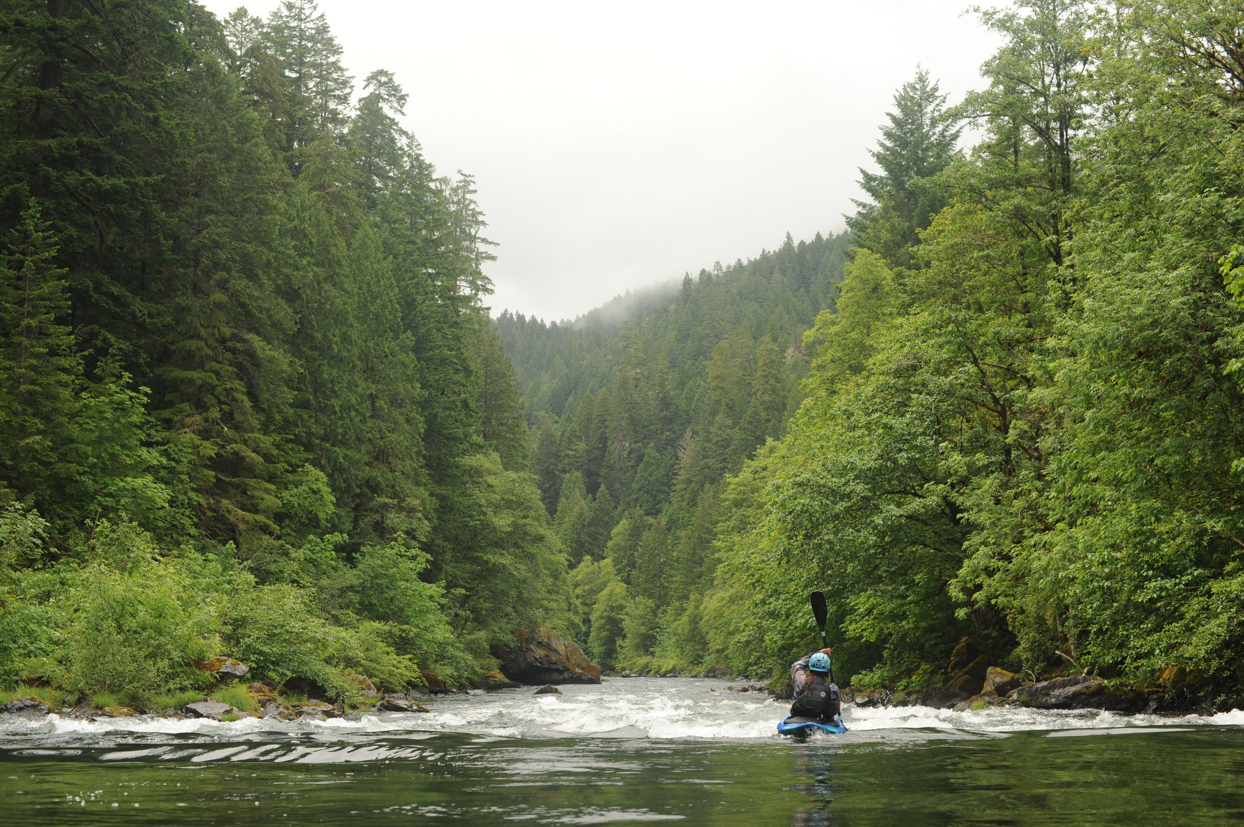
This is an ideal class III river with several different sections to choose from providing opportunities for 6-8 mile day trips or longer during the times when the water is high. The rapids are closer together near the top and slowly get farther apart. A standard intermediate run and the classic whitewater section is from Horseshoe Bend to Gravel Bin, but anything above Susan Creek is good fun. The beauty is great, the isolation is good, and the season is long. This river is best after the first heavy rain in the fall and in most years the season lasts all the way through Memorial Day weekend. Flows start to drop after that and interest in fishing increases.
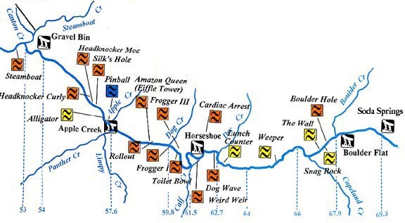
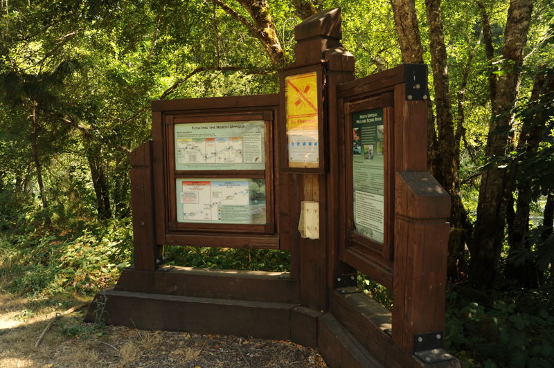
This run splits conveniently into five sections as identified by BLM and well labeled on river maps. Paddlers often combine sections or do portions of sections depending on flows and level of whitewater challenge desired. The river makes a great destination for trips where a big group can subdivide into smaller groups that paddle different segments before all coming back together in the evening. Before embarking on any section of the North Umpqua, check the BLM guidelines to avoid conflict with fishermen.
Segment 0: Soda Springs to Boulder Flat (1.25 miles)
The put-in is a little rugged for rafts but is an add on enjoyed by kayakers. This section is more continuous and a lot of fun.
The free-flowing Wild and Scenic North Umpqua River Corridor begins just below the Soda Springs Power House.
Segment 1: Boulder Flat to Horseshoe Bend (6.5 miles; float time 2-3 hours)
This is a beautiful 6-mile section of class II-III river with fast clear water, rock cliff vistas and intimate nooks with ferns on shore and salmon in the water. It also has a highway shuttle and a campground at the takeout (Horseshoe Bend CG). It's a touch easier than the segment downstream but still requires class III skills to navigate successfully.
Launch at Boulder Flat C
...Upppermost put-in below Soda Springs Powerhouse typically only used by kayakers.
The standard uppermost put-in typically used by rafts.
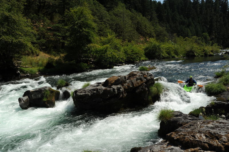
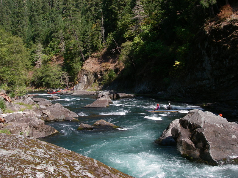
This scenic spot is located on the boulder-choked right side of an island, with an easy bypass on the left side of the same island. The reasonable entrance to the Garden is reached by going left at the small drop near the top of the island, and then cutting toward river right through a small channel. Caution is always advised as the boulders do catch any wood that has floated downstream.
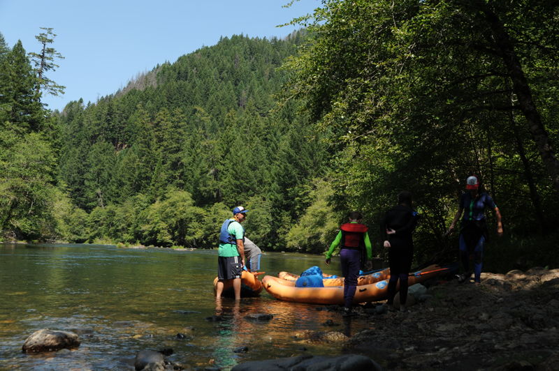
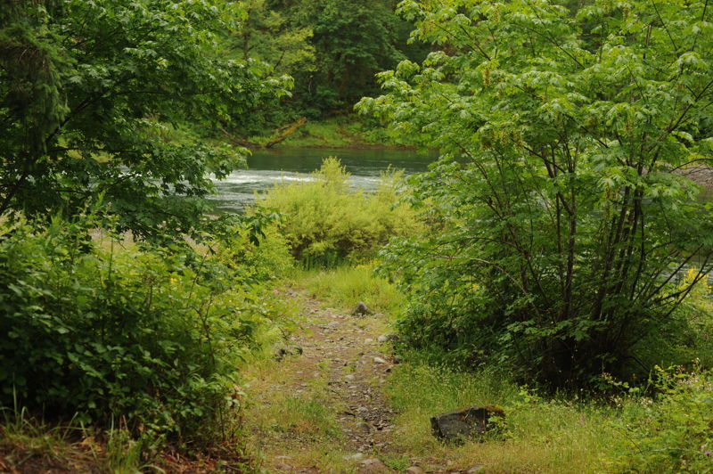
Good access point suitable for rafts with a short carry but limited parking.
Not a suitable access for rafts but sometimes used by kayakers as an intermediate access point for a short run down to Gravel Bin that begins just above Alligator and Pinball.
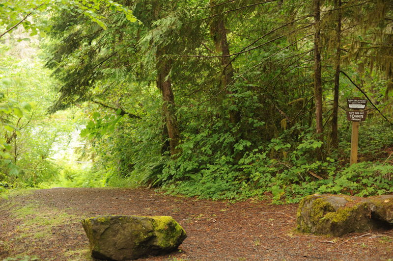
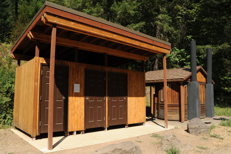
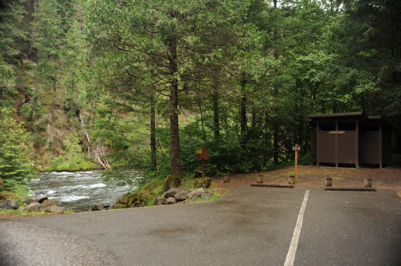
This take-out is suitable for rafts and well marked with ample parking and turn around space making it a good location to leave the majority of vehicles. You will also find a toilet and changing screens.
Ample parking and turn around space. A good access point for rafts.
Starting river right, turning left into rapid. Go through small gap between rock on right and submerged rock on left, getting hit from left with whitewater as you drop into the hole. Entrance is hard to see and afternoon sun blinds your approach. The entrance is very bony below 1000 cfs and almost impossible to run without getting stuck. At high flows, the technical entrance/rocky grounding can be avoided completely going wide to the right.
Right river center. Lining right side of your raft up with barely visible froth of water on right should guide you into correct position for drop. No other visible position marks. Come in slow and easy, last second course change is almost impossible. Position for rescue throw bags are close and available on right back at bottom of falls in slow, clockwise whirlpool. Kayak portage is easy around left side of falls on left bank, raft portage nearly impossible.
Scouting is a must as the prescribed drop is only about 6 to 8 feet wide. Perilous unseen boulders are on the right and a pour-over ledge, capable of flipping a raft, shoots off the left side of the falls. Below is a boil and hydraulic that may high-side a raft or roll a kayak and a whirpool which can circulate rafts or swimmers.
Sep 16, 2022
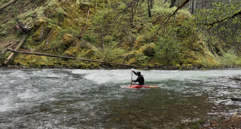
The LCCC, a paddling club based in Portland, travels the 3.5 hours to the Nump once per year, camping and paddling for 2-3 days in a row. This year we were lucky in that even though the Cedar Creek Fire was burning one drainage to the north we had good air quality. Even luckier, local rains brought up the flows by about 50 cfs each day.
Our trip started with a Friday run from Boulder Flat to Horseshoe Bend. The flow that day was about 850cfs, and we had some brand new members who were grateful to start out on the 'easier' section. On Saturday the 17th and Sunday the 18th we paddled from Horseshoe Bend, at 900 and 950 cfs respectively. This section is a delight at low water with clean lines, deep eddies, and lots of friendly play spots.
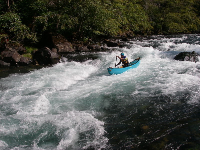
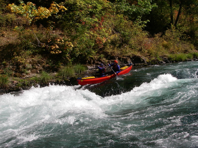
We had only one small raft in the flotilla, but also quite a few canoes and IK's to balance the preponderance of kayaks.
The largest rapid is Pinball and it follows on the heels of a drop called Alligator that tends to chomp on those newer to the river. We had one swimmer at Alligator but knew to set a rope on river right below it. Our newest paddler flipped at the top of Pinball and swam the whole rapid, saying at the bottom that it was so fun that he'd be willing to swim it again.
Jul 26, 2020
A summer trip on the North Umpqua. We put in at Horseshoe Bend and ran down to Gravel Bin with a stop for lunch and swimming along the way.
Oct 15, 2019
Not sure if the links above were supposed to go to the segment descriptions I think Teresa was referencing, but the BLM has 5 of them fairly well described such as her favorite-
https://www.blm.gov/or/districts/roseburg/recreation/wild\_and\_scenic\_river/umpqua\_river\_segment\_1.html