Pigeon
1. Walters Power Plant at Waterville/Big Creek to Hartford Bridge(Pigeon Gorge / The Dirty Bird!)
Apr 4, 2026
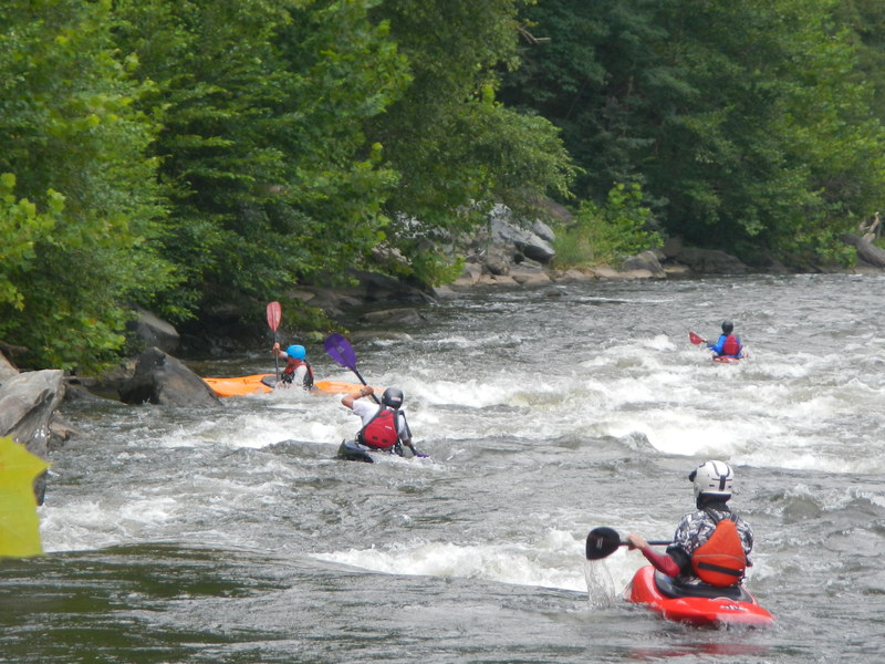
A group of us had a fun warm day of surfing our way down the run on 4/4/26. I'll add photos here of multiple runs over time to get this page more up to date.
Oct 8, 2025
Looked up the damn release time on a duke energy site. Was sitting there at 5:30 pm ready to go when the water started flowing around 5:45. Great run, mainly long wave trains and some good sized holes. Took about 40 min. Good put in and take out.
Mar 11, 2025
Hey friends! Due to the hurricane, the pigeon river has changed quite a bit! I like to think that the river is still a blast! Many new surf holes have popped up, many of the rapids have changed, banks were wiped clean of trees, parts of the interstate have fallen in, there's construction everywhere. Altough it is open and runnable, keep in mind there are places throughout the river where there are pieces of metal on the bank or in the river, and there is no shortage of strainers or trees in river. Most are very avoidble and are very easy to see.
The river has seen a significant change in the appearance of the water, the water is now normally a blue-ish green color and very see through. A lot of the rapids have seen monumental changes. The first mile is inaccessable to the public, duke energy has a one way road meant for just construction vehicles, they have shut down the put in by the power plant. It in is the works to create a new put in at the first mile bridge. There is very limited parking and we have been instructed to be mindful and curtious of the construction crews and rafting compaines. You can park at the AT trail parking, or on tobes creek but keep in mind the bridge is still an active construction zone with giant work trucks driving through and workers walking around throughout the weekdays.
Now as for the rapids, starting at the bridge.
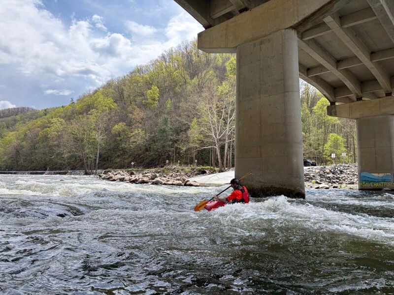
There are new rapids and a nice surf hole right before the bridge. There are two holes at normal flow here, ideally stay center go around the holes and avoid the pylon.
The line going into veggematic can be similar to as it was before, stay right cut left at the bottom. All the rocks through here have moved. Near the end of the right line there is a fun looking pourover with a little drop, you can't see it upstream but behind it is a nasty little rock that'll make you question your life decisions if you hit it.
(As of 3/11/25 there are two trees down on the right side, you'll have to pinball down around it. They are building a construction acess road on the right bank)
At veggematic you can also go to the left now if the water is high enough to cover the rock garden ~1500 cfs. There's a couple of big rocks but generally a nice slant all the way down it. I haven't been this way this much, however I have seen it successfully rafted with a 4 load at 1700cfs, no problems whatsoever. Looked really fun and splashy.
The stretch inbetween veggematic and big bend now has a few new rapids in it as well. The rock you could do the spin move off of is still there. There are two options here, go right around that rock and then get back left around the group of rocks and going back to the right at the end, or go left the entire way and cut back right again. Left line can get shoaly at lower levels but above ~900cfs its a nice ride. Towards the end there is a nice wave to the left right before the water heads back right. (As of 3/11/25, there is a tree down far off to the left, higher flows it could come into play ~2000cfs)
Big Bend itself did not see much changes, the bank on the right side (aka stoners beach) changed drastically. We have been calling stoner's mountain because about 8-10ft of rock was deposited there by the flood waters. The walls along the left bank have been washed away as well. The area is almost unrecognizable from what it looked like before.
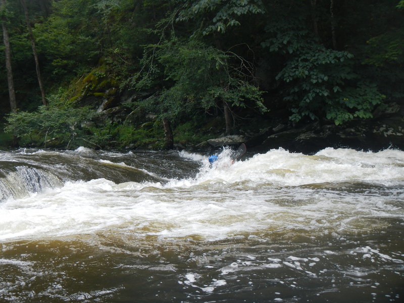
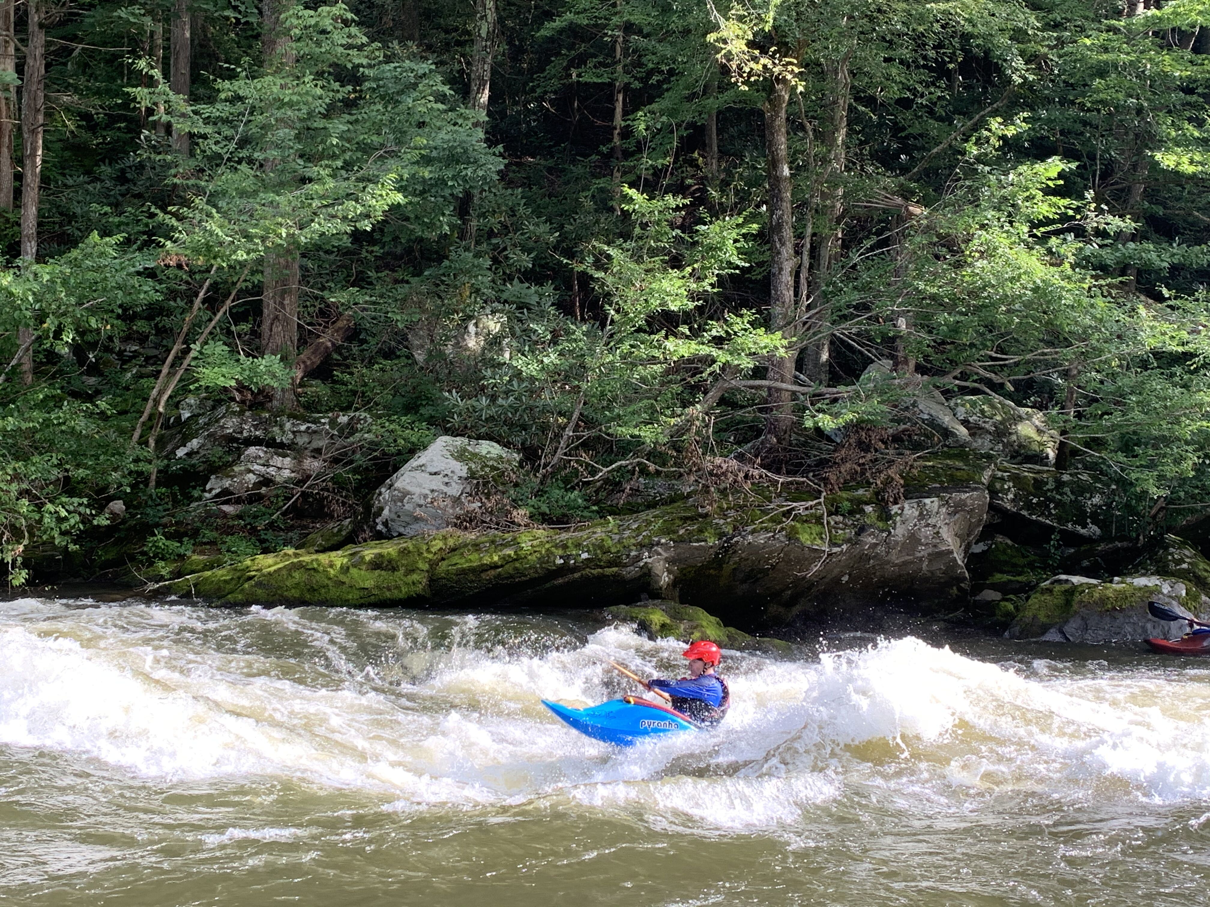
Snap dragon is drastically different, the rapid now has two holes in it and alot of wave train. It is significantly longer now and has alot more play in it. Easily my new favorite rapid! At higher flows (2000+cfs) I've been cutting to the right at the top and finding my way back left at the center to aviod the hole as it becomes pretty nasty.
Roller coaster now has a line with a drop for kayaks on the left, but be careful of the rocks at the bottom for flows under (~1200cfs). The middle line has a nice pourover with a good surf spot, then flows to the right through the bend like before. The big sideways wave is still there but only at flows greater than 1600cfs
A few of the rocks are still there in playground, but showstopper (the surf hole top of playground) is not there anymore and everything after that starts to flatten out. Here is where you really start to see the impact of the flood on the interstate. They have constuction all through here. The water runs to the right next to the rock road they've built for construction.
This is where it gets tricky to know where your're at because all of the rocks have moved and all the rapids are different. Through S-turns you'll see a lot of class 2 bougie water, maybe a small hole here and there. It looks very open and you can see everything. Most of the water flows and stays to the right here.
Guide is completely new, pyramid rock is gone, theres a couple of new holes spread out through it. The left line is there but can be difficult to accomplish, the hole on the left ('the soup') is no longer there either. Through the right line dodge two big holes and ride the wave train. The railroad wall has seen a lot of damage, and the river bed is much higher here than it previously was. The cove behind the wall on the left side after guide is now a mountain of rocks. Sheet metal is creating a bigger zipper rapid with a small wave train now.
Roostertail has flattened out at the top a little, the rapid seems more level with the beach that is to the right of it now. However, the wavetrain at the end can get pretty big and flows for a bit longer than before.
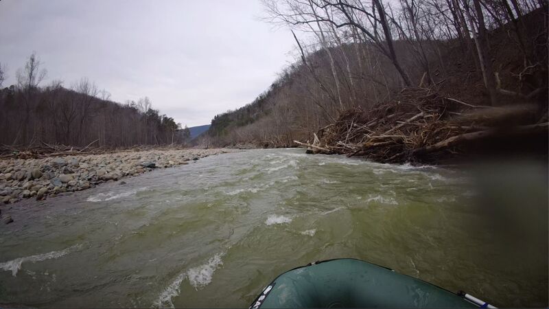
Brown's lake is just about the same, the banks are full with debris. Definitely shallower in most places, the water flows all the way to the left for most of it now. The creek that feeds into the river here had a bunch of silt deposited and blocked it for awhile, but with recent rains and higher water levels its washing the sand away beginning to open it up again.
Duck and run is now 'Dodge or die'! It is imperative that you start angling away from the right bank as soon as possible, there is tons of trees that got pushed up onto the bank and now the water runs straight into and under big piles of them. Stay to the far left and you will be fine. Other than that, it as a new feel to it as well, big wave towards the end in the center of the rapid with a medium wave train after it.
The part of the river after that where you would move in an zig zag fashion is now filled in with rocks all on the left bank. The island that separated the river left and right above duck and run has grown forcing all the water to the right. There are a few waves and pourovers through here.
Rock Garden is now the line to take if you had a full load of people, getting to the microwave line can prove to be quite difficult because of how shallow it is now. Theres plenty of water heading to the right at the top now and you can ferry back to the left at the bottom before basketball rock easily. Microwave has been washed out, theres a few new waves but nothing worth whitewater hiking to get to. The Right side of the river in this area is now higher up than the left, where as before it was the same height bank to bank
Double reaction looks about the same, but its all smaller. The tombstone rock has shifted apart a little, and the curler wave is still ther but significantly flatter. High flows it is a different story though, looks closer to what it was around 2800+cfs. You can now go on the left line of tombstone at normal release flows. (As of 3/11/25, there is a giant tree with a rootball blocking the left line at double).
Superglue is non-existent now, the rocks have all moved and even when the wave is somewhat there, there is a rock at the bottom of it which prevents you from getting in the little bit of surf that is left. There are some nice wave trains that form through here though, it's not what it used to be but its not a bust in my opinion.
Accelerator is a little more steeper but not by much, the biggest change here is being able to run a right then center line or even a left line if you're feeling it. I think the lines have opened up here a bit more than they used to be. When in doubt though, go over the small curler then stay right of center.
Governor's hole isn't much different other than that the right line opened up quite a bit so you don't have to go left here in a raft anymore.
Swimmers stretch now has a rock feature in the middle just before the jump rock. Other than the construction on the right side, it is pretty much the same. The channel leading into the outopost to the left at the end has seen so much rock and tree deposited it looks completly different.
Rock and roll changed substansially due the flood reloacting Johnson's Island. The rapid is now completely flat and doesn't open to the right unless the flow is above 3000cfs. As the flow goes left, a new rapid has formed here and we have been calling it 'Aftermath'. There are two channels on the far left, one cuts to the far left and goes by the Raft Outdoor Adventures outpost and the other cuts right to Aftermath.
There are a few waves headed down to the public takeout, theres a nice surf hole by the road that we call 'road hole' and the big rock right after 'your mom'.
The public takeout got flooded but is still there, the bp was severly flooded and has closed. The town of Hartford saw a lot of water and people are still in the recovery process, remeber to support small business in the area!
***Trip photos taken 2/22/25***
Sep 9, 2024
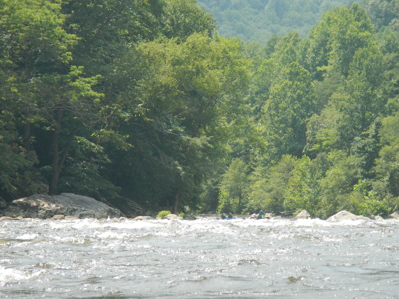
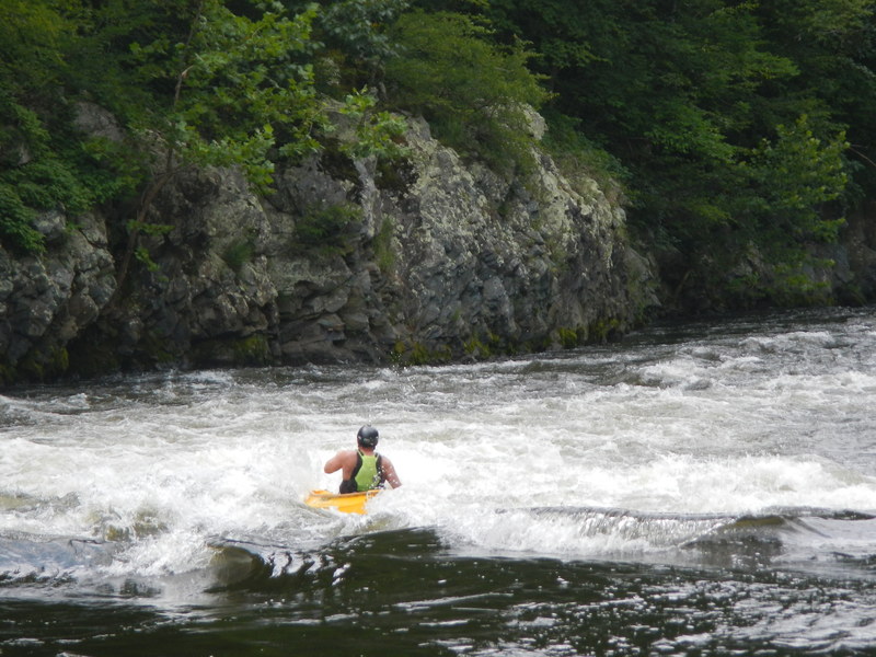
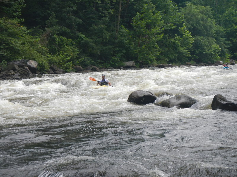
A collection of photos from the past couple summers of surfing, mostly at Roostertail.
Jul 10, 2024
Jul 13, 2017
As of 2017, there is now a shuttle service operating on the Pigeon River from May thru the middle of Sept.. It is run by a retired gentleman named Charlie, and the service is called Charlie’s Shuttle.
He generally hangs around the parking area for the general public take-out at the bottom, just upstream of the bridge and upstream of the majority of the take-outs for the raft services in a white pickup truck with a yellow rotating beacon. He charges $10 per person for the shuttle. If you want to be guaranteed of meeting him, he suggests you give him a call on his cell phone (423-608-0582) and arrange times. He will also do shuttles for the Lower Pigeon.
Jun 11, 2015
6-2-15 G in octane canoe and Eli in inflatable canoe, CT and Josh in maxi me. G swam toward the bottom of the first rapid but had good lines after that. G and Eli caught eddys and picked apart all the rapids. Ct and Josh got a few good surfs in small hydraulics.
Aug 10, 2014
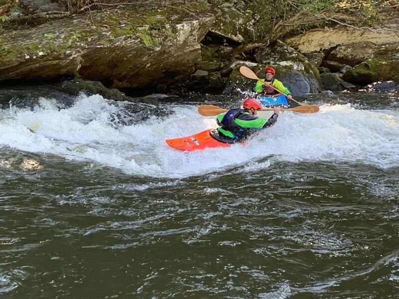
The upper hole at Double Reactionary. Most boaters use this hole to set their path for the remainder of the rapid.
Aug 9, 2014
Vegomatic (rapid just below the 1st bridge)
Aug 5, 2014
Waves & wave/holes on the right, green water on the left
Aug 5, 2014
Center (upstream) boater is hitting the hole. He's angled right which will usually send you into the eddy where the boater on the right is. My ideal line would be to clip the hole relatively straight which would put you just right of where the boater on the left (downstream) is. From there, you just boof over a small (2 ft) horizon line.
Aug 5, 2014
AKA Snapdragon, Dragon Baby. the hole is just to the right of the paddle in the black helmet / white shirt / red PFD, but is hidden by the horizon line
Aug 5, 2014
View from the eddy on river right by the bush. Left Line - from this eddy, angle across the river and catch the eddy by the large flat top boulder on the left (or blow by it) From the eddy you can angle right and finish by the pyramid rock on bottom right or take a line ~ 5-6 ft off the left bank. There is a large pourover and some funky water in the middle that most people will want to avoid.
Jul 22, 2014
Open boater running the Highway - the curly wave at the top is your landmark. Hit the breaking part and angle about 30 degrees to the left. Photo was at 2 turbines / 1400 cfs.
Jul 14, 2014
Tony S and Pete G demonstrating the center line at powerhouse
Jul 14, 2014
Hal surfing a small hole above BFR
Nov 15, 2011
I hate my life but at least this makes it bebarlae.
Nov 15, 2011
I thought I'd have to read a book for a disvcoery like this!
Nov 15, 2011
AKAIK you've got the anewsr in one!
Nov 26, 2010
FYI: The info line for Walter's hasn't been updated since September 5th -- No use trying to check levels there to try and catch a winter release..... boo!
Nov 11, 2009
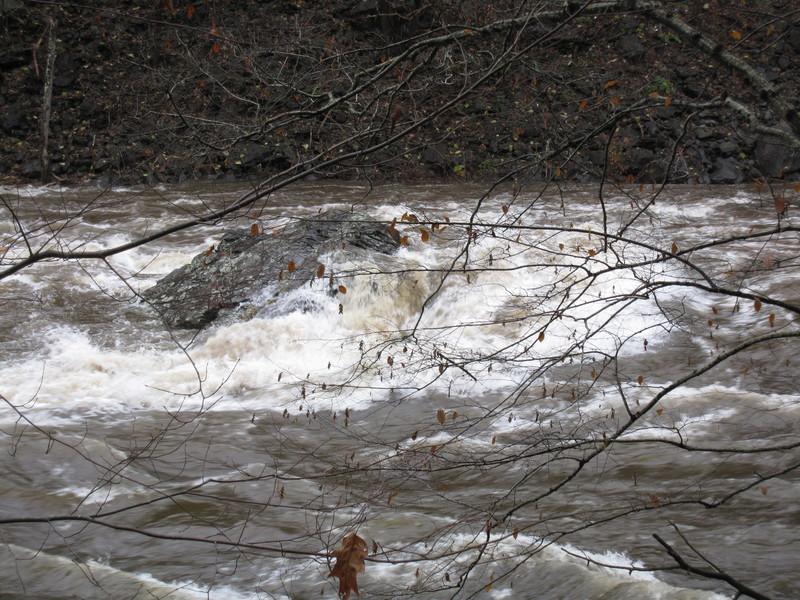
This is Big Rock at 12,000CFS.
May 5, 2009
The Pigeon Runs alot in the off season, the Key to catching it is knowing the right # to call and how to 'read' the data that you get. The number is 1-800-899-4435, you want the walters (?) lake level and in-flow. This is posted at 8am every morning. what I was told (and seems to hold true) is when the in-flow is over 400-500 cfs the lake fills up around a foot an hour. If the in-flow is this high or higher and the lake is 1 to 3 ft down then they will release at least some. That said it relates to the weather, summer dry, no rain= no release. Winter, fall or spring and rain is forcast the you are a go. The higher the in-flow the better your chances are. I lived there for over 2 yrs and have been skunked by looking at the take out and saying it runing lets go. They can and will cut it off at anytime, exp. if they see you attempting a moon light run. That has been one of the best things I have done in a boat (raft, wish I was in my Kayak). Hope this helps.
Apr 10, 2009
I have worked as a commercial guide some time now, living in the southeast. I call the Pigeon River home in the spring and summer months, and spend as much time playing on that river as working.
This spring, thankfully, we have gotten a substantial amount of rain, and it seems as though a couple rapids have changed. The biggest change that has happened this season seems to be the bottom hole of Lost Guide, the first class IV rapid, about 3 miles from the put in. It seems that some rocks have moved, making the bottom of the rapid steeper, and also making the hole more of a hydraulic, and less of a wave. This has become a GREAT surf spot, for both kayaks and rafts, with a huge eddy on the river right side, just below the hole. Its easy to paddle into, and super easy recovery below the rapid. This has become the best surf spot on the Pigeon by far, hope everyone enjoys!!
Feb 4, 2008
spam snipped
Jun 30, 2007
Sneek line at accelerator. Kind of looks like a hole, but it isn't, very smooth easy line.
Aug 26, 2006
Very soon, Blue Ridge papermill will be coming up for its new permit. I hope AW and any other whitewater or outdoor enthusiast will do there part in fighting the renewal of this permit. The Pigeon River is at stake.
FYI,
an alternate line at Lost Guide is to run far right (about 10 ft from the river right bank) and then cut left after passing the hole.
At Accelerator, start river right at a small curling wave and cut diagonally left across the rapid.
For the post about Maytag be careful running this hole. Ther is rebar in the hole and it can do some damage. Rooster Tail does have rebar in the hole. I have been a guide on the river it is there.
May 25, 2005
A Report From the Pigeon:
a local rafting company manager was in a shredder yesterday with us three hardboaters and he pointed out new rebar lying lengthwise in the playhole after LOST GUIDE RAPID. It's normally called 'ROOSTER TAIL RAPID' -- the next rapid after LOST GUIDE. I didn't know its name but he said that's what everybody calls it. The rafting mgr said they normally allow their customers to jump and swim this normally safe rapid but now with the rebar they can no longer do that. He pointed out that if someone were to roll at this popular playhole it could do some serious damage to one's head. I skirted the meat to the right yesterday and was fine. My two friends from Knoxville ran the meat and were fine. It was about 3000 CFS so we didn't really see it but the mgr. assures us that at regular flow it's visible and quite a problem. So, he requested that we spread the word to all hardboaters: 'Catch an eddy way before ROOSTER TAIL if you swim LOST GUIDE and it's probably best to not play in that wonderful hole anymore.' You can still run the meat of the rapid and not get hurt --- well as long as you don't flip in the meat.
By the way, the bottom hole at the Rooster Tail rapid is still good to surf, the top hole is the one with the rebar in it.
He also said that the river widened a bit after the floods and therefore the Pigeon holes aren't as good as they used be.
Apr 1, 2005
This river has change since the floods of 2004, like most rivers here in the SE. Snapdragon is gone as well as the play immediately below this. The hole at the bottom of Guide Sucker is good, not the ledge, but the hole next to the rock. There are tons of holes to hit on the fly. The waves at Rollercoater are gone as well. Still lots of fun but it is 'The Dirty Bird!'
Apr 30, 2004
Quite possibly one of the best river runs in the south! If you've never checked out this totally awesome river you definitely should! Lots of fun, pillowy water that can treat you well if you give it the respect it deserves. When you get to Hartford, don't get out! There's some fun ledges below the traditional take out that can be a lot of fun to play on. Oh yeah, and Maytag near the lower run's takeout! Pretty fun rapid with a pretty munchy hole! This river has improved tons in recent years about people should support an environmental victory! If you're ever in East Tennesee you have to get on this river and try it out! Happy paddling!
Oct 25, 2002
One more little note about Accelerator:
It was created when the folks building
I-40 blasted out part of the river bed.
Thus, it's an unnatural rapid. being
upside down in your boat here is real
bad, as the natural angular cleavage of
the rocks in the area and the blasting
combined make for a rather chaotic
river bed. I've run the hole here a
whole lot of times (I was a guide
there), and it is frequently run by hard
boaters. But for pete's sake, hit it
straight. There are a lot of nasty little
obstacles just below. if you want to
avoid the hole, I would suggest setting
up more center. There's a green
highway that will take you straight
down.
Oh, and at lower flows, running the
cheat line on the right in the Guide can
almost be harder and more
dangerous from a flipping stand point
in the hole. That side is real shallow,
and I've seen a number of head
injuries there from boaters who rode
down underwater. Hit the hole straight
and you're golden.
May 2, 2002
A few additional notes on the Pigeon:
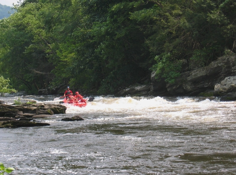
Powerhouse rapid, the first ww after the putin, is a 100 yard stretch of solid Class III. Just after that is Full of Water, a short Class III drop that is playable.
Lost Guide is a Class III rapid with a Class IV slot (raft line middle, just left of the pourover). I've seen kayaks and people held and recerculated in the hole and a number of commercial rafts flip there. The hole isn't as sticky now as it once was 5-6 years ago (spring floods shifted the rocks there) when a raft guide had to be resusitated on the rock just below the rapid.
The other 2 rapids which, along with the Guide, constitute the Big 3 on the Pigeon are Double Reactionary and Accellerator and you'll find them around 3.5 miles down. On Double, the entire river is pushed through a 15-20 foot slot on river left, where Tombstone rock creates a 4-5 foot curling wave to the right. There is also a hole in the entrance that slows you down before getting to the curler. The rapid is III+/IV depending on level.
Just after Double, on river right, is a great P&P surf spot for advanced paddlers called Super Glue. It's very surfable, but there is great potential to smack the rock that causes the hole if you flip...quite a few teeth have been lost there.
Accellerator is about 75 yards after Super Glue. It is a 25 yard stretch which loses 12-15 feet of elevation, with a river wide horizon line. The kayak line is right-to-left, skirting the Class IV President's Hole at the bottom. The raft line is to barrell over the hole. The good thing is either way you will hit it with a lot of speed. The bad thing is it is the worst swim on the river (Powerhouse is bad, too, but the rock aren't very sharp...Accellerator is lined with some cutters). There is also significant foot-entrapment risk here.
Summer releases are usually between 1,000-1,200 cfs which is pretty tame. If you get the chance to go 1,800 to 2,000, it'll be a pushy, fun ride. 2,500 and up starts washing out the drops but still makes for a fun raft trip.
BTW, the river has really made a lot of progress returning to health in recent years. According to TWRA it is again supporting a significant fish population and is on par with most other area rivers as far as pollution levels (thanks for your work, AW!!!). However, it still has a brownish tinge and some suds from the Canton, NC papermill releasing color into the water.
Jan 1, 1900
Put In Stretch for the Upper Pigeon
Entrance to Vegomatic, first rapid below the first bridge.
First Rapid below the first bridge
Second rapid below the first bridge
Line for running the meat of the Lost Guide
Lower Section of Lost Guide
Kayak Sneak route through Lost Guide along river right, there is also an easier sneak route on river left not visible in this picture.
Bigger waves than this shot makes it look like, there is a large eddy on river right between the two holes. Easiest line is river right using the eddy, the most difficult is right down the middle, the far left line falls somewhere in between.
Jan 1, 1900
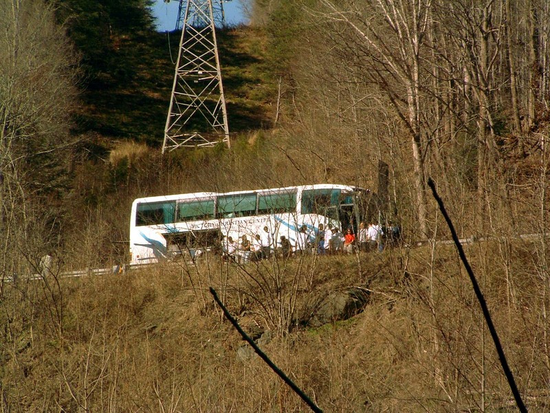
This bus was broken down right above the power plant at the pigeon. that sucks for them
Jan 1, 1900
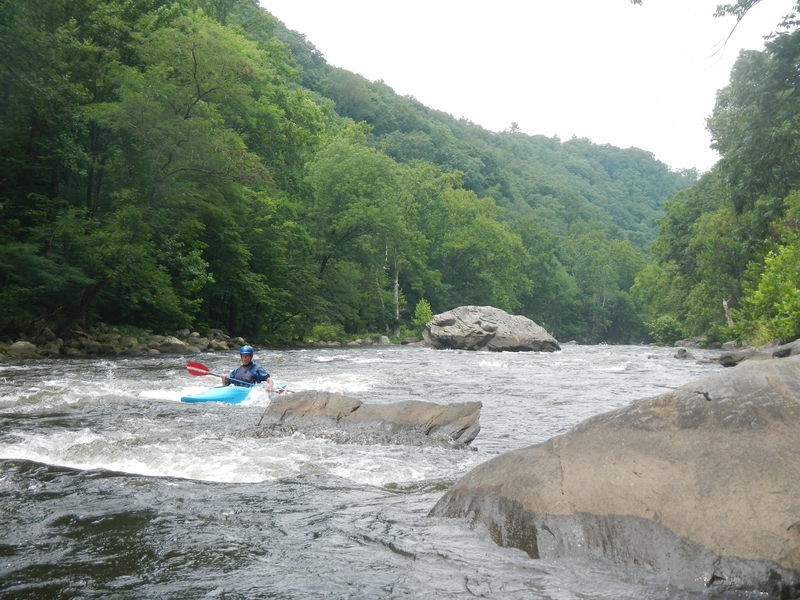
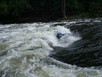
See the terror in his eyes!
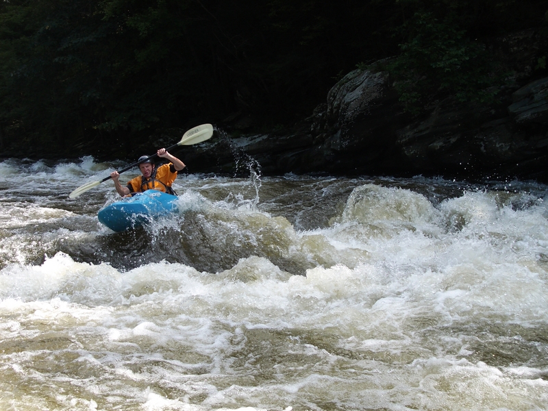
She is MEAN!
Jan 1, 1900
This is a medium to high flow shot of Snapdragon, probably around 1,800.
Jan 1, 1900
This is a really fun surfing wave, with a good beach to take a break. Good eddy and a lot of room if you miss a roll
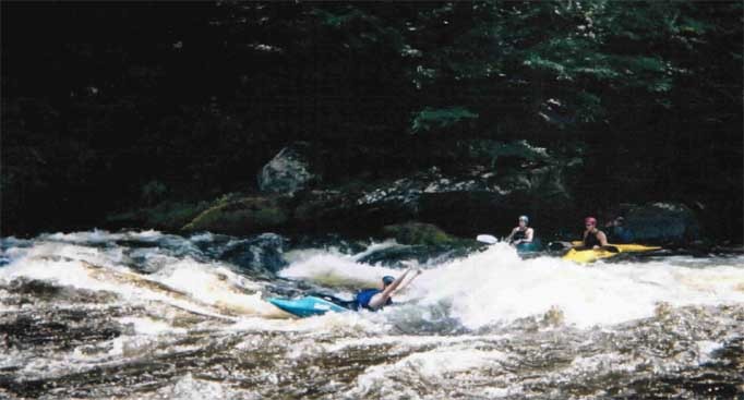
Last rapid before it flattens out, big nasty holes