Weber
06. Scrambled Egg Bend to 89(The Eggs)
| Difficulty | III-IV+ |
| Length | 2.7 mi |
| Avg Gradient | n/a |
| Gauge | Weber River at Gateway, Ut |
| Flow Rate as of 42 minutes | 214 cfsbelow recommended |
| Reach Info Last Updated | February 19, 2024 |
American Whitewater spent several years participating in the relicensing of a hydropower dam on Utah’s Weber River that dewaters a stretch of whitewater known as the Scrambled Eggs run. In 2018 we reached an agreement with all parties calling for improved take-out access, as well as four pulse flow [...]Read More
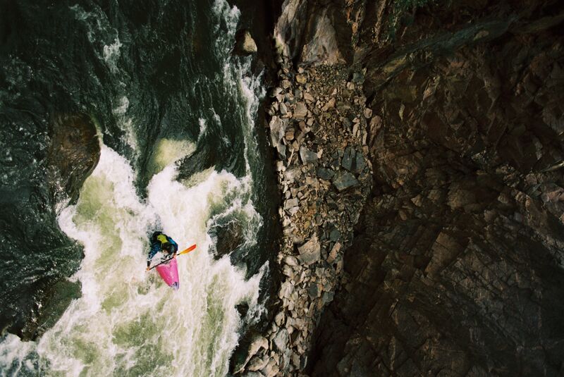
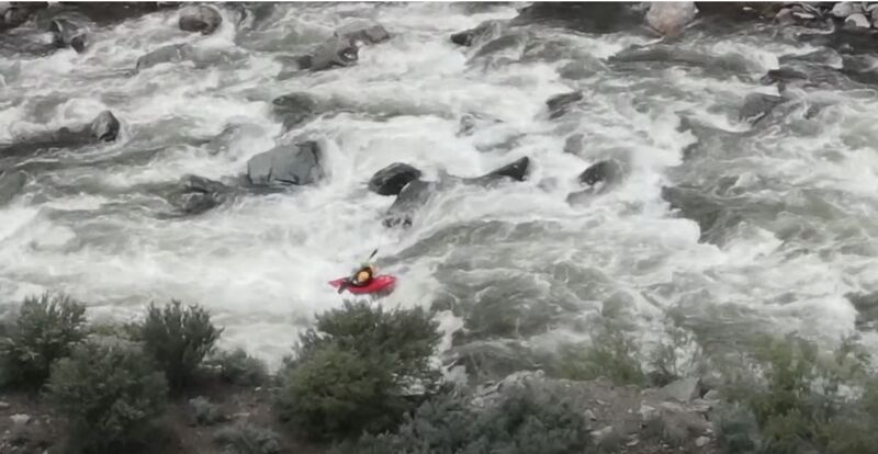
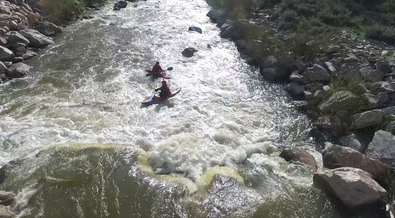
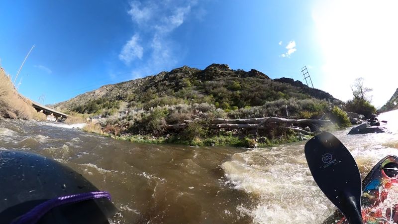
This is the classic Weber whitewater run. The Eggs are a unique boating experience indeed. The put in is, well interesting, as are the drops themselves. The run itself is short with a nice warmup in the lead-in and the bend, then a drop that can surprise you, some boogie water, then three main ledge drops and a class 2-3 run out. The run can be complicated by various amounts of debris in the water.
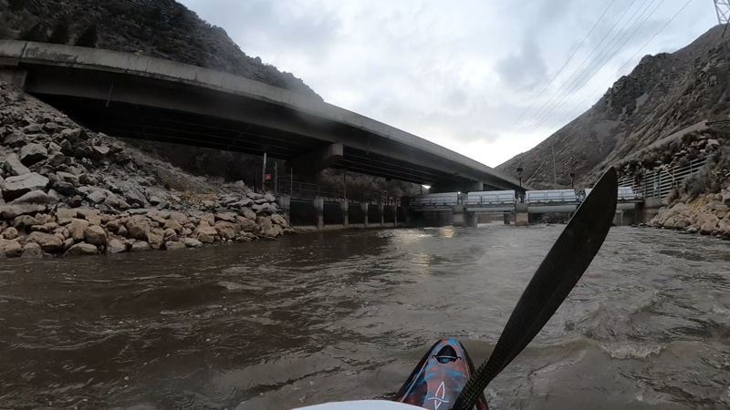
The put-in for the run is accessed from the eastbound I-84 rest area before Mountain Green. From the rest area, take a right and drive downstream and park by the dam. Walk along the fence a 100 yards downstream from the parking to the designated fisherman's access to put in. Paddle under I-84, and in a 1/4 mile get out right if you want to scout the bend. You can scout the bend and the 3 drops at once, or paddle the bend and get out river right again to scout the drops, and set safety if desired.
At lower flows, the run is technical. The low water line usually enters left by a large pipe, then moves center, then right (past the left cave eddy which makes a good breather at medium flows), then a move left in the bend. As it approaches 1500 it becomes much more pushy, sticky and challenging. The second drop is often the stickiest. Its possible to portage the first two drops and seal launch in below the second or third drop if you don't like the looks of the first two. A swim would result in a very long time in the water at these flows and safety is hard to set from the right bank for the bend; easier for the drops. The runout below the drops becomes nice III/IV- at high flows; its too bad there is no easy access to putin down there. It is possible to portage the entire bend and drops, to keep a high water run in the IV- range.
At the end of the Canyon, just past the powerhouse on river right, be sure to get out on river-left just upstream of the recently-rebuilt diversion dam. After getting out you can either walk downstream on the Forest Service road
...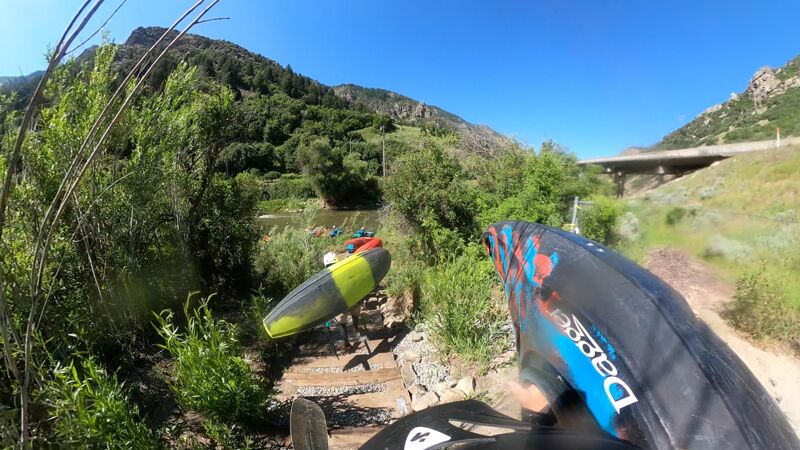
Pull into the Rest Area and then drive to the downstream end of the area follow the signs to the river access that is well below the dam (river right). This area will be rebuilt in the coming years to be a nicer more formal access area.
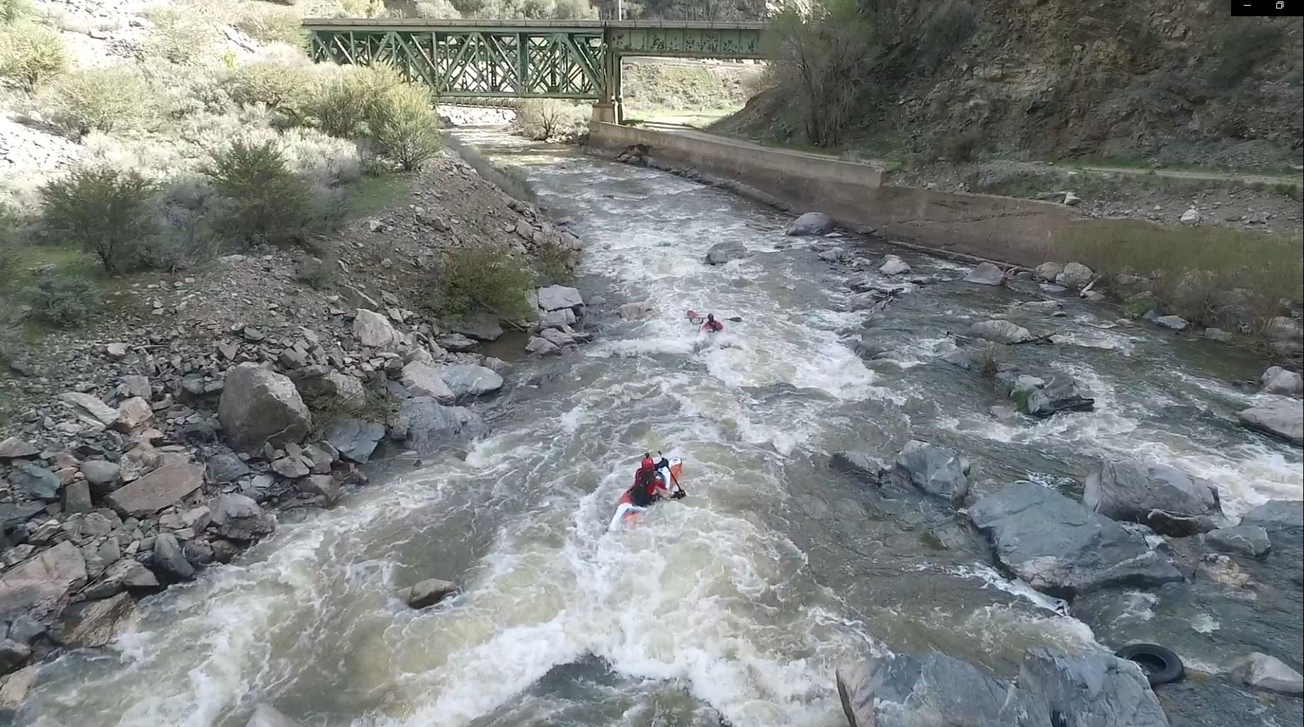
From the put in to the top of the Bend is fairly short so get your practice eddy turns and maybe a roll. The top section of the Bend is enter going left, then moving center following the majority of the water. You can enter right, though at lower levels you will be hitting a lot of rocks. Towards the middle bend there is a good breather eddy in the center of the river.
Entering Middle Bend, there are two choices Center or left, a straight shot down the middle through a couple holes or left side down a S-Wave type chute between rocks, both are really fun.
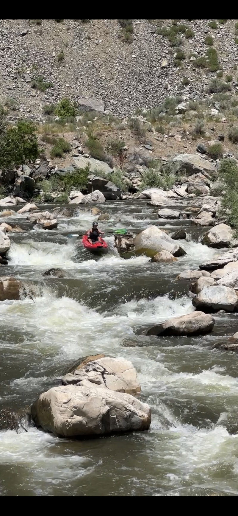
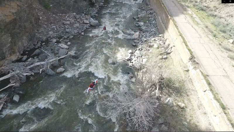
In this Lower Bend section, it is pretty rocky, and there are multiple channels to take. I typically start right and move left following the majority of the current. There are two steep drops in this section
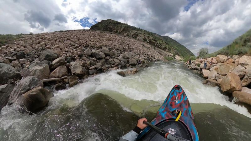
Drop 1 in the series of 3. kayakers right has a small slot you can take at medium flows. At lower flows there is a rock at the bottom of it, best to boof more center at lower flows. At high flows this becomes a huge wave or hole depending on level.
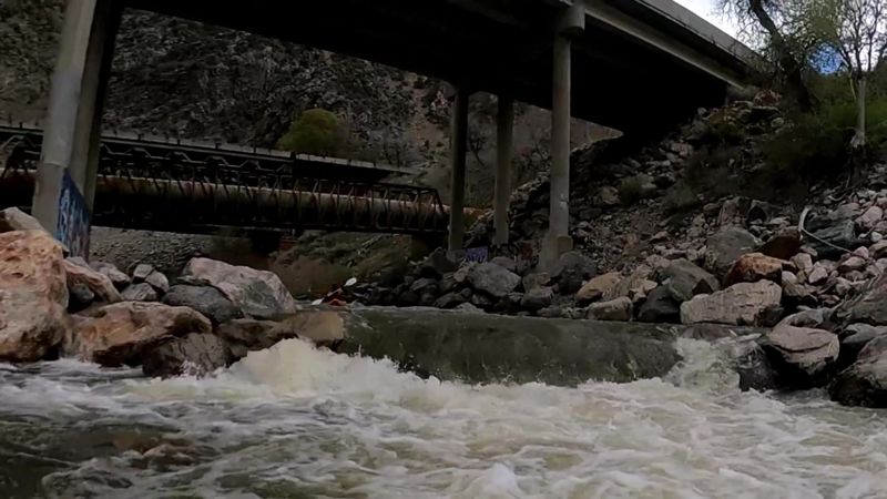
To scout Drops 1,2 and 3 there is a eddy right side under the freeway bridge. a short walk under the train bridge will put you at the 1st drop. boulder hop to see 2 and 3. and if you want to portage there is an eddy just down from drop 3 where you can put back on.
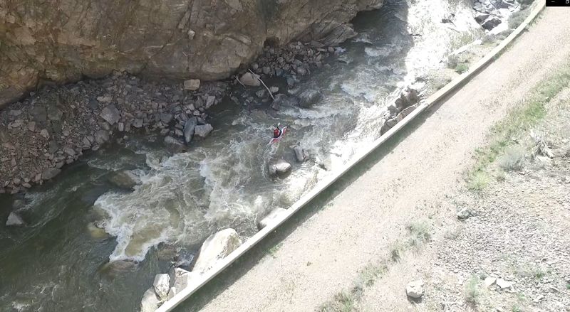
When coming off Drop 1, you will see a big rock in the center of the pool between the two ledges. You can go on either side of the rock. It is possible to take this drop left, center or right, just hit it straight. The pour over can really mess with you. I have seen this pour over hold kayaks for minutes, and recirculate swimmers, it is not a good place to swim. This also becomes a big wave or hole at high flows.
Drop 3 is a little farther down stream than the space from 1 to 2, and is rather jagged, not straight across like 1 or 2. Pick your diving board and boof.
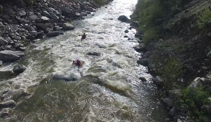
Drops runout is a nice little wave train shortly after drop 3, that has some rocks to avoid. Some people that portage the drops put in after this to get the Class III section below.
THIS IS A MANDATORY PORTAGE, PLEASE DO NOT RUN THE GATES!
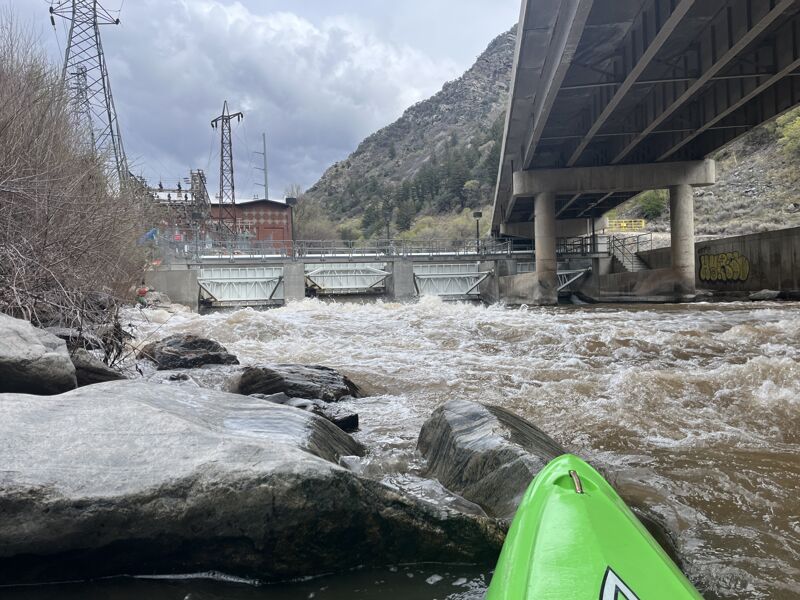
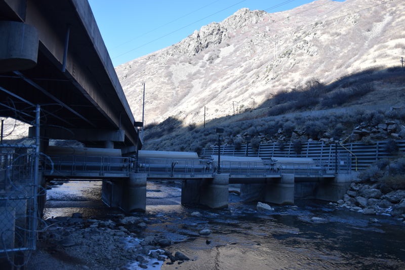
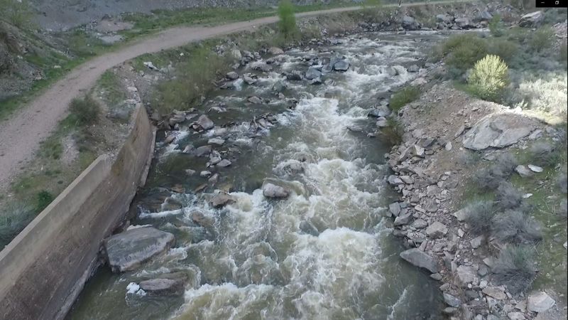
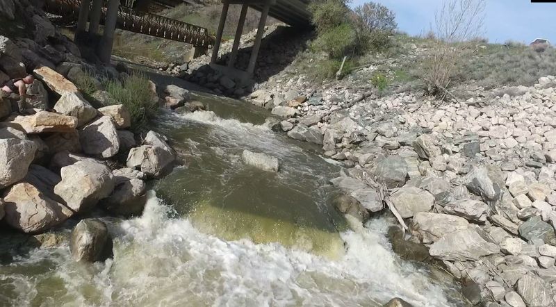
As you come to the Power Plant, prepare to portage the diversion dam just downstream on river left. Just upstream of the diversion dam on river left is a grated canal entrance that during the warmer months (when the diversion dam gates are closed) takes all the water from the river. It is a fairly large pool in this area but the water is moving here so approach and take out with caution. Take out upstream of the grated canal, walk under the bridge on the obvious US Forest Service road downstream, respecting all fencing and signs. In about 100 yards a canal overflow often (but not always) restores some water to the river and you can slide back into the river to paddle out. If there is not water you'll need to walk to your take-out on the Forest Service road.
There are 4 gates / openings in the diversion dam, and when they are open the river flows freely through the bridge-like structure. Paddlers sometime paddle through the second opening from the left when the gates are open, but this is strongly discouraged. When the gates are closed it is impossible.
The re-entry point from the portage. Its about 100 yards, from the power plant, follow the road past the canal re-entry and then watch your step coming down the hill. Navigate around the tree to the small eddy. Enjoy the rest of the float, it is pretty wide and shallow until the take out.
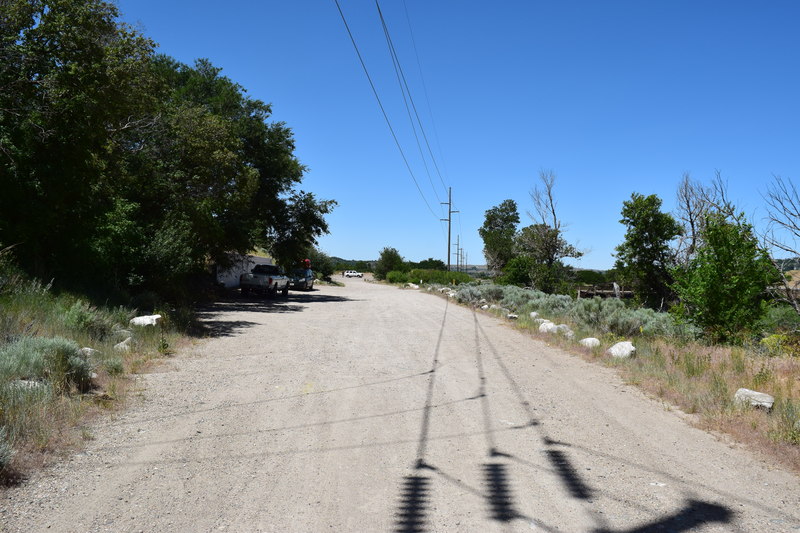
Take out upstream or downstream of the old bridge be mindful to watch for the dangerous diversion dam just below the bridge. Park out of the way in this general area just downstream of the gate on the Forest Service Road leading up the canyon. You can walk up the Forest Service road to the diversion dam if you want to scout the egress above the diversion dam.
Jun 10, 2025
Apr 17, 2025
In the midst of the rain we drove up to the Weber for a good day of paddling. The upper gate to the put in is still closed for construction on 84 but was easy to get around. The upper dam had a fire and as mentioned in the alert so its fully open. No wood or anything else notible to report. Below the portage quite a bit of water was coming over the divertion spill was and also from under the dam.
Jul 22, 2023
First time running this. Plenty of challenges with rocks. Scraped over rocks throughout. Overall a ton of fun and challenging.
Jun 25, 2023
A great lap with 5 others today, Flows using the PacifiCorp gauge were about 715cfs. Which is a good medium flow. The drops were ran by a few of the guys. Drop 1 Center right, Drop 2 Right and drop 3 anywhere. There is a great boof before the power plant, right in the middle of the river.
Video of todays float can be seen here. Eggs 715 cfs
Jun 21, 2023
Super good trip, the bend had plenty of line choices, just remember to lean forward or you might get stern squirted. On the scout of the drops it seemed like the rocks had shifted with the higher flows. Looked like there was a line on the left of drop 1, then right on drop 2 and center on drop 3. We put back in between Drops 2 and 3. The wave trains and boofs were amazing at this flow. Here is a link to a video I made https://youtu.be/Zd1fJHplCFs
May 8, 2022
This was a full Eggs run, put in to the bridge diversion dam, this is about the minimum flow that I would run this full section. The 498CFS on the USGS gauge at Gateway transfered to about 220cfs on the new Pacific Corp gauge: https://www.pacificorp.com/community/recreation/water-release/weber-river.html
Here is a link to a Youtube video at flows about 310cfs
***At these lower flows, it is very rocky, a dry head run would be best, and the pin potential is high***