Cedar River
Landsburg bridge to Maplewood Roadside Park
| Difficulty | II |
| Length | 22 mi |
| Avg Gradient | n/a |
| Gauge | Cedar River Below Diversion Near Landsburg, Wa |
| Flow Rate as of 30 minutes | 170 cfsbelow recommended |
| Reach Info Last Updated | December 2, 2024 |
The Mountains to Sound Greenway stretches more than 100 miles along Interstate 90 from the shores of Puget Sound in Seattle, across Snoqualmie Pass, and into Central Washington. Encompassing over 700,000 acres of public land managed by local, state, and federal agencies, the Greenway protects an extraordinary landscape that [...]Read More
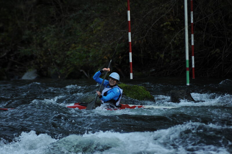
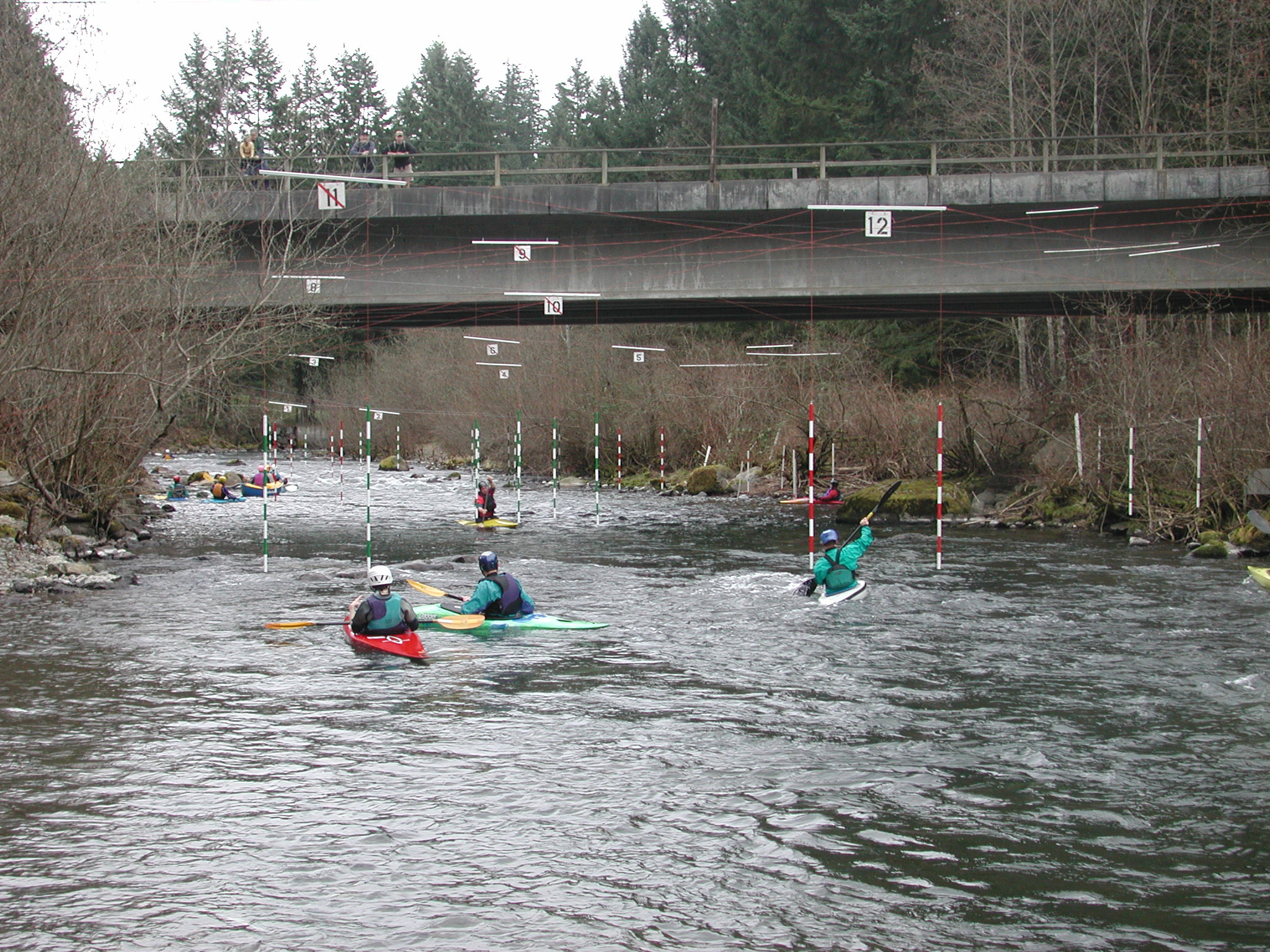
The Cedar Rivers is the site of the annual Cedar River Slalom race typically held in late March every year. For additional information see League of Northwest Whitewater Racers site. The race course is set up as a permanent whitewater slalom training site that is maintained by local volunteers throughout most of the year. Good flows begin with the fall rains and continue through the spring.
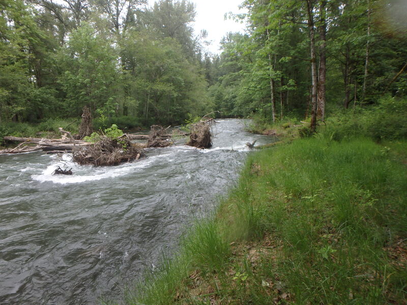
For those who run the river, small boulders provide good eddies and ample opportunities for practice. Some sections pass through braided channels that can collect wood debris and paddlers need to be aware of wood hazards particlarly at higher flows. King County has purchased a number of parcels along the river that are now managed as natural areas with forest restoration actively underway in the riparian corridor. As you approach Renton evidence of human impacts becomes more evident. This lower section is a bit easier in terms of whitewater and sometimes used by instructors working with beginners.
Access Logistics:
To reach the Landsburg Whitewater Slalom Course, the uppermost put-in, take Exit 17 (Front Street) off I-90 in Issaquah. Drive south on Front Street through downtown Issaquah. Although the road changes names a few times, continue south for 12.5 miles until you reach the Landsburg Bridge, which crosses the river. Along the way, you’ll pass under Highway 18 and the Hobart store/post office.
For those planning to run the river, you can go from Landsburg down to Lake Washington, with several access points along the way. A popular intermediate access point is Rotary Park, located at the Highway 169 bridge near the junction with Highway 18. This access point is 7.5 miles into the run. If you wish to run the lower section (an additional 9 miles), there’s a take-out on the right bank at Maplewood Roadside Park, located about a mile east of the Highway 169/I-405 junction. Refer to the map for additional acces
...
The put-in is located on river right at Landsburg Park, which is managed by Seattle Public Utilities. Access to the site involves a short walk, suitable for hand-carry craft, leading to the top of the slalom course.
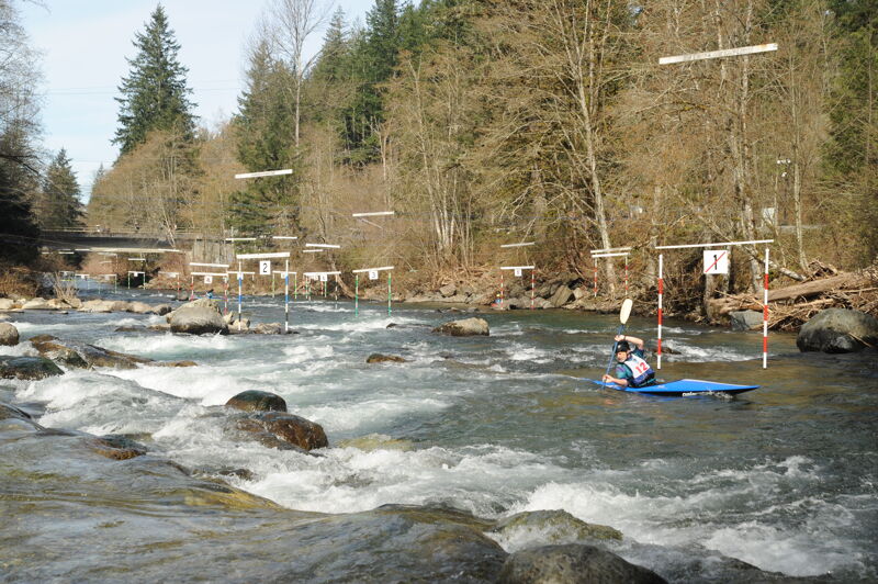
The rapid at Landsburg was engineered to facilitate salmon passage upstream where the pipeline crossing under the river. Local slalom boaters came out when the boulders were being placed to create a river environment that benefits salmon while also enhancing the whitewater slalom course that existed at this site. Paddlers typically park on the downstream river right side of the bridge at the trailhead for the Cedar River Trail. You can then walk your boats up to the park on river right and put in at the top of the slalom course. The League of Northwest Whitwater Racers typically organizes a slalom event here in the spring and fall. Local slalom racers maintain the course and go to this site to train.
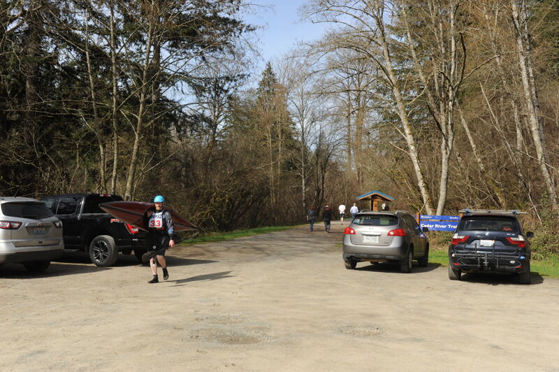
Access on river right downstream of the 276 Ave SE Bridge at the Landsburg Trailhead managed by King County Parks. The access improved when the site was identified as a location for gravel augmentation that provided an improved access to the water at the downstream end of the slalom course.
Start of the Dorre Don Reach Natural Area that extends for approximately 1.5 miles. The Dorre Don Reach Natural Area is a King County Department of Natural Resources and Parks (DNRP) Ecological Land. Ecological Lands are managed for the protection of their ecological value, with appropriate public access.
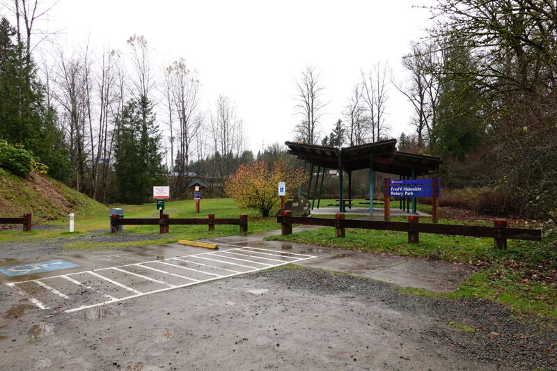
An intermediate access point at the Fred V. Habenicht Rotary Park with good low bank access. The park is on river left upstream of the Highway 18 and Highway 160 Bridges. It is about a 100 yard walk from the parking area to the water across a grassy lawn that has a picnic shelter.
The Cedar Grove Road Natural Area is managed as King County Ecological Land. Ecological Lands are a category of King County Water and Land Resources Division (WLRD) properties managed for the protection of their ecological value. Appropriate public access and interpretive opportunities are accommodated on these sites where they do not harm the ecological value of the site.
The Belmondo Reach Natural Area is managed as King County Ecological Land. Ecological Lands are a category of King County Water and Land Resources Division (WLRD) properties managed for the protection of their ecological value. Appropriate public access and interpretive opportunities are accommodated on these sites where they do not harm the ecological value of the site.
Cedar River Park is a 23-acre community park situated along the Maple Valley Highway administered by the City of Renton. The park includes the Renton Community Center, Carco Theatre, and Henry Moses Aquatic Center. River access is on river right just upstream of the I-405 Bridge.
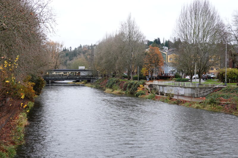
Access on river left at a park administered by the City of Renton just downstream of the Renton Library that spans the river.

This park is managed by the City of Renton and is located on river right where the Cedar River joins Lake Washington. The access has a boat ramp.
Apr 5, 2026
It was a beautiful April day for the Cedar River Slalom race with 40 racers from the United States and Canada with a wide distribution of ages.
Apr 27, 2025
375 cfs- I got stuck on rocks a few times- passible but it would be better with more water. I only had to portage at the Dore-Don log jam. This is well marked with a red sign under the bridge. Portage starts 75 yards down the old right channel and is hard to see from the channel, but is well marked once you get into the trees. There is one river spanning tree that I had to roll on my side to get under. There is a marked log jam “danger stay right” where you can take the right channel and short portage, or you can stay right in the main channel if you are confident in your skills. Numerous other trees and logpiles that were straightforward to navigate without taking out.