Green
2 - Kanaskat Palmer State Park to Flaming Geyser State Park(Green River Gorge)
| Difficulty | III-IV |
| Length | 12.1 mi |
| Avg Gradient | n/a |
| Gauge | Green River at Purification Plant Near Palmer, Wa |
| Flow Rate as of 1 hour | 238 cfsbelow recommended |
| Reach Info Last Updated | April 2, 2026 |
Boaters have a long history of working for protection of the Green River Gorge. Explored by Wolf Bauer and members of the Washington Kayak Club (one of AW’s original founding clubs) in the mid-1960’s boaters quickly realized the Green River Gorge was one of the most spectacular river canyons [...]Read More
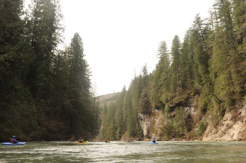
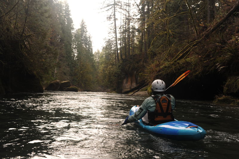
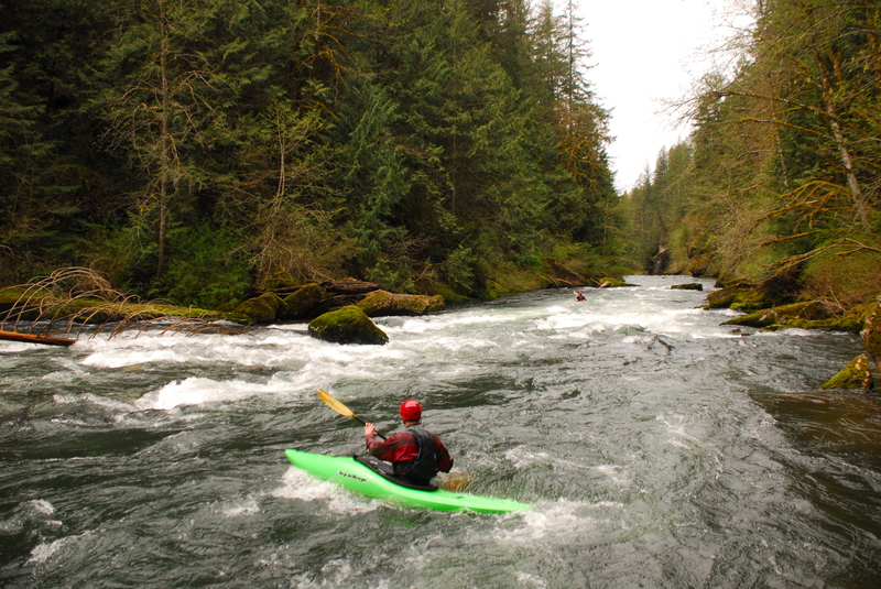
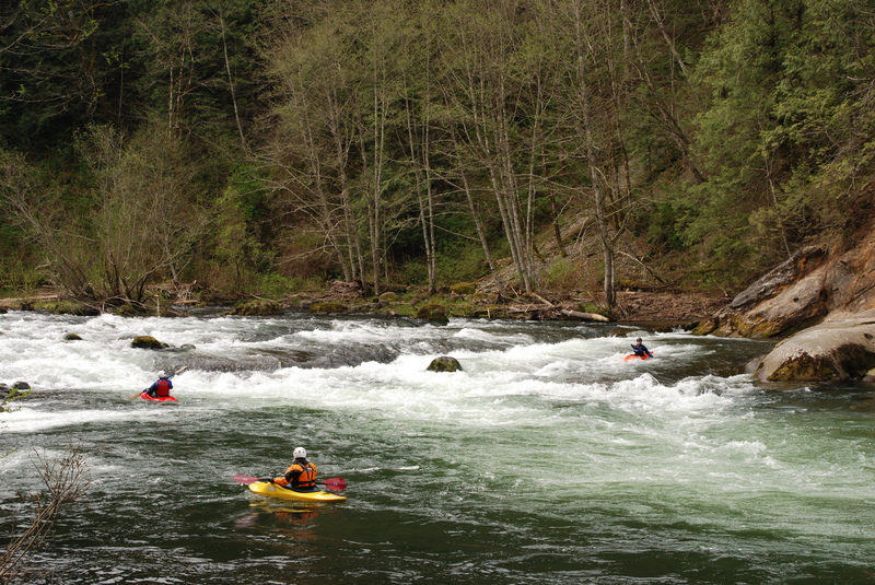
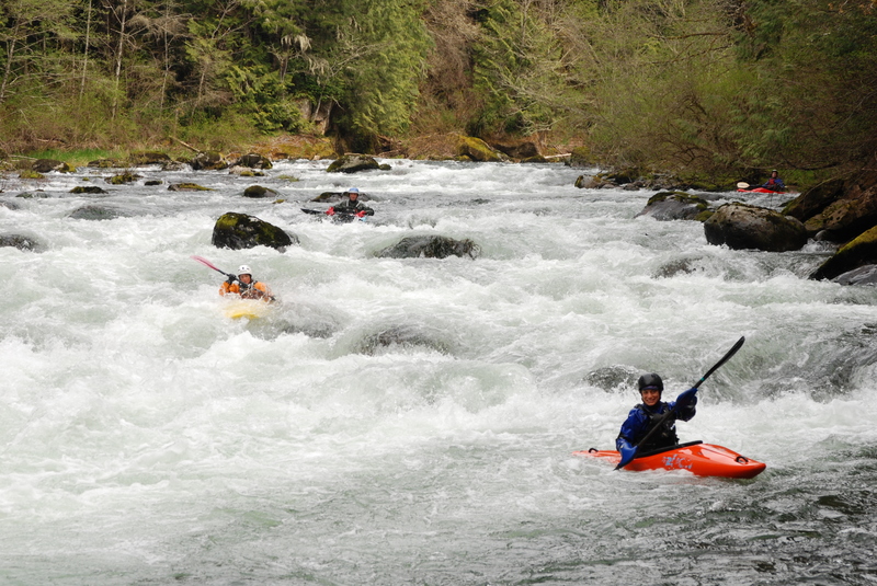
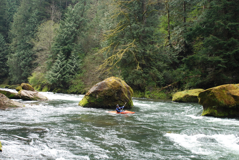
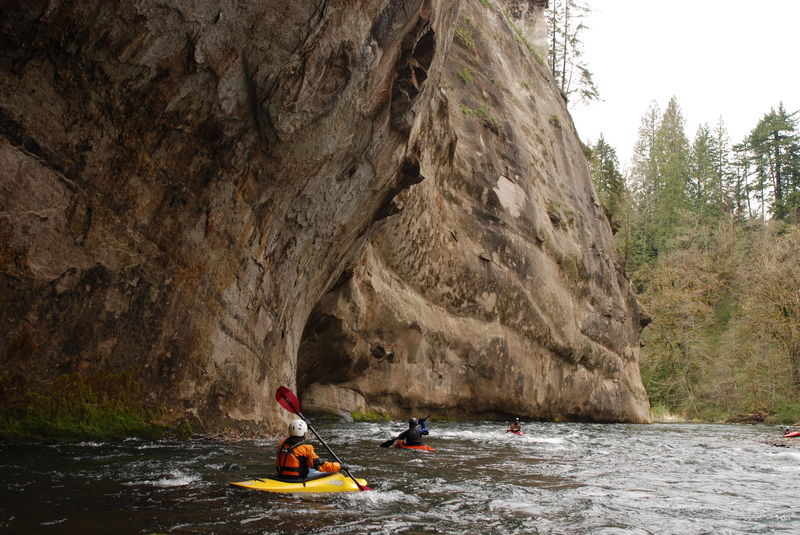
The Green River Gorge is one of the best whitewater trips close to Seattle with fun drops, good play spots, and easy access for a day trip all in one of the region's most scenic river gorges. It has some great intermediate to advanced whitewater. Many rafters and kayakers will run the entire gorge, from Kanaskat-Palmer State Park to Flaming Geyser State Park, but it is also possible to take-out or put-in at Paradise for those with hand carry-craft and the willingness to make the steep carry. This options provides a take-out for advanced paddlers just interested in the Upper Gorge and a put-in for intermediate paddlers interested in accessing a great class III run through the Lower Gorge.
This stretch is dam-controlled, and the ever increasing demands of urban growth and endangered salmon come before boaters. The Green River Clean-Up hosted by Washington Recreational River Runners typically occurs during one of the first weekends in May.
Upper Gorge, Class IV/IV+:
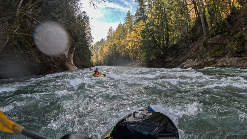
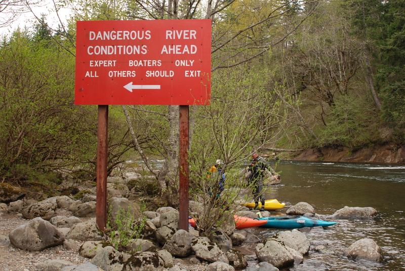
Once you get to the river the action starts within the first 50 yards at Ledge Drop 1. At higher water Ledge Drop 1 can be a fun play wave. The river then snakes along the edge of the park, you pass a second access point at a nice set of surfing waves, and then enter the gorge (marked with warning signs). At lower flows, rapids are less continuous with plenty of space to collect yourself before the next drop, but at higher flows the run becomes more continuous, with class III rapids become class IV.
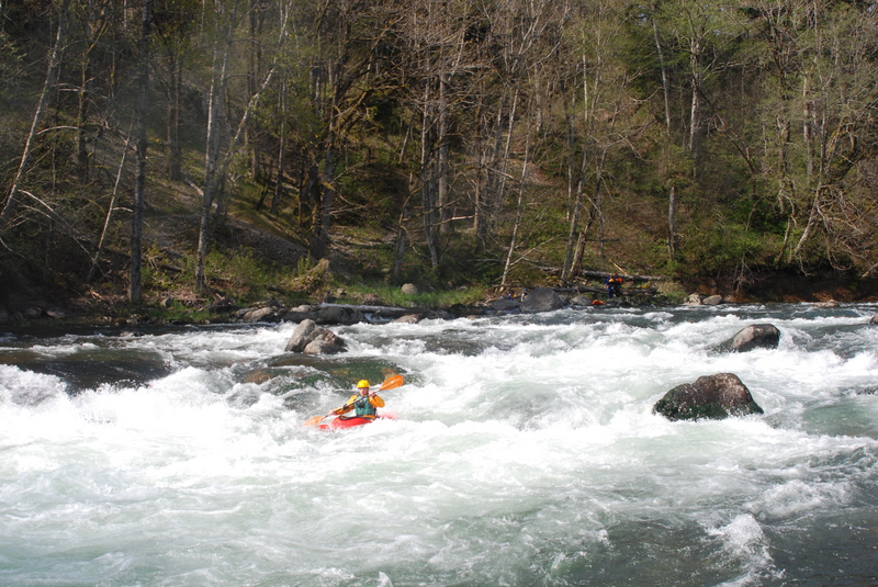
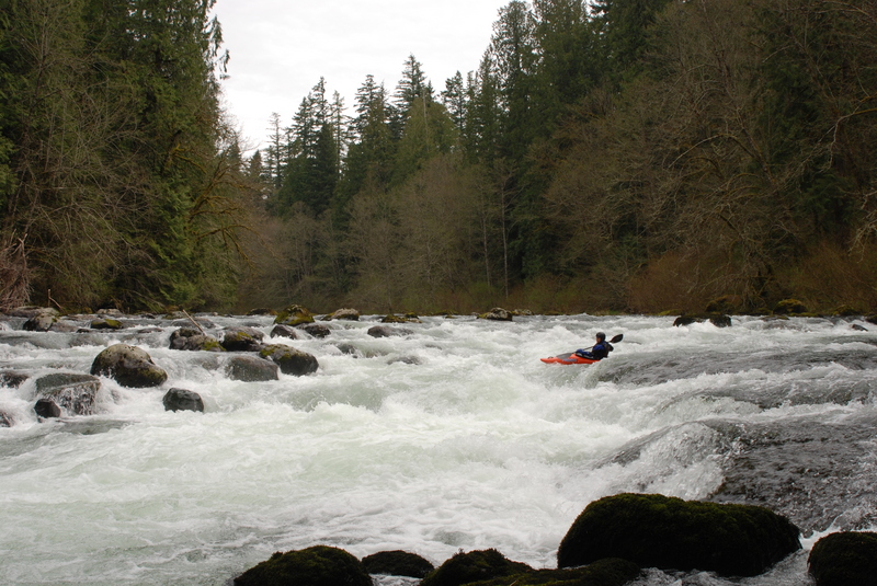
After about a mile and a half with several class III rapids, you'll reach Pipeline. This rapid can push class IV but if you're on your line it's fairly straightforward. The drop is at a sharp right bend with a boulder bar that extends out from river right. As you round the corner, head back hard to river right to avoid the large reversal on river left--the Pipeline, which can be hard to see until you're right on top of it.
A few bends after the Pipeline you'll co
...
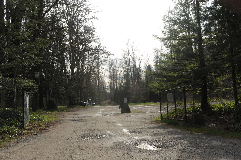
The put-in is in Kanskat-Palmer State Park (Discover Pass required). Follow the kayaker signs and when you get to a junction, head right to reach the upper put-in. If you follow the other road towards the left, an alternate put-in, you will miss Ledge Drop 1.Park in the upstream day use area. It's a short trail, about 50 yards long, from the parking lot to the river.
Ledge Drop One is immediately downstream of the put-in. Normally you can find a good line by entering the right side and following the tongue. Located at river mile 56.2.
Just around the corner from the downstream access point in Kanaskat Palmer State Park you come to Ledge Drop Two. Follow the current around the as the river bends to the right and then thread your way the hydraulic at the end. Located at river mile 55.7.
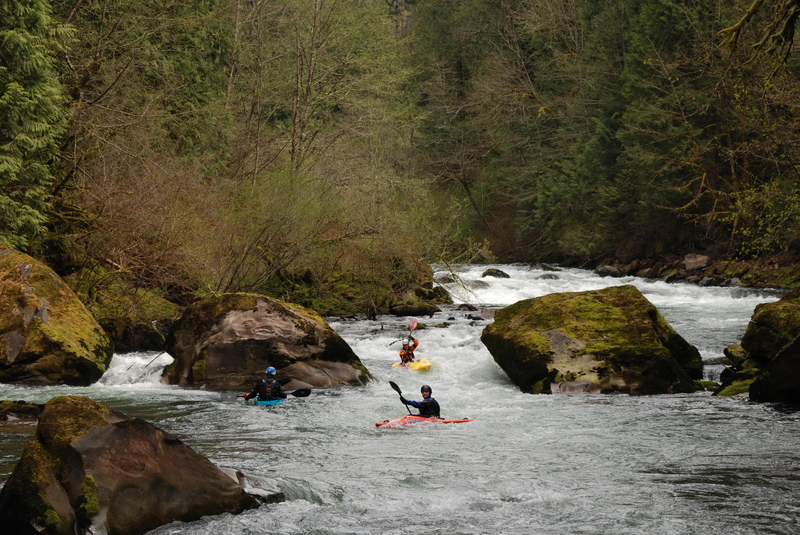
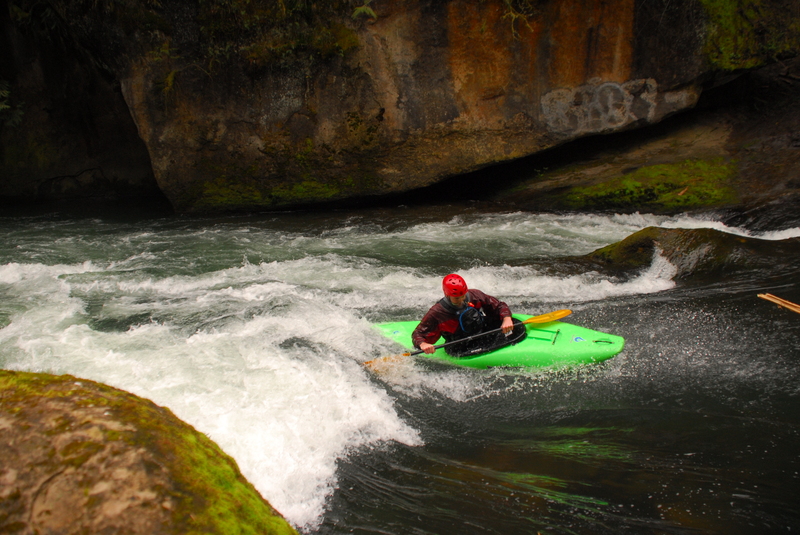
Always a tricky one that has caused many flips in a hole that extends most of the way across the bottom of the drop and a fine line to skirt around it on the right. A good line is to start towards the left as you approach the drop, work center, and then drive back to the right to avoid the hole at the bottom. Located at river mile 54.5.
Keep your eyes out for the powerlines overhead. As you pass under the powerlines and take the river right channel at a small island you will be at the top of Mercury. This marks the start of the most challenging half mile of whitewater on the run. To run Mercury find a line down the center left side and grab the eddy on river left at the bottom to set up for the Nozzle. Located at river mile 53.8.
On the Nozzle it's important to line up for the center slot between the two large boulders. The far right slot has a severe pin hazard that has caused trouble. The center slot is the line even at high flows when the two rocks on either side form large holes. Located at river mile 53.7.
At lower flows this section is not much trouble but at higher flows things happen fast and hydraulics start to form around the large boulders downstream of the Nozzle. You have a couple slots to choose from. Located at river mile 53.6.
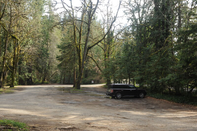
Park in the lot across the street from the building at the edge of the gorge and walk toward it to find a gate leading to a steep set of stairs that wind down beneath the bridge to the river-left put-in just below Paradise Falls. The access begins at a rock ledge just downstream of a large boulder on river left, where a series of often-slippery stairs climb up under the bridge to the building and parking area above. The parking area and stair access are privately owned; a $5 fee is required for parking and use of the stairs unless you are a Washington Kayak Club member, as the club maintains an access agreement with the property owners.
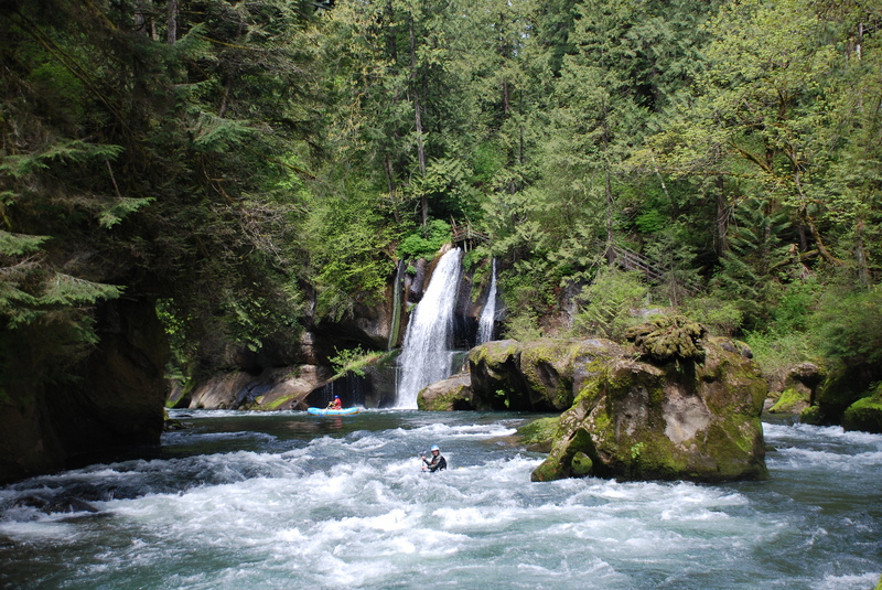
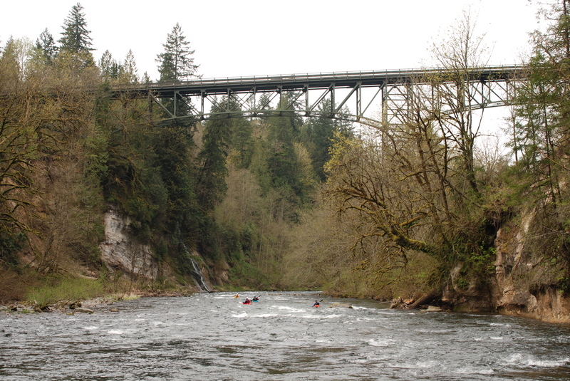
One of the most scenic sections of the river is a nice float as after you pass under the Green River Gorge Bridge (aka Franklin Bridge). Located at river mile 51.1, with access on river-left just after the falls requiring a steep climb up stairs to the building and parking lot above. WKC has an agreement with the owners that allows their members to access parking and stairs for no fee. Otherwise, it's a $5 fee to park and $5 to use the stairs.
A fun play spot around 1400 cfs. Some come here for park and play. You can also take out here on river right and hike the steep user-created trail up to the parking lot. Located at river mile 51.0.
This river-right access, that has been the standard access point for boaters over many years at the dividing point between the Upper and Middle Gorge. It is commonly used by kayakers and others with hand-carry craft, as a take-out for the Upper Gorge or put-in for the Lower Gorge and is located immediately above Paradise Ledge. A steep dirt path connects the river to the Franklin Ghost Town parking lot, requiring a strenuous climb into or out of the gorge. A longer, more gradual trail continues downstream toward the end of the sequence of rapids below Paradise Ledge. The parking area and access are privately owned and used by permission of the landowner. Washington Kayak Club has an agreement allowing members to use the access without charge; otherwise, a $5 cash parking fee is required.
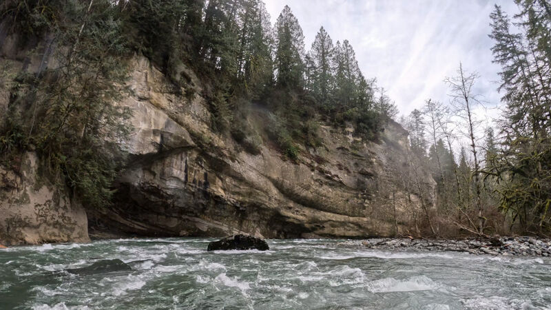
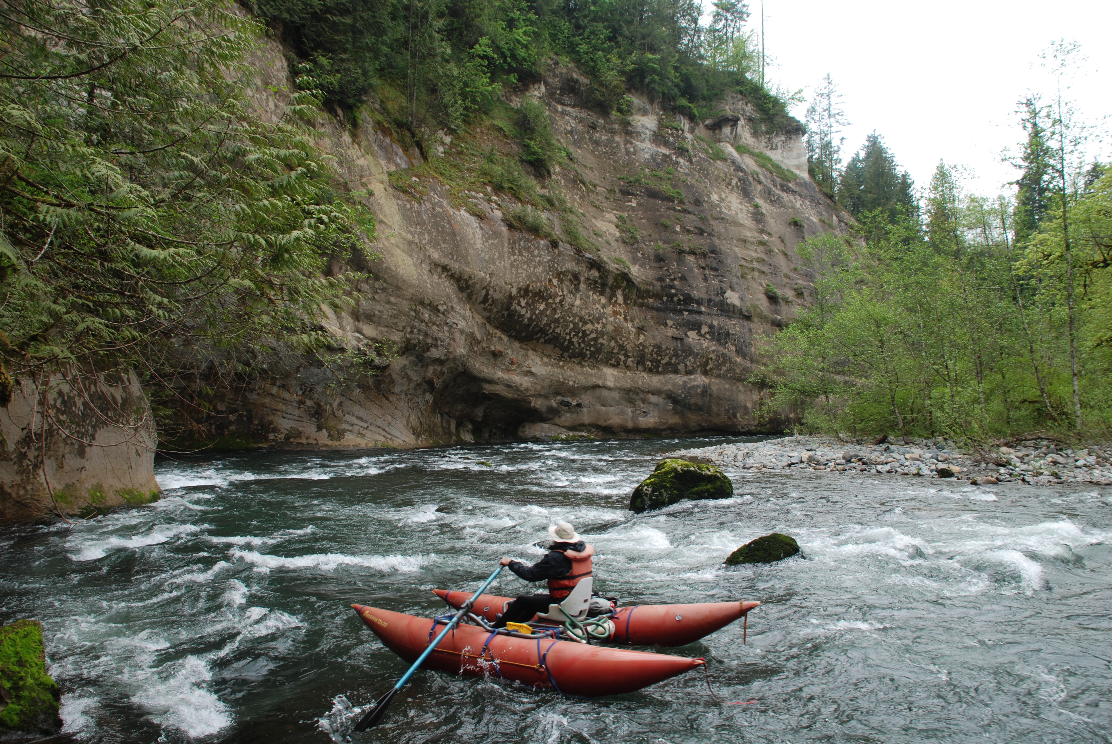
One of the most beautiful sections of the Lower Green where the river takes a sweeping bend around to the right with a big wall on river left that towers overhead. Located at river mile 48.8.
Also known as 'EBDB,' the Enumclaw/Black Diamond Bridge. As you pass under the bridge it's another 2 miles down to the take-out at Flaming Geyser State Park. It is possible to hike down to the river on the upstream river left side of the bridge making it a potential access point for an extended run of the Yo-Yo reach downstream. Located at river mile 47.1.
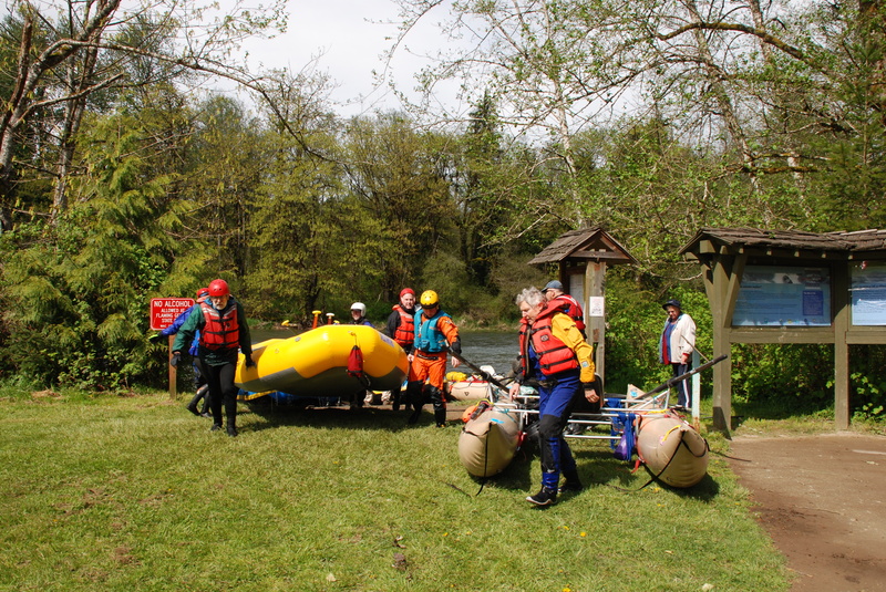
The take-out is on river left in Flaming Geyser State Park (Discover Pass required) near picnic shelter 3 across from the bathrooms. Enter the park and turn right continuing on the road through the park towards the end. When the weather is nice you can spread your gear out on the lawn to dry. In inclement weather the picnic shelter becomes a convenient changing area.
Mar 31, 2026
We had a beautiful day for a full run of the Green River Gorge meeting at Flaming Geyser at 11am. By the time we were at the put-in at Kanaskat Palmer and ready to launch it was noon. We reached Paradise at 1:30pm and picked up another boater there and continued on a short distance before finding a sunny spot for a lunch break. We were at the take-out around 3:00pm.
Jan 20, 2026
This was my first time in the Gorge, and it was a beautiful day. I was in my packraft, and we had 1 IK and 2 hardshell kayaks. We put in on river left just below the falls, walking down the steep stairs from the building next to the bridge.
Paradise Ledge has a big log above it, but there's ample room to get around it on river right. Candice showed us the petroglyphs on river left at the beginning of Flaming Geyser SP.
Oct 30, 2018
Sept 29th 2018 Saturday ran Lower Green Gorge. At horseshoe bend there is a tree spanning the river with root wad on river left. We portaged on the right. The river is calm enough in the bend to safely get out on the gravel bar to walk around without any issues. Washington Kayak Club has posted pictures on their forum.
Apr 3, 2014
4/2/14 at ledge drop 2. The left route at the top there looks blocked with a wood pile. This is just below the small rocky island at the top of the drop. We went a bit right of all and at the 1100 cfs we had it was a bit bumpy, but we were able to get back left. From below we were able to see there is a perhaps 15-20 ft. wide passage thru the wood; this is where I usually go but was unseen from above. I think we’ll just have to be very careful there until another big water hopefully removes the wood? Another hunk of wood could totally block the channel. I think I will go slowly to the left of the small island to visualize all this, and be able to hop back right if needed.