Klickitat
1 - Yakama Reservation to Leidl Campground
| Difficulty | III+ |
| Length | 22 mi |
| Avg Gradient | 53 fpm |
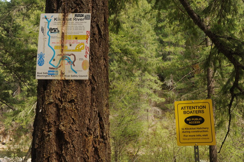
| Gauge | Klickitat River Near Pitt, Wa |
| Flow Rate as of 1 hour | 799 cfsbelow recommended |
| Reach Info Last Updated | March 21, 2026 |
Washington’s legendary volcanoes – Mount Rainier, Mount St. Helens, and Mount Adams – are the source of wild, free-flowing rivers and streams that cascade over big drops and through deep basalt canyons on their way to the Columbia River. Rivers like the Clear Fork of the Cowlitz, Cispus, Green, [...]Read More
While the Wild and Scenic Rivers Act provides the strongest protection for conservation of rivers, other legislation has provided protection of rivers from hydropower development. Section 13 of the Columbia Gorge Scenic Area Act includes important river protection measures. The Wind, Hood, and Little White Salmon were protected from [...]Read More
Kayakers and rafters usually flock to this popular section of the Klickitat around Memorial Day weekend. The put-in road typically remains snowed in at least through early spring, so it's a good idea to get a road report before making the trip (see Bennett's book for an entertaining story of two rafters who flagged down a snowmobile shuttle).
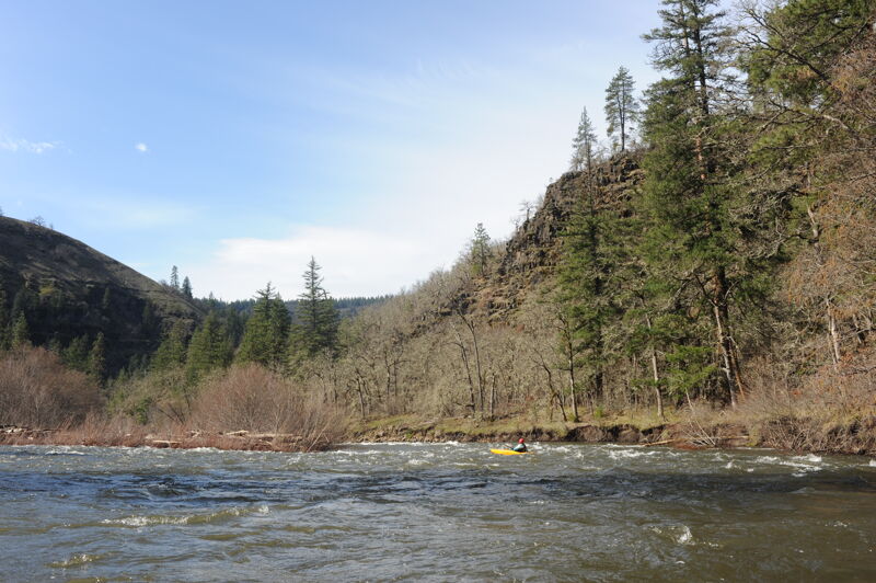
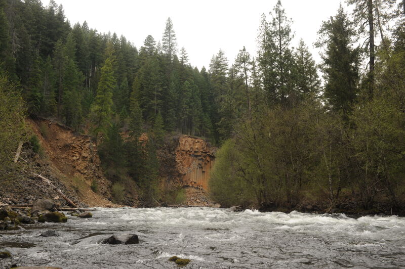
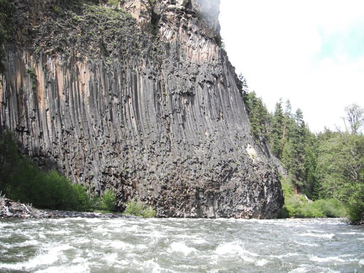
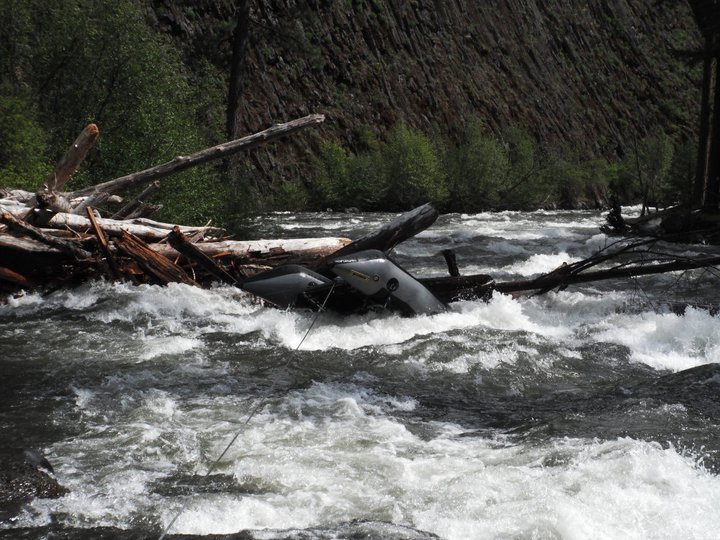
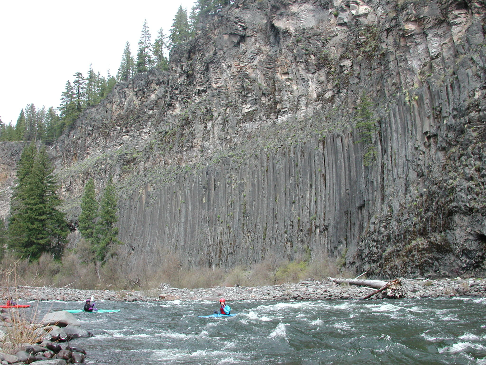
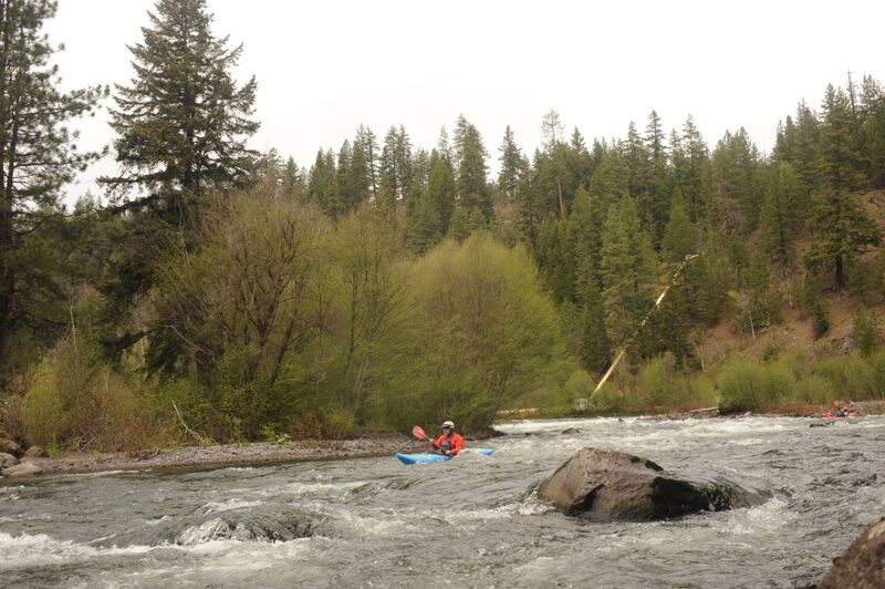
The upper put-in, typically used only by kayakers, is a very steep slope at the reservation boundary. Bring some rope to hold onto the end of your boat. At least you don't have to carry your boat—it carries you. Otherwise, you can lower each boat down on its own 70' rope. The upper section starts out steep and fast but still rates Class III+. You are in a gorge, so once you're committed there is no access. The run is incredibly beautiful, with perfect basalt columns rising 400 feet straight out of the river in some places. The rapids consist of slides that lead directly into big basalt headwalls, and there are several fun wave trains. Boat scouting should be fine, although things happen fast and wood hazards are common.
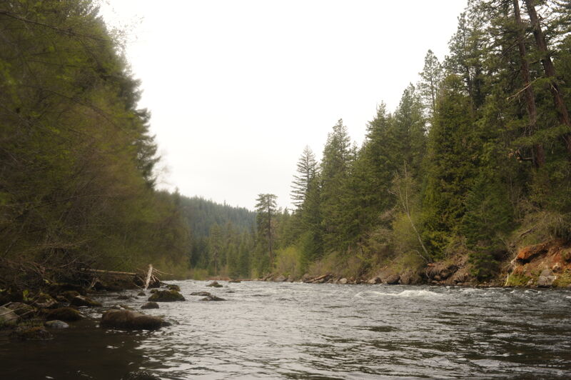
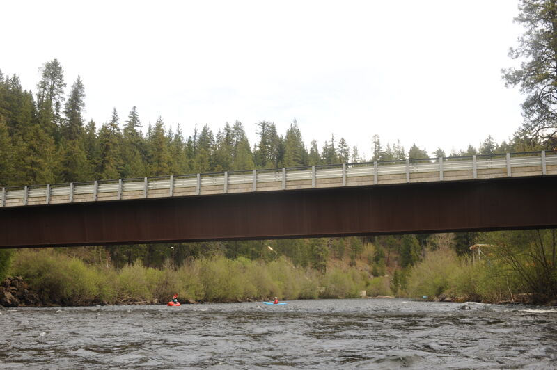
After a couple of miles, the rafter put-in at Parrot's Crossing is reached, and the run continues with a few bigger Class III rapids before calming down a bit to easier Class III. Much of the run is continuous and requires paddlers to have a strong roll. Swims can be long and abusive, even at the lower end of the runnable flow. While the gradient begins to ease with bigger meander bends, wood is a constant hazard that shifts from year to year. This is the most beautiful section of the river, with the largest cliffs of basalt columns. In the last three miles, the character of the river changes with fewer headwalls and easier Class II+ boulder gardens, except for one mile of continuous Class III ending about a mile above the fish hatchery.
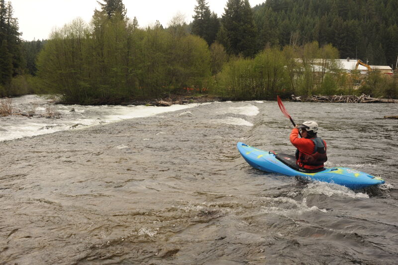
Most kayakers take out on small beaches in the forest on river right above the hatchery and the weir. Rafts often continue, running the weir on the left and
...
From the town of Glenwood head 0.5 miles east toward Goldendale and turn north on to Mt. Adams Rd. Follow this road 2.3 north to the T junction and turn left on the K1000 road. Kayakers typically continue to road mile 6.2 and a pull-out where a steep trail at the Yakama Reservation boundary marked by a sign. If you reach the Cougar Creek bridge at mile 7.1 you've gone too far. At the reservation boundary you can scramble down into the canyon to the point where Muddy Creek joins the Klickitat. It is a steep slope and a rope can be helpful for controlling the descent of your craft.
Parrot's Crossing, a few miles downstream of the reservation boundary and provides much easier access and great riverside camping. This site is typically used by rafters or for those who wish to skip the more challenging rapids and wood hazards upstream. From the town of Glenwood head 0.5 miles east toward Goldendale and turn north on to Mt. Adams Rd. Follow this road 2.3 north to the T junction and turn left on the K1000 road. Turn off the K1000 road at mile 3.3 head down into the canyon on the K1400 road (it may not be marked). Head down 0.7 miles and then turn right on K1410 and continue another 1.5 miles. At that point head left and continue on down to the river. A good launch for rafts and some nice camp sites are available at this access point which is about half a mile downstream from Dairy Creek.
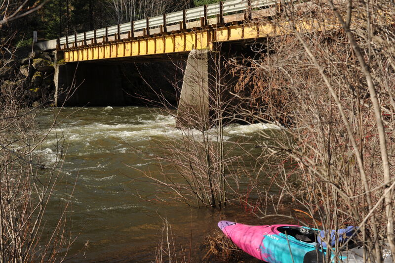
The hatchery access on river right upstream of the bridge has been the standard take-out for most kayakers and day trippers. The access is reached from mile 3.1 on the Glenwood-Goldendale road. Turn northeast (you should see a sign for the hatchery) and follow the road 3.1 miles down into the canyon (the last mile is a series of switchbacks).
The hatchery access on river right downstream of the weir is a put-in for those running downstream from the fish hatchery. The access is reached from mile 3.1 on the Glenwood-Goldendale road. Turn northeast (you should see a sign for the hatchery) and follow the road 3.1 miles down into the canyon (the last mile is a series of switchbacks).
This is a good access point for a short class II run down to Leidl or on to Stinson Flats. At mile 11.3 on the Glenwood-Goldendale Road turn onto the forest road across from the mill that descends down to the river. You will be on river right with views of the river and in 3.4 miles you will reach the Summit Creek Bridge. You can put in on the downstream river left side of the bridge. Note however that the road is marked for no parking along the road. You can continue upstream on river left and there are additional informal access points as you continue upstream. At mile 7.5 the road starts to climb up away from the river and at mile 9.2 you will reach the fish hatchery gate which is closed to public access on river left.
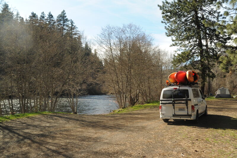
Access on river right below the bridge in the campground. Concrete ramp. Located at Glenwood Highway mile 12.6. Administered by Washington Department of Fish and Wildlife.
Apr 20, 2026
We did an overnight trip from Parrots Crossing down to Leidl. The pace was fast with continuous rapids and we discovered we traveled 3.5 miles in the first half hour. The run was relatively clean but there were a few log jams along the sides. The hatchery weir was no problem to run down the left although it was a bit shallow immediately downstream of the weir on the river left side. We carried over to the island downstream of the weir and put in on the right channel.
Mar 16, 2026
We paddled from Summit Creek Bridge down to Icehouse. The segment from Summit Creek to Leidl took about 40 minutes.