Miller
East Fork to NE Old Cascade Highway
| Difficulty | IV |
| Length | 4.7 mi |
| Avg Gradient | 83 fpm |
| Gauge | South Fork Skykomish River at Skykomish, Wa |
| Flow Rate as of 26 minutes | 371 cfsbelow recommended |
| Reach Info Last Updated | December 17, 2025 |
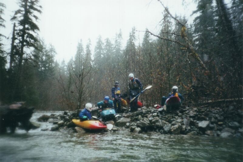
The Miller River is less popular with paddlers seeking cutting-edge steep creeks, but it offers a fun run for the occasional Class IV creek boater looking for adventure in the Skykomish River watershed. That said, the river still demands respect, with plenty of log and pin hazards. Flows are typically highest during fall rains and spring snowmelt, but access can be snowed in during the coldest winter months.
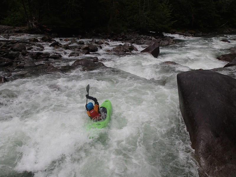
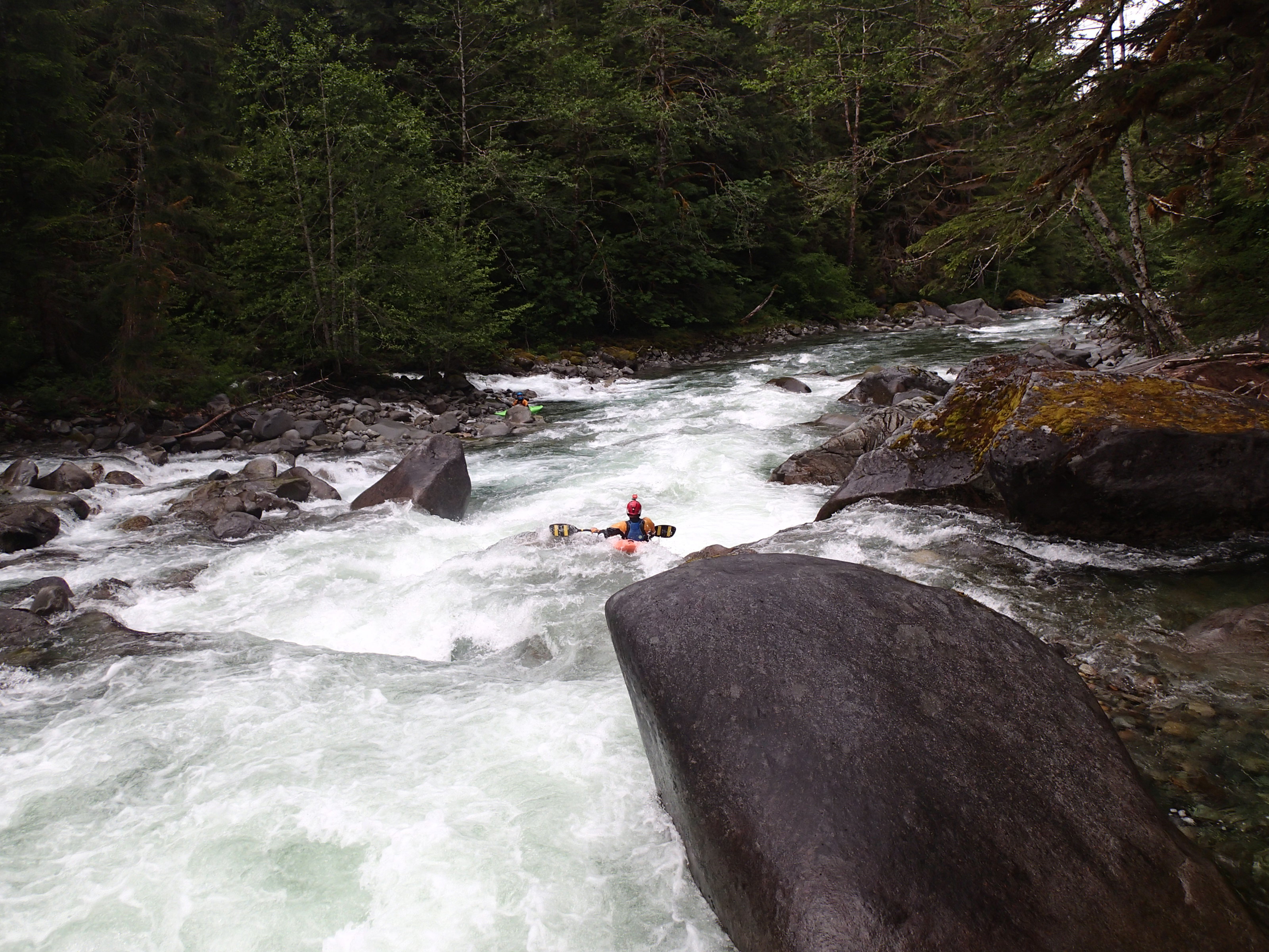
The river begins with fun Class IV boulder garden rapids. Most have clear lines that are easy to read from the boat. The best whitewater lasts no more than two miles, after which the pace calms considerably through lower-gradient boulder gardens and gravel bars. This lower stretch is fine when water levels are adequate, but low water can make navigation tricky.
Logistics: The Miller River is a short run with roadside access. The classic run starts on the East Fork Miller and continues past the confluence to the Old Cascade Highway. With the river crossing permanently gone, the lower gradient, minimal whitewater in the lower reaches, and plans to restore the floodplain, it now makes sense to take out further upstream.
To access the river, take Highway 2 to mile 45.9 and turn onto the NE Old Cascade Highway (look for the sign for Money Creek Campground). Follow this road 1.1 miles past the campground, then turn right onto Miller River Road (FR 6410). Driving up Miller River Road, you will see your first good take-out option where the river comes close to the road. For a shorter run, continue up to the Miller River Group Campground, which is a possible take-out near the end of the best rapids.
To reach the put-in, drive over the West Fork bridge (mile 3.5) to a location where the East Fork Miller approaches the road near mile 4.3 at an elevation of 1,290'. Note that the rocky channel you may have passed with little or no water is not the main channel. Be sure to put in higher upstream than the location described in Bennett's guidebook—his
...
At Highway 2 mile 45.9, turn onto the NE Old Cascade Highway (look for the sign for Money Creek Campground). Follow this road 1.1 miles, then turn right onto Miller River Road (FR 6410). Continue past the West Fork bridge at mile 3.5 to a put-in where the river comes close to the road, near mile 4.3, at an elevation of 1,290'. Note that the rocky channel you may have passed with little or no water is not the main river channel.
At Highway 2 mile 45.9, turn onto the NE Old Cascade Highway (look for the sign for Money Creek Campground). Follow this road 1.1 miles, then turn right onto Miller River Road (FR 6410). Continue 2.2 miles on Miller River Road to the Miller River Group Campground. This is a take-out option that comes at the end of the best whitewater.
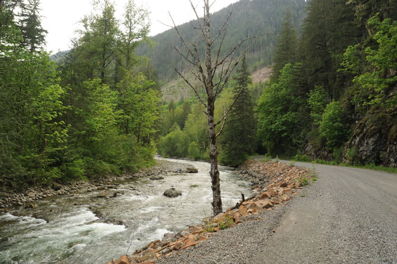
At Highway 2 mile 45.9, turn onto the NE Old Cascade Highway (look for the sign for Money Creek Campground). Follow this road 1.1 miles, then turn right onto Miller River Road (FR 6410). Continue 0.7 mile to a segment of road that runs along the river. This is a potential take-out and also a good place to assess flows. Downstream of this point the gradient tapers off and King County has indentifed the reach from here down to the confluence as a priority site for floodplain restoration.
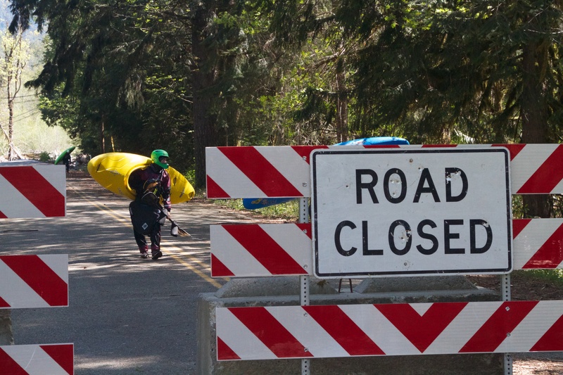
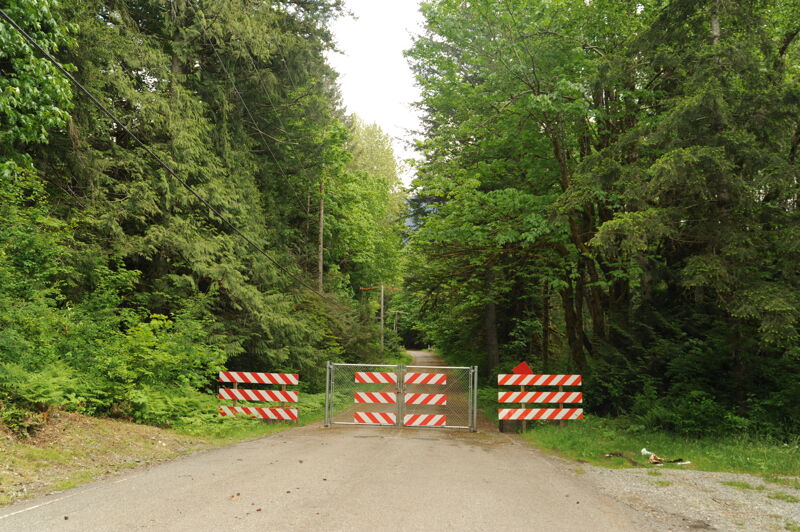
At Highway 2 mile 45.9, turn onto the NE Old Cascade Highway (look for the sign for Money Creek Campground). Follow this road 1.3 miles to the old river crossing at an elevation of 890'. The historic Miller River Bridge, constructed in the early 1920s, still stands, but the approach washed out during a January 14, 2011 storm, permanently closing this crossing. Ironically, a Bridgestone Super Bowl commercial depicting the bridge washing away aired just a few weeks later. River access is still possible from river left, though King County plans to remove the remaining road prism as part of floodplain restoration.
May 22, 2025
Trip in the Skykomish River drainage that included a stop to assess Miller River access.
Mar 20, 2024
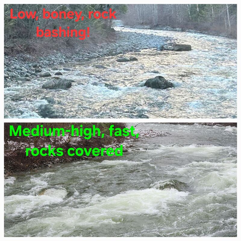
At the pullout where the river is first visible heading up the shuttle road (potential takeout), there are three bigger rocks in the streambed you can see to get a feel for level. These reference photos are for very low end of runnable and healthy-medium (or perhaps pretty high depending on your perspective). How much water you have at the put-in will vary depending on where the water is coming from, as the west fork and a river-right feeder can both add a lot or none at all. Have found the correlation with Skykomish gauge (AW virtual) to be very hit or miss, so pays to know what you're looking at when you get to the river.