Miller
East Fork to NE Old Cascade Highway
May 22, 2025
Trip in the Skykomish River drainage that included a stop to assess Miller River access.
Mar 20, 2024
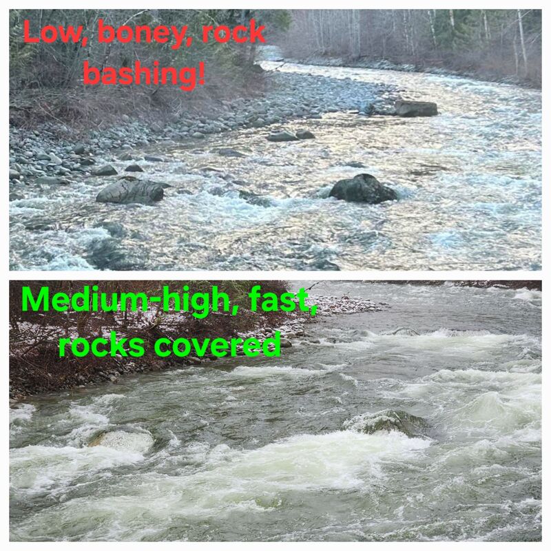
At the pullout where the river is first visible heading up the shuttle road (potential takeout), there are three bigger rocks in the streambed you can see to get a feel for level. These reference photos are for very low end of runnable and healthy-medium (or perhaps pretty high depending on your perspective). How much water you have at the put-in will vary depending on where the water is coming from, as the west fork and a river-right feeder can both add a lot or none at all. Have found the correlation with Skykomish gauge (AW virtual) to be very hit or miss, so pays to know what you're looking at when you get to the river.
May 13, 2020
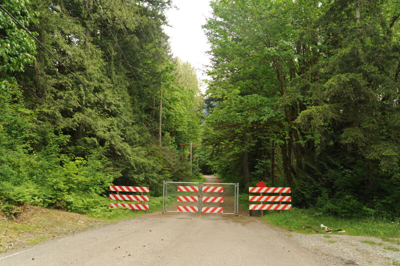
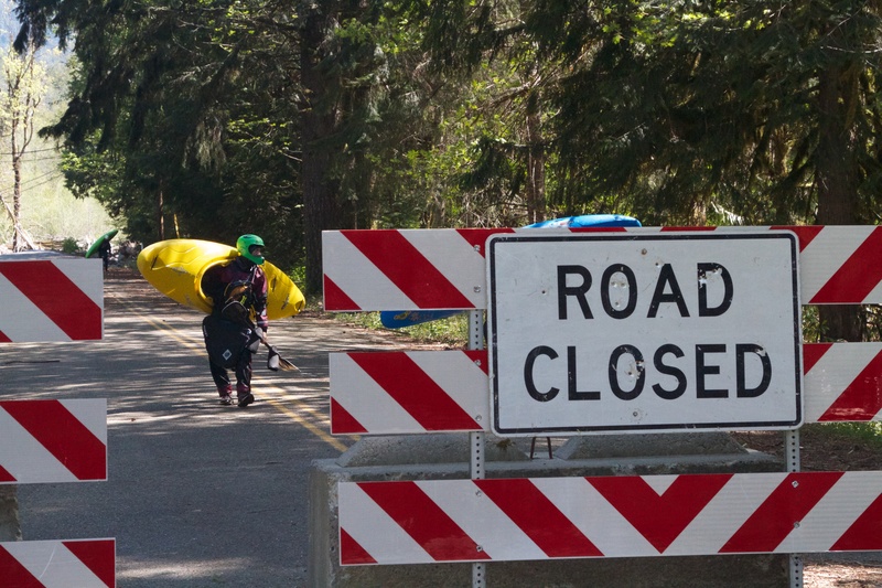
Updated 2020: Put in 1/4 mile up from the Westfork Miller bridge. Park at small pullout. Hike thru woods 7-8 minutes. Take out at the National Forest Group Campground. Run is 2 miles and takes roughly 20-30 minutes depending on flows and pace. Concerning flows. This run gets quite grungy (scrapey) at lower flows, esp. in the last 1/2 mile. Look for a minimum of 8k on Sky gauge and higher if it's rain. The run holds water well, and can be run quite high, but it's good to know the lines. 12-13k on Sky gauge is a pushy medium flow. It's easy to miss the takeout if you don't know where it is.
Jun 10, 2017
450 cfs, 6/10/17
May 7, 2013
Miller River take-out at the site of the washed out bridge.
Nov 21, 1999
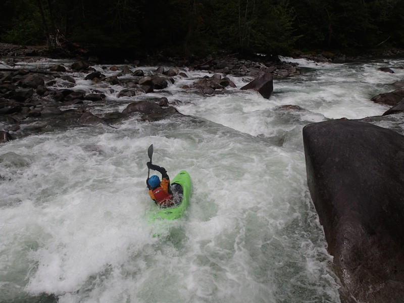
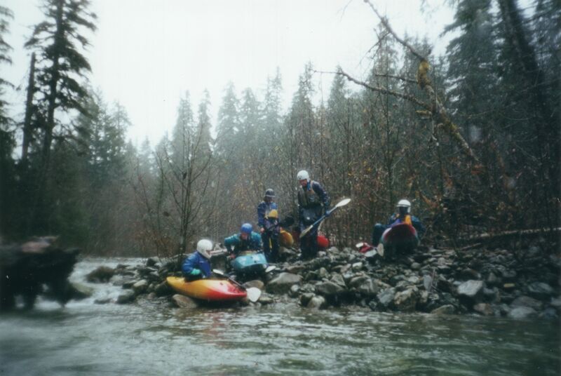
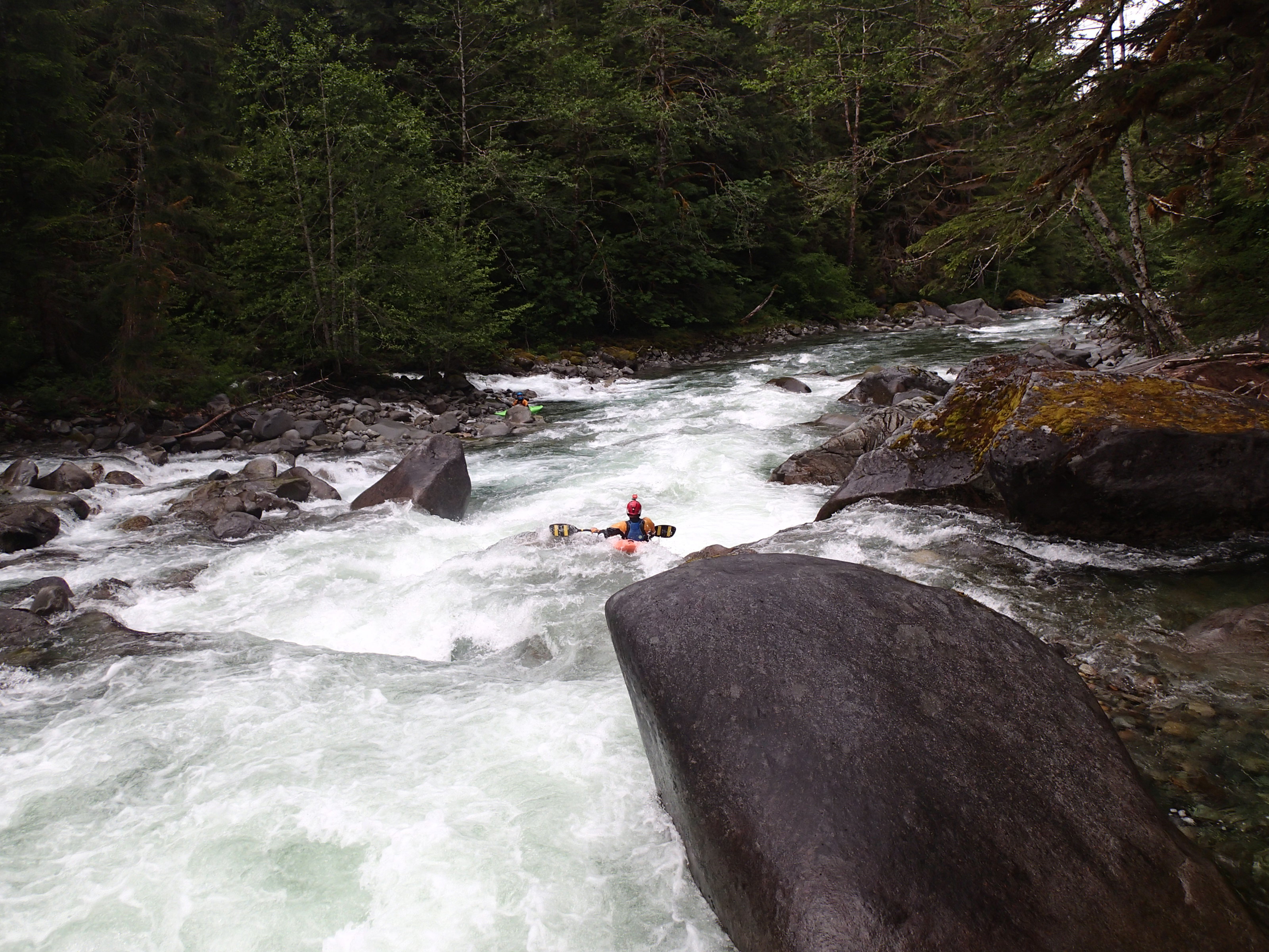
We had a crew of eight, which was a little large for this run, but we made it work. We crossed the bridge over the West Fork of the Miller and continued upstream about a mile to a spot where the river ran relatively close to the road, above the suggested put-in in the Bennett book. It was quite bony for a while, with a class II–III bump-and-grind feel, but the river began to pick up as we approached the confluence with the West Fork. Flows were still a little low, but there was enough water to boat, and we wouldn’t have wanted it much lower (the Skykomish at Goldbar was at approximately 5500 cfs).
One of the bigger drops on the run sits just above the confluence and was the site of one of our swims when Dave Pearton became hung up on a log. This was the second log encounter of the day, as Willie had earlier taken a log pin that also resulted in a swim. The more difficult section of the run was fairly continuous, with eddies scattered here and there. Once the river flattens out and cabins start to appear, the run is mostly over, aside from a few short drops similar in character to the upper section.
This was an early winter day on the Miller, enjoyed with a group that had never paddled it before. We were glad we put in upstream of the West Fork confluence, as it allowed us to enjoy a longer stretch of good whitewater on the East Fork. We continued downstream to the Old Cascade Highway, with the gradient tapering off as we approached, and took out at the bridge as snow began to fall.