Skykomish, N. Fork
2. Bear Creek (Drum Beater) to South Fork Confluence(Canyon, Upper, and Lower North Fork Skykomish)

Apr 4, 2026
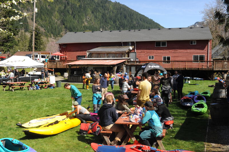
It was a great weekend for the Collegiate Whitewater Festival with beautiful weather and optimal flows on the Skykomish River. The event had 77 racers and 45 volunteers for a great day out on the water. The intermediate race was from Confluence to Boulder Drop and the advanced race was from Boulder Drop to Split Rock followed by awards and prizes at the River House in Index. The races photos are in a separate report on the Main Sky page.
Mar 16, 2026
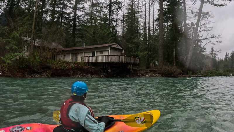
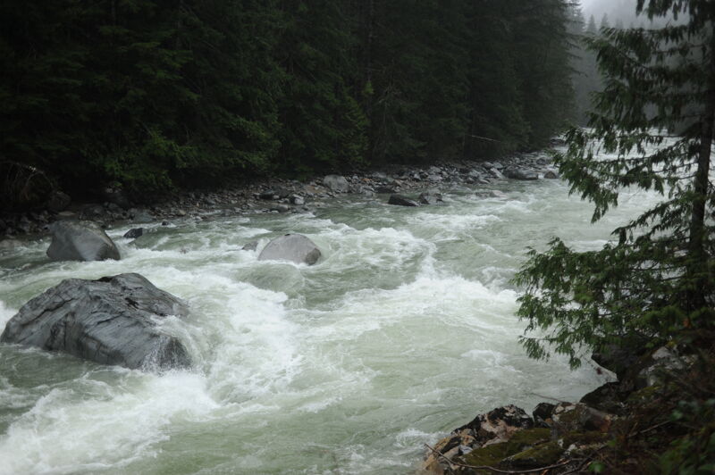
A beautiful day on the river, despite the rain. Snow on the banks. 3.7' on the Galena gage. Some new wood, including a river-wide log just past the house with the cable car. Easy to spot and easy portage around it on river right. There are also a couple of new trees down in the new channel, that are avoidable, but you have to zig-zag through them. The big tree at the bottom of the new channel has been cut back a bit, so it's more easily passable on river left. We got around it, but would've had to walk if the water had been any lower.
Jan 9, 2026
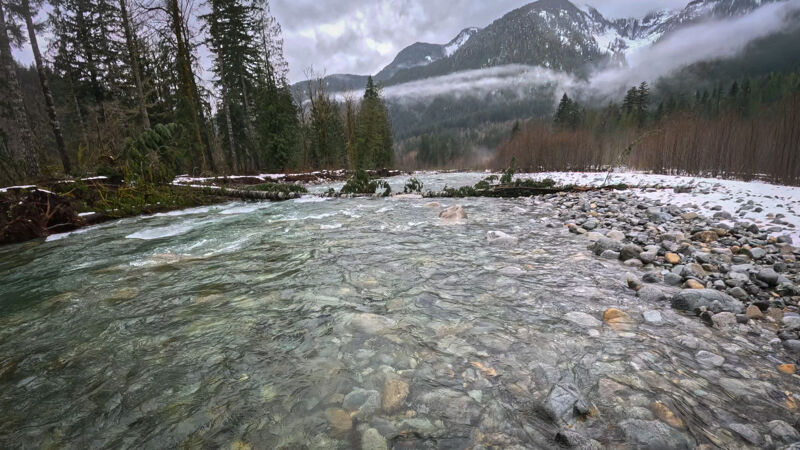
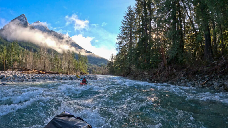
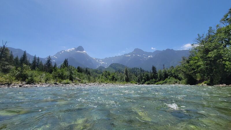
5 paddlers (4 hardshell kayaks, 1 packraft) went from 7 Mile Bridge to Index. The flow was low, but it was still a fun day, with absolutely spectacular views of mist and snowy mountains above the clear green water. I got my drone up after our run, too- see photos.
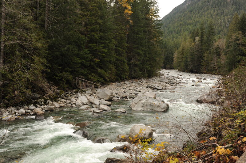
One of the prettiest rivers in the PNW.
Dec 24, 2025
9 of us put in at 7-mile bridge. The roads were clear all the way. 4 of us took out under the bridge in Index and the other 5 continued down to the SF confluence.
They day started clear, which was nice, as we could see the beautiful snowy mountains around us. I'm not familiar enough with the individual rapids to know what has changed since the flooding, but from what my fellow paddlers were saying, there have been some pretty major channel shifts- old channels now completely dry. And some of the rapids are different- steeper in places.
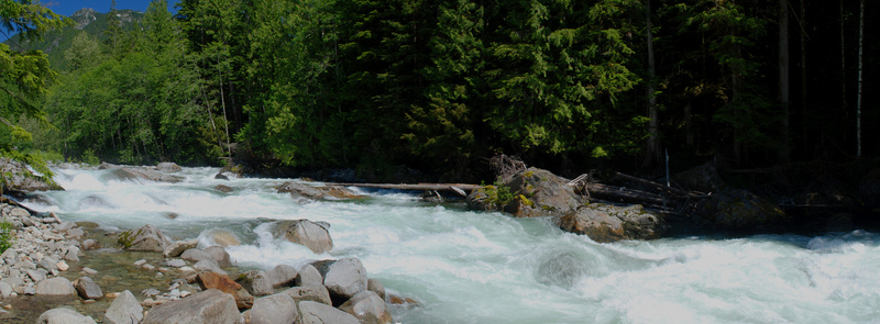
There was a lot of wood on the banks and quite a few trees leaning precariously over the river, looking ready to go at any moment. There was one big tree down across much of the channel, but it was passable on river left.
It was a fun level and a beautiful day for a paddle.
Dec 18, 2025
During recent high-flow events, the Index–Galena Road was damaged on the west side of the 499 Bridge on river right, at approximately mile 10.2, about half a mile downstream of Roostertail. This section of road lies at a low point where it passes through the channel migration zone and has been a chronic problem area for many years. During high flows, the river routinely overtops the road at this location, depositing debris as a high-flow channel is activated. During the most recent event, approximately one lane of pavement was lost, and hyporheic flow now passes into and through the road prism.
In addition, a major avulsion event at mile 3.0 on the Index–Galena Road resulted in the river activating a new channel a significant distance away from the road. As a result, the channel immediately adjacent to the road now functions as a high-flow channel that is dry except during the highest flow events. The recently reconstructed road realignment, which was moved outside of the channel migration zone between Trout Creek and the Seven Mile Access (mile 6.4 to 6.9), performed well during these events. Both the private Trout Creek access and the public Seven Mile access points remain in good condition.
Vehicle access to Roostertail and the Canyon section of the North Fork Skykomish is currently not available. Boaters will need to put in at the bridge or hike upstream.
Jun 11, 2025
Main Sky gauge started at 4100 cfs (3.9 ft on Galena gauge) and dropping that morning, not really sure what the level was when we put on.
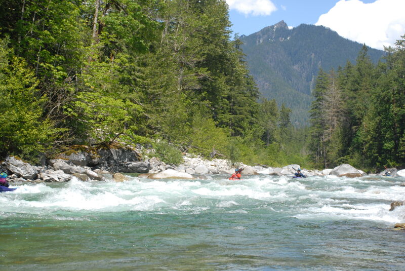
Level was low, but still good to go from 7 mile access to the Confluence/Hwy 2.
The whitewater was absolutely gorgeous and fun. The best part is the continuous nature of the rapids and the scenery.
Great read and run for those with the skills. Good step up to solid class 3 for those looking for a new section. The biggest hole (that I found) was right after the bridge in Index. The wave train leads into a big wave hole that can get a bit spicy. I don't remember that wave hole being that big, but I also haven't done this section in several years.
This is my new favorite local run!!!!
Jun 2, 2025
Had a great run yesterday on upper NF Sky from Rooster Tail to Seven Mile Bridge. Level was a nicely padded medium. AW gauge showed the river as very low / below recommended, which was inaccurate.
Paddlers should use the newer NOAA gauge at Galena: https://www.nwrfc.noaa.gov/river/station/flowplot/flowplot.cgi?SNGW1. I've found the correlation to be very accurate, with 3.5 - 4.0 being the sweet spot. Above 4.0 is getting pretty pushy, but still great if that's what you're looking for. I've run it at 3.1 and still had a good day with the right mindset, but it's really bony. Would be great for AW to start using this gauge that's near the put-in and not the main Sky gauge which is only a rough correlation at best.
Jun 23, 2024
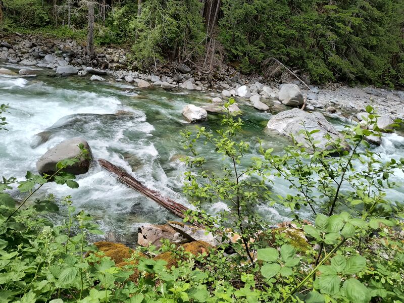
Just adding a picture to go with Doug's update. This log arrived 6/21/24. It completely blocks the lower left channel, but you can get down the lower right. Best to scout from road.
Jun 23, 2024
Between 6/19/24 and today a large limbless log has lodged in the left lower chute of El Nino. This log can be seen by stopping along the road as you head up to a put-in. It is very difficult to see from the river! It could a dangerous encounter.
Fun run at this level.
Jun 19, 2024
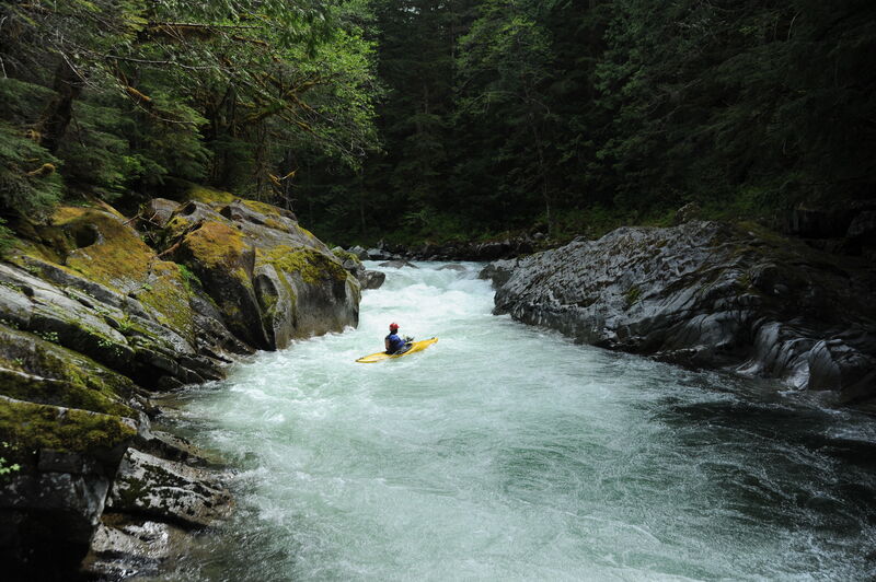
The water was on the low side but still plenty for a fun trip on the North Fork Skykomish. Estimated flow was 1150 cfs on the North Fork in Index and 3900 cfs on the Skykomish at Goldbar Gage. This was a good level for a first-time run of the canyon and we had a few folks along who had not done it before. At this flow the rapids in the canyon are pool drop with a few big eddies that accommodated our group of a dozen paddlers. One log on river left about halfway through the canyon was in play and had to be avoided. There was also a tree that extended in to Let's Make a Deal from river right. It was possible to boat the center chute and avoid the log and the left chute was totally clean.
A couple of us ran the far left line at Rooster Tail without any issues but many portaged. From Rooster Tail on down the river had many exposed rocks but plenty of water for clean lines through most of the rapids. We stopped for lunch on the island between Pinball 1 and Pinball 2.
It was a beautiful day and great to be back out on the North Fork Skykomish River. Trip video by Kanako: < https://gopro.com/v/vkLBQV1vragJW >.
Nov 9, 2023
Ryan Matthew and I did a quick weekday trip on the North Fork Skykomish from Drumb Beater down to the bridge just below El Nino. The level was 3 ft on the Index gage and 3500 on the Skykomish Goldbar gage and dropping. There were rock hits in just about every rapid but no stops--it was very low but just enough water. It was a fun level to see the canyon at the start without any the hydraulics characteristic of higher water. Let's Make a Deal had some wood in play with a tree that was in the channel over to the river right side. The left and center were clean. At these low flows it was very straightforward to boat scout.
We ran Roostertail on the left (scouted from the island) but it also looked like enough water to run the main line to the right. The huge root ball that was in the landing zone for many years is gone and the rapid was clean of wood.
We took out on the downstream river right side of the bridge (a trail leads down to the river and there is space to park a couple cars). It looks like we could have continued on down to the access at Seven Mile Bridge (we were worried it might be too shallow on the rapids over rock bars in that section).
It was good to see the road repairs finally finished after nearly two decades. The Forest Service and Snohomish County did a nice job of leaving adequate space for parking off the highway at Seven Mile Bridge, as requested by American Whitewater. They also left a trail to the river although they did some planting in the most direct path to the water. Our community will need to step up and take a leadership role in ensuring the site stays nice as it could also become attractive for dispersed camping.
May 23, 2020
A return to the North Fork Skykomish River after many years. We drove over Jack's Pass and used bikes to shuttle.
We saw a log in Let's Make a Deal in the center-left slot that was not visible from upstream during our boat scout. The center-right slot was clean. A giant rootball is in the landing zone of Rooster Tail. You could probably get around it to the left if you are on your line but a lot of flow was going into it. We opted to portage but you could also likely sneak on the far left if you committed to that line farther upstream.
The run was otherwise clean and just as fun as we remembered.
Road was clear over Jack's Pass.
May 11, 2019
Ran this last Saturday (5/11/2019). AW Virtual gauge 2300cfs, Main Sky (goldbar): 7700cfs. Half put in a drumbeater and walked rooster tale, other half put it below rooster tale and paddled to the road wash out. Consensus among the 10 of us was this was a great medium flow for kayakers. We were rather shocked given most of the beta online would suggest this was below recommended. Not bony by any means. Any rocks poking out of the water were easily avoided, and it wasn't high enough to call it 'pushy'. Perhaps the higher level suggestions were based on rain fed levels. This day was 100% snow (no rain in over a week, an odd may). Those of us that passed on the canyon would have like to see it a little lower for our first time, Not much in the way of large eddies to regroup. Other than a log in rattlesnake, there was no major wood in play that couldn't be seen from your boat and easily avoided. Even the short section from Rattlesnake to the road wash out (~4miles), had plenty of action and was well worth the drive through jack pass.
May 24, 2017
We put in right below Rooster Tail at a flow of 843cfs and while there were a few shallow gravel areas to scrape thru it was still good fun and the drops mostly channelize. Amazing water quality, clear clear. The road over the pass, FR65, was in good shape, not too potholed. Hopefully the NF road will be reopened someday.
Jul 5, 2012
I had not been up to the North Fork in many years so went up and over Jack's Pass for a scouting mission as part of advocacy work I was doing to ensure an access point when the road is reconstructed.
May 31, 2008
Paddled the NF on 5.31.08 from the first gate downstream of Jack's Pass (follow Beckler River Rd) to Big Bend (Main Sky) Gate was locked, portaged Bear Gorge/Falls!!!!! and Drumbeater. Big wood in Let's Make a Deal, hard to see during read and run, Scout early, Line on far right. Rooster on left and some other changes downstream. A few more pieces of wood down to Index but actually in pretty good shape compared to past years. Not a bad paddle to Index. Always worth the effort!!! Viva La NF!!!!!!!!!!
Dec 18, 2007
During storms in December 2006 the Index Galena Road providing access to the North Fork Skykomish River was damaged in 8 separate locations with severe damage that washed away the entire road at several of these sites. The road is closed to the public from mile 6.4 to mile 14. The traditional take-out at Trout Creek is located at mile 6.1 and the put-in at Drumbbeater is at mile 11.7. The washouts near the take-out (at mile 6.4 and 6.9) represent the most significant damage and the county anticipates it will take 5-10 years to complete engineering, secure federal funding for repairs, complete the work, and open the road for public use. As an alternative access you can drive up the Beckler and over Jack Pass approaching the put-in from the upstream end (the county has arranged for plowing this road as resources allow). The road however is gated at mile 14. Private cabin owners have a key to the gate but this is not open to the public. In addition a new slide at mile 13 that occurred during December 2007 storms now blocks the road preventing access even by cabin owners. Some paddlers have put in at the gate at mile 14 (although the gate is sometimes left open it can be closed at any time). The put-in at mile 14 adds approximately 2.3 miles on the run including a class II section and a portage at Bear Creek Falls and Drumbbeater (be sure you can recognize these).
Nov 15, 2006
The road is closed at Trout Creek.
Nov 10, 2006
11/11/2006 PLEASE NOTE: the gauge is reportedly off! A very experienced oarsman who knows the Sky intimately reported that 6500ish felt like 9000ish. The difference will be exponential with higher flows....
Nov 11, 2003
The North Fork was good to go and relatively free of hazards from Drumbeater down to Trout Creek. Slots through Let's Make a Deal were clean of wood. Rapids downstream of El Nino have changed and there are a couple new surprise holes.
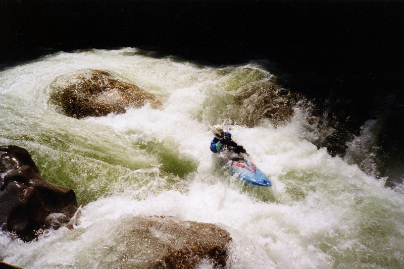
Jun 23, 2002
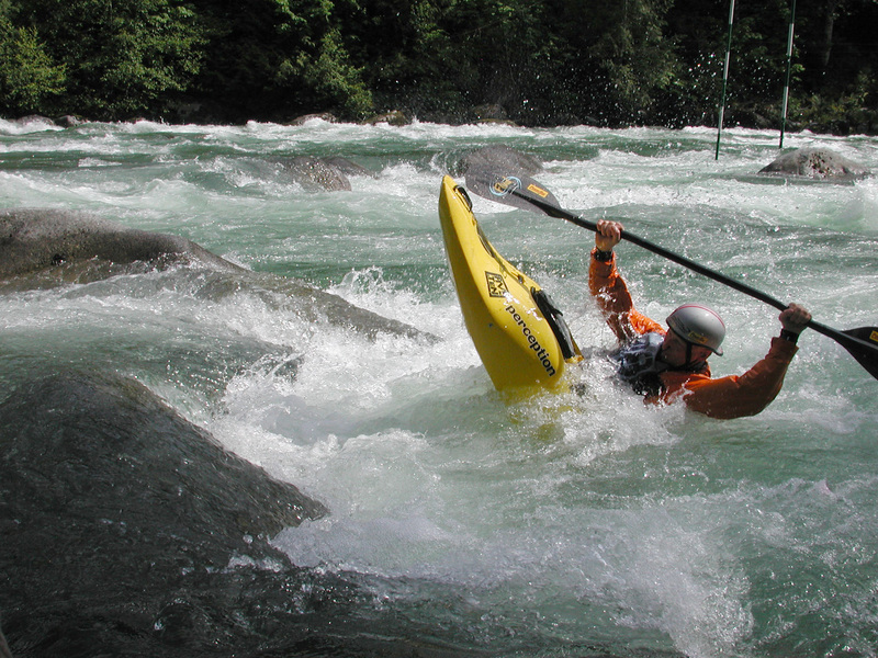
The SkyFest Rodeo Competition at Llama Ledges.
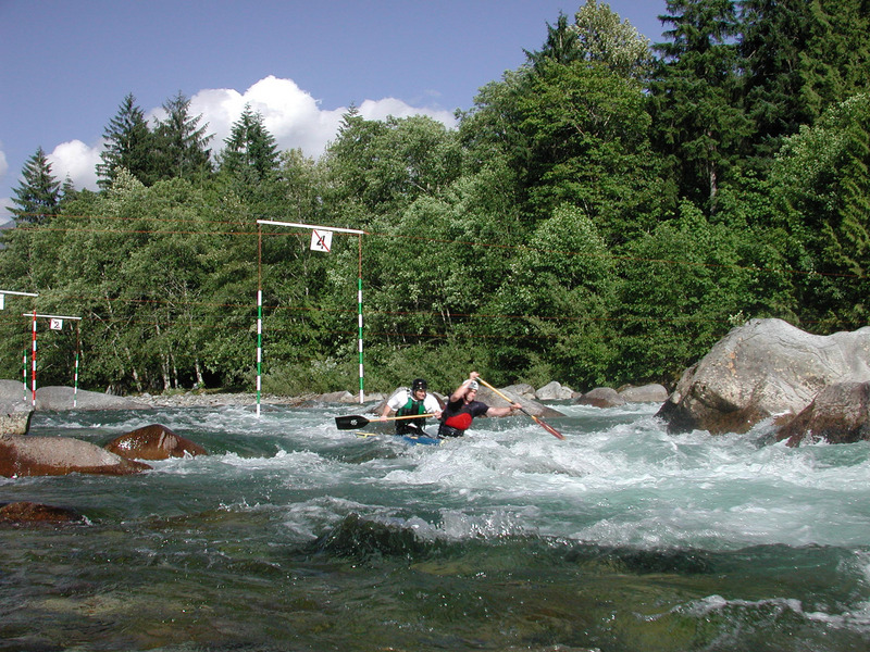
Jul 10, 2001
The SkyFest slalom races at Llama Ledges.
Apr 28, 2001
Russ, Willie, Everett, Eric, Mel, Pearton, Mike, and myself. The run started out good with the canyon section. It was my first run in the Corsica and I blew the footpegs off the rails within the first few hundred yards. I made it through the canyon locked in by my thighs and then wedged the float bags in the front to provide some support. I decided not to run Roostertail given my boat situation and Eric and Mel decided to portage as well. All came through ugly, but fine until Russ who took a nasty spill and bounced through the drop upside down. He pulled out with a shoulder injury. The rest of the run was fun and largely uneventful.
Jan 1, 2000
This run is not in my paddling log but was in 1999 or 2000.