Snoqualmie, S. Fork
2. Twin Falls State Park to 424th Ave SE cul-de-sac

Apr 23, 2026
Five of us took a leisurely paddle from Twin Falls down to the cul-de-sac. 3 hardshell kayaks, a packrafts, and a C1. Low flow, but enough water that we weren't scraping along. Much of the wood reported last month was gone and we didn't need to portage around anything. There were 3 significant trees down, all of which were easy to spot. The first two were above the canyon and were passable on river-left. The third was on Turtle Rock- full width of the river, but we were able to go under it on river right. At higher flows that might not be possible.
Apr 12, 2026
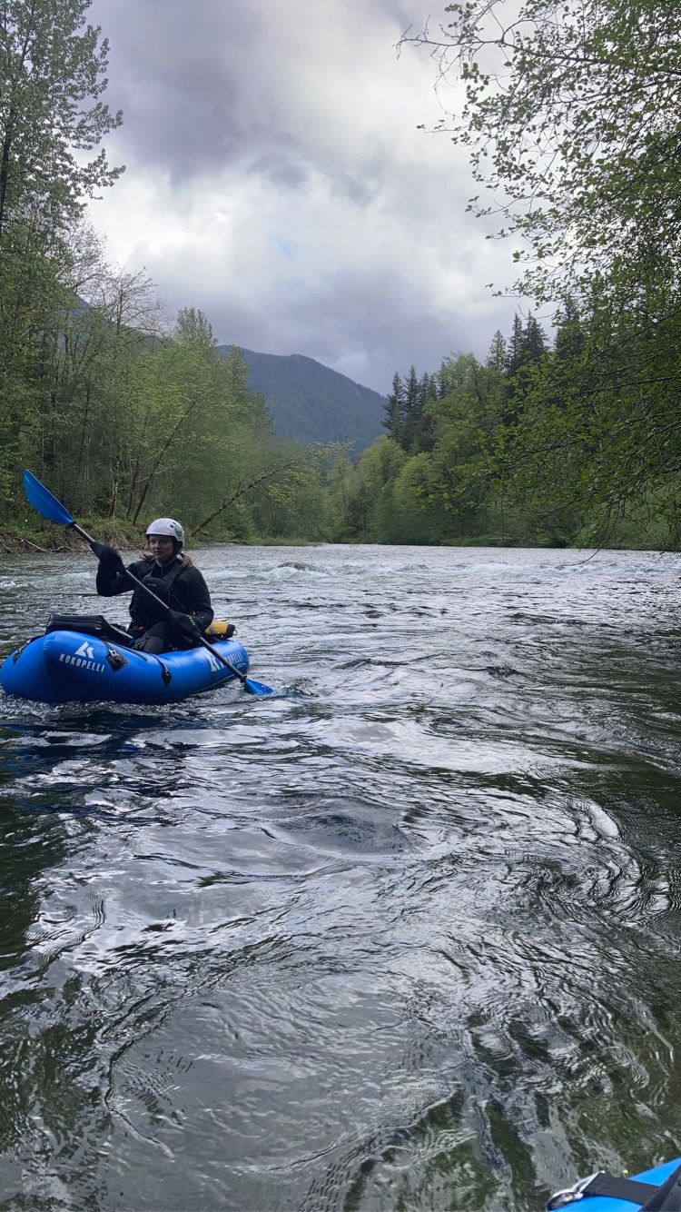
A great little run- in packrafts when you just need to get out on a beautiful day. Although the gauge was a bit low for our preference at 285CFS, we opted to give it a go. We were able to manage the low flow, with minimal butt scraping. We were also able to avoid the wood obstacles- by walking around the first river spanning tree on the exposed gravel bar and floating under two (see photos). At higher levels, the river spanning wood obstacles will likely need a different management solution. All in all, a great day, with good class II fun.
tried uploading photos.... but keep getting errors, unrelated to file size. I guess just be on the lookout for wood, especially near the clay wall.
Dec 22, 2025
I was with a large group of kayakers on Saturday, and we put in at the 468th Ave bridge, because Olallie SP was closed. We ran the river down to the 424th Ave cul-de-sac. It was a really fun level.
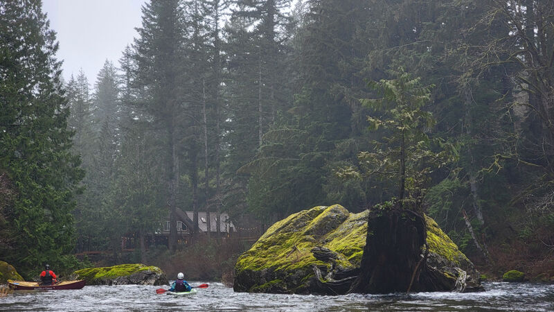
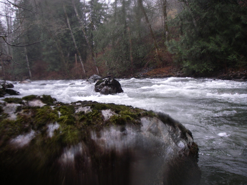
Turtle rock is sadly no more- the flood waters of the last couple of weeks moved the big stump that made the turtle's head. Here's what that rock used to look like. https://www.sanderlingphotography.com/SanderlingPhotography/PNW-Paddle-Clubs/2024/PTCC-SF-Snoqualmie/i-Qrpjb6V/A
There was a large tree across nearly the whole river immediately before the rock formerly known as Turtle Rock. It is passable by a narrow channel far left, or if you duck and the water level is low enough, you can go underneath it on river right.
Apr 30, 2025
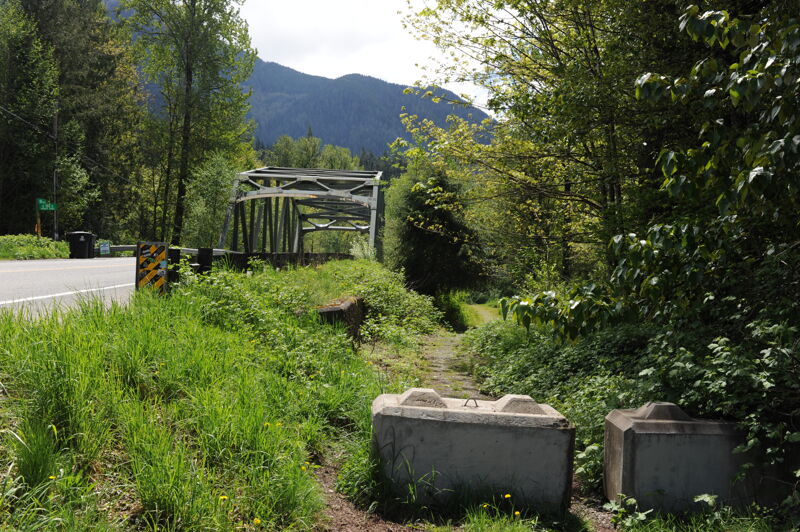
Stop at the 468th St. Bridge.
Jun 4, 2022
Paddlers: Patrick (Kayak), Dale (Kayak), Meryl (Kayak), and Mark (Packraft).
The Upper MF at over 3500 CFS and recently ran it at 3100 CFS a few days prior that we decided to switch to the SF as the levels were in the recommended range at 850 CFS.
Weather: Was typical spring PNW weather with sunshine in the early afternoon phasing to cloudy and a drizzle and decent rain by the end.
Run: It was a fun solid run with good wave trains and strong currents at most rapids. This is a good level for stronger Class II paddlers.
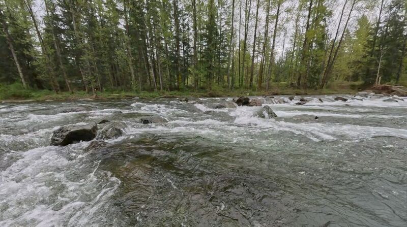
Hazards: Near the end of clay wall rapid there was a river level tree fell on river right. Just be away as it might not be visible as its was barely under the surface.
May 18, 2022
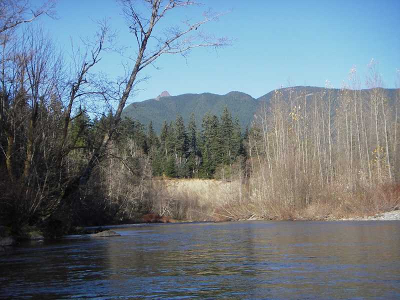
Yesterday we ran this section at around 700cfs and I'd say this is about the perfect level for beginner paddlers. Much less than this and the gravel bar sections would be pretty bony, much more and it will pick up speed and be a bit more continuous. Our group was just two packrafters, and I had used a razor scooter to shuttle through the side streets and across the bridge at Camp Waskowitz. The shuttle took me about 35 minutes intermittently walking and scootering. We put in at the parking lot for Twin Falls.
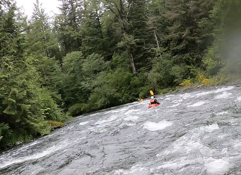
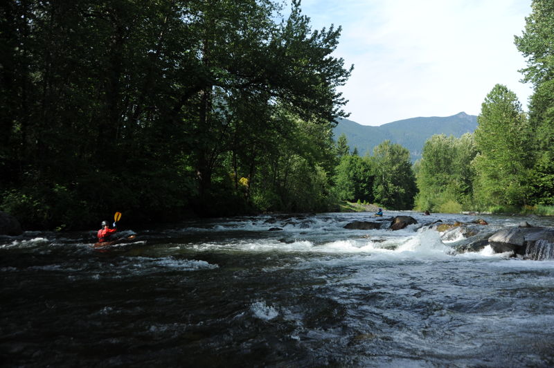
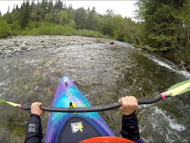
The first rapid is a nice warmup and is just a fun little chutey wave train banking off the left wall. After a couple more class II rapids the river passes under the 468th st bridge. From here the river calms down a tad for a good half mile or so, the first split right after the bridge we went right with no issues. Before you even realize it, you'll reach the Clay Wall rapid which is just an easy little wave train with one large boulder in the middle that I assume creates a nice hole at higher flows. We caught the eddy river left below the clay wall and took a quick pause. Leaving the clay wall, the river wraps around a big left bend and here's where we encountered the only wood hazard on the run. Basically the river split, 90% of the flow was going right so we followed. Very shortly after this the river splits again, only this time you must go left because the entire right channel which took most of the water with it drops under an absolutely nasty logjam. The entire current pushes under several channel spanning logs and an accident here would mean serious trouble. That being said if you take the second left channel the wood is easily avoidable and shouldn't pose a problem to those who are paying attention. A large boulder on river right marks the start of the class II+ rapids and there are a couple more as you approach Waskowitz Canyon. The first footbridge marks the start of Waskowitz Canyon, a continuous class II+ section of whitewater that lasts roughly 1/3 of a mile. There was no wood in play, and the rapids are basically just a big boulder garden with some holes and wave trains here and there. One thing I would note, on a sunny afternoon plan ahead and bring sunglasses. The entire canyon section we were being blinded by the reflection and it made not scouting kind of a pain in the ass.
The canyon section slowly tapers off as you pass under the second footbridge and then around a left hand turn. Shortly after this turn is 'the Weir'. This isn't really your typical 'weir' as there is no uniform drop and not much of a recirculating current. This rapid should not be disrespected, there are a couple nasty little pin rocks on several of the middle-left lines and at 700cfs there is not enough flow to make any of these slots clean. I ran one that looked like it had a decent flow through it but ended up skipping my ass down rocks before telling the girlfriend to walk around. There is an easy clean line far river right that avoids the entire feature but from the left side where we stopped to scout there wasn't much of chance of us making it back over there.
The river meanders it's way down to the 436th ave SE bridge and has a couple more class II rapids along the way. The takeout at the bridge is on river right. We took out in this micro eddy right before the bridge. It wasn't great for beginners to catch but it worked. There may be a better access point here at the bridge but I didn't look very hard. Whole float took roughly an hour and a half with a couple little stops to practice eddylines.
Jan 3, 2021
New wood as of 1/2/21. Nearly river wide log above the logjam that's been there awhile--easy to spot. Stick left and either scoot or walk your boat depending on flows. Channels through the logjam below are still clear, far right goes, left side works when the river is high (otherwise makes for a bumpy ride).
Some wood still in the canyon about midway down. Log from river left near a nice break spot, you'll notice a branch from it sticking up towards the center of the river. There's now another branch on river right in the same area. Plenty of room down the center but with newer paddlers or swimmers be sure to keep an eye out.
May 28, 2020
Evening run down the South Fork with a few families.
May 24, 2020
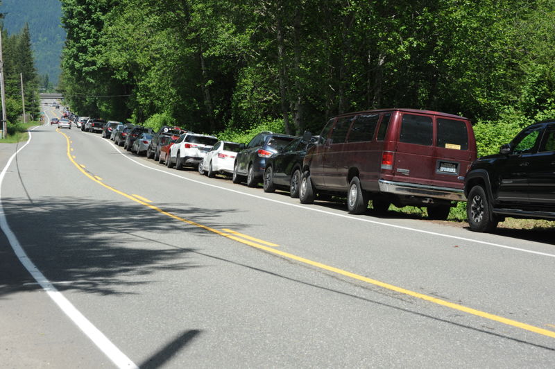
Kids trip on the South Fork Snoqualmie with James, Lucas, and Leanna Girton and Tom, Aki, and Taka O'Keefe. It was a good day for a bike shuttle because no parking was avaialble at the State Park trailhead and cars were parked along the road all the way out to the Interstate.
May 17, 2020
A fun evening run down the South Fork Snoqualmie River where we encountered a few friends from Paddle Trails Canoe Club.
Apr 24, 2017
from paddle trails canoe club Trip Report: April 23, 2017 exploratory trip on the SF Snoqualmie to check out the tree blockages.
Apr 15, 2014
Floated down the river this weekend (April 13, 2014) in two Alpaka packrafts with my dad. We are on the lower-intermediate level in terms of packrafting/kayaking experience. Water was at 335 cfs (recommended range, per site, is 300-2500) -- and at 335 it was still good to float, but I wouldn't have wanted it to be any lower. We put in at the parking lot to Twin Falls, and got out at the 436 Bridge, just as the entry here describes. Float time was just under ~1.5 hours, including a couple of quick stops at a few eddies. It felt shorter than the 5 miles described (not sure if it actually is shorter than 5 miles, or was merely our perception because of the many fast-paced sections).
\\\*************
The first ~.5 miles from the parking lot (to first bridge over river) had an intermediate amount of waves and wave trains: enough to keep us ready for whitewater, but not too bad. The next mile or so was quite placid and with beautiful scenery. But then the next few miles compensated handily for the relaxation, with lots of rocks to dodge (at least at this low water level), constant maneuvering, and fast-paced action. The river drops surprisingly a lot in those places: you can really see the gradient. Despite the dodging and a few rocks we each ran into, neither one of us ended up in the water.
\\\*************
There were a couple of fallen trees on the banks and partially on the river, but none that blocked the river fully. All in all, beautiful scenery, and good fast-paced action.
May 7, 2008
There's really no info in the guidebooks about the South Fork below the class II+ run, but it's worth knowing about.
The SF is runnable down to the confluence with the Middle Fork. There are a few rapids, but they are mostly above the first bridge in North Bend. After that, the gradient begins to slacken.
A couple of miles below the last bridge, the river turns sharply left and you'll probably see some snags, which are dropped by the river when the current slows. From that point until the confluence, there will be several logjams, which may or may not be passable. This stretch changes drastically from year to year, and there's no way to know what it's like.
In this stretch, it's possible to see herons and bald eagles.
Once you reach the confluence with the Middle Fork, the main Snoqualmie continues down into the town of Snoqualmie. You can take out at the confluence, or continue down to another convenient takeout.
This run is best at over 1000 cfs, but it's probably not a good idea to run it over 1500 cfs unless you've already run it once.
Nov 19, 2006
Boulder garden near the end of Waskowitz Canyon
Nov 22, 2005
This is the gravel fan below the first island. There is always a tree ready to fall in the water here. As soon as one goes, another takes its place.
Entering the clay wall area. Below this is a small rapid where many people practice surfing. A storm in 2005 moved the most significant rock, making the biggest hole not as fun as before.
This is a small chute approaching the canyon. There is a pair of rocks in the center at the bottom. At flows above 1000cfs, this creates an enticing hole with a rock behind it.
This is the rapid that bends South after exiting the canyon. The most common route is right of the island, near the wall.
This is the weir from the right bank. The biggest danger in the weir is logs that collect after large storms.
Jan 1, 1900
Big tree down from river right just below Clay Wall. If you can get really close to the tree at 906 cfs on river left to sneak by in your boat. Or just get out and drag it in the shallow water. There's some wood after this, then the big log jam