Kings
4. Pine Flat Dam to Centerville (Route 180)

| Difficulty | I-II |
| Length | 12.2 mi |
| Avg Gradient | 14 fpm |
| Gauge | Kings Rel Pine Flat Lake |
| Flow Rate as of 27 minutes | 6159 cfsrunnable |
| Reach Info Last Updated | July 7, 2015 |
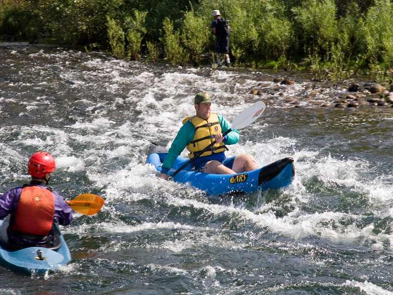
The Lower Kings River, (below Pine Flat Dam) is a very nice river for canoeing and for beginning kayakers and rafters. It is a good summer after work destination. It also has some decent play spots, especially for modern play boats. The scenery is excellent, changing from foothill grasslands to valley oak forest. Mostly the river is quite wide, but there are a number of narrow winding side channels with overhanging forest canopies.
Getting There:
From the north, take freeway 99 to Fresno, then take freeway 180 east to its end. Jog south (right) one mile to Kings Canyon Ave. (highway 180) and drive till it crosses the river at Pierces' Park (the take-out). To go directly to the put-in or for shorter runs only drive a half a block south from freeway 180, to Belmont Ave. and turn left (east). Follow Belmont to Piedra.
From the south, take freeway 99 north to Freeway 198 east. Immediately take the Plaza Drive exit and go north through Dinuba to Adams Ave. Turn left to Frankwood (if going directly to the put-in) or on to Reed Ave (if going to the take-out). Go north on Reed to 180 east, to Pierce's Park. If going directly to the put-in go north on Frankwood to Piedra Rd. to Piedra.
River Mileage and Elevations:
Location Mile # Elevation
(feet) Put-in0 560Piedra Bridge3 515Winton Park3.5 510Alta Weir5 490Avocado Lake6.3 480Channel Split6.5 475Gould Weir7.3 465Mansion8.5 450Fresno Weir9.3 430Highway 18012 385
Put-in and Take-out:,
There are many public access points from the dam to Avocado Lake either at Fresno County parks or from roadside turnouts. Below Avocado the banks are mostly private property. At highway 180, the privately owned Pierce's Park provides a nice take-out and camping for small fees. Free but more awkward take-outs can be made at the bridge or just past Pierce's Park
...The very first rapid is one of the steeper ones on this section, but it is wide and straight.
A long, wide section of flatwater follows. There are small eddies along the sides which are good for practicing eddy turns and peel outs. There are some bedrock features and cliffs along the right side which form small play waves, and sharp eddy lines.
Islands divide the river into 3 main channels with several interconnections. Staying far left leads down a wide shallow channel to the mouth of Mill Creek. In May of 2007, boaters reported a barbed wire fence extending out into this channel from the left side. Be very careful to stay to the right of this fence if you venture into this channel. In the past one could paddle even more to the left up the mouth a ways, though the creek only has flows in the winter and early spring. Heading downstream, the left channel is fairly narrow and shaded. The center channel is wide, shallow and sweeping. The right side channel is fairly small and has some sharp turns before it rejoins the middle channel.

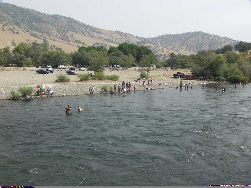
The river right bank is a county park and campground along a section of flatwater. The name, 'Choinumni' comes from the local indian tribe that inhabited this area.
A group of islands have developed along the outside edge of a large alluvial fan. They form a U shape with the top of the U facing upstream. Two main channels run down the left and right sides of the U, while several small channels also cut through the U at spots. The left channel is long, narrow, shaded, fast and interesting, but the right channel is probably safer for beginners.
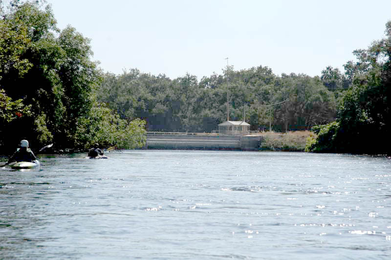
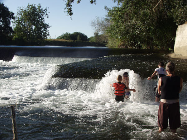
Alta Weir is a low dam structure that diverts water into an irrigation channel to the left. The main hazard is concrete dividers spaced every 8 feet across the river (and the trees that sometimes snag on those dividers). The drop itself has had no reversal for many years and does not now pose a major hazard. Many paddlers do run this weir, but it is also very easy to portage on river right.
The dividers in the weir are designed to hold boards in place that further dam the water. When the boards are in place they create a steeper and more awkward drop. The boards are needed to dam the water at very low flows, but the irrigation district has gotten into the habit of leaving them in all year long no matter what the flow.
Alta is popular for its river wide surf wave which forms just below the drop.
Many groups also take-out just upstream of the weir on river left. There is a steep bank, but the road is next to the river and there is a large parking area.
Stay out of the river left channel above the irrigation gate structure. Water is sucked down and through the bottom of the gates.
A high voltage tower is on top of a hill on river right. A trail leads up this steep hill to a big turnout on the road.
A narrow, shady, channel splits off and does not rejoin the main channel for over a mile. This left channel bypasses the Gould Weir. Avocado Lake is immediately on the other side of the left bank. The right channel is cluttered with rocks placed in the river bed for trout habitat. These rocks make for fun manuvering. This right channel, splits again, but then rejoins after a short distance. After a half mile it splits again with the right most channel leading to Gould Weir.
The river splits again, but at lower flows, most of the water goes down the right most channel leading to Gould Weir. Portage on river left starting a ways above the weir. The bank is mostly concrete riprap near the weir and so it is awkward to take out. Close to the weir the banks are steeper and the current faster. A dirt road leads around the weir and to a nice put-in below. At medium and high flows it is easy and best to avoid this channel. At low flows the middle and left channels can get too low so that paddlers are forced into the Gould Weir channel.
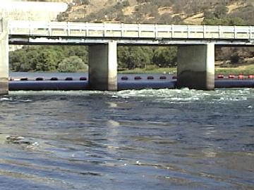
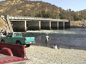
Just after the Gould Weir Channel rejoins the center channel, a private road crosses both branches of the river via metal bridges. The bridge over the main/right channel is very low and blocks passage at higher flows. At 6,800 cfs kayaks can barely slip under, but rafts and canoes must portage. It is a short but awkward portage with lots of stinging nettle. The bridge over river left channel is high up and never presents a problem for boaters.
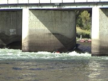
Portage river left. This is a 6 to 8 foot high dam is about 3/4 mile past the fancy Harris Ranch Mansion. White fences on river right continue a ways past the mansion. Just after the fences end, a thick telephone cable passes over the river and the river curves right, then left. Looking downstream boaters will see a small building atop a concrete wall. This wall is the right bank of the dam. There are no other warning sign and the dam itself is visible only as a horizon line. The river curves to the left enough that it is impossible to see the portage till you are on top of it. Once you see these structures hug the left shore and get ready to portage.
There are two options for portage on the river left. The most common option is to slink, one at a time, past the berry bushes to a narrow hole in the bushes about 20 feet from the lip of the dam. If you have beginners somebody should stand in the water and drag them into the hole so they do not drift past. Only one boat at a time really fits. Fortunately the current tends to be relatively slow as the dam is very wide. At high flows, however, this option can be scary.
The second option is to take out upstream of the berry bushes and drag boats 50 yards or so behind the berry bushes. This is a much safer option but is less obvious and gets little to no use, so the trail is usually overgrown and the take-out is not obvious. The local paddling club has discussed putting a sign at this take-out, but has not yet done so.
The land at this portage is public; Bureau of Reclamation upstream, and Fresno County downstream, so it is a legal stopping and picnicing spot in this lower section.
Take out under the bridge on river right or around the corner at Pierces Park. There is also an awkward take up a steep bank just past Pierces Park on the right. There is a large turnout for parking and a large tree next to highway 180. County owned land on river right, upstream of the bridge is being developed for fishing and boating access.
May 2, 2008
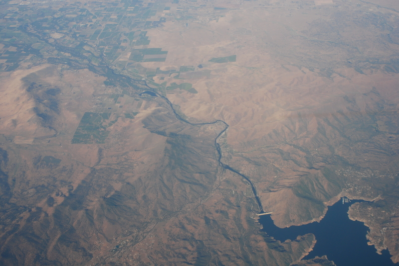
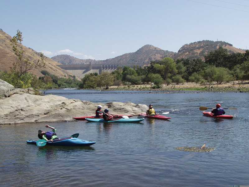
Pine Flat Dam on the Kings River
Sep 15, 2005
Surfing Alta Wave at low flows can be difficult in a shorter, slower boat because the wave is so small, while the current remains very fast.
Flow was 2,800 release from Pine Flat dam, but perhaps 800 to 1,000 cfs less below this weir.
This building atop a concrete wall marks the right bank of the Fresno Weir, an 8 foot high dam. When you see this view, paddle to the left bank and look for the portage.
Kat stands in the water to push Evan into a hole in the bushes which is the start of the portage path around Fresno Weir. There is room for two boats at most while only one boat at a time can actually beach and get out.
That is the lip of the dam only 20 feet or so behind her.