Kings
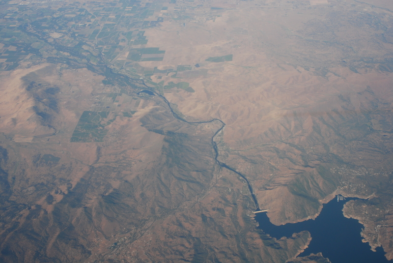
4. Pine Flat Dam to Centerville (Route 180)

May 2, 2008
Pine Flat Dam on the Kings River
Sep 15, 2005
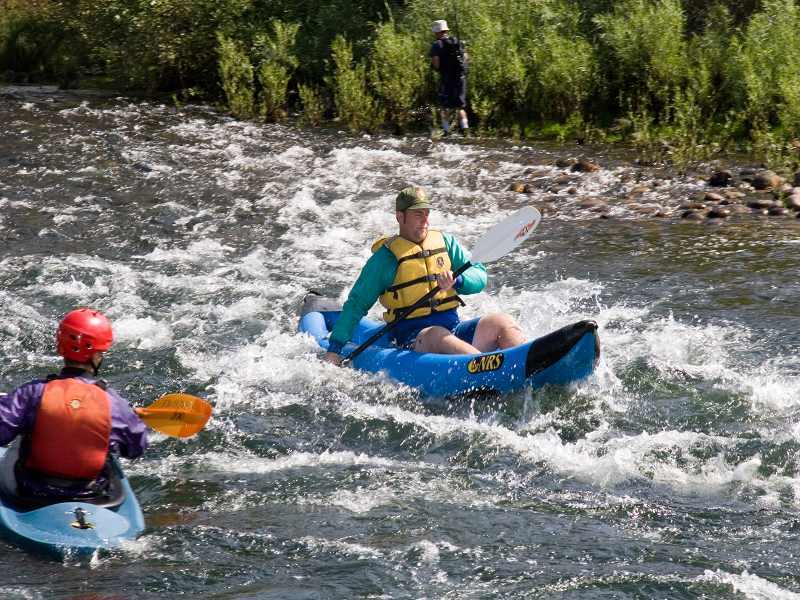
Surfing Alta Wave at low flows can be difficult in a shorter, slower boat because the wave is so small, while the current remains very fast.
Flow was 2,800 release from Pine Flat dam, but perhaps 800 to 1,000 cfs less below this weir.
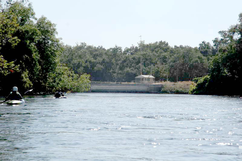
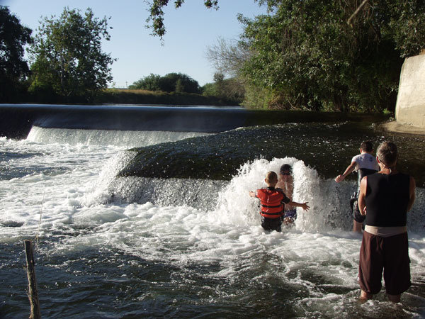
This building atop a concrete wall marks the right bank of the Fresno Weir, an 8 foot high dam. When you see this view, paddle to the left bank and look for the portage.
Kat stands in the water to push Evan into a hole in the bushes which is the start of the portage path around Fresno Weir. There is room for two boats at most while only one boat at a time can actually beach and get out.
That is the lip of the dam only 20 feet or so behind her.
Sep 15, 2003
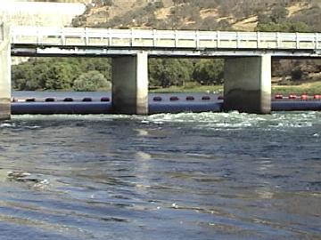
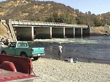
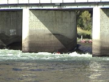
This bridge is just below Pine Flat dam. The weirs underneath have killed several people who became trapped in the recirculation. Launch boats 300 feet downstream and avoid this hazard.
Sep 5, 2003
This bridge is just downstream of Pine Flat Dam. The weirs between the bridge suppports create deadly recirculations that have killed a number of people. Launch boats 300 feet downstream and avoid this weir.
Aug 15, 2003
The Alta Weir is one of several weirs between Pine Flat Dam and highway 180. The portage on river right is very easy.
This picture, from Spring of 1995 shows high water of about 13,000 cfs, when the river is legally closed to boating.
The smooth mound of water on the right or upstream side of the picture is the main part of the weir. There are concrete dividers spaced every 8 feet across the river. They are about 2 feet high. Each divider has a vertical slot on each side. Boards are slid down into these slots to dam the openings and raise the water level for a diversion on river left.
The boards are only useful for backing up very low flows, but in recent years they tend to get left in all year instead of just in late fall.
This apron on the edge of the weir forms a fun pocket under the water big enough sit in. Several people could fit at once.
Release from Pine Flat was about 2400 cfs, but the flow is quite a bit less than that actually coming over this weir. The water coming over this small apron is about 1 inch deep.
The water tempurature was fairly pleasant on this day, but most of the summer it will be freezing cold.
The Fresno Weir is the furthest downstream of several weirs between Pine Flat Dam and highway 180. Portage on river left. Look for an opening in the bushes just 20 or 30 feet away from the lip of the dam.
This weir is a ways below the big Mansion and immediately below the Friant Kern Canal siphon. It is still a couple miles or so from Highway 180.
Water is diverted into two canals on river right. Fresno Irrigation District and Consolodated Irrigation District get their water from this diversion. There is much less flow below this weir.
Aug 11, 2002
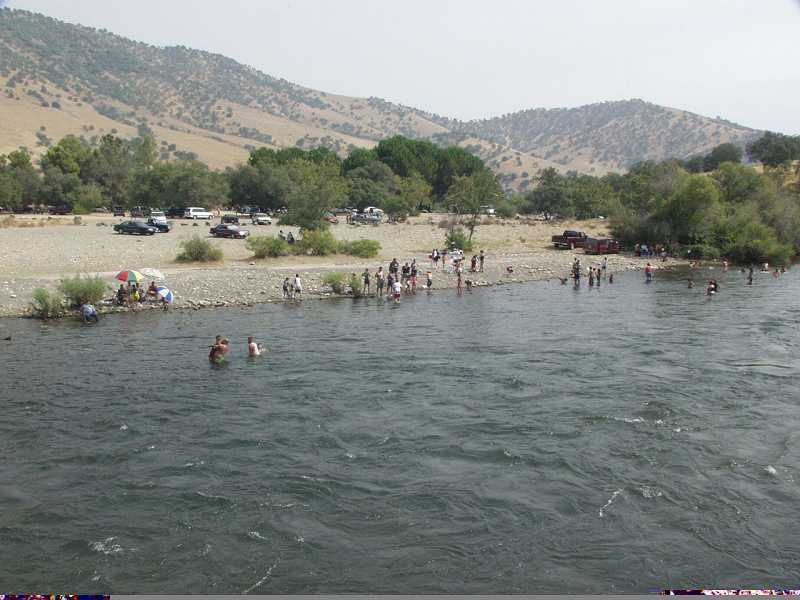
Winton Park is open for day use and river access. There are picnic tables and toilets.
Sep 1, 2001
These large eddies are good places for beginners to practice their turns.
Jan 1, 1900
This Channel has a wide shallow entrance, constricting to this small drop, followed by a narrow channel, then some sharp turns before it rejoins the center channel.
Gary waits in the narrow section of channel. The first sharp turn is visible downstream.
Raft entering the left most chute below Piedra Bridge. This is the largest and most commonly run of the three chutes.
Gary was resting after playing in the eddylines for awhile. There are big eddies on both sides of each of the 3 chutes. This makes this a good place for eddyline playboating, ferry practice and just hanging out.
Jan 1, 1900
This chute looks really big and scary if you have never run whitewater before.
Jan 1, 1900
This bridge is just downstream of Pine Flat dam. The weir underneath forms deadly recirculations and has killed several people. Launch boats 300 feet downstream and avoid this weir.
Jan 1, 1900
The Kings river is a lovely class 2
float trip below Pine Flat Dam to
Piedra or on to Centerville.
Gould Weir (low head dam) helps divert water from the Kings River into the Enterprise Canal. It is on the right most channel a mile or two below Avocado Lake. Portage on river left, starting a ways upstream of the dam. There is no take-out close to the dam. A road leads around the dam to an easy put-in below.
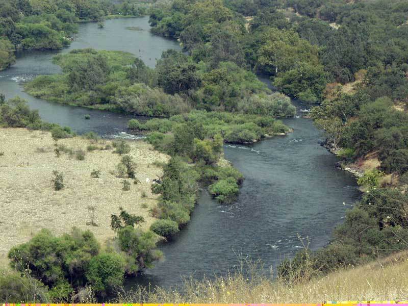
This is the second group of islands. The river right channel is the most open. The river left channel is very pretty but has tricky manuevering at the end.
At low water the wave below Alta Weir becomes smaller, smoother. It just becomes a green hump at some point.
The streambed is shallow here, so there is no hole or recirculation below this weir.