Rock
Worm Lake outlet to Sturgeon River (9.1 miles)
| Difficulty | II-III+ |
| Length | 8.3 mi |
| Avg Gradient | 69 fpm |
| Gauge | Rock Near Covington Approximation |
| Flow Rate as of 30 minutes | 8 cfsbelow recommended |
| Reach Info Last Updated | March 12, 2026 |
Put-in: Old Michigan Hwy.28.: 46.55199 -88.47518
Alt.Put-in: US141/M28: 46.57329 -88.49423
Take-out: Plains Road: 46.58407 -88.57554
Drainage (at Alt.put-in): 40.3 Sq.Mi.
Overall Gradient: ~60 FPM
Full-Mile Maximum Gradient: ~71 FPM
Note: Run includes 3.4 mile paddle out (with no rapids and little gradient) on Sturgeon.
Warning: Early season runs may find the Rock completely ice-free, but find portions of the Sturgeon iced shore-to-shore! Be prepared to 'knuckle-walk' or portage 1/4-1/2 mile stretches.
The Rock River has far more continuous rapids than is typical in the Midwest! Do not take lightly the II-III rating! At low-to-moderate flows, the difficulty will generally be on par with any class II-III run in the Midwest. However, paddlers should be strong, confident, intermediate paddlers, with an experienced group (solid rolling skills, practiced in river safety and rescue techniques) before attempting this run at moderate to high levels. At such levels, most paddlers will be left with the impression of the bulk of this run being essentially one long rapid, quite different from the usual pool/drop runs of the Midwest!
===================================================
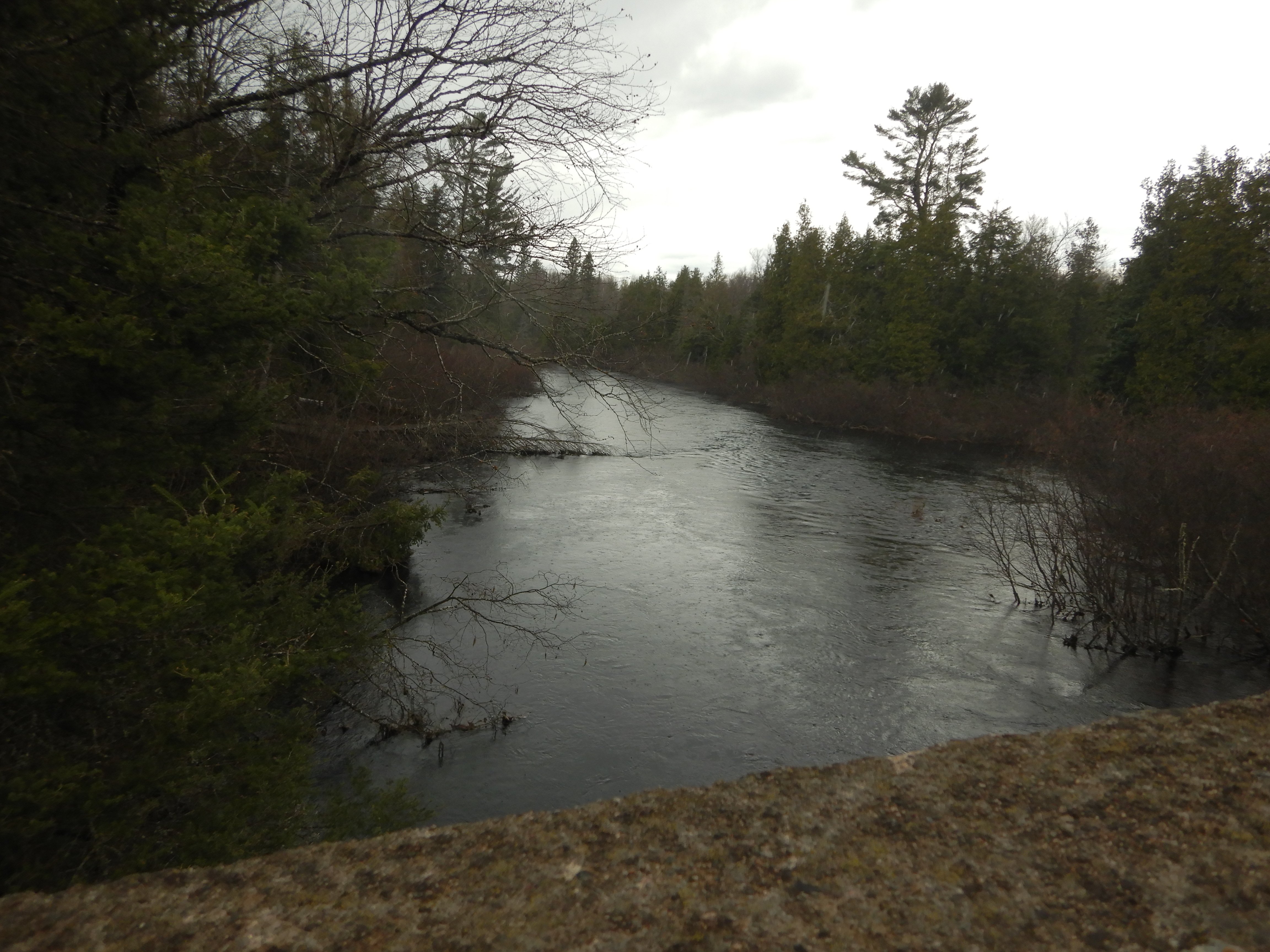
From the recommended put-in, a brief flatwater paddle brings you to some light rapids. Shortly you'll encounter a very low footbridge which will be a limbo at low-to-moderate levels, and will require portage at moderate-to-high levels. Soon thereafter the river assumes the character it will hold for much of it's length: essentially one, non-stop rapid. Trees in the current are not uncommon though usually can be paddled around. Be alert! As of April 2001 there was one beaver dam that could be 'snuck' by a paddle through the trees on the left.</
...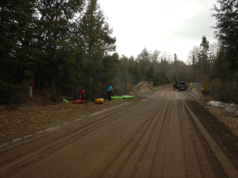
Park roadside and put in.

A property owner has a very low footbridge which will be a limbo at low-to-moderate levels, and will require portage at moderate-to-high levels.
USGS lists a sampling site at Hwy.41 with drainage area at this point of 40.3 square miles.
While one could shorten the trip by 2+ miles by putting in here, we generally recommend using the upper put-in (as listed on this reach). It gives boaters (especially those who may be less familiar with the run) a chance to 'warm up' and see what the run is like.
If you have any difficulty or concern running the upper part of the run (down to this location), you should seriously consider taking out here. The run from here down steps things up a notch or two.
As the river sweeps to the left, it approaches the most significant rapids/sequence. At low-to-moderate flows, this may be boat-scoutable. At higher flows, (and even moderate flows, particularly for less experienced paddlers, or those not well-familiar with this run) scouting is highly recommended. A tight bend partway down is prone to containing wood. Action is very continuous for a good ways downstream. Anyone having problems anywhere on this stretch will be in for a long chase if they end up out of their boat.
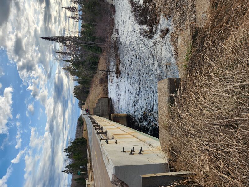
This is the end (mouth) of the Rock River, and the end of the gradient on this run. Just upstream from the confluence there is a small bridge across the river. At medium to high flows this will be a challenge to get under. Be careful; it comes up quick. You may need to land and portage. Try river right.
From here, you normally have three miles of pretty much dead flat paddle out to the usual take-out. Directly across the Sturgeon River from the mouth of the Rock River, there is a house. It may be possible to (and one time we were there, we did encounter the property owner, who volunteered that we could) take out at that property to skip the long paddle-out. However, finding the right back roads to get to that property is not easy, and (if I recall) there is a gate (well back from the property) which will be closed anytime the property owner is not present. Thus, I would not count on using that access to eliminate the flat water paddle.
Most will take out at Plains Road.
Some may continue to check out Tibbets Falls on the Sturgeon (which will probably be at flows which may be very dicey, with massive diagonals and keepy hydraulics).