Peshekee
Peshekee Grade Road (various, up to 18 miles)
| Difficulty | I-III |
| Length | 15.3 mi |
| Avg Gradient | 14 fpm |
| Gauge | Middle Branch Escanaba River at Humboldt, Mi |
| Flow Rate as of 26 minutes | 47 cfsbelow recommended |
| Reach Info Last Updated | April 21, 2019 |
Roadside run with numerous possibilities for access (I.E., shorter trips). With the exception of the uppermost stretch, this is generally considerably tamer than the most popular U.P. runs and a nicely scenic float trip with plenty of moving water and class I-II boogie, plus a few more substantial rapids (I.E., pool/drop nature). Length of trip (in early spring) is likely to be limited by how far up Huron Bay/Peshekee Grade Road you can get before it is impassible due to snow. Again, the stouter drops are up higher on the run.
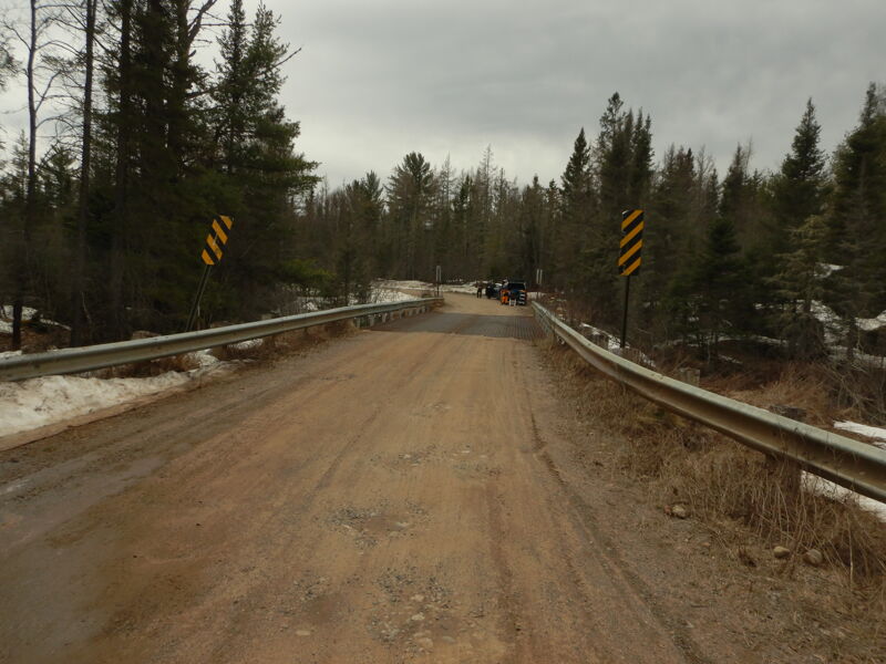
The road crosses the river numerous times. Runs are known to have been made from as far as 'seven bridges up from Hwy 41'. By that point the Peshekee is a fairly small stream and above there the gradient is very low. (Note: As you travel up the (Huron Bay/Peshekee Grade) road, there are a number of bridges (or culverts) across the Peshekee, but also across numerous sidecreeks. Thus your bridge count may vary.)
From bridge seven to bridge six is the fastest portion (2.7 miles, 23'/mile avg). One of the better options for a short, easy run may be from bridge four to about a mile upstream of bridge one (3.9 miles, 18'/mile avg).

All distances listed are 'upstream, from mouth' (rather than the usual 'downstream, from listed put-in'). Since early-season runs will likely be from someplace short of the listed put-in (due to roads being impassible), this method should make it more straightforward to determine the length of your available run.
The description (and the following list) mentions various bridges, which are usually counted as you drive up County Road 606/Huron Bay Grade (I.E., as you head upriver). Note that this bridge count does NOT include bridges on sideroads. Thus, as you head downriver, your bridge count will be different than the bridge count on your drive up. There may be additional sideroad or driveway bridges which are not listed here. Therefore do NOT rely on counting bridges (on your way downstream) to determine your progress toward (or arrival at) your intended take-out.
Gradient upstream of this bridge (for quite a distance) is quite low. We find it hard to recommend any put-in (for whitewater boaters) above this point. (This bridge appears to be at the 545 meter contour on the topo maps, or about 1788'.)
Why not cut off a half-mile and put-in here instead of 7th bridge.
Drainage area at this point is ~18 square miles.
Yowser! Check it out: Google Todd Jones Photos
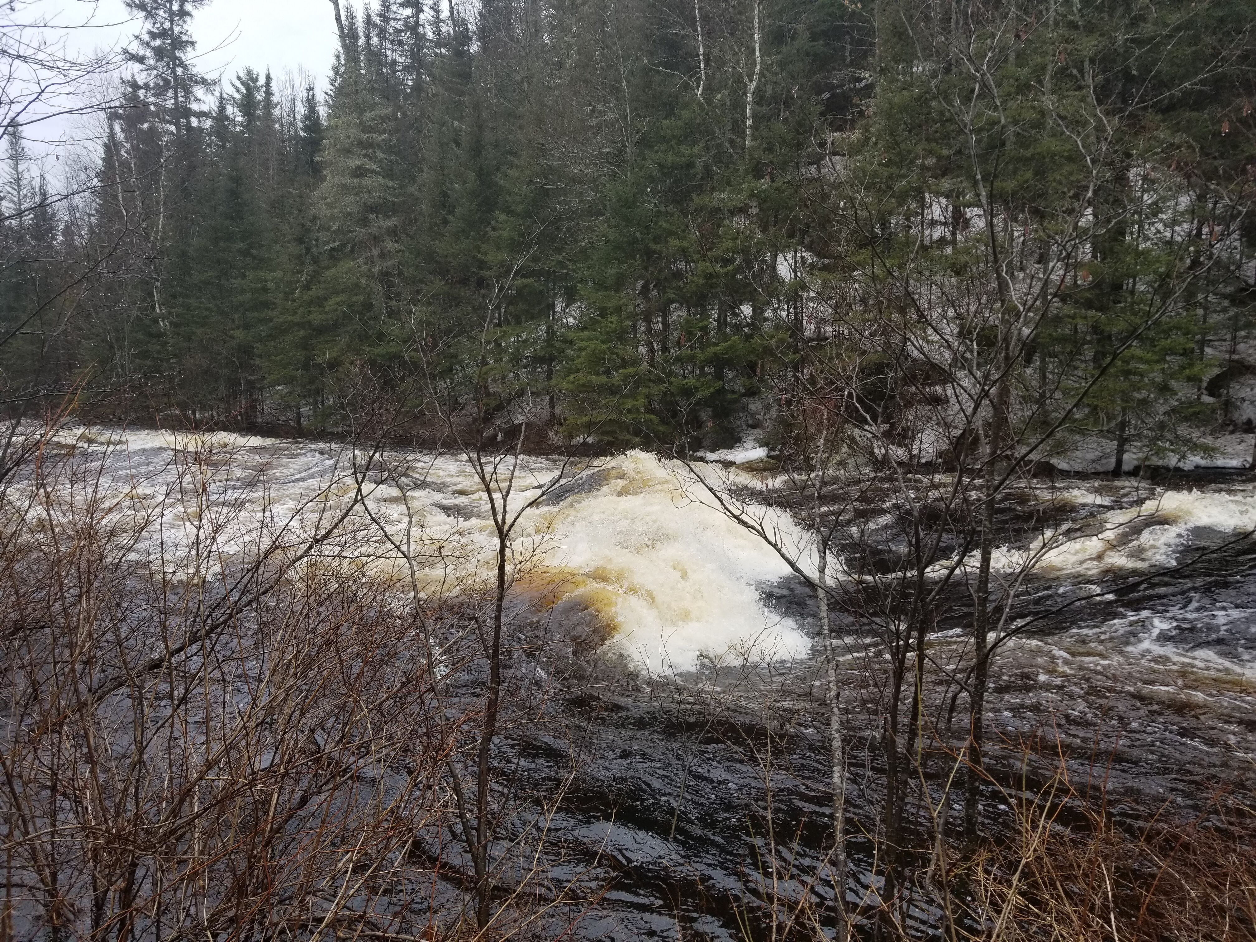
A (possibly sticky) wave/hole precedes a fine stretch of rapids almost the rest of the way to the next bridge.
Good place to get out from the upper stretch. The next few miles are very low gradient. (This bridge is immediately adjacent to a road just marked 'Dead River'.)
If parking can be found, this would make a great spot to put-in for the next stretch of river.
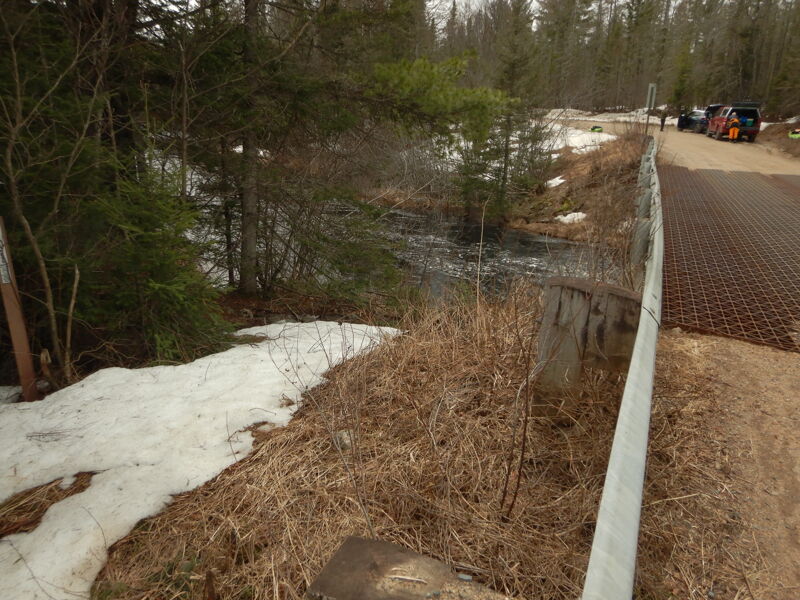
Put-in at south east corner of bridge. some parking on west side. A fine long stretch of low-grade rips begins here.
A fine half-mile plus of low-grade rips starts a bit upstream.
Drainage by this point is very near 44 square miles.
This bridge appears to be just downstream of the 1600' contour line on the topo maps.
USGS gauge at this site (0.6 mile below confluence of W.Br.Peshekee) listed drainage as 133 square miles.
It does not appear (from online satellite views) that there are any rapids downstream of this bridge. If parking and river access are convenient here, this may make a better take-out than paddling the remaining distance to Highway 41.
Apr 27, 2025
As far as I can tell, there is no longer a Moose Rapids gauge, which had been used as a proxy for the Peshekee. For what it is worth, it was 2100 cfs at Michigamme River Near Crystal Falls, MI - USGS-04062500
And, it was 368 cfs on the Middle Branch of the Escanaba.
I don't really know what level it was, but there was snow in the woods. The water was in the tag alders, but didn't seem to be flooded. See pictures of put-in at 5th bridge. All we saw were a few class I waves and maybe a class II near the end. Other than that, it was just a nice paddle, but really no white water to speak of. Maybe what features there might have been were flooded out?!? I guess you need to start further north.
Boris said: The run started with a long stretch of flatwater, followed by serval fun rapids. The river was in flood, so catching eddies or surfing waves was difficult. Next time, I would probably skip the first five miles of the run. It was good exercise though!
Apr 20, 2019
Ran this today at about 1700 cfm on Moose Rapids gauge...river was highest I've seen it yet. Some smaller rapids were washed out almost entirely, while the bigger sequences made large standing waves and wave trains...the big drop towards the end of the run took down 2 of 3 canoes, I was the only kayak to try it and it was a blast but tricky...definitely class 3 Rapids at this level, mixed with class 2 swift water between Rapids. Ran between bridge 4 and bridge 1.