Black (Mississippi Trib.)
E) Hatfield Dam to Power Plant (3.2 miles)
| Difficulty | II-III(IV) |
| Length | 3.1 mi |
| Avg Gradient | 20 fpm |
| Gauge | Black at Hatfield |
| Flow Rate as of 1 hour | -1029 cfsbelow recommended |
| Reach Info Last Updated | February 25, 2024 |
See the 'Flows' tab for details of the present release agreement.
Also, as many boaters have noted, our 'virtual gauge' (as cited above) is often of rather little merit. The most relevant info is available from a NOAA gauge associated with the powerplant. We are told if you subtract 700-1200 from the 'Hatfield Hydro Plant' reading, that will approximate the flow in the natural river channel.
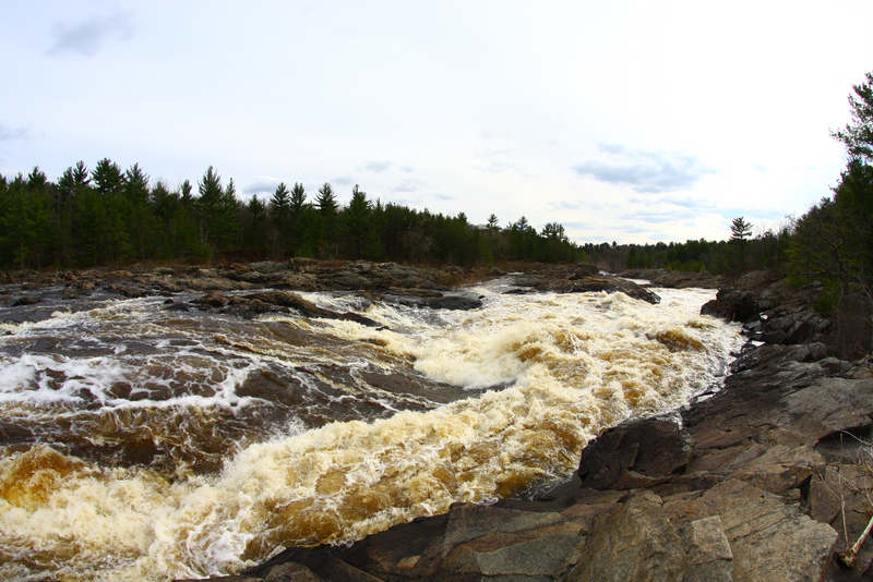
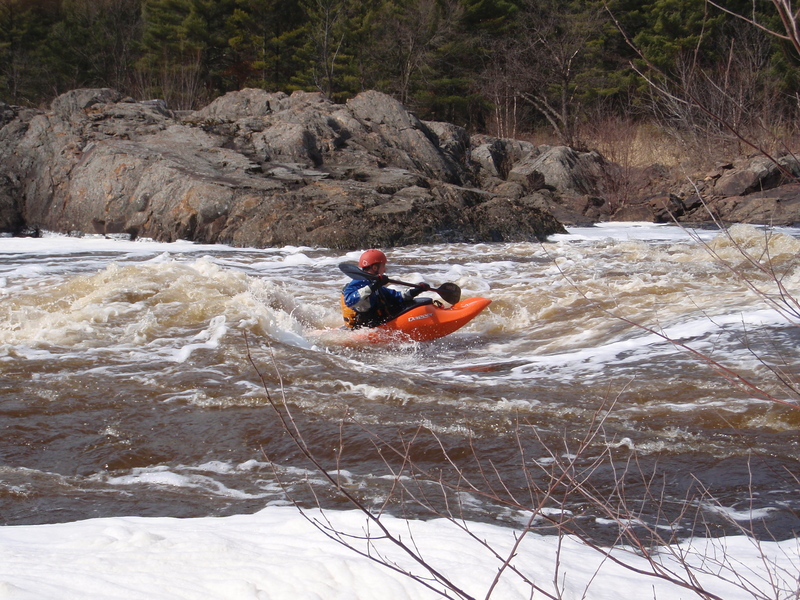
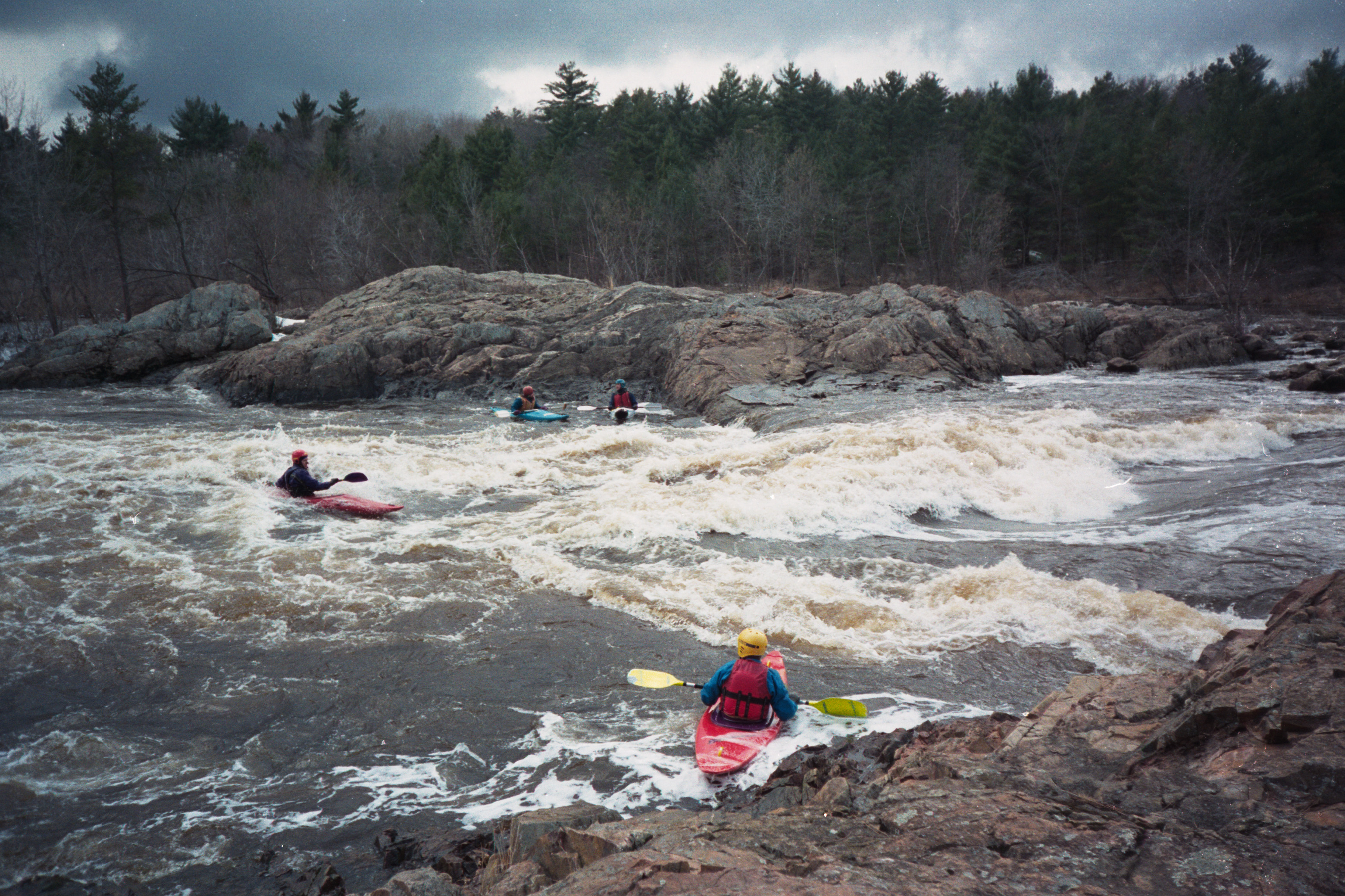
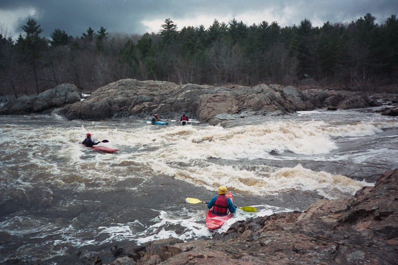
When the full reach is runnable, it can provide some rare 'big water play' in Wisconsin.
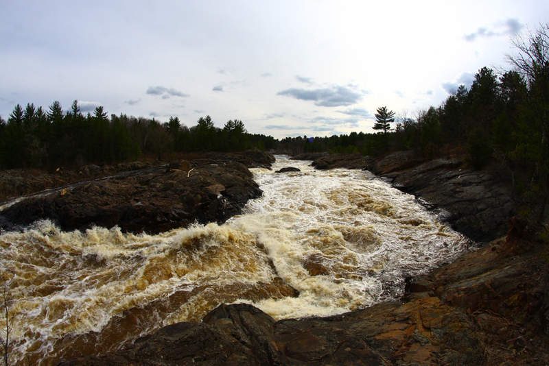
This may be done as either a 'park-and-play' at the put-in (where the best play waves are) or as the listed three mile run from the dam to the powerplant. The run may be extended to a landing at Halls Creek to add three more minor drops (though most whitewater boaters forgo the added flatwater this necessitates).
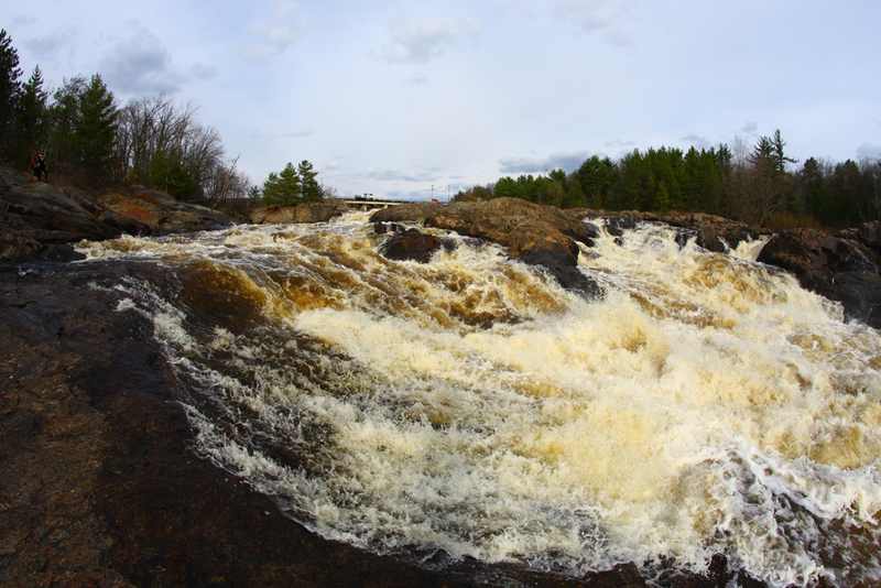
The usual run (at moderate to high flows) starts about a quarter-mile below the dam (the first point reached from the carry-in from normal roadside boater parking). Between the dam and this point lie some serious drops which contains near inescapable boiling cauldrons at moderate to high flows (class IV-V+).
Note: As long as one puts in below this upper stretch, no rapids are greater than a class II-III rating.
In times of lower flow (and during the scheduled releases) the drops from the dam to the carry-in pool are runnable, and may provide some class III-IV entertainment. In fact, according to Jeff Polzin: 'the section immediately below the dam is full of fun class 2 drops at 75 to 150 cfs ... there are a couple of easy class 3 drops (at the K bridge and at the second zag of the 'Z' approximately 2 miles downstream from the dam)'
Also at times of lower flow (i.e., when this reach is 'dewatered' due to the power plant diverting all the flow), boaters may wish to check out the reach from Below the hydroplant to Halls Creek
...
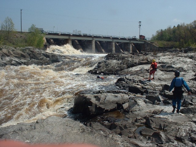
The Hatfield Dam forms the Arbutus Reservoir and diverts flow around this short stretch of river to the Hatfield Powerhouse. Drainage area at the Hatfield Dam is approximately 1290 sq.mi. (as calculated via USGS StreamStats Beta software).
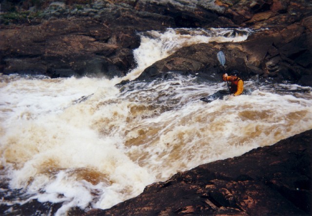
At times of lower flow (and during the summer releases), boaters carry from the 'Campground Wave' to near the dam to run the sequence of great 'creeky' drops immediately downstream of the dam.
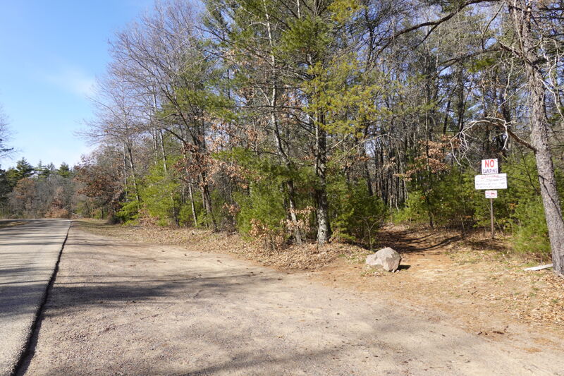
Located along W. Clay School Road, the put-in is on river left on land owned by the hydropower operator and access is provided as a condition of the hydropower license and a requirement to provide public access. Look for the prominent 'No Camping' sign and another warning of the potential for rising water levels. Parking is available by pulling off the road and it is a 300 yard walk in to the river. Stay right where the trail forks staying alert for the signs that mark the way to 'Kayak Access.'
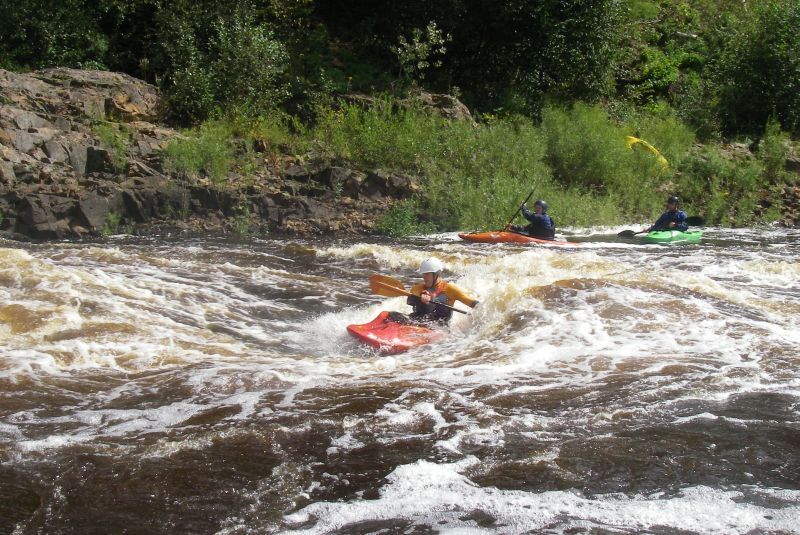
At higher flows, typically in the spring when flow exceeds the capacity of the hydropower project or when the project is offline, a great surf wave forms at the put-in.

Downstream of the put-in waves, and after you pass beneath the highway bridge, an island splits the river flow. The main channel is to the right, and the flow drops across a bedrock intrusion. At some flows a fine surf can be had here.
The following video shows this run, from put-in to take-out of this section, plus the next listed section of this river:
A rocky outcropping splits the flow and allows some minor play.
A final boulder and bedrock intrusion allows minor play (though most folks don't bother, since they've played out the upper stuff).
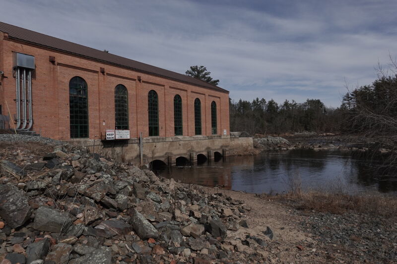
A public take-out provided as a condition of the hydropower license is provided on the downstream river right side of the powerhouse. A small parking area and picnic site is open to the public providing access to the river but parking is limited.
Apr 6, 2019
Best I can tell at this time, in addition to the '888' phone line no longer being available, neither is the web address John listed.
The best info I have now found online is at https://www.ready.noaa.gov/ready2-bin/state.pl?product=hydro&state=wi
which is a L-O-N-G page of data on numerous dams. Pull up that page, then search the page for the text 'Flow'. Doing so will reposition the page to the latest reading, generally showing (in the top-third of the page) 'Pond height' (which will nearly always be in the 800's), followed by 'Tail Heights', then 'Flow'.
(The rest of that page lists periodic readings going back to the prior day.)
Apr 10, 2013
888-HYDROWI is no longer being supported by the Dam Operator.
Current flow information can be found at:
http://www.crh.noaa.gov/arx/?n=hatfield\_arbutus\_monitor