Bad
A) Cayuga to Foster Jnctn. RR bridge (7.6 or 4.3 miles)(Upper)
| Difficulty | II-III(IV) |
| Length | 7.2 mi |
| Avg Gradient | 28 fpm |
| Gauge | Bad River Near Odanah, Wi |
| Flow Rate as of 54 minutes | 88 cfsbelow recommended |
| Reach Info Last Updated | May 18, 2022 |
In Cayuga, the Bad is a meandering quietwater stream and stays that way for the first mile or so. A railway line follows the Bad along the entire reach and the bridges provide a handy reference. At about two miles into the run, after the first rail bridge is passed, light boulder bed rapids lead into a pair of ledge drops which are a warm-up for the drops to come.
The Conley Road bridge (at 3.3 miles) can be used as an alternative put-in (shortening the run to 4.3 miles).
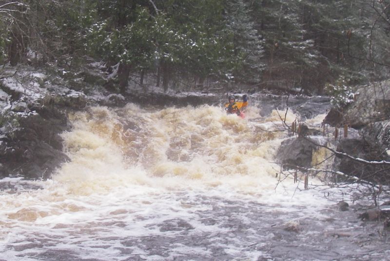
The Bad starts accelerating downhill from here. Take care to count railway bridges as the river builds to fairly continuous class II-II+ water. Just beyond the third railway bridge down from Conley Rd, grab an eddy and scout river-right from the railway line. Rocket Railroad Rapids, the most challenging drop on the reach, lies just below. It starts with a fast flume of water leading into a ledge (about 4' or so) followed by a steep boulder slide of perhaps another 6'.
Click this link to see video: https://www.youtube.com/watch?v=W4HEw2FD8F0
Downstream the river then alternates between fastwater and class II rockbed with a pair of class III boulderbed drops interspersed to liven things up.
You'll pass two more railway bridges downstream of Rocket Railroad with the last significant drop being located about a half mile below these. After this the pace drops off and you'll be looking for the next railway bridge which marks your take-out.
The Foster Junction take-out is located by driving 1.6 miles west of Mellen on Cty GG and looking for a small dirt road turning to the left. A short distance down this road is a grassy area along the railway. If you are not with someone who knows the run, we recommend you walk the eighth of a mile or so down the railway to the bridge over the Bad, to aid in recognizing the spot when you get to it on the river! Indeed, you may wish to mark this location with some te
...
USGS lists a sampling site at Minnow Creek Road / Morse with drainage at that point of 31 square miles.
Ever wonder what's upstream of this section? Well, there is one nearly quarter-mile stretch which looks at least mildly interesting, just a bit downstream of Morse. Other than that . . . flat water, flowing water, maybe a couple minor swifts and boulder fields for the remaining four miles to our listed put-in.
Drainage area at our listed put-in is approximately 51 sq.mi. (as calculated via USGS StreamStats Beta software).
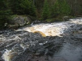
The first series of rapids is encountered after about a mile of flat water. Less experienced boaters may wish to take out river right to scout this class II+ sequence.
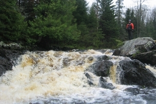
This is the first Class II-III drop on the run. The river-right tongue is a nice ride at 4.3 feet. Most boaters should be fine 'boat scouting', but less experienced boaters may wish to take out river left to scout.
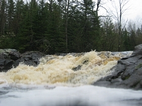
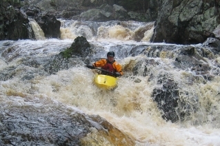
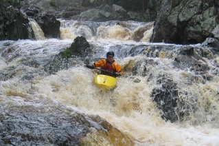
This is the second class III drop of the run. Note that there is a big rock in the middle of the drop (see photo). As the name implies, we generally run down river left.
Some boaters opt to put in here, cutting off over 3.25 miles of river, skipping the first three drops, to focus on the major event downstream.
USGS lists a sampling site at Conley Road having drainage area of 82 square miles.
(Third downstream of Conley Road.) GET OUT HERE TO SCOUT!!!
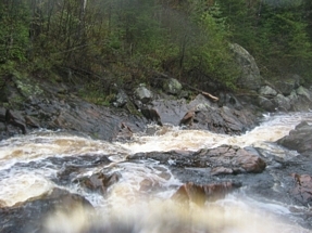
Get out river-right ABOVE the bridge (5th road + railroad from the start, or 4th RR, or 3rd RR from Conley Road, 0.9 miles down), to scout this entire sequence. Eddies below this bridge are few and small.This is the intro to the two larger drops below, and consists of three to four class II-III drops back-to-back.
This is the first of two big drops at the end of the Rocket Railroad Intro. Note the nasty piton rock in the middle. If you run the river-left slot, be aggressive, lean forward ('dive head-first through the hole'), as that pour-over loves to send boats vertical! At moderately high flows, a river-right boof may be appealing (to possibly avoid being unceremoniously stuffed and recirculated), though you'll have to make a quick right to head to the second part of this drop.
The link (clickable up in the main description or cut/paste from here) shows YouTube helmet-cam video as a paddler starts at the railtoad trestle and paddles through to the bottom of the rapids. Footage continues as two more paddlers run the bottom drops. Note how all three paddlers get tail-endered (and the third one swims). This can be a very sticky boiling pool, especially at higher flows!
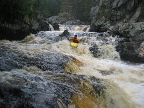
The second of the two big drops at the end of the Rocket Railroad. ( Rocket Railroad A is in the background of this shot.) You usually have your option of a right or left line here.
There's a rocky prominence evident in the stream just upstream of Happy Creek (river-right) and Hardscrabble Creek (river-left). It appears this should cause some rapids of interest, but is apparently lacking specifics from the write-up provided to us. Anyone able to fill-in details?
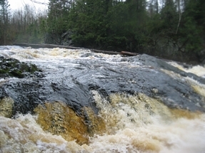
This is the final class III drop of the day. It is about 0.5 miles below bridge #7 (RR bridge #6). There was a BIG LOG river left when we ran this. Scout river right to see what is adorning this rapid when you arrive.
GET OUT HERE!
Drainage area at our listed take-out is approximately 95 sq.mi. (as calculated via USGS StreamStats Beta software).
From the recommended take-out (at the seventh RR bridge), you'll have a brief (0.15mile) walk NNE along the tracks to get back to your car. (Yes, you could stay in your boat an additional quarter-mile, til the river hangs a sharp 90-degree right, to the outlet of a tiny creek, to take-out and carry up to the tracks and to the LEFT to your car. However, we prefer the assurance of taking out at the RR as it is an unmistakeable spot.)
Apr 12, 2020
Ran on 4/10/20 @ ~400 (off Bad near Odanah). This is a real gem of WW in the Northwoods. Ran from Coyuga Junction down to Foster. As described the river has a few significant drops with well spaced out flat water stretches. The flatwater however does not feel as lengthy due to how it is broken up. Additionally, as described counting bridges is helpful and taking out above 4th RR bridge to scout Conley/Rocket is good. At this level this was clearly a V- with a pretty sticky hole and a tricky upstream set up. (Upstream looks a bit like Rockcut on W. Fork). We portaged RL over bridge putting in at collection eddy RR following small gametrail/path. Downstream there are a few rapids until TO at 7th RR bridge with graffiti on it.
May 30, 2013
Ran the river Tuesday May 28 2013 me and Tyler cut the tree out of the way on the main line but part fell into the line the Minnesota crew cleaned out. We ran the main line I made it but he got stuck in the drop and had to swim after trying to roll about three times. The hole is very sticky and his boat got beat down for about 40 min before I was able to pull out with part of a tree. I also have had my boat stuck in that hole before. Any one who runs Rocket Railroad/Conley Falls should have very good paddle skills.