Tyler Forks
A) Moore Park to Vogues Rd (up to 8.5 miles)
Apr 12, 2020
Ran 4/11/20 @ ~375cfs . Note the road down to PI wasn't fully plowed of snow which added another 1/4 mile to the hike up to the dells. Portage following right next to the river, RL up above the dells. There is a small eddy RL upstream of the main section, but there is some more narrow moving water that could add potential fun. The dells are great fun and provide a great beautiful intro to the run. The alders aren't that bad and about 20 min of boat-bush-pushing got us to the bridge. From here down to Wren there are a few sizable drops interspersed with long sections of flat/moving water. The lead in the Wren is pretty obvious and eddies were catchable on the fly RR. Note that there is a 12' log over the full lip over the falls. A real shame. This was a mandatory portage at this level, but at lower levels a maneuver may be possible RR under the log. Sketch. From here down to the TO is fun boogie, holes, and haystacks. There was no other mandatory portages and a low amount of wood as compared to other creeks in the Mellen area.
Apr 30, 2015
We ran this at about 240cfs on 4/24/15. The dells were a bit grungy, but fun. This can be a fun river to run if you avoid the over grown meanders, which will be the longest 1.3 miles that you ever paddle. Due to the matrix moves you will be endlessly repeating as you paddle though this overgrown section. The dells are worth the run, but definitely drive up to the alternate put-in afterwards. Wren Falls is fun as long as you use a well timed boof stroke. **Trying to pencil over the fall isn't a good idea.** The boil line is a ways out there(ten feet). Running the fall river left of center may lead you into the wall. The current near the wall, at this flow, is neutral to flushy, so if you find yourself here more than likely you'll have time to push off the wall, roll and paddle away.
Nov 12, 2014
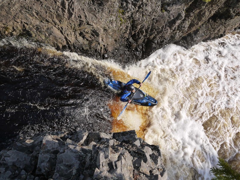
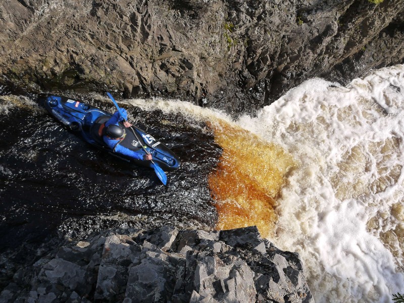
Tony Catania at the lip of wren falls
Nov 12, 2014
Wren falls @170cfs
May 19, 2014
Ran Tyler forks at around 170 CFS on 05/17/2014. The dells section is a very easy point and shoot class III with a slight technical line at the last slide to avoid the piton rock on the center of the channel. Eddy and take out just after to avoid two river wide strainers back to back.
Wren falls was a good III+ drop at this level. Setting up safety rope and few boaters to collect a possible yard sale is recommended because of minor recirculation.
The river was very bony below Wren falls and is not really worth the boat abuse. You can do multiple runs of Wren falls and take out here.
Jun 23, 2012
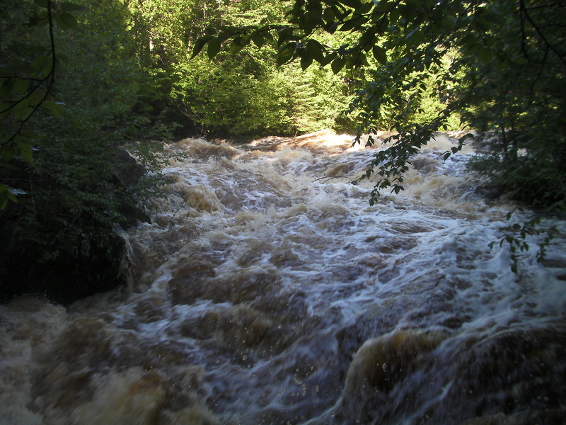
Tyler Forks Dells section 6/21/12 at 1100 cfs on gauge.
Jun 23, 2012
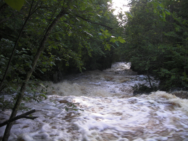
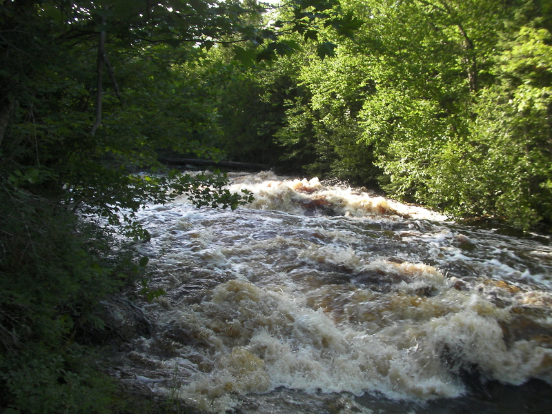
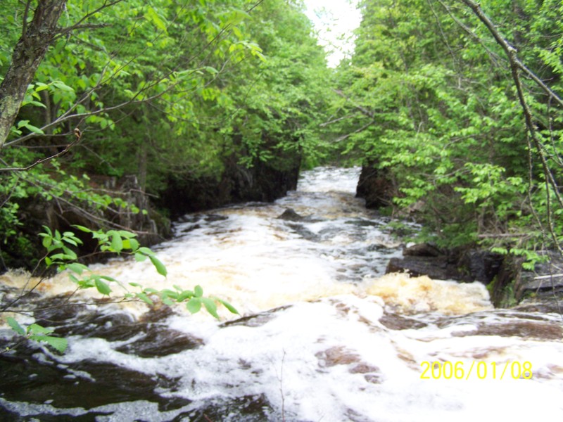
Tyler Forks just below HWY 77 at 1100 cfs on gauge
Jun 23, 2012
Tyler Forks Dells section 6/21/12, gauge at Stricker Rd reading 1100+ cfs.
Jun 23, 2012
Tyler Forks dells section 1100 cfs
Jun 23, 2012
Tyler Forks dells section 1100 cfs
Jun 23, 2012
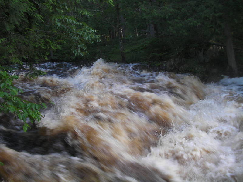
Balsam falls below hwy 77
Jun 22, 2012
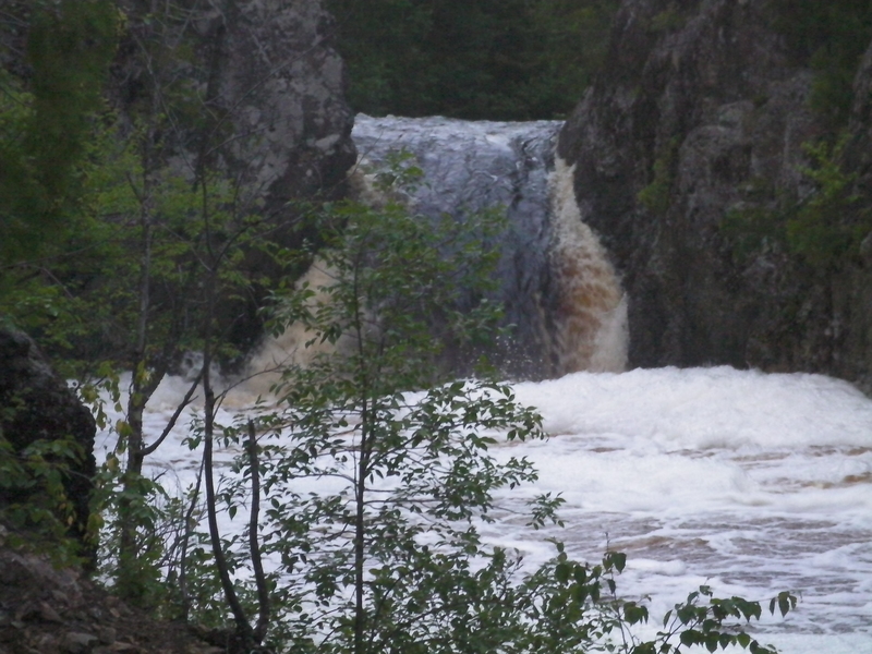
Wren Falls at 1100+ cfs on gauge
Apr 23, 2012
Ran Wren falls tonight at 70 cfs on the Tyler Forks gauge. This is a good, safe level for the falls.
Jun 19, 2011
There is now a gauge on the Tyler Forks! Not the preferred stream to have streamflow (Brunsweiler or Upper Bad would have been better) but we will now know when Wren Falls is running and it should be very useful for the Potato as well and may provide better info for the Upper Bad than the gauge way up near the Lake. The USGS station number is 04026561, located downstream of Hwy 169 with a drainage area of 70.5 sq mi.
Apr 21, 2009
Running Tyler Forks Dells
Jun 15, 2008
This pic is looking down thru the dells.
May 29, 2008
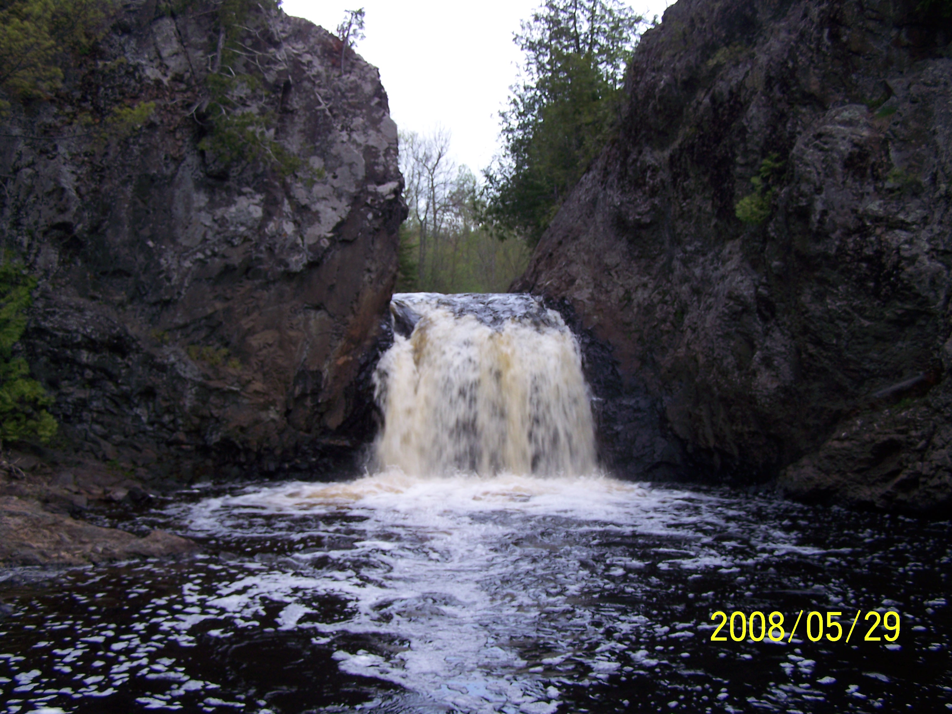
Last Drop of the dells section. The bulk of the gradient is in the background.
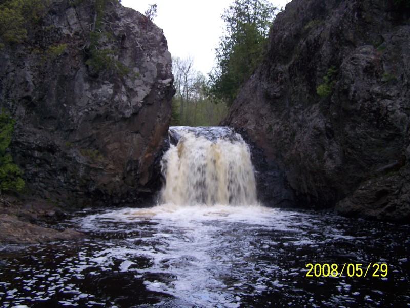
This is Wren Falls at a low level. It is really fun to fun to run higher, but is really nasty at high spring flows.