Salmon, North Fork
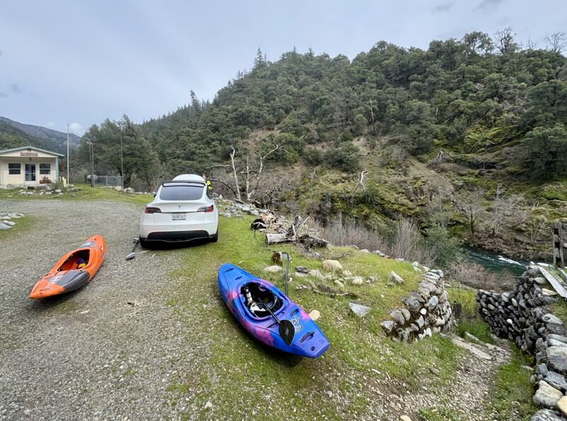
Gallia Mine River Access to Forks of Salmon(NF Canyon Run)
Mar 29, 2025
Early spring day on the North Fork from Gallia all the way in to Forks of Salmon. I'd call this the lower half of a medium flow: plently of water to make the full run enjoyable but not fluffy, and not too much flow for the Indian Point Gorge to be unreasonable.
May 17, 2023
The entire staff of American Whitewater had an opportunity to get out on the Salmon River in the early evening as part of our staff retreat at Otter Bar. The run began on the Wild Mile section of the North Fork and continued on down the mainstem on the Forks Run to the Nordeimer Campground access. The run took us approximately 90 minutes with a short surf session at Otter Bar Waves. It only took us about 10 minutes to run this Wild Mile section of the North Fork. Additional photos can be found on a trip report associcated with the Forks run.
May 6, 2023
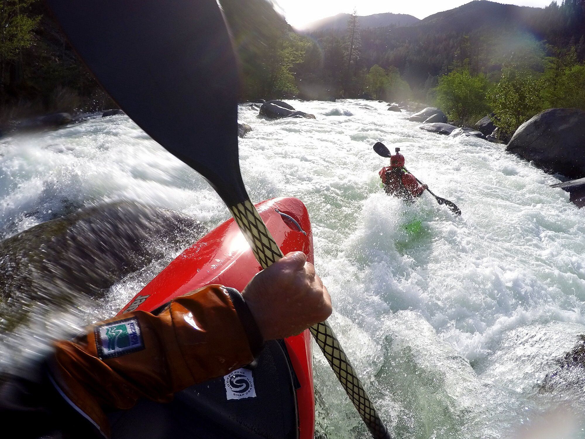
Great run on a day of shifting light and weather and medium flows. It was the first day of the 2023 Salmon River Whitewater Gathering, which is all about getting people together and out exploring as many of the 23 runs in the Salmon River watershed that can be boated in a weekend. Other groups started at Idlewild and paddled thorugh this section later in the day.
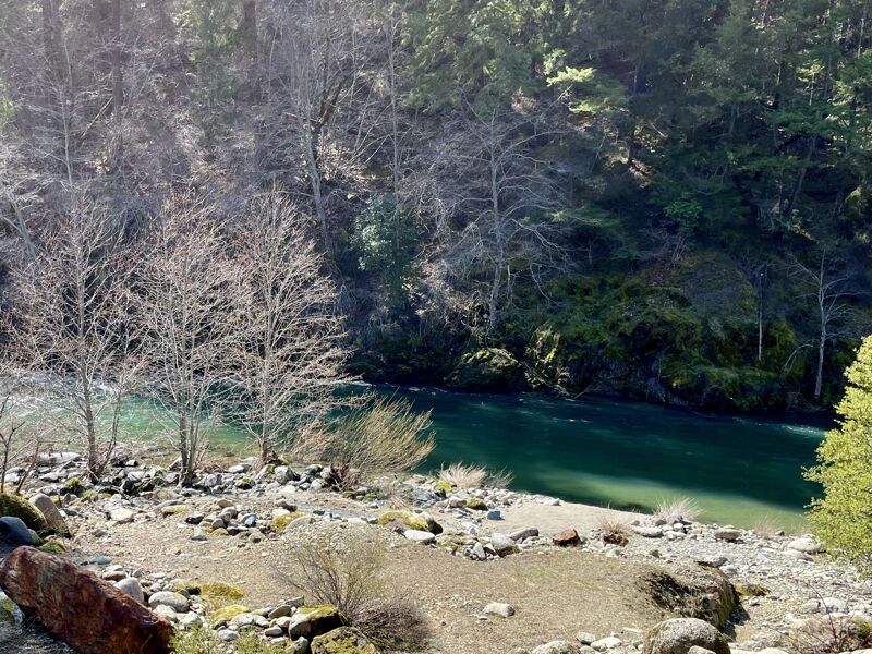
The NF Salmon Canyon Run is one of my favorite sections of river here due to its diversity and number of rapids plus the gorgeous scenery and cool canyon. While snowmelt has the South Fork Salmon a bit murky, the North Fork has remained fairly clear and emerald green. I think of 3,750 as a lower liit of medium flow--or upper limit of low flow--for this run: not too low to enjoy but also slower and not powered up.
One change since I last paddled this run four days prior: a tree fell from the left bank just above Getting Going. It blocks most of the channel but can be paddled around on the right at these flows.
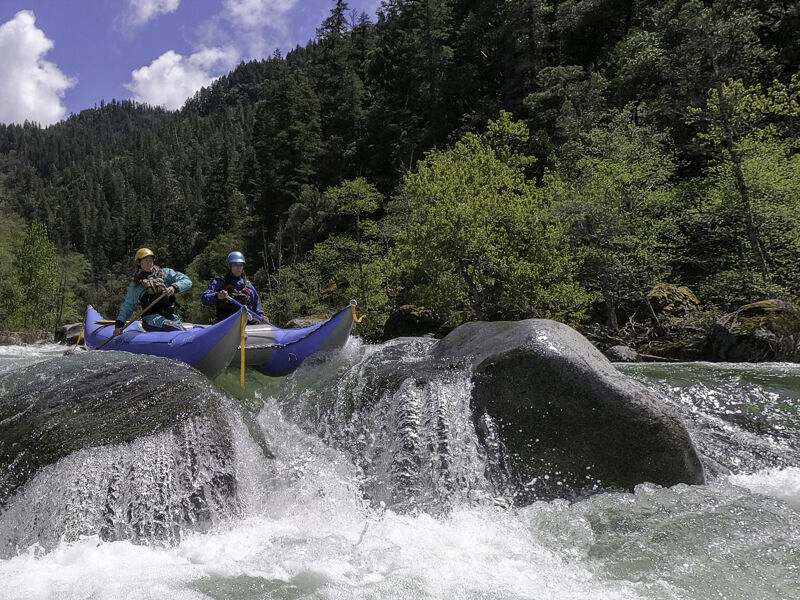
It was fun to join Nicole and Sean to see them R2 this section, something that is very rarely done: this run is mostly the domain of kayakers, although it has been rafted before.
We kept the run low key by taking out at Saw Pit Flat rather than paddling the Indian Point Gorge, although flows were ideal for that this day. We went and ran Butler next.
May 2, 2023
A quick under two-hour-long rally on the North Fork from Gallia to Forks of Salmon with a three-person local crew. The only eddy we caught was in the entry to the crux at Indian Point Falls--always worth a check-in there. Door-to-door the whole adventure took 2:45. Perfect, fun level for a zippy run without being too much in Indian Point Gorge.
Mar 16, 2023
Mar 16, 2023
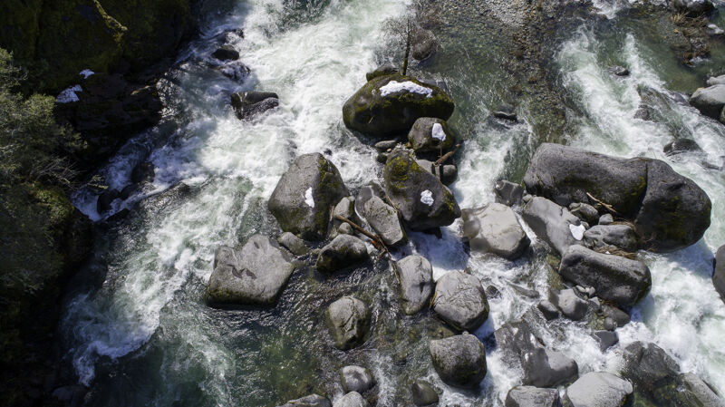
Aerial views of Boulder Gulch and The Pinch shot as part of a drone-scouting effort to make sure the rapids were free of wood hazards. Great tool for this! Flew from the pullout at the nine-mile marker on Sawyers Bar Road.
May 8, 2019
Scenes from my whitewater kayak commute from work in Sawyers Bar to home in Forks of Salmon: ride upriver to work with a co-worker and paddle back home 15 miles at end of work day, repeat. It's extra nice in May to have long days and not be racing home to beat the dark, but the trade-off is blinding evening sun.
May 2, 2019
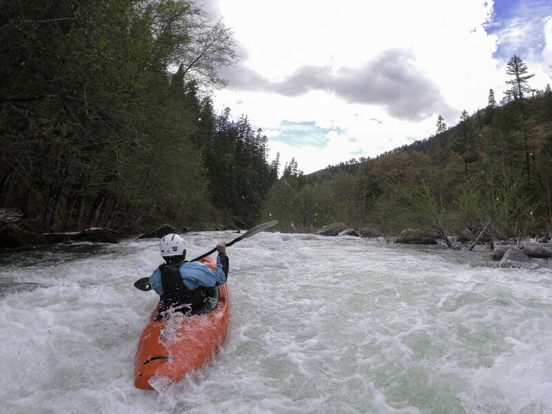
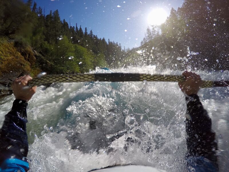
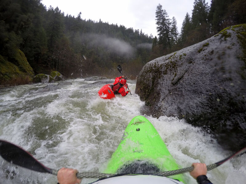
Some GoPro shots from an afternoon run down with the Otter Bar crew on the North Fork Canyon from the Gallia Mine put-in to home in Forks of Salmon. At 3,800 cfs on the Somes Bar gage, this is what I consider to be on the lower end of a medium flow, but definitely not low.
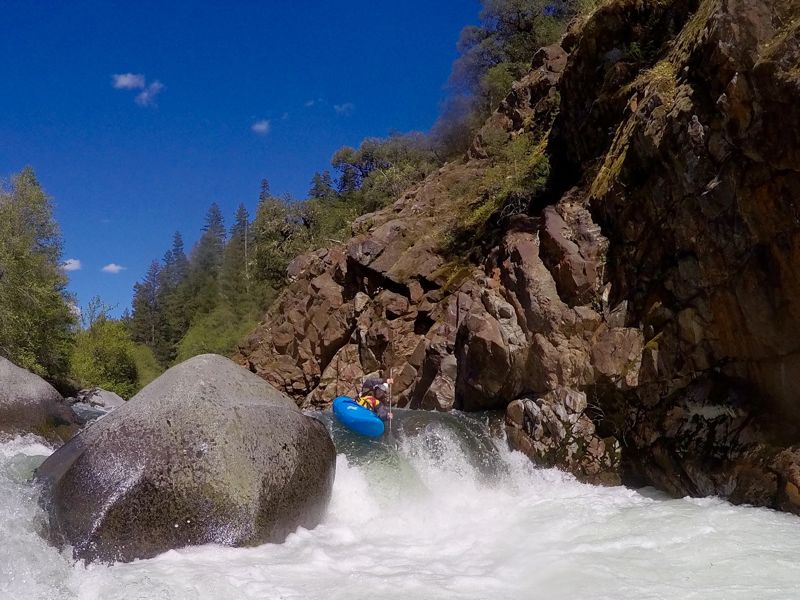
This is one of my favorite sections of river in the Salmon watershed but most paddlers just drive by on their way to better known sections. The alternating metamorphic rock and granite boulders makes for diverse rapids and there are some epic boofs and swipes on smooth granite here. The final Indian Point Gorge just two miles upstream of Forks of Salmon adds some class V spice; most paddlers take out above this at Saw Pit Flat (Sawyers Bar Road milemarker 3.8), but I always do the full run because I really enjoy it and also because I have to in order to take out at home downstream.
Nov 22, 2017
A rare fall run on the NF Salmon Canyon Run. Flows aren't typically high enough to paddle this awesome tun until winter time. We lucked out and got in a late afternoon run in this wet fall. Bottom end of a medium flow.
May 29, 2011
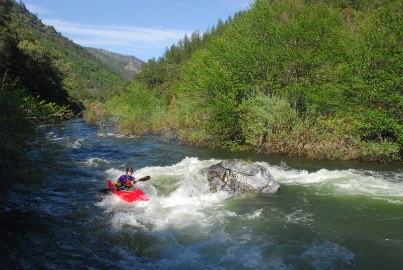
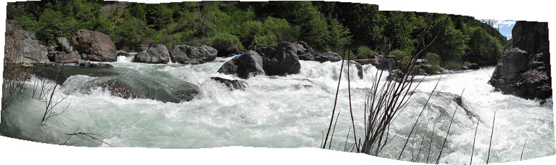
Panoramic shot of Indian Point Falls taken from the river right bank along the lower part of the drop. Low end of medium flow.