Honey Creek (Menomonee Trib)
*Check wood alert!* Honey Creek Pkwy. to Menomonee R. (1.76+2.14 miles)
| Difficulty | II-III+ |
| Length | 1.8 mi |
| Avg Gradient | 30 fpm |
| Gauge | Honey Creek at Wauwatosa, Wi |
| Flow Rate as of 1 hour | 1 cfsbelow recommended |
| Reach Info Last Updated | April 16, 2026 |
NOTICE: MMSD has plans to remove virtually all of the cement on this run. Streambanks will be excavated to create a floodplain (wherever possible) and meander the stream. While cement may remain under road bridges, it's likely that rocky rubble will negate any remaining hyraulic jumps.
Their website now indicates the project 'has been pushed out several years, with construction unlikely to start before 2028.' Post 'restoration', it will be boatable, but likely with minimal whitewater interest -- probably little more than a class I-II rock-dodge. It will likely take higher flows to become boatable (needing more water to cover rock they will place in the stream), and (what's worse) it will likely be far more dangerous with rock throughout the channel, making being upside-down or out of your boat quite brutal, with increased possibility of hard impacts, bruises, broken bones, and foot entrapments.
Quick Facts:
Location: Wauwatosa (Milwaukee, WI).
Put-in: 8354 W. Honey Creek Parkway, Milwaukee
Take-out: 7200 W. Honey Creek Parkway, Milwaukee (for just Honey Creek, for the unusual circumstance you're not continuing down MenTosa).
Take-out: 4014 W. Bluemound Rd, Milwaukee (take-out for MenTosa, since virtually all boaters of Honey will proceed to enjoy that run).
Shuttle Length: 3.8 miles/10 mins: Recommended Shuttle Route* (there are quicker, more direct routes, however, we recommend scouting numerous locations en rout
...Upstream of our listed section, this creek is underground for nearly 3.8 miles. From McCarty Park (at 2500 S.82nd Street), it passes under many blocks of residential properties, and passes under a namesake park (Honey Creek Park) totally unseen. It passes under the intersection of 84th and National Avenue, parallels between 82nd and 83rd Street north to the State Fairgrounds, passing under the southeast third of the Wisconsin Exposition Center, then veers eastward to pass under the 'Milwaukee Mile' Racetrack (right about where the pit lane rejoins the main track), paralleling that oval track around the south curve to the middle of the north curve, where it veers north to pass under the Hank Aaron Trail and the north parking lot, before veering west to pass under Alder, Kearny, 84th Street and the expressway before it sees daylight again just beyond the westbound onramp from 84th Street to the expressway, just upstream around a bend from our listed put-in.
===================================
Upstream of McCarty Park, the creek is above ground for 3.2 miles, to where it emerges from under I-894 near the 5500 block of W.Allerton Avenue (where its drainage area is just 1.64 square miles). Nearly all of that stretch is cement ditch surrounded by grassy sloped shoreline/parkway (no trees or shrubs creekside) as it passes between residential properties. There is only minimal slope with a couple very minor very short blocks or 'jumps' disturbing the otherwise featureless flow ... nothing like what is found in the section of creek we have detailed below.
So, while there may be times that upper section could be boatable, it is doubtful you would find it at all interesting from a whitewater perspective.

If descriptions above and below are not enough to dissuade recreational boaters from considering this run, consider the following quotes (with personal emphasis added), from years back in the Shepherd Express (a local 'alternative' newsweekly), an article entitled 'Going with the Flow -- How the suburbs are helping close the beaches':
'Tests during rainfalls ... at 15 sites along waterways in Milwaukee County regularly show Ecoli and fecal coliform amounts are thousands of times higher than the EPA standards for beach closings ...'
'... numbers this high are comparable to untreated sewage.'
'One study found ... about 15% of fecal coliform found in stormwater runoff is from dogs.' (I.E., people who do not pick up after their pets!)
'people can get sick from water like that, but the illness may be passed off as something else since it isn't that severe.'
'The highest concentrations of E.coli and fecal coliform have been found in Underwood Creek in Wauwatosa and in the Little Menomonee River'
Honey Creek also tested massively high, especially during and immediately after the week of state fair.
So . . . take all that for what you wish to make of it!
Two options:
A) Park on W.Honey Creek Parkway (across from the second or third house east of 84th Street).
B) Park on S.Honey Creek Parkway (about 0.2 miles north of Bluemound Rd, 0.1 mile south of powerlines) (at the first jump, as listed below).
In either option, a 'commando style' put-in is recommended! Get into your boating gear at your take-out, so that (at your chosen put-in) you can as quickly as possible just grab your gear out of the vehicle, get into the woods, down the embankment, and put on before gathering too much attention.
If using option A, it is STRONGLY recommended to either scout the first ledge ahead of time OR to get out above it to scout. (It is generally possible at nearly all flows to 'beach' onto the sloping cement or into the shoreline brush to then walk down to the ledge.)
If using option B, you'll be right at this ledge, and can decide whether you're putting in above or below it.
Just upstream of our put-in, as the creek comes out from under 84th Street, it spills across a short rounded pourover.
This is likely to have a fairly uniform boil-line and not offer much reasonable play at most flows.
Some may be inclined to paddle up to check it out, but more will likely just head downriver.
There is no reasonable legal put-in upstream of this ledge. There is a large commercial development (on river-left), and no parking on 84th (on river-right).
Considering that this ledge is shorter and generally the least interesting of what's on this creek, there is just not much reason to hassle with trying for put-in above it.
This pourover is potentially the nastiest, hence one that I most often have portaged or just put in below it.
The cement at the base tilts back toward the drop, making a far 'keepier' hydraulic.
Scout this drop before putting in upstream! Get as close to water level as possible!
Look CLOSELY to notice that the backwash flows back toward the drop from 10-15' downstream.
You have to paddle 'uphill' to get out of this drop!
If you are unsuccessful at landing a 'boof', staying upright, and paddling out of the reversal, you will be caught in an awkward spot to get yourself and your boat out in the event of a swim. If you are unable to grab hold of your boat, it will flush a long way downstream unless you have a good posse of boaters (in boats and/or on shore) ready to wrangle it ashore!
If you are out of your boat as a result of ANY of the hydraulic jumps, you are likely to be able to stand in the backwash in cement ditch and walk out!
(NOTE: this is contrary to advice in virtually any other whitewater situations! Generally you DO NOT try to stand in swiftwater/whitewater until/unless you are in an eddy.)
Given that water quality is nasty, that this is a rather visible location, and you are generally wanting to be as 'invisible' as possible, this is not a spot you want to be standing around too long, setting safety, and having to do a rescue. All of which is to say, look carefully, make your decision, put-in (or portage), and get going.
BTW, the secondary name refers to athletic fields which flank the creek here (football and track fields river left, ball diamonds river right), though they are behind thickets of buckthorn and other trees and shrubs.
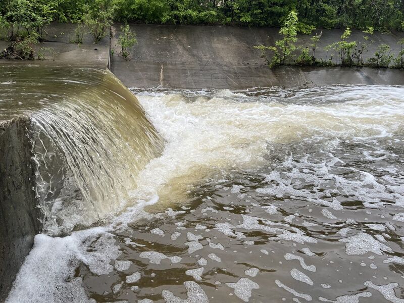
The second pourover (as most of the remaining pourovers) is much more reasonable at virtually all flows. Paddle assertively to launch a clean 'boof' and paddle away on the water which sheets away from the base of the drop. (Failure to paddle aggressively may result in being back-endered, and possibly flipped or sucked into the reversal/hole here.)
The secondary name alludes to Wisconsin Lutheran High School which lies upslope river-left (and whose athletic fields gave name to the prior 'jump').
Three pourovers occur under or immediately after bridge crossings. This one is at the downstream side of the Bluemound Road bridge.
At some flows, this can ge a bit 'sticky', so charge it, boof it, and paddle out!
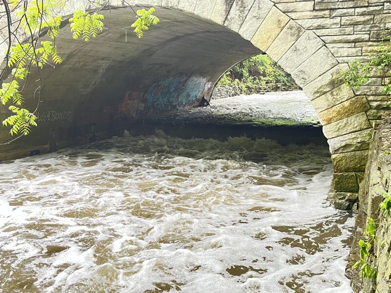
Immediately after coming out from under the Honey Creek Parkway road bridge, this drop can provide some play potential (surfs), if one is inclined to do so in such a cesspool of a creek as this is.
A little bit of quarried rock lies in the pool here, but tends not to be an issue at most flows (at least, as long as you are not upside-down).
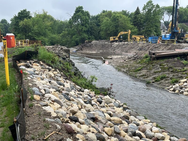
The new bridge is higher over the water than the old bridge was, and the creek has been widened as well. The cement trough has been removed from a short way upstream and downstream, and the bed and banks have been lined with rock. At boatable flows, I suspect most/all rocks in the riverbed should be covered and passage should be unhindered.
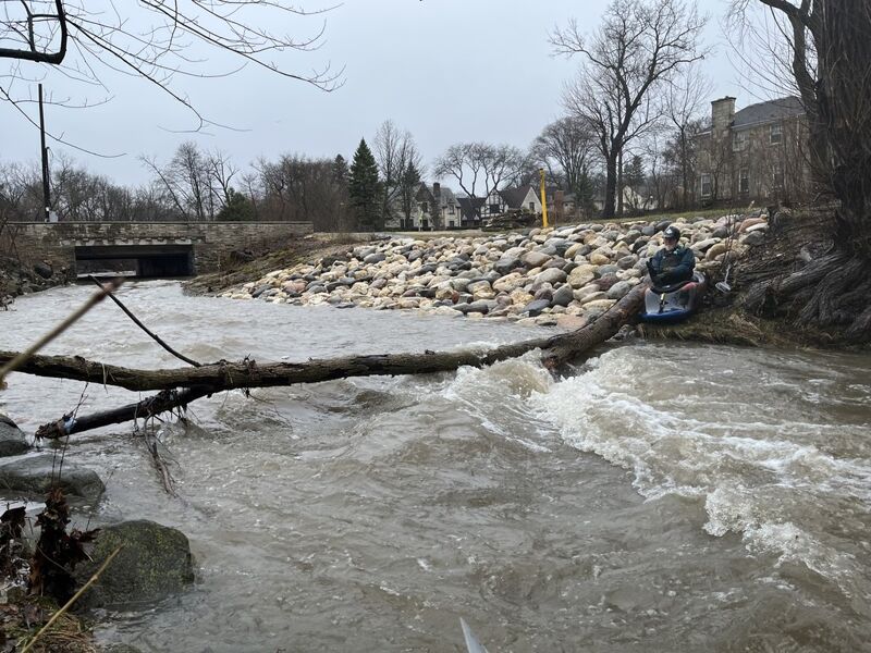
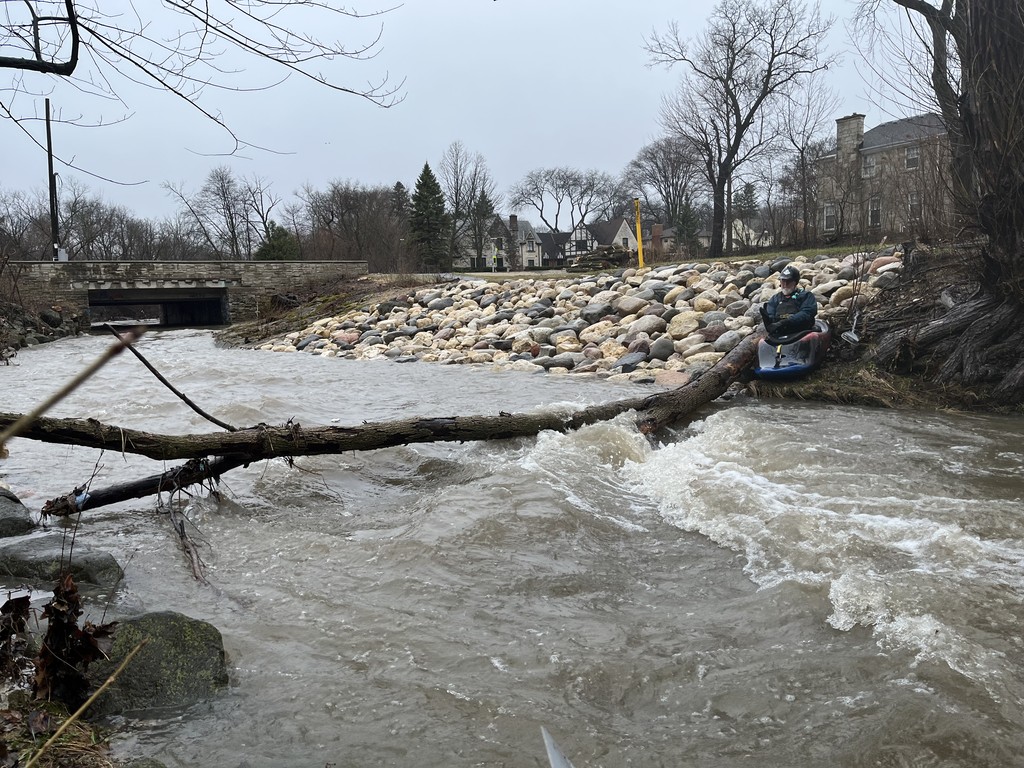
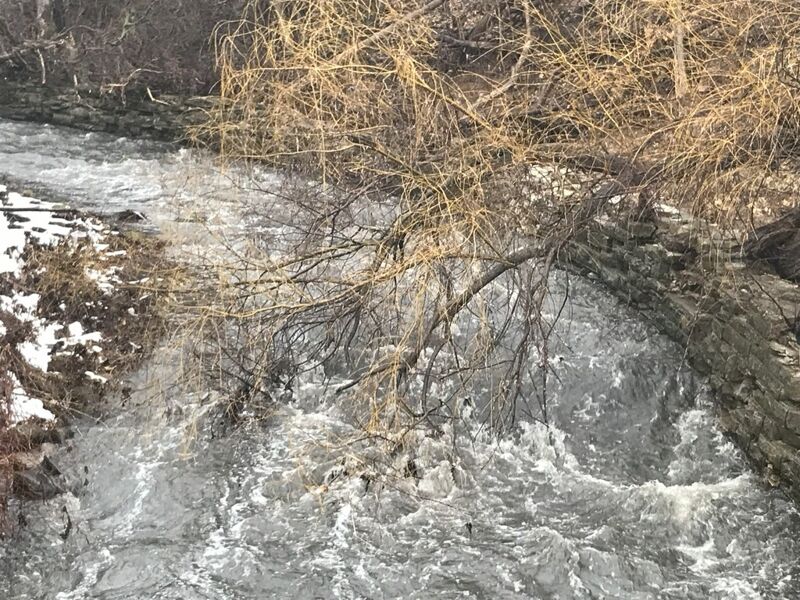
NOTE: As of 2025.12.16, a huge tree lies in creek as it re-enters cement ditch. River-right is the rootball, which won't be passable to river-right. River-left the tree trunk angles up to the high left bank, and should be 'duckable' at far left at most boatable flows.
A second tree spans the cement ditch just downstream, but is horizontal, far enough overhead as to be no problem at any reasonable flow.
STOP AND TAKE A CLOSE LOOK HERE AS YOU RUN SHUTTLE! Additional wood may hang up and block safe passage!
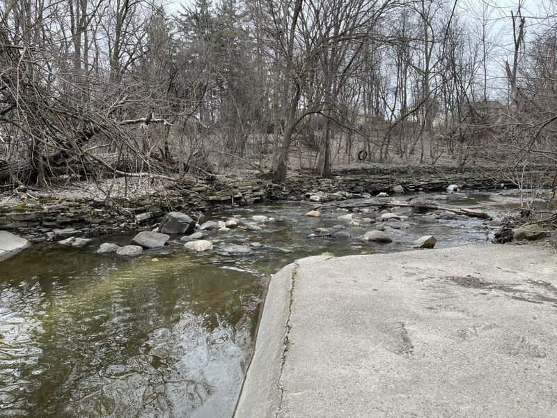
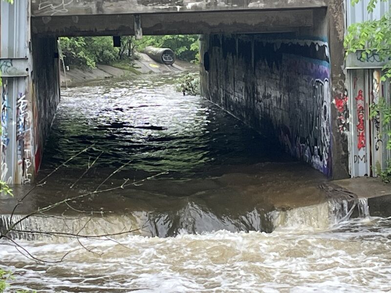
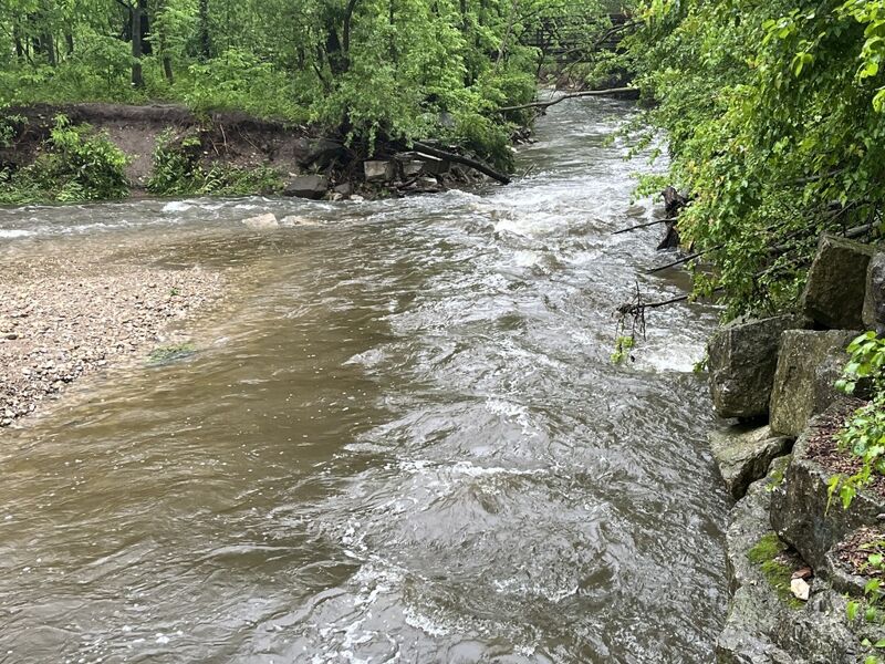
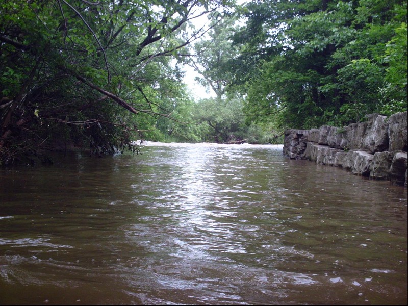
At this point the bottom changes, from concrete to scattered rocks and bedrock. Most of the remainder of the run, either one or both riverbanks will be man-made vertical stone walls. There will be eddies and places one can get ashore, but there will also be places that is not likely nor easy!
Immediately upon leaving the cement ditch, considerable rock rubble populates the streambed. (Expect much grunging at lower flows.)
As the creek swings to the right and heads to the next road crossing, you will find a really sweet little rapids. The left bank is vertical grouted-rock wall, with the strongest current immediately alongside. River-right has shoreline eddies, and the shore is dirt, shrubbery and trees.
Since this is a rather blind roundhouse curve with strong current, WHILE RUNNING SHUTTLE, STOP AND PARK TO SCOUT FOR STRAINERS OR SNAGS!
After the above-mentioned 'roundhouse bend', flow heads under another parkway bridge. On the immediate upstream edge of the bridge, a fine little wave can form, and a decent eddy river-right, under the bridge, allows repeat play (when it is worth bothering to repeat).
NOTE: The tree shown in the photo has been cleared, but new deadfall is possible at any time. Always scout this before putting on.
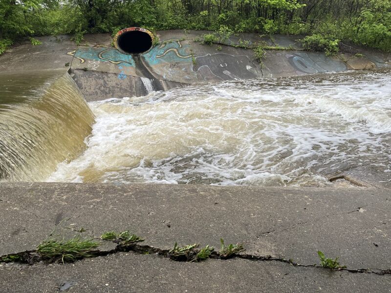
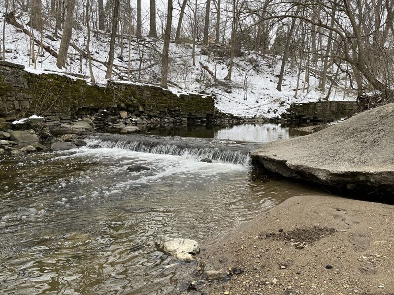
The final ledge/jump lies under Portland Avenue (second bridge after leaving cement ditch). Water sheets shallow on the approach at most runnable levels, making it difficult to maneuver. The reversal at the base of this ledge can be significant at some flows, so be prepared to boof and paddle strongly away.
The riverbed becomes more natural (gravel, cobble, and random large rock and rubble). Riverbanks vary from rock walls to gabions (rock filled wire baskets) to boulders to dirt/mud banks. There is increased risk of deadfall, since river banks are highly eroded in places, and trees are at water's edge.
ALWAYS SCOUT AS MUCH OF THE RUN AS POSSIBLE BEFORE PUTTING ON, TO BE AWARE OF SNAGS AND WHETHER THEY ARE AVOIDABLE THAT DAY!
If you looked at it a year, a month, a week, or sometimes even just a day before, do NOT assume the situation did not change! If it has rained enough for this to be up more than one day, the soil is saturated and trees may topple!
Not far after the Portland Avenue Jump lies a brief bit of rock garden rapids. Unfortunately, this is also an area with HIGHLY eroded banks, making it prone to whole trees dropping into the creek.
CHECK THIS AREA FOR SNAGS BEFORE PUTTING ON UPSTREAM ! (Only one is present as of 2026.04.22, but should be far overhead at any reasonable boatable flow. Note that this can change with every storm or high-water event.)
Park near the 'Dewey Hill' sledding area (just south/upstream/around the bend from the Aurora/Zilber Family Hospice). Walk into the woods and carefully down the steep banks to the creek to look upstream and downstream for any snags!
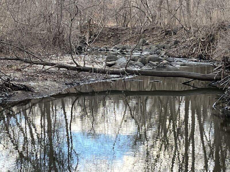
A bit downstream of the prior rock garden area, after passing river-left gabion basket shores (wire cages filled with rock), lies an area of rocks and gravel deposits. The deepest channel is to river-left, while center-to-right is shallow gravel shoals.
For years, a large tree has blocked the creek here, but as of 2026.04.22 has washed out.
Before putting on, while setting shuttle, stop about 200' west/upstream of the final bridge (where the USGS gauge is) to walk across a finger-like clearing and into the woods to see this area of river.
The penultimate (second last) action on the run is a minor rockgarden rapids.
A (likely defunct) utility conduit cuts across the riverbed in a concrete box/culvert. At moderate to high flows, a fine surfable wave forms here, and has a decent eddy at river-left.
NOTE: After August, 2025 flooding, the river-right wall at this location has collapsed into the creek, and riverbed around the pipe and cement transect has eroded, leaving the whole thing much more exposed. At low flows, water passes under the pipe and cement. This combination of differences will change the behaviour of this feature.
The gauge is on river-left at the upstream (south) side of a bridge on West Honey Creek Parkway.
As with a number of USGS gauges, a camera at this gauge takes a time-lapse video (still-photos, once per hour), so ... 'SMILE! You're on candid camera!'
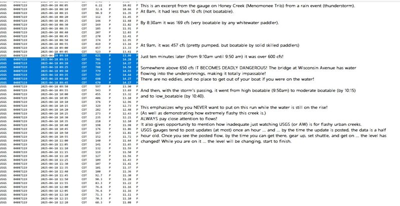
As the photo shows (well, if you go to the 'Gallery' and go to the photo, and click on 'Full Resolution'), this creek flashes up (and down) very quickly.
When the 8:00AM reading was posted (at 8:20-8:30), you saw less than 10 cfs. When the 9:00AM reading was posted (at 9:20-9:30), you saw 457 cfs (and likely would have said 'Let's go!'). By the time you loaded into your vehicle (possibly calling or messaging other boating friends to join you), and drove to your take-out, scouted the HIGHLY RECOMMENDED locations, and got to the put-in, it would likely be 10:30 (or later), and the creek was back down to 235 cfs,and dropping to 140 cfs by the time you hit the confluence with MenTosa!
Beyond the final road bridge (with the gauge), the stream twists to the right and widens. A major gravel shoals has been deposited here which will be 'grungy' at 'low-boatable' flows.
The left shore is highly eroded. Trees drop from shore (or wash down and accumulate there), so head center or river-right (at flows above 250 cfs) to avoid those complications. The right bank (upstream and downstream of the pedestrian-and-bike-path bridge) is vertical rock wall and failing gabion baskets.
The boulder rubble pitch at the narrowing has largely been washed out by flooding, so the only concern here will now be currents (pushing toward the wall) and wood which may hang up through here. Some skilled maneuvering may be needed!
While running shuttle, stop, walk onto the bikepath bridge, look upstream and down to check wood and water situation here before putting on! Walk upstream to have a look at the approach to see if wood exists on the shoals upstream.
Most folks will continue to the confluence and catch most of the MenTosa run to its takeout. For the exceedingly rare circumstance that it is necessary or otherwise desired to skip that, take-out is best river-left, either immediately under the pedestrian bridge, or as soon thereafter as practical.
Be aware that there is a failed gabion basket lying midstream at the confluence with the Menomonee River. This is no problem if you are upright, but potentially ugly if you flip or are out of your boat coming through here. You don't want to roll or swim at the confluence and get snagged by a chain-link-fence-basket full of rocks! It also makes this an 'iffy' spot to try for any stalls or squirts in the confluence currents.
While this is the end of Honey Creek, few boaters will take out here. Most will continue about 2 miles, down the better part of the 'MenTosa' run (Menomonee River in Wauwatosa), utilizing it's take-out.
Jun 4, 2025
Just a 'scouting' report to add some photos of this run.
Apr 19, 2025
As mentioned in the write-up, this urban creek is very flashy during significant rains. The attached annotated screen print shows just how flashy this can be. This was from a thunderstorm which dropped just over an inch of rain in about an hour.
Oct 15, 2014
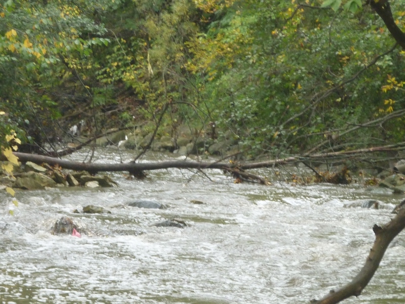
This is why you ALWAYS want to scout as much of this run as possible (by getting out of your car various places alond the parkway road) before putting on! Snags such as this occur with alarming regularity between times this little run has enough water, and there are so few and such small eddies at runnable flows that it may take class IV skills to catch them.
Oct 3, 2014
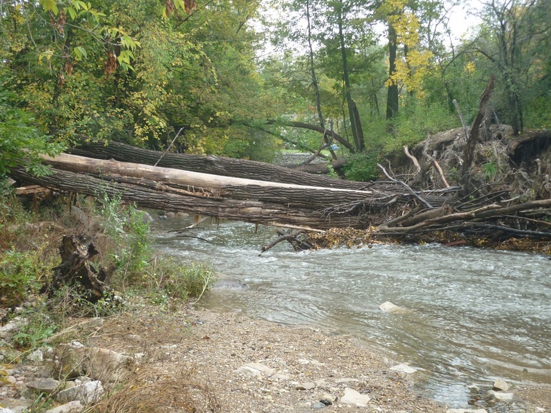
This deadfall happened spring, 2013 and isn't going anywhere anytime soon. Experienced boaters with good skills, looking well enough downstream, should be able to catch eddies and may be able to limbo under the higher (river-left) end of things. However, debris could accumulate at any time, blocking off the viability of that maneuver! Do not put on the river without checking as many places as possible for reasonable passage.
Jan 27, 2014
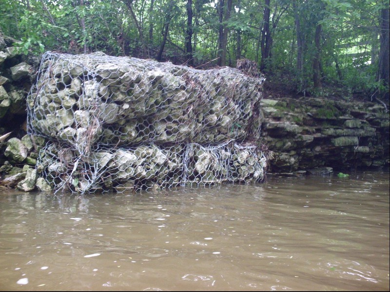
Almost inexplicably, in this creek (and in too many other places), engineering firms are contracted to put gabions (wire baskets filled with rock) on streambanks in an attempt to control erosion. The problem is, almost everywhere I've seen them used, I've seen them fail, resulting in tangled wire in the river!
Apr 26, 2011
Water quality: Terrible! Honey Creek has the highest median concentrations of E Coli of tested stream sites in Milwaukee County -- 1,900 colonies per 100 mL -- 200 col/100 mL is maximum acceptable for human contact (swimming).
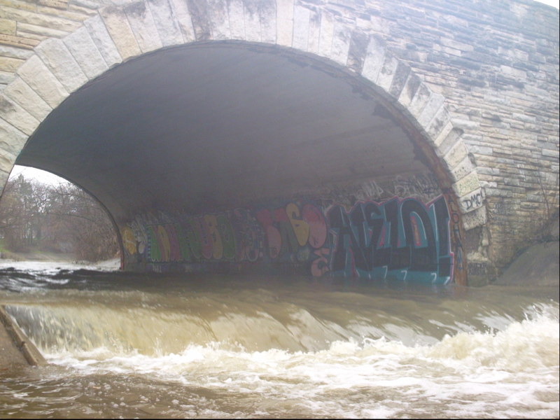
Scenery: Mostly city cement, man-altered stream-bed, and 'tagging'.
'Whitewater' (in the first half of this reach) is created by 'hydraulic jumps' (cement ledges) which exist (as I understand it) to aerate the water and somehow/somewhat blow-off some of the downstream momentum.
Jun 19, 2009
As mentioned in the full write-up, at times of heavy rains, while there are no known outflow points on THIS section of river, the Menomonee is VERY LIKELY to suffer from Combined Sewer Overflow (CSO) at times that this sections is runnable. It is recommended that you check the MMSD website *********** http://www.mmsd.com/v2/news/overflow\_advisory.cfm *********** for conditions before running this reach
when there have been heavy rains, then decide for yourself if you wish to risk boating in the (diluted) sewage affecting this river. Areas affected should generally be clear (of the bulk of that specific contamination) a couple days after the CSO ends. However, that will be to late to matter, as both these reaches (Honey and MenTosa) will generally have dropped to non-boatable levels by then.