Honey Creek (Menomonee Trib)
*Check wood alert!* Honey Creek Pkwy. to Menomonee R. (1.76+2.14 miles)
Jun 4, 2025
Just a 'scouting' report to add some photos of this run.
Apr 19, 2025
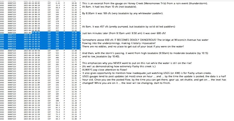
As mentioned in the write-up, this urban creek is very flashy during significant rains. The attached annotated screen print shows just how flashy this can be. This was from a thunderstorm which dropped just over an inch of rain in about an hour.
Oct 15, 2014
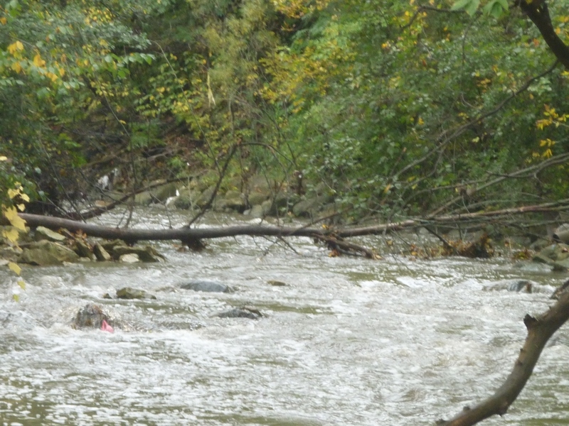
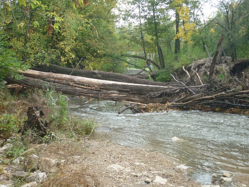
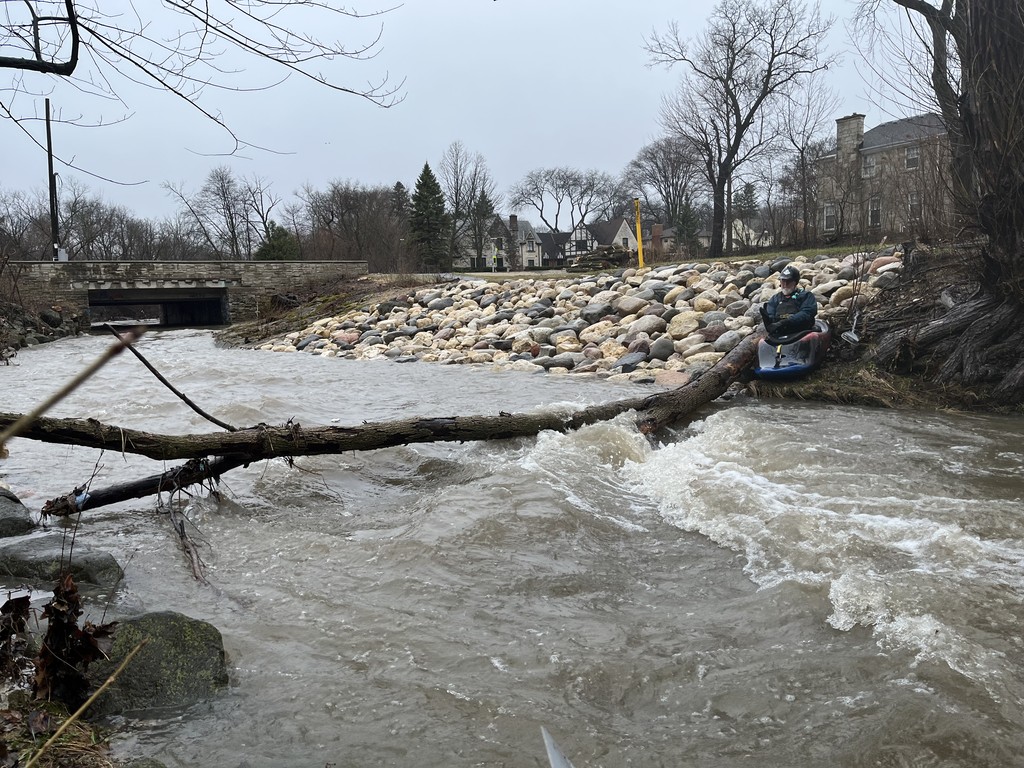
This is why you ALWAYS want to scout as much of this run as possible (by getting out of your car various places alond the parkway road) before putting on! Snags such as this occur with alarming regularity between times this little run has enough water, and there are so few and such small eddies at runnable flows that it may take class IV skills to catch them.
Oct 3, 2014
This deadfall happened spring, 2013 and isn't going anywhere anytime soon. Experienced boaters with good skills, looking well enough downstream, should be able to catch eddies and may be able to limbo under the higher (river-left) end of things. However, debris could accumulate at any time, blocking off the viability of that maneuver! Do not put on the river without checking as many places as possible for reasonable passage.
Jan 27, 2014
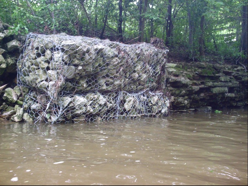
Almost inexplicably, in this creek (and in too many other places), engineering firms are contracted to put gabions (wire baskets filled with rock) on streambanks in an attempt to control erosion. The problem is, almost everywhere I've seen them used, I've seen them fail, resulting in tangled wire in the river!
Jan 27, 2014
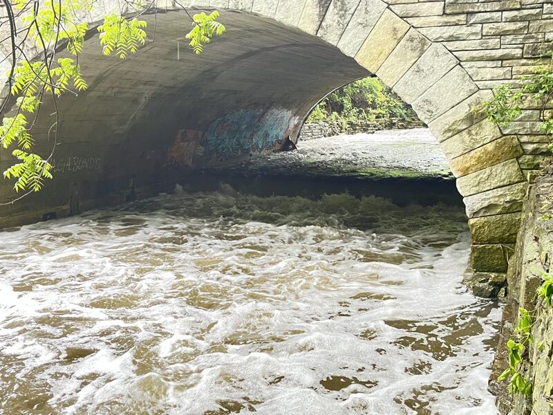
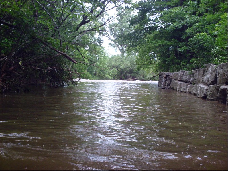
As Honey Creek runs to meet the Menomonee River, the right bank is a vertically stacked rock wall. A failed gabion lies square in the middle of the outflow right in the confluence currents. (No problem if you are right-side-up, but do not flip or roll here!)
Apr 26, 2011
Water quality: Terrible! Honey Creek has the highest median concentrations of E Coli of tested stream sites in Milwaukee County -- 1,900 colonies per 100 mL -- 200 col/100 mL is maximum acceptable for human contact (swimming).
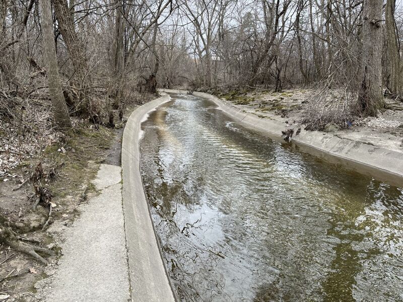
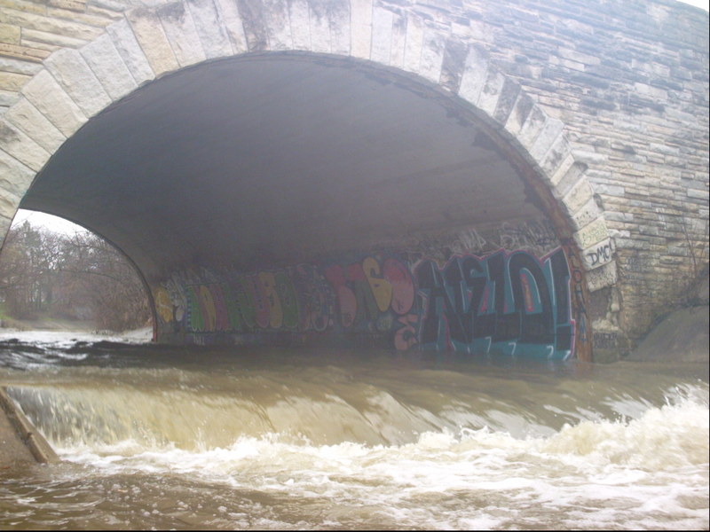
Scenery: Mostly city cement, man-altered stream-bed, and 'tagging'.
'Whitewater' (in the first half of this reach) is created by 'hydraulic jumps' (cement ledges) which exist (as I understand it) to aerate the water and somehow/somewhat blow-off some of the downstream momentum.
Jun 19, 2009
As mentioned in the full write-up, at times of heavy rains, while there are no known outflow points on THIS section of river, the Menomonee is VERY LIKELY to suffer from Combined Sewer Overflow (CSO) at times that this sections is runnable. It is recommended that you check the MMSD website *********** http://www.mmsd.com/v2/news/overflow\_advisory.cfm *********** for conditions before running this reach
when there have been heavy rains, then decide for yourself if you wish to risk boating in the (diluted) sewage affecting this river. Areas affected should generally be clear (of the bulk of that specific contamination) a couple days after the CSO ends. However, that will be to late to matter, as both these reaches (Honey and MenTosa) will generally have dropped to non-boatable levels by then.