Little
2. Upper Two to Eberhart Point(Upper Two)
| Difficulty | III-IV(V) |
| Length | 5.9 mi |
| Avg Gradient | 76 fpm |
| Gauge | Little River Near Blue Pond Al |
| Reach Info Last Updated | February 1, 2019 |
The Upper Two while not quite as hard as the Suicide section above it is chock full of high quality rapids.The last mile of the run from Humpty Dumpty to the Chair Lift is the most continous section of whitewater in LRC, and that makes it a very high quality delightful mile of whitewater indeed .
After a few class 2 and 3 rapids you arrive at Rock Jumble [Screaming Right Hand Turn ]this long class 4 rapids bops down through a low angle boulder bed making a sharp right turn at the bottom.
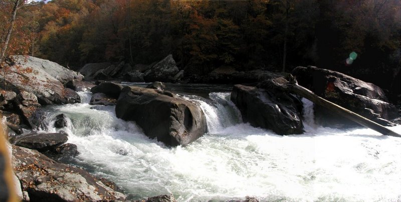
Below here the river slowly winds though big spooky boulders to Road Block a 100 yds below.Road Block is a one move rapid ,a boof off a 5 foot ledge,that is very clean and simple as long no mistakes are made. The left side outflow of the hole is obtructed by a sloping rock wall that pushes the backwash back into the hole this makes the hole extremely sticky.Boats have been stuck in it for hours and swimmers often get recirculated in it for uncomfortable periods of time.There have been many incidents and a death here in the last few years so be alert particularly at higher waterlevels .
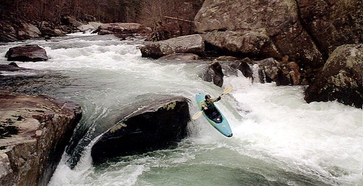
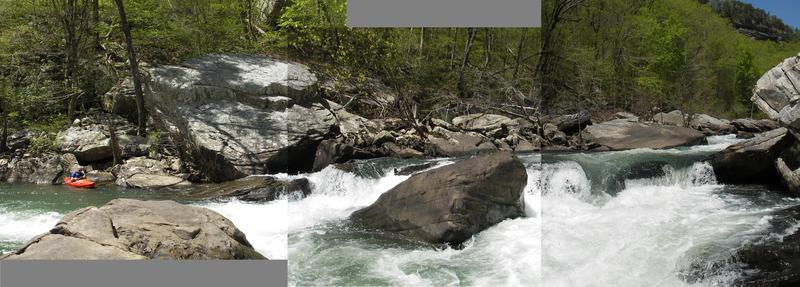
Humpty Dumpty follows quickly.This beautiful photogenic rapid drops between car and house size boulders in two big leaps.The boof at the top drop is an Alabama classic and the hole at the base of the second drop gets bigger and bigger as the water gets higher.
Below here the pace contiues unabated,the next mile throws up closely spaced class 3 and 4 rapids right down to Eberhart Point.Most are unnamed but a few names in order are Mr. Bubble,Roostertail,Whiplash, Empire State,and Deep Throat.This last mile is fast paced read and run and there is nothing that is normally scouted.The hardest rapid is Deep Throat which has some horrible looking pin rocks in the middle of it's bottom drop.Ugly as they are there never seem to be any real problems there.
To get to the takeout, take hwy 35 east from Interstate 59, cross over Little River. There is a gauge on the SE pyling and
...
Easy move but the hole is hard to escape. Lots of close calls in the center hole. Can be snuck on the right at some flows.
Feb 21, 2026
With nothing else in the area seemingly runnable, low water LRC provides. Paddled with Dano Jones and Steven Halpin for a beautiful day in the gorge.
Photo is of the sieve on the river right side of Humpty Dumpty, which is one of the more impressive sieves I have seen. Great day for it!
Mar 26, 2009
When checking the phone gage, the number prompts have been changed. Press 4, then 2, then 2.,
NOT!
Mar 17, 2005
The Little River at Blue Pond gage was recalibrated after Hurricane Ivan in 2004. Here is the new correlation for the Blue Pond gage and the Hwy 35 bridge gage. These levels should be considered in flux, because the Blue Pond gage will be recalibrated in the near future, as water levels permit. (3/1/05)
Blue Pond = 35 Bridge
500-650 cfs = -2.0
650-800 cfs = -1.0
800-1100 cfs = 0.0
1100-1300 cfs = 2.0
1400-1500 cfs = 4.0
1600-1700 cfs = 6.0
2000-2100 cfs = 7.0
2100-2200 cfs = 8.0
2600-2700 cfs = 12.0
I have an Excel 2000 spreadsheet that predicts the levels for Little River and several other rivers in the southeast. If you
Jan 1, 1900
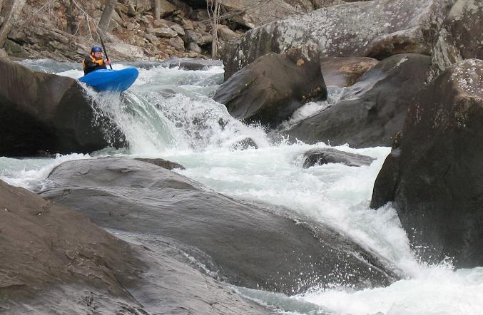
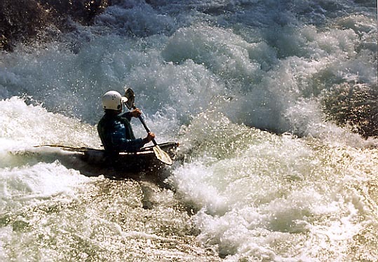
Geoff Kohl drops into the turmoil at the bottom of Humpty Dumpty.
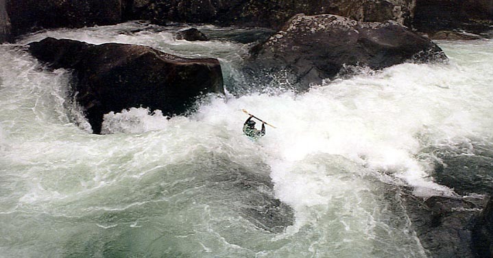
The bottom of Humpty Dumpty tends to flip, eat and spit out paddlers.
90% of the water in the Little River Canyon goes over the last drop in Humpty Dumpty. It loves to flip paddlers.
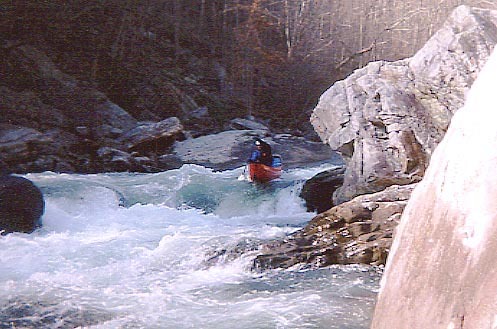
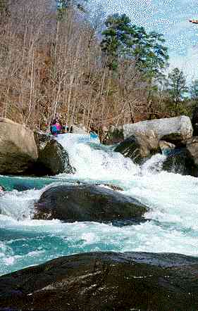
Geoff Kohl runs the first drop of Humpty Dumpty. You can see Road Block in the distance.
Rob does a nice boof off the first drop of Humpty Dumpty.
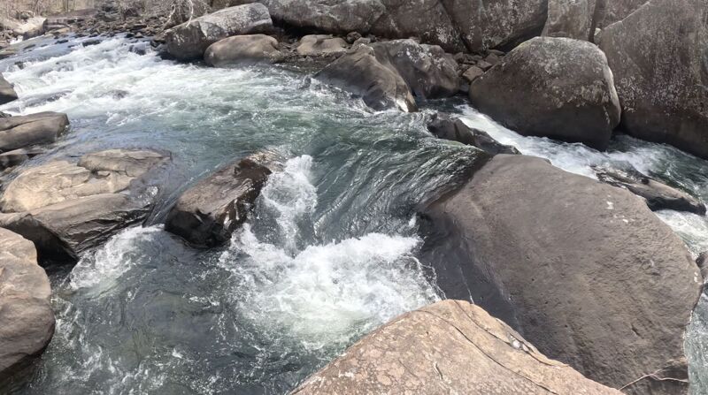
This is a great shot of Humpty Dumpty at 2'. You can clearly see the two ledges that form the drop as well as the perfectly placed scouting rock. At lower levels, you'll have your choice of a left or right line over the bottom drop.
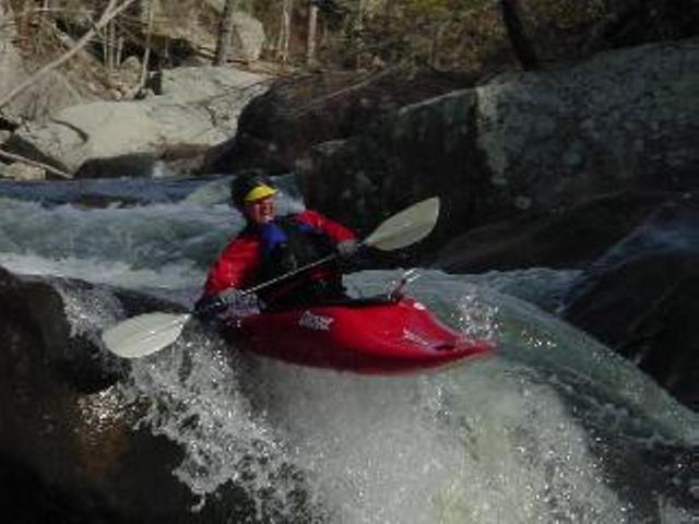
Matt Breaks does a great boof off Road Block
This is Scott Bristow running road block. (We miss you Scott)
This is the last part of the Upper 2 put-in trail.
Humpty Dumpty can be run down to -4' (maybe a little lower). However, the center slot at the bottom gets too narrow to run at around -3'.