Alcovy
3- Factory Shoals

| Difficulty | III |
| Length | 1.3 mi |
| Avg Gradient | 33 fpm |
| Gauge | Alcovy River Below Covington, Ga |
| Flow Rate as of 45 minutes | 185 cfsbelow recommended |
| Reach Info Last Updated | March 1, 2015 |
This run is located within Factory Shoals Park, a county-operated venue 10 miles south of Covington, GA, just off state highway 36. They charge a few bucks for park use during peak periods (warm months). Address: 450 Newton Factory Bridge Rd, Covington, GA 30014
This run has a visual gauge located on the bridge just past the entrance of the park on Newton Factory Bridge Rd.
Before you do the first run on this one, it's a good idea to scout the river trail from the bottom up to the bridge and note any new wood or other strainers. Also if it is your first time, you will want to see what you are getting into on the lower half mile; it gets a bit hairy.
The put-in is in the campground on the north side of Factory Bridge Road. Just drive thru the campground until you see water, then find a good parking place. If the campground is closed, go across the bridge to the parking area immediately left at the other end. Follow the riverside trail upstream about 100 yards to the first ledge and slide on in. There is some private property that is well marked that you will not want to trepass on.
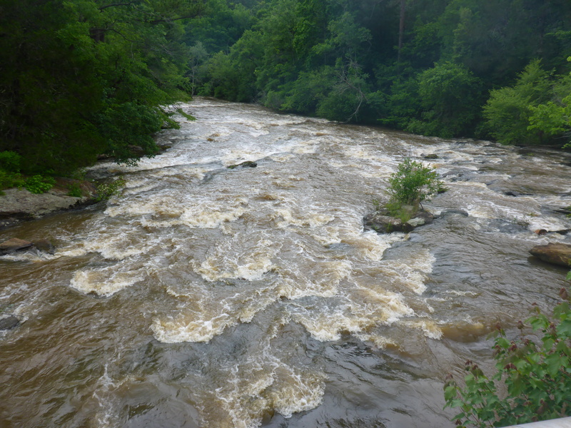
The rapids start a quarter mile around the bend from the campground putin. Above the bridge, rapids are class I-II; several ledges with some surfing potential at some levels. Below the bridge is an island with a variety of routes dependent on water levels.
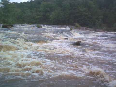
The gradient increases the further you travel below the bridge. Ledges begin to get more complicated and currents pick up and get more pushy.
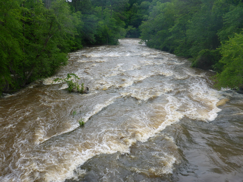
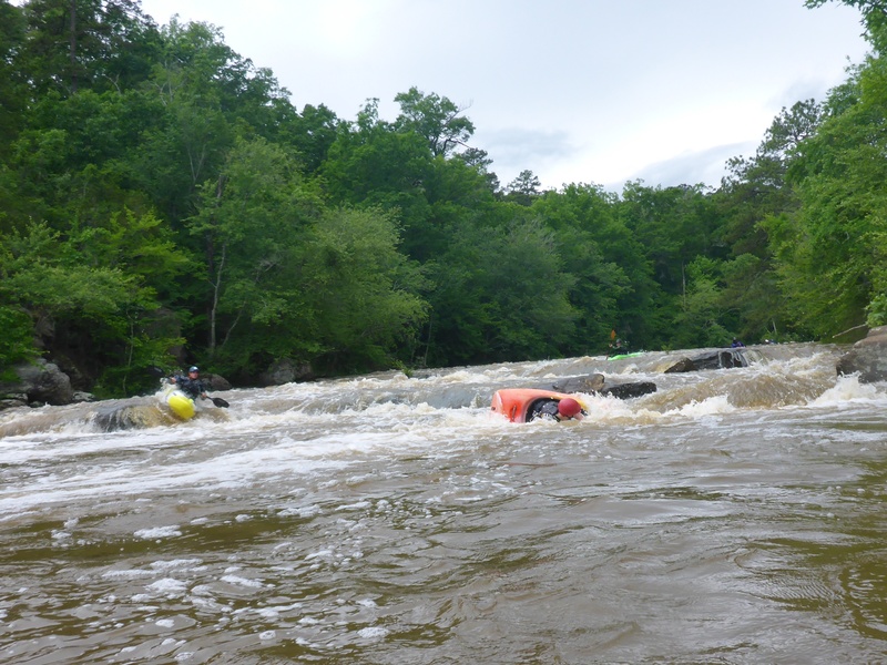
A half mile below the bridge, a hundred yards of flatwater pool gives you a chance to catch your breath. Access at this point is good on both sides if you want to pull out; below the pool things are going to jump up to class III. There are a couple of difficult ledges to work down before you line up for the last drop. You can spot the little midstream island from this point that marks the final ledge; as you get closer you will notice the distinct horizon l
...
There is a pour-over on river right and a wave train on river left. Several good places to surf.
This ledge is a straight forward Class II. Offers some play at varying water levels.
There is a good spot for side surfing on river left. Center line is a boof, with an ender spot just to the left of the boof rock. Right side can also be run, though it may be more shallow and rocky than the other options.
Run the slide on river left. Or run Twist and Shout rapid on river right.
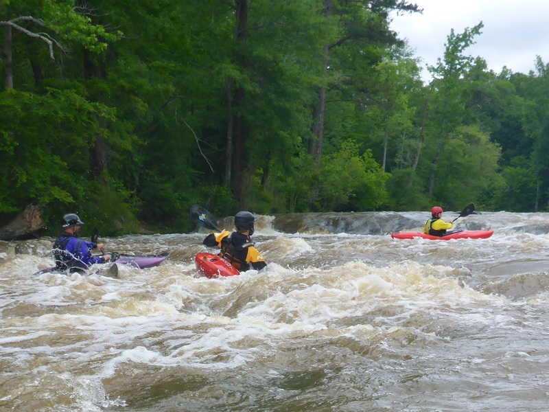
Most people run the 'Toilet Bowl' line, which is a flume/slide into a mildly undercut boulder on river right, or the central boof line into a shallow pool below. Beware, as there is potential to pin in a chute between the Toilet Bowl line and the boof line - boats of all sizes seem to fit perfectly into this crevice.
More experienced boaters looking for a thrill tend to run the left side of last drop.
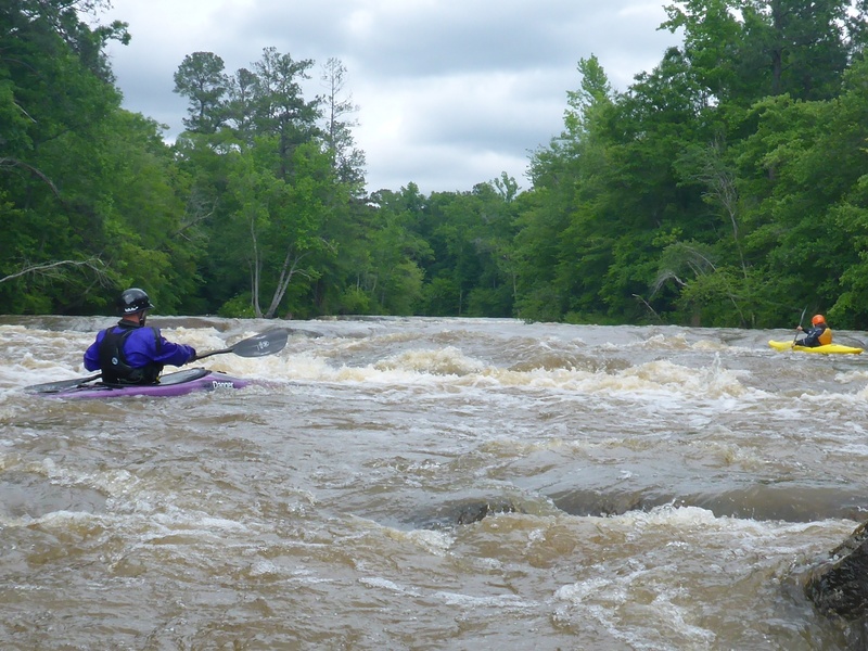
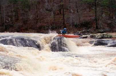
Tommy Price on the last drop in Factory Shoals. Photo courtesy Will Reeves.
Jul 30, 2012
The gauge is not very accurate since it is WAY upstream but the flow of the Alcovy in Covington (seperate gauge) is accurate for this section of river.
Apr 18, 2011
couldn't post the link so here it is! It was taken in early April 2011 with my GO Pro Cam.
http://www.youtube.com/watch?v=kWHw0OdDAes
Jan 24, 2006
Well, you could run it under 1.0 on the gauge, but I sure wouldn't. I hit a rock every 20 feet down this very short little stretch of whitewater. There are three little class 2 rapids above the bridge, and three class 3 rapids below the bridge. The whole run is less than half a mile. The ledges past the bridge are cool with good flows and can bump up to class 4 with flows over 1.8.
Jul 27, 2005
http://waterdata.usgs.gov/ga/nwis/uv?02208450 is the gauge site for this reach