Alcovy
3- Factory Shoals
May 18, 2014
At levels of 1.5ft and up a side channel opens up on the far river left side, just past the bridge.
Jul 30, 2012
The gauge is not very accurate since it is WAY upstream but the flow of the Alcovy in Covington (seperate gauge) is accurate for this section of river.
Apr 18, 2011
couldn't post the link so here it is! It was taken in early April 2011 with my GO Pro Cam.
http://www.youtube.com/watch?v=kWHw0OdDAes
Nov 19, 2006
Today @ 6 pm online gauge was 340 & falling. Bridge gauge was 1.2, good level, definatly pleanty of water.
Mar 12, 2006
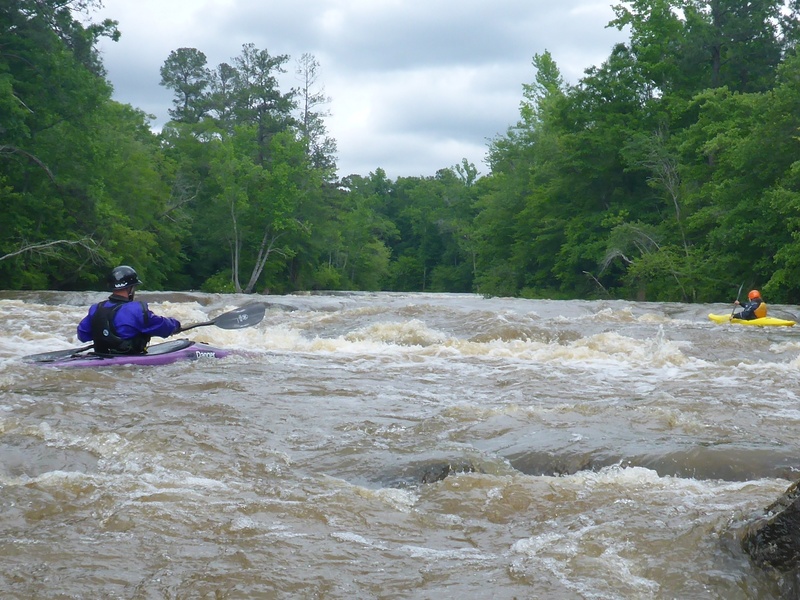
At 283 cfs there are some excellent play spots including a decent surf wave at the pool between the shoals below the bridge and a splat rock on river right almost 50 yards downstream of the bridge.
Jan 24, 2006
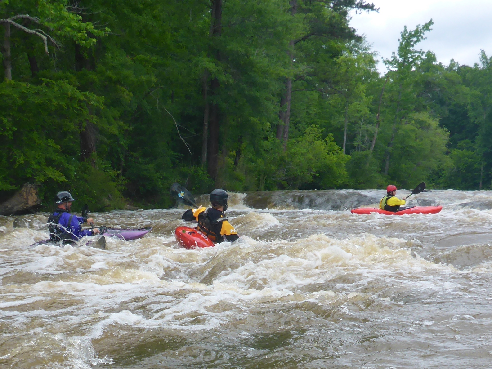
Well, you could run it under 1.0 on the gauge, but I sure wouldn't. I hit a rock every 20 feet down this very short little stretch of whitewater. There are three little class 2 rapids above the bridge, and three class 3 rapids below the bridge. The whole run is less than half a mile. The ledges past the bridge are cool with good flows and can bump up to class 4 with flows over 1.8.
Jul 27, 2005
http://waterdata.usgs.gov/ga/nwis/uv?02208450 is the gauge site for this reach
Mar 18, 2005
Will,
Thanks for all the pics but they need to be resized. No one can even look at them, they are all over 800kb each. This eats up American Whitewater's server space, and people with dial-up will never see those pics. Around 200kb or so would be much better. Thanks.
Jul 16, 2004
Directions from Covington
Take Hwy 36 South, pass Hendersons
and go a few more miles. You will see
Factory Shoals road on the left, turn left
and look for the camp ground road on
the left about 200 yards from the
bridge. The gauge is on the south
west bridge piling. The take out is
accessed by entering the park on the
south side of factory shoals road and
going to the big bend parking lot. Hike
down to the river and scout the last
drop if this is your first time.
Bridge Guage
6/28/04 gauge 1.0
6/29/04 gauge 1.2
7/1/04 gauge 1.2
7/3/04 gauge 1.2
7/4/04 gauge 1.27
Internet Gauge
6/26 3.5
6/27 6.25 (spike that made flow)
6/28 4.5 (additional rain)&
6/29-7/1 3.5
7/2 8.0 (heavy rain) should show up
7/4-5 on bridge
For more info:
Michael Beyer
Park Director (ranger)
770-787-6309 h
770-787-6670 w
Jul 15, 2004
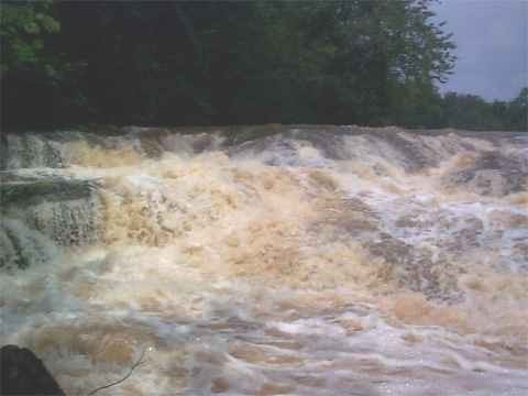
This 6' ledge series gives you a good warmup for the last drop, just below. It also allows one last chance to eddy out on the right and walk out.
Surging crosscurrents, undercuts, sucker holes, obstructions, foot-long iron pins embedded in the rocks ... what more could a creeker ask for? This line is doable but fairly nuts.
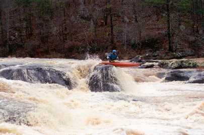
This area provides a couple options ... the deep channel right of center is a straightforward flume. Just beyond the right edge of the picture is a 7' boof into a nice pool. (see Brad's photo of Tommy Price) You can see the little round midstream island in this photo that visually marks the last drop from upstream.
Mar 6, 2003
From Mark Hicks:
Whoops, I should have read your previous e-mail first as you mention in it the Alcovy section right above Lake Jackson. Per the way upstream Alcovy River gauge at north of Grayson (located about 6 miles below the Upper Upper Alcovy River/Creek run) http://ga.waterdata.usgs.gov/nwis/uv?site\_no=02208150 , the Alcovy River is HUGE at that upstream location so this weekend you should have a lot more water than 1.2 below the bridge at Factory Shoals on Alcovy River. The three times I have paddled it it was between 1.2 to 1.6 on the bridge gauge and it was fun trying different routes including the boof move in the last rapid. My understanding is the hydraulics start to get really big around 2.0. The Upper Upper Alcovy run located between GA Hwy 29 and Alcovy Rd is possibly too big to run right now as most of the water is probably running through trees right now.