Sullivan Creek
2. N. Fork Sullivan to Hwy 31 (Gorge)
| Difficulty | IV-V |
| Length | 1.9 mi |
| Avg Gradient | 194 fpm |
| Gauge | Sullivan Creek (calculated) |
| Flow Rate as of 1 hour | 64 cfsbelow recommended |
| Reach Info Last Updated | October 14, 2025 |
SUMMARY A power company built 2 dams, power houses, diversion pipes, and transmission lines on Sullivan Creek in Northeast Washington almost a century ago. The project fell into disrepair in the 1950’s and in 2007, project owner Pend Oreille PUD asked the Federal Energy Regulatory Commission (FERC) to give [...]Read More
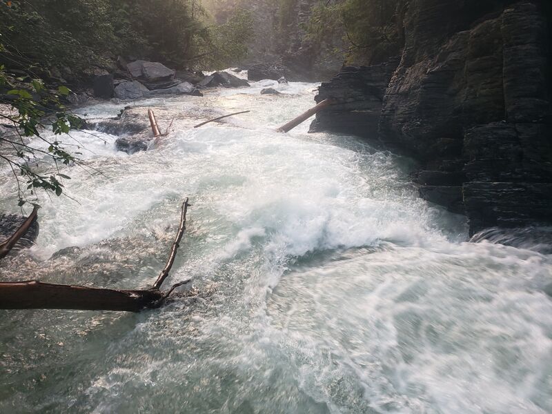
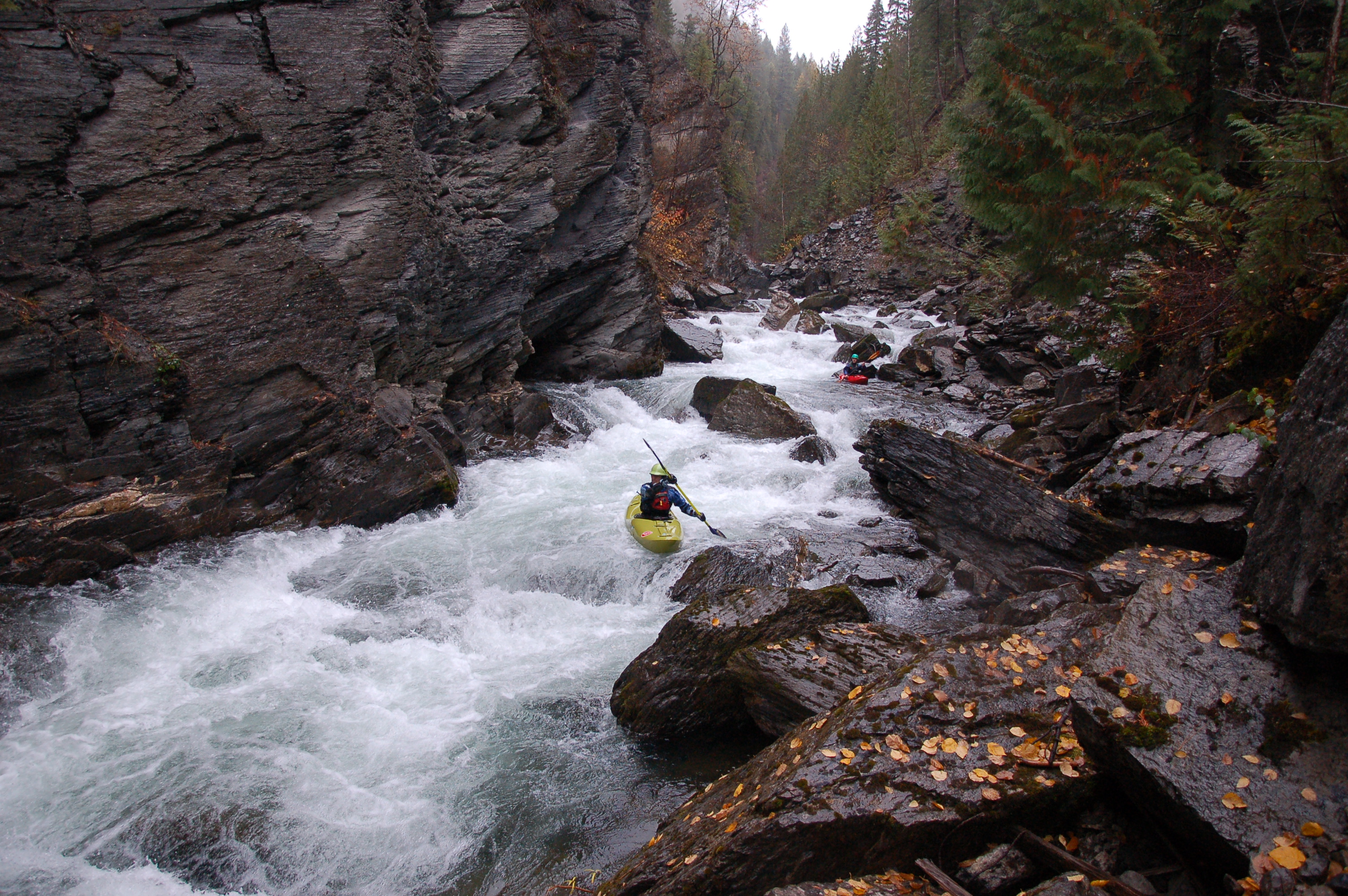
Sullivan Creek is a Class IV-V blue water stream flowing from the corner of WA, ID, and BC. Sullivan is shrouded in cedars and tucked in an imposing dark gorge, and the watershed supports rare animals like mountain caribou, grizzly bears, lynx, bull trout, mountain whitefish, and genetically pure redband trout. Think of it as a little piece of British Columbia dipping down into Eastern Washington.
Check out a video of a fall descent of the Sullivan Creek Gorge, with a bit of information on American Whitewater's work in the watershed. NOTE that some of the rapids appear to have changed significantly since this video was taken, including the nice little falls near the end of the run.
Thanks to negotiations by American Whitewater, Sullivan Lake is drawn down each fall resulting in ideal boating conditions starting sometime in early to mid September, continuing 24/7 until lake level targets are met, which is likely to extend to September 30th and possibly longer. American Whitewater negotiated enhancements to the historical drawdown releases including starting a month earlier, targeting 3 weekends for optimal boating flows, and the installation of new online stream gages. Specifically, the flows begin increasing the Tuesday after Labor Day at no more than 80 cfs per day, but there are strict limits on how much water temperatures can be raised each day which can in turn limit the amount of the flow released. Paddlers can watch the flow increase on the stream gage for the Sullivan Creek Gorge on the AW page, and once the releases are up the river should flow more or less consistently for much of the fall unless rising stream temperatures require easing flows. The agreement includes a goal of at least three weekends of predictable flows in the 180-220 cfs range early in the season, which are ideal flows for paddling. The drawdown release should cease by November 15.
Wood tends to plague Lower Sul
...Put in at one of the roadside pull-offs before the river diverges away fom the road into the gorge. There is a rough 'trail' down river right that you can hike to check flows and view some of the upper rapids.
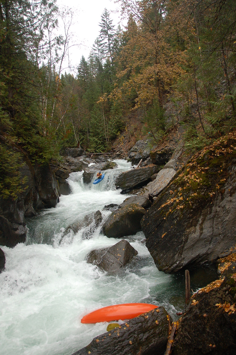
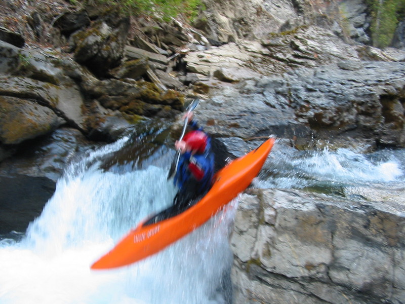
The classy and clean finale of Sullivan Creek is often the highlight of the trip. An entry slot leads to a clean vertical falls, followed by a hole/drop that is run/boofed down the left.
There is a new formal takeout just downstream of the takeout bridge / powerhouse. American Whitewater played a role in the creation of this take-out.
Sep 30, 2022
The rapids on Sullivan Creek are overall cleaner of wood than in the past couple years. There is still lots of wood dodging required and plenty that could shift around when the water raises.
The falls (last big drop) is mostly wood free and can be run from top to bottom. I have been walking two rapids but the entire run could be done without portages
Nov 14, 2017
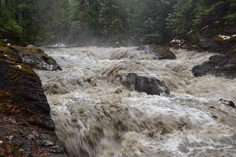
Sullivan Creek at 600cfs, moving dam removal related sediment.
Oct 23, 2009
The fall of 2009 offered unusually low water releases from Sullivan Dam, but the creek still provided a great opportunity for some early fall paddling.