Lamington
Chester to Pottersville(Black River)
Apr 21, 2010
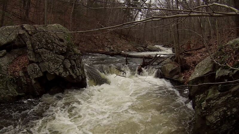
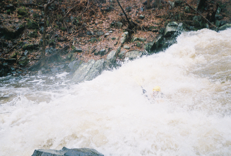
This is the last drop in the Black (Lamington) From Chester to Pottersville.
My camera wet and screwed up the film.
Feb 2, 2010
I ran this last week at 200 cfs or about 2.5 ft high on the fall and it seemed optimal for sneaking under many logs as well as humping over others. All the drops were open except for the 1st big drop. It was a hairy deal but I put in a complete run. Looking over the comments nobody has given this run any tlc with a saw for some time.
Apr 29, 2008
I scouted Trout Brook and Reinhart Brook during the spring floods. They were both running when the Black was at 1,750 cfs. Trout Brook is basically a death trap at that level, but Reinhart Brook was a sweet class III-IV. Good luck catching these runs though. Black river road was flooded out and impassable to give you an idea of the level.
Apr 18, 2007
Awesome reach. Thanks to Stephen Strange for posting the details. Nick P. Noah S. and Brian H and I put in at the fishermans access just below the pond. The level was around 260 cfs and we were more than pleased, maybe even a bit lower would have been nicer for our first time on the reach. The small dam outlet to the pond looked sketchy, maybe some debris or metal so we skipped it and went on. Every drop on the Black was run! Unfortunately the pool below six foot falls had two large trees which made for awfully nasty swim when it was run by an unnamed member of our party who had just gotten back from the Big Sandy. Please use extreme caution running six foot falls, if you swim the hole will eject you into the trees leading to an underwater body pin forcing the swimmer to climb his way to the surface through underwater branches (super ugly). The Kay falls were runnable center left, nasty rapid was bad ass and finale falls was clean and sweet. Again, awesome reach and as of 4/8/2007 everything was runnable except six foot falls, and of course there were around 10 portages in the boogie water because of strainers.
One of the local landowners strung what appear to be dear attractants across the river downstream of the State Park, I guess to prevent the deer from destroying the spackel buckets its in. I don't know, but either way exercise caution in the boogie water after the park.
Apr 17, 2007
The Kay family lived on top of the hill, up river left in Chester. This location was the site of their summer retreat on the river. This dam was unrunnable until yesterday when flooding appeared to have cleared a large strainer from the pool below, use caution of course. This reach is awesome and complimented by gorgeous scenery and historical markers.
Prelude rapid right above six foot falls. As of April 17th 2007, there is a large strainer immediatly after prelude, before six foot falls requiring portage, but both rapids were runnable.
Nov 28, 2006
I ran this with my Brother Thanksgiving morning. We grew up hiking in Hacklebarney so it was great to paddle it. We put in at the fishermens pond and had 6-7 riverwide strainers before we got to the Park. Both big drops at the top are unrunnable....which was disapointing. At least Nasty Rapid was clear (except for wood on river left at the top...easily avoidable). This run needs some TLC. It could be a blast at high water.
Oct 19, 2006
No way i had no idea that this was a runable whitewater creek! i pass it every sunday on my way to my lax games.
Mar 13, 2006
I scouted this creek yesterday and on the secound half, past Hacklebarney park, along side Black River Road, just a few yards before the gauging station (which is on river right, a few feet from black river road)there is a rope or wire going completly across the river with a NO TRESSPASSING sign on it.Physically, even at high water, Idought it would be a problem but perhaps someone dosn't think you belong there? Also anyone this river for the first time you would want to get out a little after that gauging station once you see house on river right because there is a falls,make sure you scout this. I got heart but I wouldn't do it, not yet that is.I would venture to say you realy need to know what you are doing to make it down safly. I plan on taking out before the falls.
Jan 9, 2006
Unless it has been replaced in the last few months (I'll go check on it soon), the sign above the gauging station is the same one which has been there for years. It's indicated on my guide map, but isn't in-play and can be ducked under unless the water is extremely high. (If it was low enough to decapitate people, it would have disappeared years ago, thanks to my hacksaw) As for the 'falls' after the house on river right, unless there's been some major geologic activity that I'm unaware of, this rapid consists of a 2-3'ledge with a small eddy below it on the left, followed by a 4'ledge, immediately followed by a slide to the left which drops about another 3-4', which pools/pillows back to the right (now downstream) and drops another 3-4' feet or so. I refer to this rapid as 'Nasty Rapid' on my map because of the upleasant looking rock at the finish in low water. It is best to scout it from river left. I have run every inch of this run a number of times and though I wish there was a 20ft falls, I haven't found it yet.
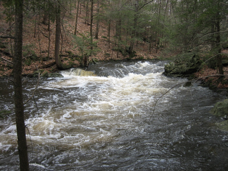
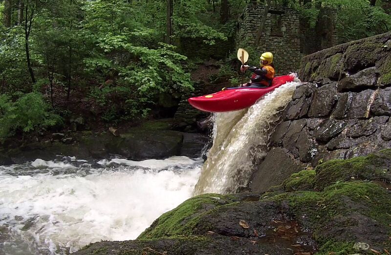
Apr 3, 2005
This is the final drop of 'Nasty' on the Black (Lamington) just above Pottersville. This was one of the best Spring Breaks ever. It rained for the entire first half of the week. The level that day (4/3/2005) was about 3.3'/600cfs)
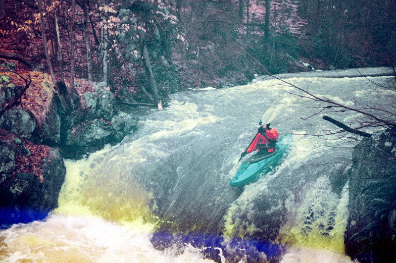
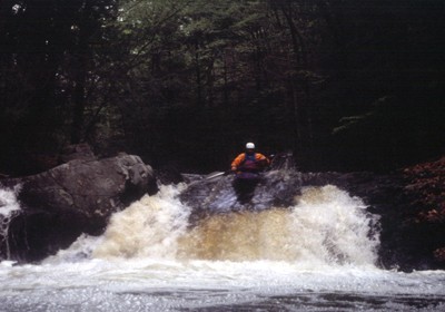
Apr 3, 2005
This is the finish of the rapid I've called 'Nasty'. Above three feet, this last section gets pretty pushy. The water has nowhere to go but up.
Jan 1, 1900
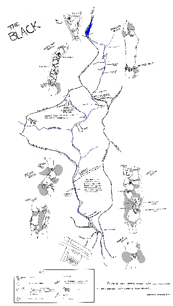
This is the very low quality version of a larger map (the larger one is actually legible).
I've set this map to print out on 11x17 paper. It's lost a little clarity in doing this, but it's not so huge. It is still mostly legible. If you want the HUGE very detailed version, email me and I'll send it to you.
This map shows where the closest AFWS rain gauge is in relation to the Lamington R.
Jan 1, 1900
Upstream of Pottersville, the Lamington River is named the Black River (I don't know why). The section I've run starts either at a mill on Rt. 24 in Chester, or (much better)at a fishing access point about a mile downstream of the mill at the outflow of a small lake. The run goes through Hacklebarney St. Pk. BUT DON'T PUT-IN OR TAKEOUT THERE. I have taken out at the Pottersville Deli in the past.
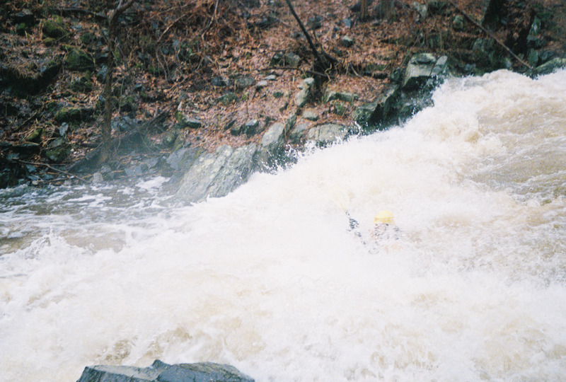
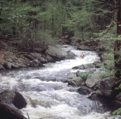
This is another typical rapid on this stretch of river. Brad is the little brightly colored blob.
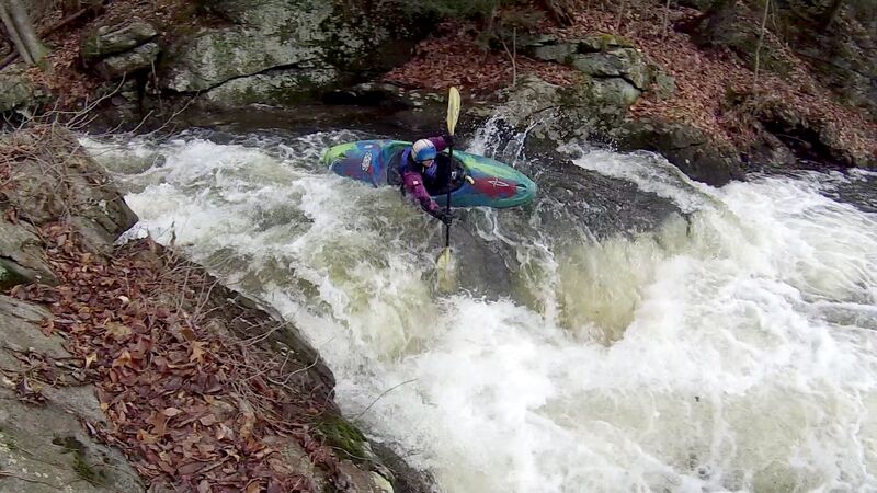
This is the largest of a few ledges in the run