Chetco
2) Craggie Creek to South Fork (Chetco Gorge)
| Difficulty | III-IV(V) |
| Length | 10.2 mi |
| Avg Gradient | 27 fpm |
| Gauge | Chetco River Near Brookings, or |
| Flow Rate as of 49 minutes | 77 cfsbelow recommended |
| Reach Info Last Updated | July 8, 2019 |
The Siskiyou Mountains in Southwestern Oregon give rise to iconic wild rivers like the Wild and Scenic Illinois, Rogue, Chetco and North Fork Smith Rivers. The region is known for its stunningly clear rivers, salmon strongholds, unique and rich biodiversity, and outstanding opportunities for angling and backcountry whitewater adventures. [...]Read More
At moderate flows the Chetco has stunningly beautiful crystal clear water. For the first two miles the river flows through easy class II rapids separated by deep pools.
Keep your eyes open for massive steelhead that return to this river to spawn. As the river turns to the south, the gradient starts to pick up and you will enjoy a great section of class III/IV whitewater with over a dozen high quality rapids separated by good recovery pools. The drops are all boulder gardens with several boulders that tower high overhead but most can be easily boat scouted.
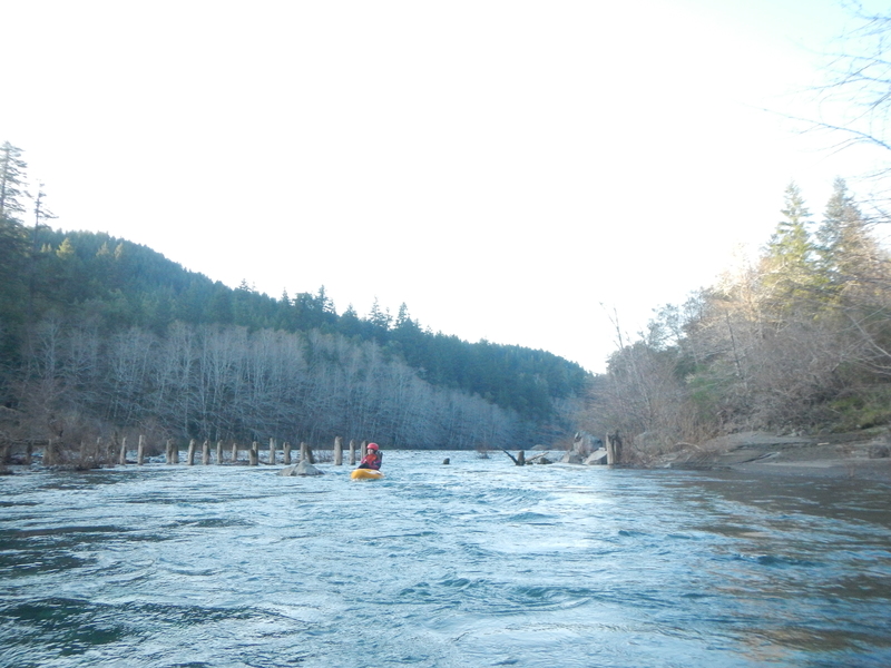
The gradient tapers off as you approach the high steel bridge where FR 1376 crosses the river. This could be a potential access point as a trail heads to the downstream side of the bridge on river right. It's another mile of flatwater to the start of the Chetco Gorge.
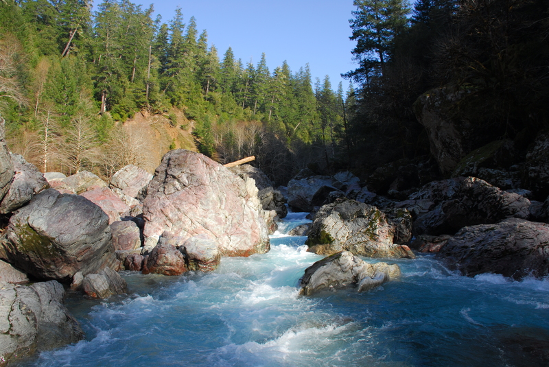
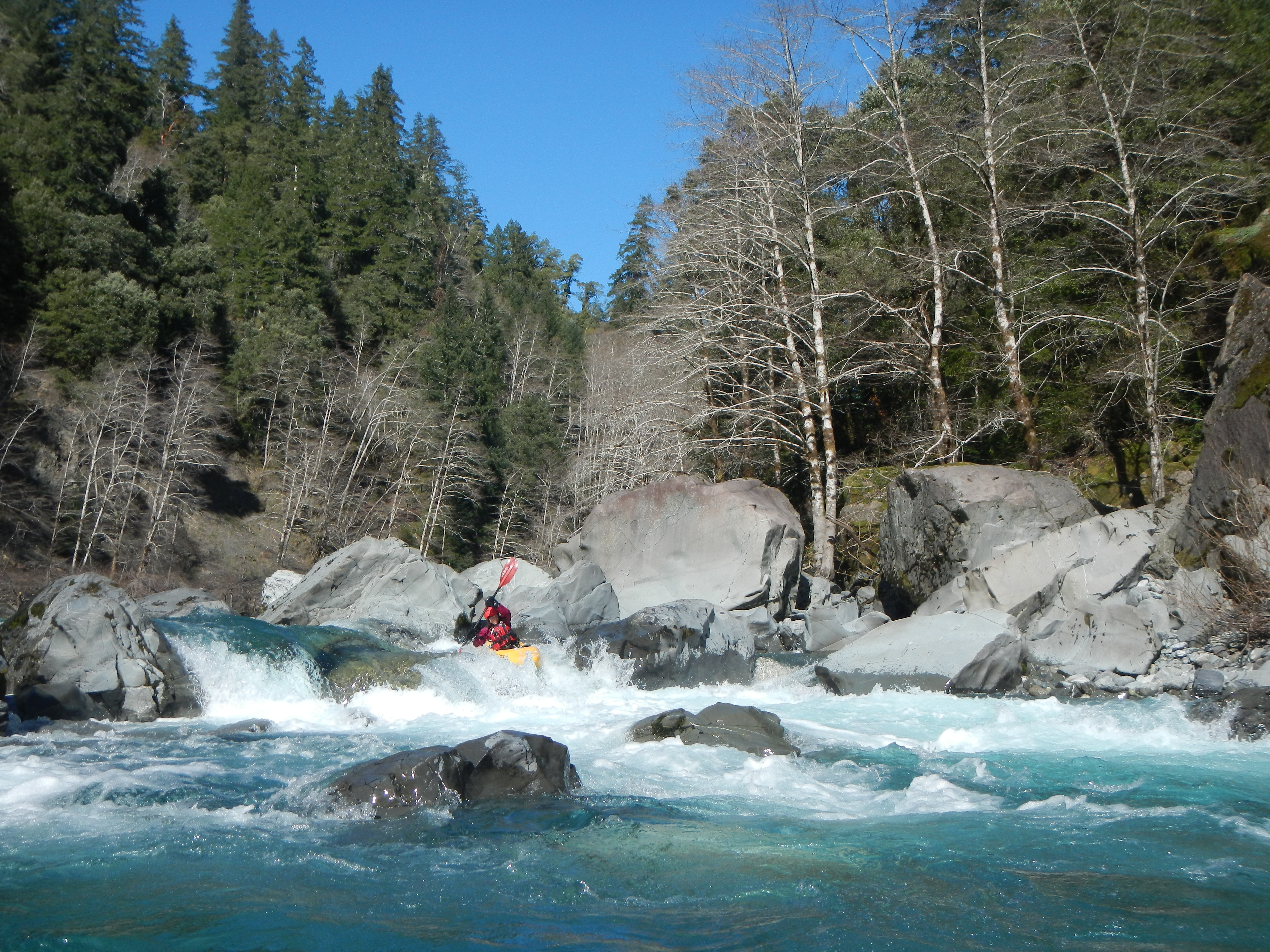
After some class II, you will reach the first class III rapid in the gorge before you soon arrive at Candy Cane. This rapid is a congested boulder garden of massive rocks swirled with reds and lighter colors giving the rapid its name. You can pull out on river right to scout the rapid which requires a sequence of moves over a couple hundred yards to navigate through the boulder field. Portaging is a little challenging over the boulders and uneven ground but it should just take a few minutes on river right. As you proceed across the pool downstream of Candy Cane, you will soon be at the start of Conehead which you will recognize by the massive Conehead Rock that towers above at the end of the rapid. Scouting is easily done on the right or a portage (easier than the previous rapid) can be done on river right. The lead-in to the rapid is not hard but the crux move is at the Conehead where you need to navigate through a series of small boulders that obstruct the route around the right of the Conehead.
Above 4,000 cfs Candycane and Conehead become big water class V rapids (portageable). At 7,000 cfs this run is a fun/large clas
...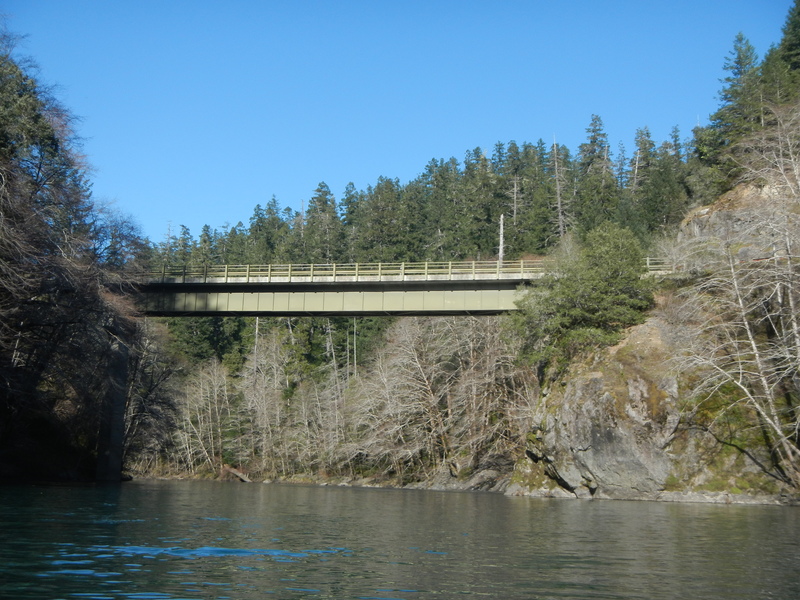
The bridge crosses over a flatwater section of the river and it is about a mile downstream to the Chetco Gorge. Potential access is available on river right downstream of the bridge.
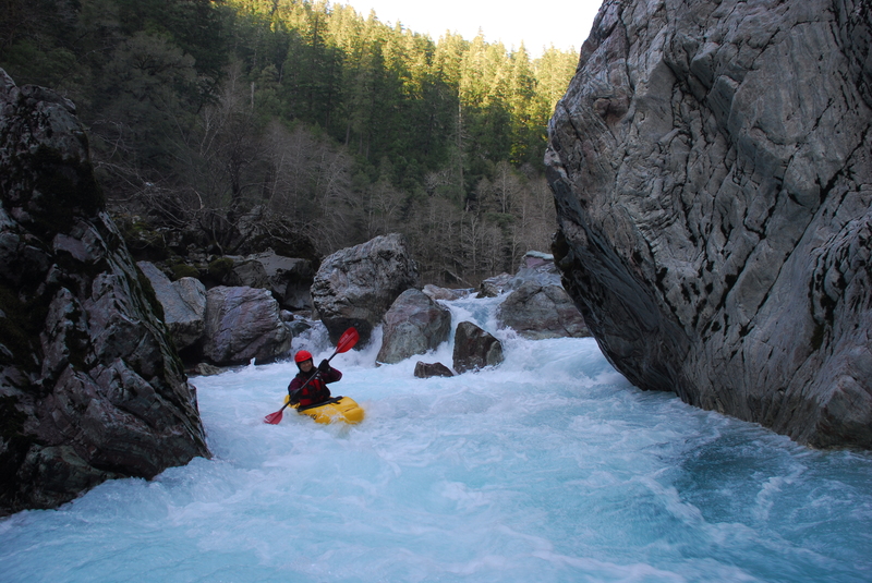
Tricky lead in rapid to navigate around the massive Conehead Rock that sits at the bottom of this drop.
Mar 11, 2015
We ran this in early March towards the lower limit of flows (577cfs). It was still plenty of fun. We hiked down the FR 1917-067 spur to Tollman Ranch as we did not have a high clearance vehicle. It took about 45 minutes to walk down. The approximately dozen or so rapids that begin about 1/3 of the way into the run were all great read and run. After a stretch of flatwater and passing under the steel bridge we came to the gorge. There are basically two rapids in the gorge--Candy Cane and Conehead--and then it's over and you have the paddle out. We did not run either drop. Candy Cane was very congested with narrow chutes and water flowing under boulders. Conehead had several rocks sticking up along the right that would have been tricky to navigate at low flow. The spur road described as the take-out in Soggy Sneakers had a massive washout. It would have been possible to hike out (although I expect the road will further deteriorate) but we elected to just paddle another 15 minutes down to the South Fork confluence where you can drive right to the river and have easy access.
Mar 4, 2015
A trip on the Chetco River towards the lower limit of the flow range.