Lusk Creek
Lusk Creek Canyon (8.1 miles)

Apr 5, 2018
A word about the 'Directions' tab for this section of Lusk Creek. Under 'Directions Description' it reads 'It appears there is likely an alternate route to the put-in (which GoogleMaps fails to see). After passing through Eddyville (2.8 miles north of CR5/Eddyville Road crossing), turn right (East) onto New Home Road, go 0.6 mile to a slight jig-jog (passing Straight Street) to continue East onto Stone Bottoms Road for about a mile. This becomes a double-track (dirt road) which should lead to (or near) the river. (Assuming this is not marked/contested as private.)'
That's almost exactly correct. However, New Home Road connects to Hwy 145 (the main road in Eddyville) in two places. If you turn right onto it at the southern intersection, the shuttle is more scenic but the road less developed. The faster (and only slightly less direct) route is turning right onto it at the northern intersection. After passing Saddle Rd (left), you must turn LEFT onto Stone Bottom Rd; if you don't, you'll just end up back at Hwy 145 at the southern intersection. Stone Bottom Rd goes north then east. In wet conditions, it will be impassable by virtually vehicles that aren't 4WD trucks. (My AWD Subaru Outback could go only so far before it became a fool's errand.) Stone Bottom Rd will eventually lead to the creek, and the road is public.
Apr 4, 2018
I'd like to spend a little time touching upon some comments made by others while offering my own two cents.
As already warned, Lusk Creek can double or triple in height in hours. Conversely, the creek drains about as fast as it crests. Even in just a moderate light rain, I saw it rise from 4’/150 cfs to 8’/1600 cfs overnight on 3/29/2018 and then drop down to 4.5’/300 cfs by the following afternoon on 3/30/2018! Catching it at a sweet spot that’s neither dangerously high nor disappointingly low will be a mix of luck and lust (or “Lusk”). At high levels with pushy current there will be genuinely dangerous obstacles and difficult-to-nonexistent portaging. And accesses off the creek and out of the wilderness forest are very limited, via arduous trails, and far from any main roads.
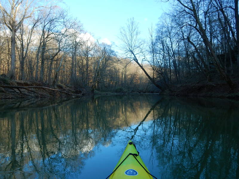
I paddled this probably somewhere in the 250 cfs range, as it was dropping at the time. I recognize that for serious whitewater paddlers this is an almost laughably low level. However, it's plenty paddleable at this stage. Sure, there will be some scraping in the shallows and fords, and nothing rises about Class II. But it's still really fun and breathtakingly beautiful.
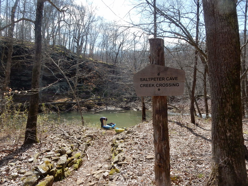
The thing is, at high levels, all manner of huge debris will be whisked downstream and inevitably lodged against the larger boulders. Immediately upstream of the Saltpeter Cave ford crossing is a big, long log pinned against a boulder on the left that juts to the right in a right-hand bend. In other words, the current pushes you toward the log pretty formidably. Skilled paddlers should know how to dodge such an obstacle, but it bears mentioning that the higher the creek, the greater the number of such dangers.
Also worth mentioning are two sets of double boulders to watch out for -- the first upstream of the canyon, the second immediately downstream from the canyon. The first is preceded by a 2-3' chute right above the rocks. In other words, at the base of the rapids one has to pivot a full, hard 90-degree turn to the left (where the current flows) to avoid being swept into and pinned against the rocks. The second set, mentioned above as a recommended portage, does collect a ton of trees and debris, but there was plenty of open water on the right to thread through without having to portage -- at least at low levels. Nonetheless, it's prudent to keep these in mind and anticipate them beforehand.
Apr 4, 2018
After schlepping down Trail 481 since Stone Bottom Road was too washed out and rutted to take down to the ford crossing (even in a Subaru Outback), we left the car at the trailhead and hiked down to the creek. For reasons that defy comprehension, none of the trails in the Lusk Creek Wilderness area are measured out in miles or kilometers, either on the trail signs or the official map. (That said, the individual trails are posted well both in the wilderness area and the map, just not how long any given trail is...) Trail 481 is approximately 1.5 miles long, and it took us 1h 40m to get down to the water from Stone Bottom Rd. If the trail had snow, we could have just pulled our boats. Instead, we had to shoulder them in, which was arduous.
Apr 4, 2018
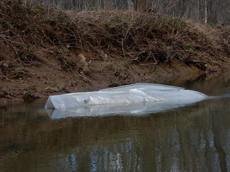
Some old-timers never do make it out of the canyon...
Apr 4, 2018
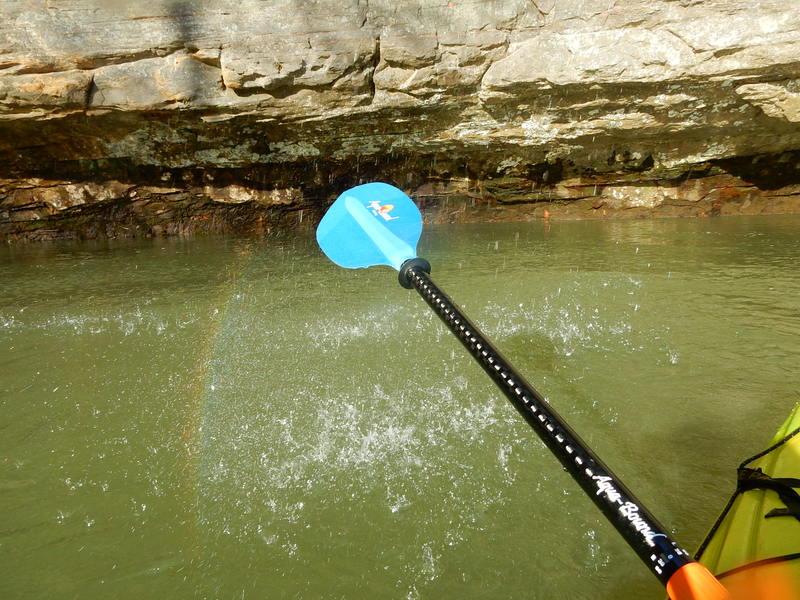
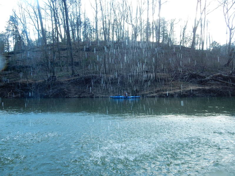
There was a small rainbow radiating off the shower-effect from a waterfall in the canyon.
Apr 4, 2018
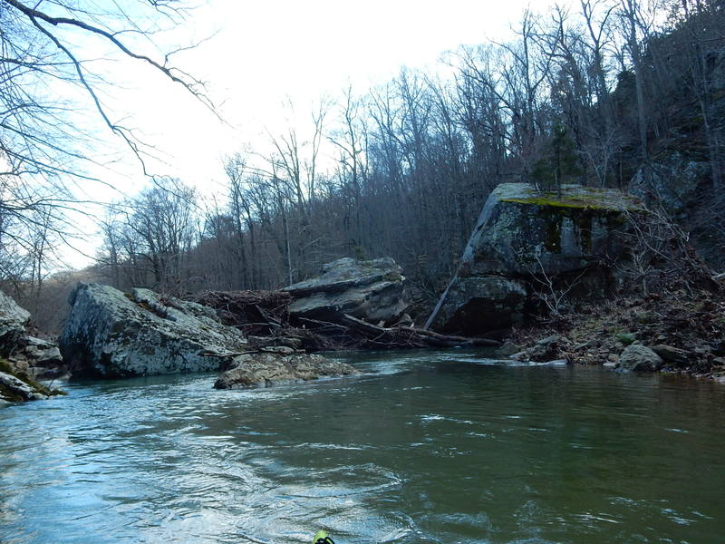
Immediately downstream from Indian Kitchen are these two ginormous boulders in the middle of the creek. There's no passage on river-left, and typically too much tree debris collects in the middle. Either portage right or thread your way through (if open) on the right without getting out.
Apr 4, 2018
After the canyon and Indian Kitchen, the environment is wooded but generally rockless, and the creek flows slowly with hardly a breath of current until after the PITO at Ragan Rd.
Apr 4, 2018
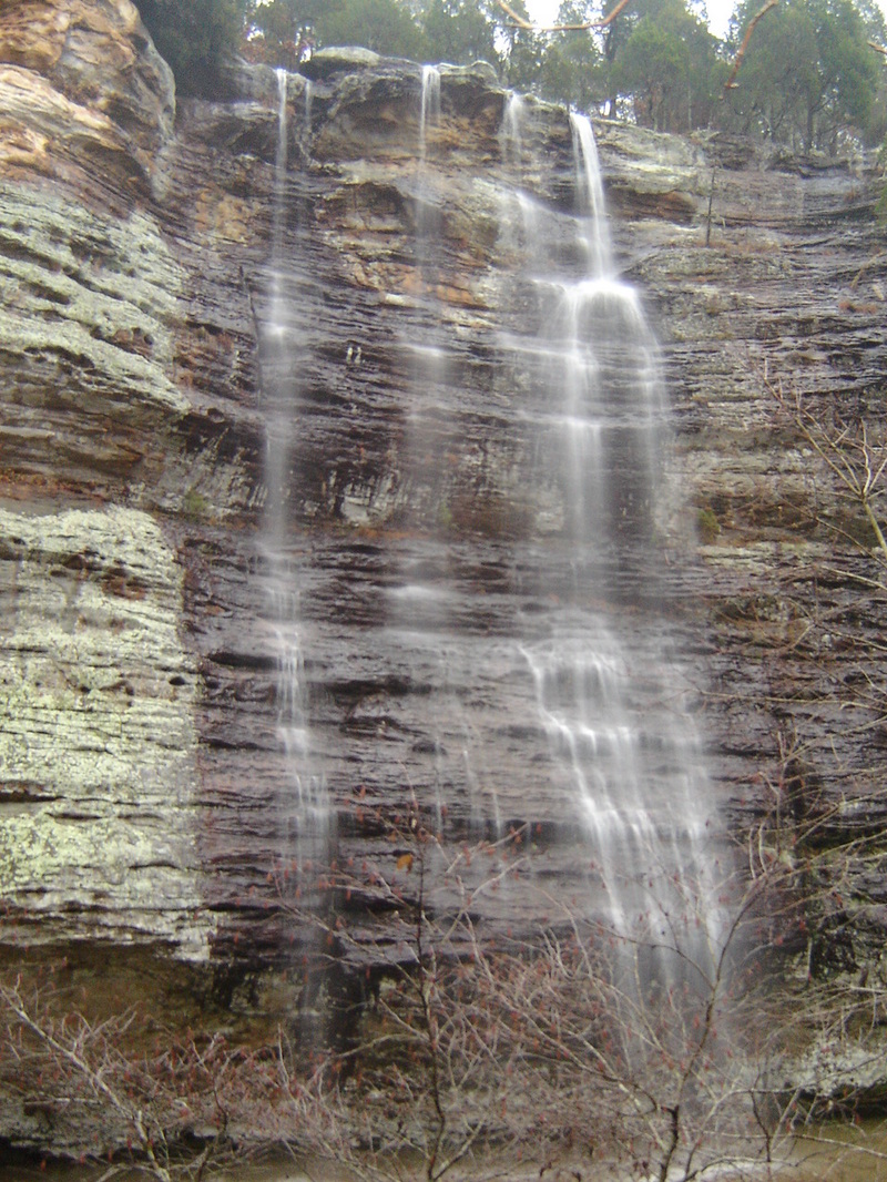
From behind a waterfall veil
Apr 27, 2011
Kayaked Lusk from Blanchard Crossing to the Eddyville Bridge on 4/24/2011. Two friends and I got on the water at 4 p.m. with the USGS gauge downstream reading 2,630 cfs. It would rise while we were on it to almost 4,000 cfs. It was certainly Class III+, with some Class IV spots that looked impossible because of strainers. The Rock Garden, just downstream from the Kitchen, was unrunnable. My buddy flipped on some huge waves just upstream from where Bear Branch enters and had to kick out, losing his kayak. Found it the next day at the Rock Garden, pinned 10 ft. up. We were very lucky. Anything over 1,000 cfs is serious whitewater, and proper gear and training are an absolute must. That being said, it was the float of my life and couldn't be happier to have experienced it.
Jan 8, 2008
On Lusk Creek, the canyon itself has no rapids, but it is a very impressive site with the vertical walls and small, tall waterfalls. However, there are several class II to class III rapids leading up to the canyon if the flow is above 400 CFS. There is also a large standing wave immediately downstream from the mandatory portage at the bottom of the canyon. At flows above 1000-1500 CFS, Lusk becomes more difficult and it is not recommended.
Bear Branch is much steeper and more difficult than Lusk Creek. It has a much smaller drainage area and, therefor, lower flows than Lusk, which can be nice. However, if you follow Bear Branch (at a decent flow) all the way to Lusk, Lusk may be over 1000 CFS.
Dec 10, 2007
Waterfall falling 80-100 ft. off canyon wall
May 7, 2003
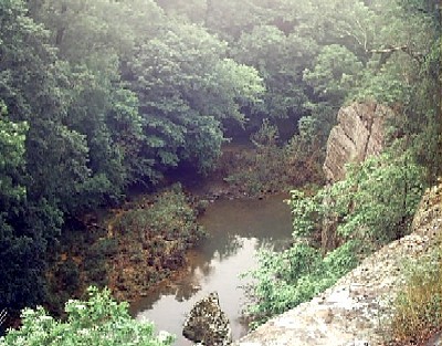
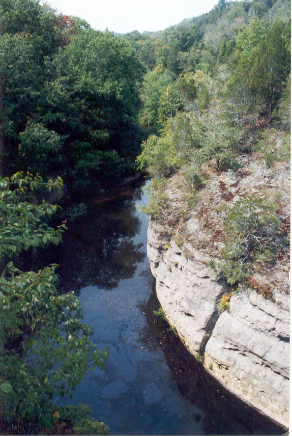
Looking down at Lusk Creek from hiking trail overlook.
Jan 1, 1900
This is a beautiful area, one of the most pristine in Illinois, and the water clean.